Daff Glen

Valley in Renfrewshire

Scotland

Daff Glen

Ardgowan Point Viewed from the slip at Inverkip Yacht Club.
Ardgowan Point Credit: Thomas Nugent

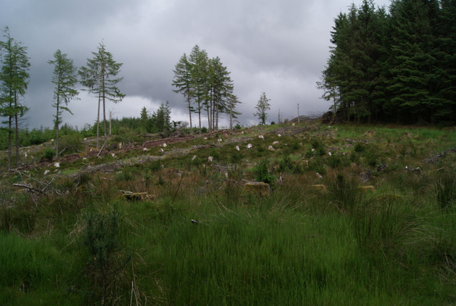
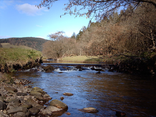
Daff Glen is a picturesque valley located in Renfrewshire, Scotland. Nestled amidst lush greenery and rolling hills, it is a popular destination for nature lovers and outdoor enthusiasts. The glen stretches for approximately 5 miles, offering visitors an opportunity to explore its diverse landscape and rich biodiversity.

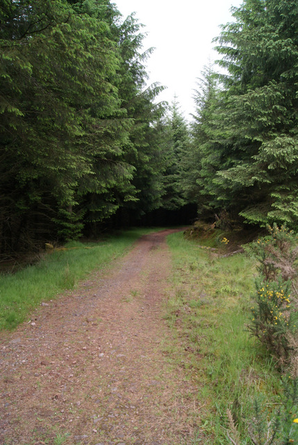
The valley is characterized by its dense woodlands, which are home to a wide variety of flora and fauna. Visitors can enjoy leisurely walks along the well-maintained trails, taking in the serene beauty of the surroundings. The glen is particularly famous for its vibrant display of bluebells during springtime, creating a stunning carpet of colors.

Daff Glen also boasts a network of small streams and waterfalls, adding to its natural charm. The babbling brooks and cascading water provide a soothing soundtrack to accompany the scenic views. It is not uncommon to spot small wildlife such as squirrels and birds while exploring the glen.

For those seeking a more adventurous experience, Daff Glen offers opportunities for rock climbing and abseiling. The rugged cliffs and rocky outcrops provide a challenging terrain for outdoor enthusiasts looking to test their skills.

Overall, Daff Glen is a hidden gem in Renfrewshire, offering a tranquil escape from the hustle and bustle of city life. Whether you are a nature lover, a keen hiker, or an adrenaline junkie, this valley has something to offer for everyone.

If you have any feedback on the listing, please let us know in the comments section below.
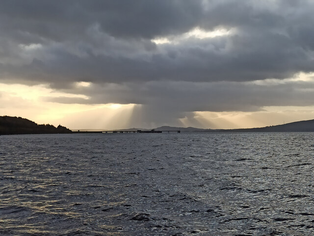
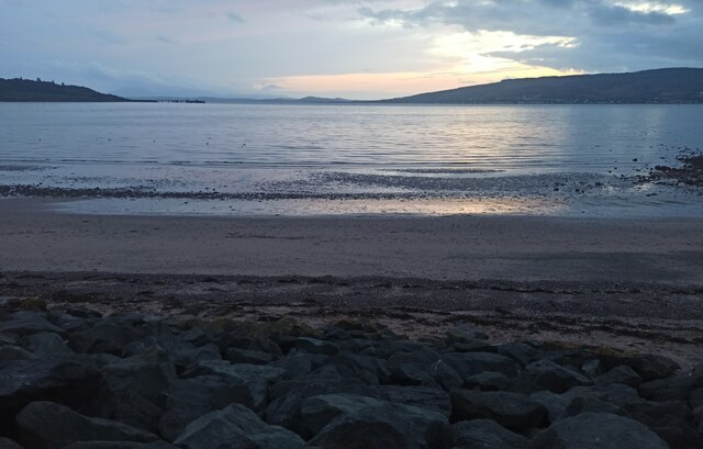
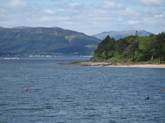
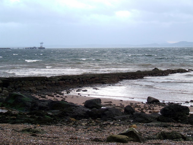
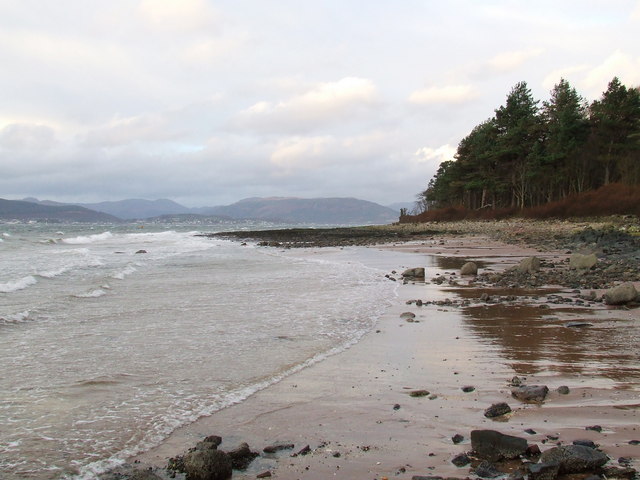
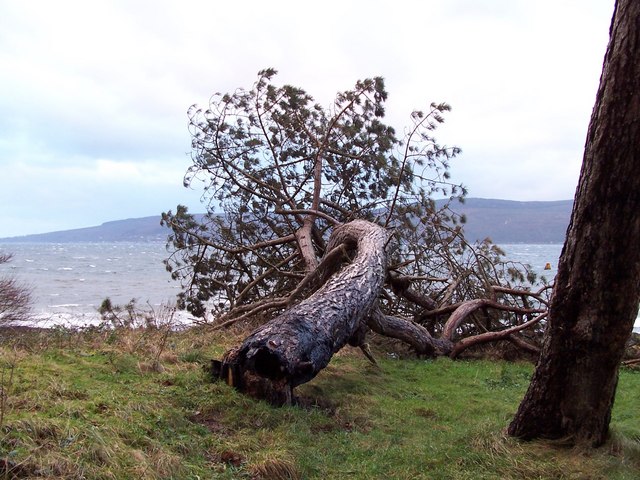
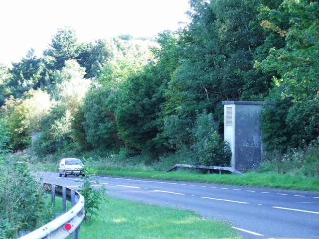
Daff Glen Images

Images are sourced within 2km of 55.905269/-4.8562985 or Grid Reference NS2171. Thanks to Geograph Open Source API. All images are credited.

Ardgowan Point Viewed from the slip at Inverkip Yacht Club.
Ardgowan Point
Viewed from the slip at Inverkip Yacht Club.
Sunset over Toward and Bute Viewed across the old power station jetty from Inverkip Yacht Club.

See also <a href="https://www.geograph.org.uk/photo/7066720">NS1870 : Sunset over Toward and Bute</a>.
Sunset over Toward and Bute
Viewed across the old power station jetty from Inverkip Yacht Club. See also NS1870 : Sunset over Toward and Bute.
Inverkip twilight Looking towards Toward Point, Bute and Arran.
Inverkip twilight
Looking towards Toward Point, Bute and Arran.
Leapmoor Forest Looking towards the top of the hill on the main track through the forest.
Leapmoor Forest
Looking towards the top of the hill on the main track through the forest.
Leapmoor Forest On the downhill section towards Hill Farm Estate.
Leapmoor Forest
On the downhill section towards Hill Farm Estate.
Inverkip Power Station Taken from Inverkip Bay.
Inverkip Power Station
Taken from Inverkip Bay.
Clyde Sunset Taken without filters, this picture shows the sun setting over the River Clyde and Toward, Argyll. The mothballed Inverkip Power Station is on the left.

August 2013 update - the power station has been demolished, the chimney was demolished by explosives on 28th July 2013 <a title="https://www.geograph.org.uk/search.php?i=43122060&page=1&displayclass=slide" href="https://www.geograph.org.uk/search.php?i=43122060&page=1&displayclass=slide">Link</a> . Only the jetty and some service buildings remain.
Clyde Sunset
Taken without filters, this picture shows the sun setting over the River Clyde and Toward, Argyll. The mothballed Inverkip Power Station is on the left. August 2013 update - the power station has been demolished, the chimney was demolished by explosives on 28th July 2013 Link . Only the jetty and some service buildings remain.
Tree Harvesting in Leapmoor Forest Much of the south end of the forest has been harvested in recent months. There are plans to erect a ten mast "community" wind farm here (subject to planning approval). See <span class="nowrap"><a title="http://www.communitywindpower.co.uk/about_us.asp" rel="nofollow ugc noopener" href="http://www.communitywindpower.co.uk/about_us.asp">Link</a><img style="margin-left:2px;" alt="External link" title="External link - shift click to open in new window" src="https://s1.geograph.org.uk/img/external.png" width="10" height="10"/></span> for information about the wind farm developer. A pile of logs awaits collection in the middle of the picture.
Tree Harvesting in Leapmoor Forest
Much of the south end of the forest has been harvested in recent months. There are plans to erect a ten mast "community" wind farm here (subject to planning approval). See LinkExternal link for information about the wind farm developer. A pile of logs awaits collection in the middle of the picture.
On Location A film crew in the grounds of Ardgowan Estate filming a scene for a future episode of "Taggart". Ardgowan House and the surrounding estate are promoted as film and TV locations <span class="nowrap"><a title="http://ardgowan.co.uk/services/filmlocationvenue.asp" rel="nofollow ugc noopener" href="http://ardgowan.co.uk/services/filmlocationvenue.asp">Link</a><img style="margin-left:2px;" alt="External link" title="External link - shift click to open in new window" src="https://s1.geograph.org.uk/img/external.png" width="10" height="10"/></span> and have been used as a location for several TV shows recently.
On Location
A film crew in the grounds of Ardgowan Estate filming a scene for a future episode of "Taggart". Ardgowan House and the surrounding estate are promoted as film and TV locations LinkExternal link and have been used as a location for several TV shows recently.
Homeward Bound Yachts return to Kip marina following an almost wind-free evening's racing in the Firth of Clyde between Inverkip and Innellan.
Homeward Bound
Yachts return to Kip marina following an almost wind-free evening's racing in the Firth of Clyde between Inverkip and Innellan.
Ardgowan Point The old stone jetty is known as The Laird's Dyke. Kilmun Hill is prominent in the background across the Clyde.
Ardgowan Point
The old stone jetty is known as The Laird's Dyke. Kilmun Hill is prominent in the background across the Clyde.
Laird's Dyke The Laird's Dyke is an old stone and concrete jetty, presumably related to nearby Ardgowan House. A closer view of the power station jetty in the background can be seen here <a href="https://www.geograph.org.uk/photo/290005">NS1870 : Oil Jetty at Inverkip power station</a>
Laird's Dyke
The Laird's Dyke is an old stone and concrete jetty, presumably related to nearby Ardgowan House. A closer view of the power station jetty in the background can be seen here NS1870 : Oil Jetty at Inverkip power station
Ardgowan Point Viewed from the beach near Kip marina.
Ardgowan Point
Viewed from the beach near Kip marina.
Vandalised tree Successive camp fires lit against the base of this tree on the coast at Ardgowan Point finally took their toll.
Vandalised tree
Successive camp fires lit against the base of this tree on the coast at Ardgowan Point finally took their toll.
A78 at Inverkip Power Station The small building is one of four which provide access to power cables which run under the road.
A78 at Inverkip Power Station
The small building is one of four which provide access to power cables which run under the road.
Moorings off Inverkip These moorings are just off Inverkip yacht Club <a href="https://www.geograph.org.uk/photo/289606">NS2071 : Inverkip Yacht Club</a>. The jetty is no longer in use and has been replaced by a more modern one a few yards to the south <a href="https://www.geograph.org.uk/photo/536011">NS2071 : Beach at Inverkip yacht Club</a>. Innellan is visible across the Clyde.
Moorings off Inverkip
These moorings are just off Inverkip yacht Club NS2071 : Inverkip Yacht Club. The jetty is no longer in use and has been replaced by a more modern one a few yards to the south NS2071 : Beach at Inverkip yacht Club. Innellan is visible across the Clyde.
Logs One of several felled trees in Crow Wood at Ardgowan Point.
Logs
One of several felled trees in Crow Wood at Ardgowan Point.
The Laird's Dyke Old jetty made of concrete blocks at Ardgowan Estate. Bullwood quarry near Dunoon can be seen across the Clyde.
The Laird's Dyke
Old jetty made of concrete blocks at Ardgowan Estate. Bullwood quarry near Dunoon can be seen across the Clyde.
Show me another place!

Daff Glen is located at Grid Ref: NS2171 (Lat: 55.905269, Lng: -4.8562985)

Unitary Authority: Inverclyde

Police Authority: Renfrewshire and Inverclyde

What 3 Words

///creeps.tuxedos.tasteful. Near Inverkip, Inverclyde

Nearby Locations

Square Wood Daff Glen

Related Wikis

Inverkip

Inverkip (; Scottish Gaelic: Inbhir Chip) is a village and parish in the Inverclyde council area and historic county of Renfrewshire in the west central...

Inverkip railway station

Inverkip railway station is a railway station serving the village of Inverkip, Inverclyde, Scotland. The station is managed by ScotRail and is on the Inverclyde...

Kip Water, Inverclyde

Kip Water, also known as the River Kip, is a short river in Inverclyde, Scotland which gives the village of Inverkip its name (Inverkip = mouth of the...
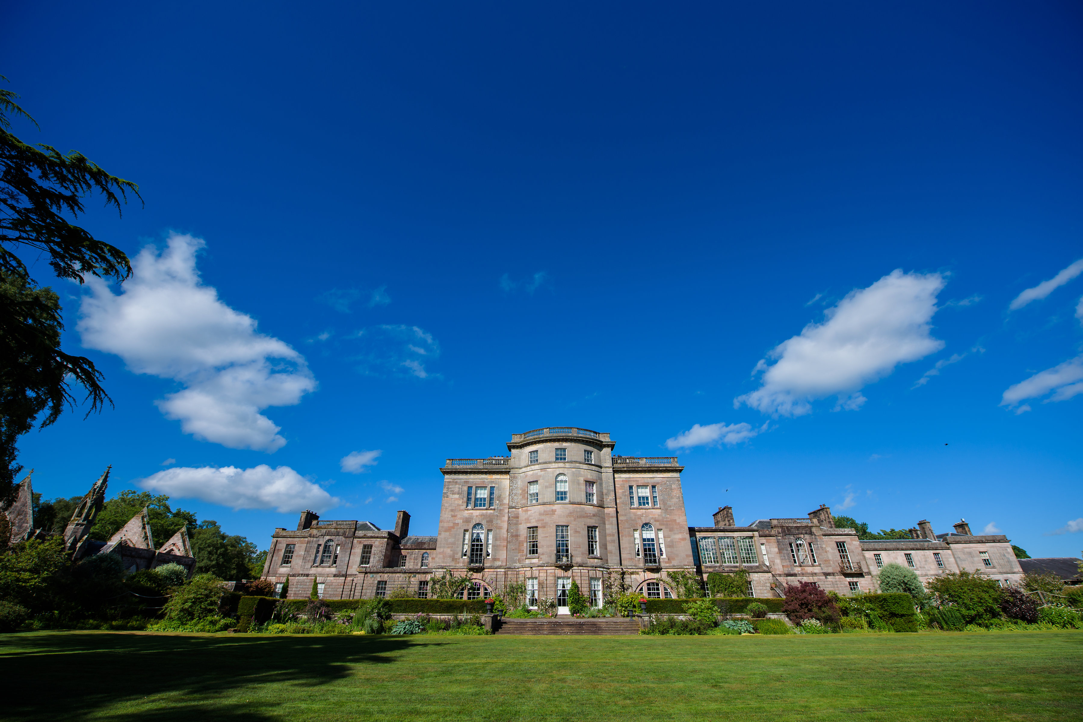
Ardgowan House

Ardgowan House, Castle & Gardens is a Privately owned late 18th-century mansion on the Firth of Clyde near Inverkip, Scotland. Ardgowan is located in Inverclyde...

Related Videos

Solo walking Three Glens and Dunrod hill 9/5/20

This was a circular walk from Inverkip village through the Daff Glen over Inlie hill then down into Shielhill Glen taking the high ...

Walking Oscar round Inverkip

Nice walk round Inverkip with Oscar.

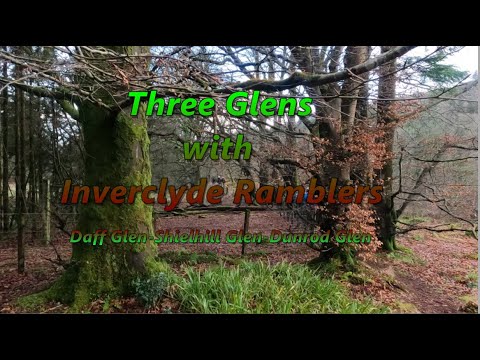
Three Glens with Inverclyde Ramblers 8/1/22

This was our first group walk of 2022 Starting from Inverkip we headed up the Daff glen then onto Everton and the Leapmoor ...

DofE Bronze expedition

Duke of Edinburgh bronze award expedition.

Nearby Amenities

Located within 500m of 55.905269,-4.8562985
Sarahs Knowe
Corbett: no
Munro: no
Natural: peak
Lat/Long: 55.9083166/-4.8516222
Power: pole
Lat/Long: 55.9008584/-4.8568153
Power: pole
Lat/Long: 55.9010027/-4.8557264
Power: pole
Lat/Long: 55.9012831/-4.853876
Power: pole
Lat/Long: 55.9019095/-4.8529637
Power: pole
Lat/Long: 55.9032131/-4.8511532
Power: pole
Lat/Long: 55.9038732/-4.8502439
Power: pole
Lat/Long: 55.9049949/-4.8487017
Power: pole
Lat/Long: 55.9045153/-4.849804
Power: pole
Lat/Long: 55.9038657/-4.8506516
Power: pole
Lat/Long: 55.9032402/-4.8514992
Power: pole
Lat/Long: 55.9026433/-4.8523629
Power: pole
Lat/Long: 55.9020162/-4.853197
Power: pole
Lat/Long: 55.9013389/-4.8541671
Power: pole
Lat/Long: 55.901111/-4.8559409
Power: pole
Lat/Long: 55.9009366/-4.8574162
Power: pole
Lat/Long: 55.9095665/-4.8549811
Power: pole
Lat/Long: 55.9091567/-4.8561102
Power: pole
Lat/Long: 55.9088099/-4.8570997
Power: pole
Lat/Long: 55.9084549/-4.8580997
Power: pole
Lat/Long: 55.9080649/-4.8592038
Power: pole
Lat/Long: 55.9078419/-4.859835
Power: pole
Lat/Long: 55.9074647/-4.8609266
Power: pole
Lat/Long: 55.9071506/-4.8618536
Power: pole
Lat/Long: 55.9069451/-4.8625452
Power: pole
Lat/Long: 55.9081583/-4.8591184
Power: pole
Lat/Long: 55.9085892/-4.8580851
Power: pole
Lat/Long: 55.9090294/-4.8570206
Power: pole
Lat/Long: 55.9094766/-4.8559602
Power: pole
Lat/Long: 55.9085845/-4.8513793
Power: pole
Lat/Long: 55.9093447/-4.8541083
Power: pole
Lat/Long: 55.9091147/-4.8532896
Power: pole
Lat/Long: 55.9088881/-4.852523
Power: pole
Lat/Long: 55.9026116/-4.8519887
Power: pole
Lat/Long: 55.9016895/-4.8520824
Power: pole
Lat/Long: 55.9025128/-4.8519032
Power: pole
Lat/Long: 55.9031002/-4.8510449
Power: pole
Lat/Long: 55.9037577/-4.8501471
Power: pole
Lat/Long: 55.904379/-4.8493117
Power: pole
Lat/Long: 55.9049804/-4.8484743
Power: pole
Lat/Long: 55.9044359/-4.8494702
The data included in this document is from www.openstreetmap.org. The data is made available under ODbL.

Have you been to Daff Glen?

Leave your review of Daff Glen below (or comments, questions and feedback).