Gavin's Glen

Valley in Buteshire

Scotland

Gavin's Glen

Grazing land at Figgatoch Farm
Grazing land at Figgatoch Farm Credit: John Ferguson

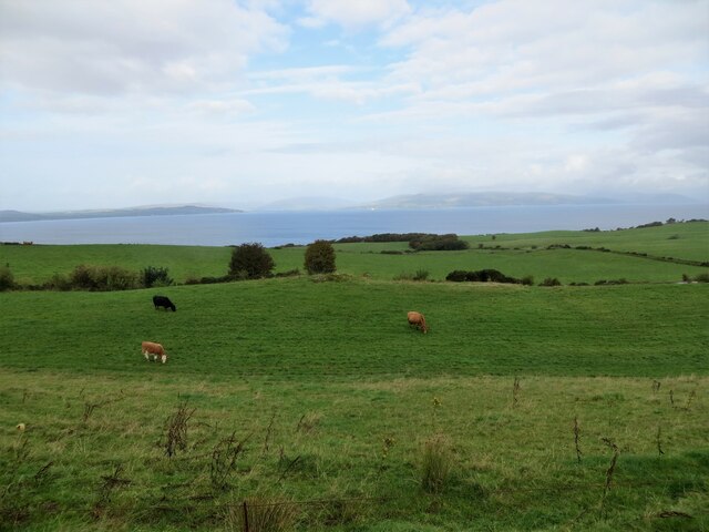
Gavin's Glen is a picturesque valley located in the region of Buteshire, Scotland. Nestled between rolling hills, this enchanting glen stretches for approximately two miles, offering visitors a tranquil and breathtaking experience.

The glen is home to a diverse range of flora and fauna, with lush green meadows, towering trees, and a meandering river that runs through its heart. The valley is particularly renowned for its vibrant wildflowers that adorn the landscape in spring and summer, creating a colorful tapestry of nature.

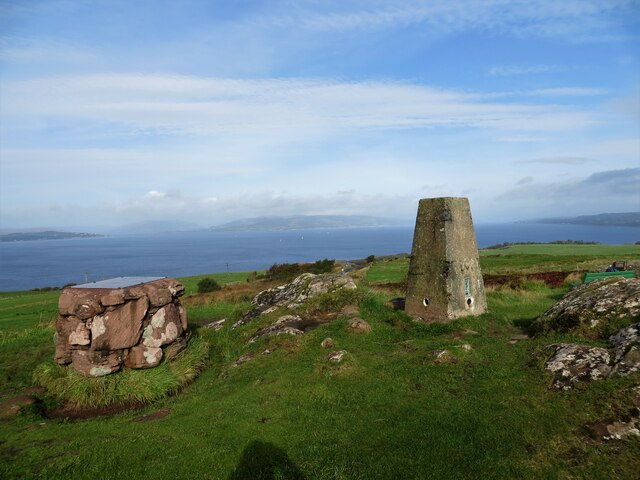
As visitors explore Gavin's Glen, they can follow a well-marked trail that winds its way through the valley, providing stunning views at every turn. The trail leads to various points of interest, including cascading waterfalls, ancient rock formations, and secluded picnic spots. The sound of birdsong fills the air, adding a harmonious soundtrack to the peaceful surroundings.

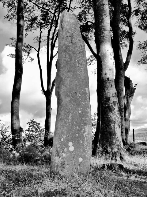
Gavin's Glen also holds historical significance, as it is believed to have been inhabited by ancient settlers dating back thousands of years. Archaeological remains and artifacts have been discovered in the area, shedding light on the early human activity in the region.

For nature enthusiasts, Gavin's Glen offers a wealth of opportunities for outdoor activities. Hiking, bird-watching, and photography are popular pastimes, allowing visitors to immerse themselves in the natural beauty and capture the essence of this captivating valley.

In conclusion, Gavin's Glen in Buteshire is a true gem in the Scottish countryside. With its scenic landscapes, diverse wildlife, and rich history, it provides a haven for those seeking solace and an escape from the bustling city life.

If you have any feedback on the listing, please let us know in the comments section below.
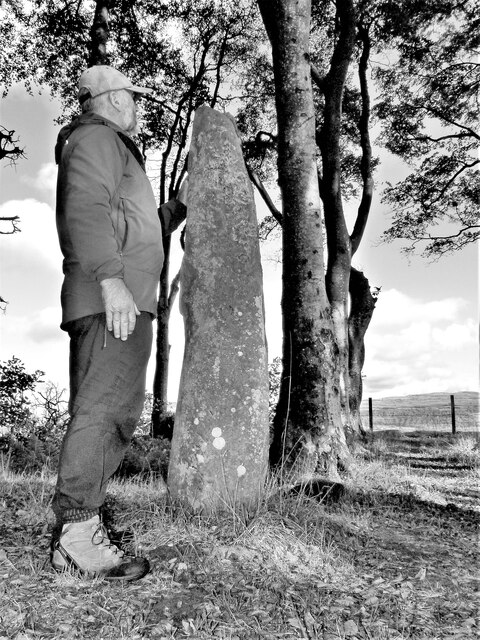
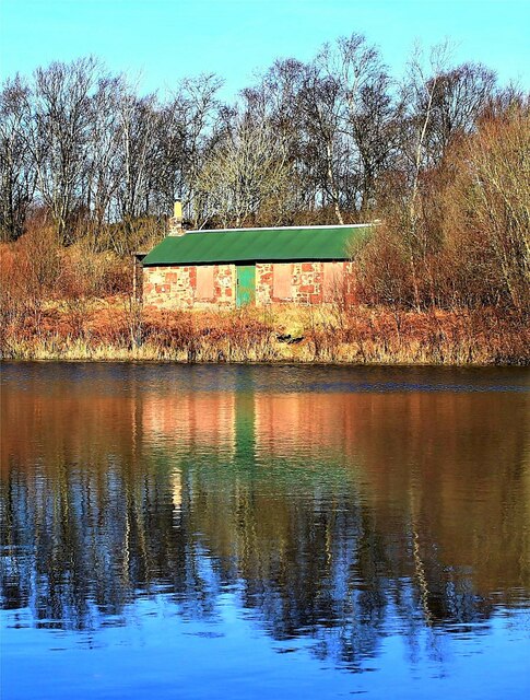
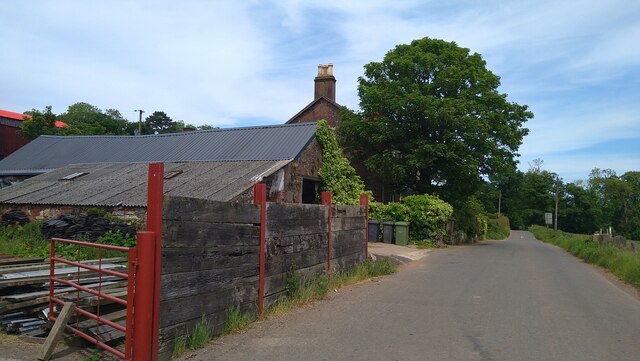
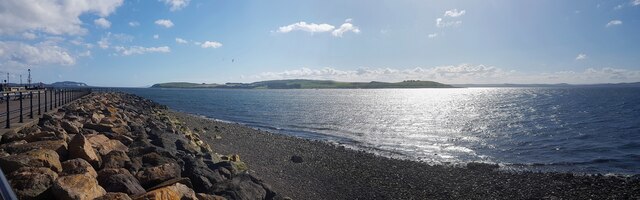
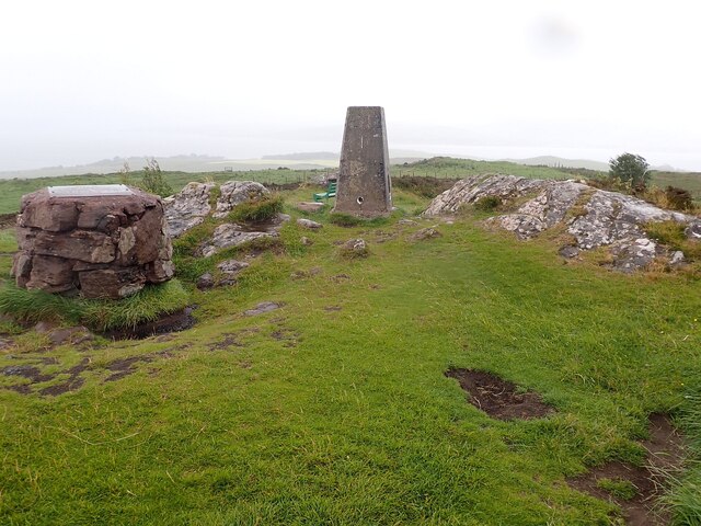
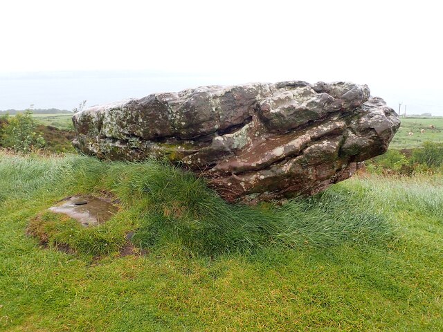
Gavin's Glen Images

Images are sourced within 2km of 55.780918/-4.924533 or Grid Reference NS1658. Thanks to Geograph Open Source API. All images are credited.

Grazing land at Figgatoch Farm
Trig pillar on Barbay Hill
Loch Shira berthing at slipway on Great Cumbrae Island Sails between Largs and Cumbrae
Loch Shira berthing at slipway on Great Cumbrae Island
Sails between Largs and Cumbrae
Gouklan Standing Stone - Isle of Cumbrae The Gouklan Stone stands in the southeast corner of Gouklan Wood.
Gouklan Standing Stone - Isle of Cumbrae
The Gouklan Stone stands in the southeast corner of Gouklan Wood.
Gouklan Standing Stone - Isle of Cumbrae The Gouklan Stone stands in the southeast corner of Gouklan Wood.
Gouklan Standing Stone - Isle of Cumbrae
The Gouklan Stone stands in the southeast corner of Gouklan Wood.
Ferry Loch Shira approaching Cumbrae Slip The small boat passed too fast and too close for the liking of the captain of the ferry who gave several warning blasts on the horn to no avail.
Ferry Loch Shira approaching Cumbrae Slip
The small boat passed too fast and too close for the liking of the captain of the ferry who gave several warning blasts on the horn to no avail.
HMS Shearwater Memorial - Tomont End Tomont End at the north point of Great Cumbrae is the site of a Monument, which was erected by the Officers of HMS Shearwater in memory of two midshipmen who were drowned nearby.

To the Memory of Mr. Charles D. Cayley,
aged 17 years
and
Mr. William N. Jewall,
aged 19 years,
Midshipmen of H.M.S. 'Shearwater'.
Promising young officers,
drowned in the upsetting of their boat near this place,
17 May, 1844.

In the summer of 1844 HMS Shearwater under the command of Commander Charles Gepp Robinson was surveying the west coast of Scotland. By mid May they had reached Largs Bay and on the afternoon of Friday 17th was at anchor.
Two young midshipman from the Shearwater, Charles Cayley and William Jewell, borrowed a small sailing boat to amuse themselves. They were out near the north end of Cumbrae when a strong north-east wind caught them and drove their boat bow-first under the waves taking the boys with it.
This was observed by the crew of another Government steamer in the bay called Vulcan which, having its steam up, went to the rescue. Unfortunately all they could recover were the boys' caps. There was a thorough search for their bodies but they could not be found.


The monument was erected by Captain Robinson and Officers of HMS Shearwater.

H M S Shearwater was a wooden paddle steamer Royal Navy surveying ship with a displacement of 328 tons. She was constructed in Harwich in 1827 and launched as a Post Office Steam Packet called Dolphin. In 1837 she was acquired by the Royal Navy and commissioned in 1840 at Liverpool as Shearwater. After surveying the coasts of Wales and Scotland she was sold off in 1857.

Charles Gepp Robinson was born in 1805 in Devon and joined the navy in 1819. For two years he was stationed in the North Sea. He then sailed the coasts of east and west Africa until 1829 searching for slave ships and indeed managed to capture three. Robinson then joined the Surveying Department working mainly in Scotland, Wales and the Mediterranean until 1856. He became a Rear-Admiral in 1864 and Vice-Admiral in 1871 and died in 1875 at his home in Oban.
HMS Shearwater Memorial - Tomont End
Tomont End at the north point of Great Cumbrae is the site of a Monument, which was erected by the Officers of HMS Shearwater in memory of two midshipmen who were drowned nearby. To the Memory of Mr. Charles D. Cayley, aged 17 years and Mr. William N. Jewall, aged 19 years, Midshipmen of H.M.S. 'Shearwater'. Promising young officers, drowned in the upsetting of their boat near this place, 17 May, 1844. In the summer of 1844 HMS Shearwater under the command of Commander Charles Gepp Robinson was surveying the west coast of Scotland. By mid May they had reached Largs Bay and on the afternoon of Friday 17th was at anchor. Two young midshipman from the Shearwater, Charles Cayley and William Jewell, borrowed a small sailing boat to amuse themselves. They were out near the north end of Cumbrae when a strong north-east wind caught them and drove their boat bow-first under the waves taking the boys with it. This was observed by the crew of another Government steamer in the bay called Vulcan which, having its steam up, went to the rescue. Unfortunately all they could recover were the boys' caps. There was a thorough search for their bodies but they could not be found. The monument was erected by Captain Robinson and Officers of HMS Shearwater. H M S Shearwater was a wooden paddle steamer Royal Navy surveying ship with a displacement of 328 tons. She was constructed in Harwich in 1827 and launched as a Post Office Steam Packet called Dolphin. In 1837 she was acquired by the Royal Navy and commissioned in 1840 at Liverpool as Shearwater. After surveying the coasts of Wales and Scotland she was sold off in 1857. Charles Gepp Robinson was born in 1805 in Devon and joined the navy in 1819. For two years he was stationed in the North Sea. He then sailed the coasts of east and west Africa until 1829 searching for slave ships and indeed managed to capture three. Robinson then joined the Surveying Department working mainly in Scotland, Wales and the Mediterranean until 1856. He became a Rear-Admiral in 1864 and Vice-Admiral in 1871 and died in 1875 at his home in Oban.
Millport Curling Club Bothy - Isle of Cumbrae Wee Minnemoer Bothy is the home of Millport Curling Club which was founded in 1838.

The first President was John Wishart from a report of a meeting held in the Kelburne Arms. The bothy was built by William Wishart about 1845. In these early years curling on Cumbrae was run less formally but from 1925 the Curling Club has flourished and more recently ladies were admitted to the club as members. The Club has been and remains active in many competitions organised by the Argyll Province and the Royal Club.
Millport Curling Club Bothy - Isle of Cumbrae
Wee Minnemoer Bothy is the home of Millport Curling Club which was founded in 1838. The first President was John Wishart from a report of a meeting held in the Kelburne Arms. The bothy was built by William Wishart about 1845. In these early years curling on Cumbrae was run less formally but from 1925 the Curling Club has flourished and more recently ladies were admitted to the club as members. The Club has been and remains active in many competitions organised by the Argyll Province and the Royal Club.
St Maura and Haakon sculpture by Matt Baker St Maura and Haakon played an important role in the history of Great Cumbrae.
St Maura and Haakon sculpture by Matt Baker
St Maura and Haakon played an important role in the history of Great Cumbrae.
Ballochmartin, Great Cumbrae Island The island is more generally known as "The Big Cumbrae" or just "Millport" after its main town.
Ballochmartin, Great Cumbrae Island
The island is more generally known as "The Big Cumbrae" or just "Millport" after its main town.
Great Cumbrae - The island as seen from Largs Looking across to the Isle of Great Cumbrae from near to the pier in Largs.
Great Cumbrae - The island as seen from Largs
Looking across to the Isle of Great Cumbrae from near to the pier in Largs.
Great Cumbrae - Barbay Hill - Trig point This Trig Point (or triangulation pillar) is on the highest point of Great Cumbrae island at 417' (127m). The views can be stunning from here  apparently - unfortunately this was not the case at the time of our visit as low cloud and rain obscured any such views.
Great Cumbrae - Barbay Hill - Trig point
This Trig Point (or triangulation pillar) is on the highest point of Great Cumbrae island at 417' (127m). The views can be stunning from here apparently - unfortunately this was not the case at the time of our visit as low cloud and rain obscured any such views.
Great Cumbrae - Barbay Hill - The Glaid Stone The Glaid Stone is a glacial erratic deposited on top of Barbay Hill on Great Cumbrae in the last Ice Age. It is c. 12' (3.6m) long with a cross section of c. 4' x 4' (1.2m x 1.2m)
Great Cumbrae - Barbay Hill - The Glaid Stone
The Glaid Stone is a glacial erratic deposited on top of Barbay Hill on Great Cumbrae in the last Ice Age. It is c. 12' (3.6m) long with a cross section of c. 4' x 4' (1.2m x 1.2m)
Great Cumbrae - CalMac Loch Shira arrives at Great Cumbrae Loch Shira is the larger of two (small) CalMac ferries that service Great Cumbrae from Largs. It is seen here approaching the Cumbrae ferry terminal - which is little more than a slipway!
Great Cumbrae - CalMac Loch Shira arrives at Great Cumbrae
Loch Shira is the larger of two (small) CalMac ferries that service Great Cumbrae from Largs. It is seen here approaching the Cumbrae ferry terminal - which is little more than a slipway!
Great Cumbrae - Barbay Hill - Track to the Trig point This track with rough steps leads from a car pull-in on the minor road which climbs up Barbay Hill to the highest point on Great Cumbrae marked by <a href="https://www.geograph.org.uk/photo/7219286">NS1657 : Great Cumbrae - Barbay Hill - Trig point</a>.
Great Cumbrae - Barbay Hill - Track to the Trig point
This track with rough steps leads from a car pull-in on the minor road which climbs up Barbay Hill to the highest point on Great Cumbrae marked by NS1657 : Great Cumbrae - Barbay Hill - Trig point.
Great Cumbrae - View to Minnemoer Minnemoer is a small loch on the slopes of Barbay Hill. It is seen here from <a href="https://www.geograph.org.uk/photo/7219837">NS1657 : Great Cumbrae - Barbay Hill - Track to the Trig point</a>
Great Cumbrae - View to Minnemoer
Minnemoer is a small loch on the slopes of Barbay Hill. It is seen here from NS1657 : Great Cumbrae - Barbay Hill - Track to the Trig point
Great Cumbrae - Barbay Hill - Rock of Ages? This boulder, near to both <a href="https://www.geograph.org.uk/photo/7219286">NS1657 : Great Cumbrae - Barbay Hill - Trig point</a> and <a href="https://www.geograph.org.uk/photo/7219294">NS1657 : Great Cumbrae - Barbay Hill - The Glaid Stone</a> has a little plaque attached to it with the heading "Great are the works of the Lord" (a quotation from Psalm 111).
Great Cumbrae - Barbay Hill - Rock of Ages?
This boulder, near to both NS1657 : Great Cumbrae - Barbay Hill - Trig point and NS1657 : Great Cumbrae - Barbay Hill - The Glaid Stone has a little plaque attached to it with the heading "Great are the works of the Lord" (a quotation from Psalm 111).
Shearwater Memorial The obelisk-shaped monument at Tomont End was erected by the captain and officers of HMS Shearwater in memory of two young crewmen who drowned when the ship capsized in 1844. The inscription reads: “To the memory of Mr Charles D Cayley, aged 17 years, and Mr William N Jewall, aged 19 years, Midshipmen of HMS ‘Shearwater’. Promising young officers, drowned in the upsetting of their boat near this place, 17 May, 1844. This Monument is erected in token of their worth by: Captain Robinson and Officers of the above-named vessel.”
Shearwater Memorial
The obelisk-shaped monument at Tomont End was erected by the captain and officers of HMS Shearwater in memory of two young crewmen who drowned when the ship capsized in 1844. The inscription reads: “To the memory of Mr Charles D Cayley, aged 17 years, and Mr William N Jewall, aged 19 years, Midshipmen of HMS ‘Shearwater’. Promising young officers, drowned in the upsetting of their boat near this place, 17 May, 1844. This Monument is erected in token of their worth by: Captain Robinson and Officers of the above-named vessel.”
Show me another place!

Gavin's Glen is located at Grid Ref: NS1658 (Lat: 55.780918, Lng: -4.924533)

Unitary Authority: North Ayrshire

Police Authority: Ayrshire

What 3 Words

///typed.wrenching.defining. Near Millport, North Ayrshire

Related Wikis

The Cumbraes

The Cumbraes are a group of islands in the Firth of Clyde, Scotland. The islands belong to the traditional county of Bute and the modern unitary authority...

Great Cumbrae

Great Cumbrae (Scots: Muckle Cumbrae; Scottish Gaelic: Cumaradh Mòr; also known as Great Cumbrae Island, Cumbrae or the Isle of Cumbrae) is the larger...

Lady Margaret Hospital

Lady Margaret Hospital is a small 10-bedded hospital at Millport on Great Cumbrae in North Ayrshire, Scotland. It is managed by NHS Ayrshire and Arran...

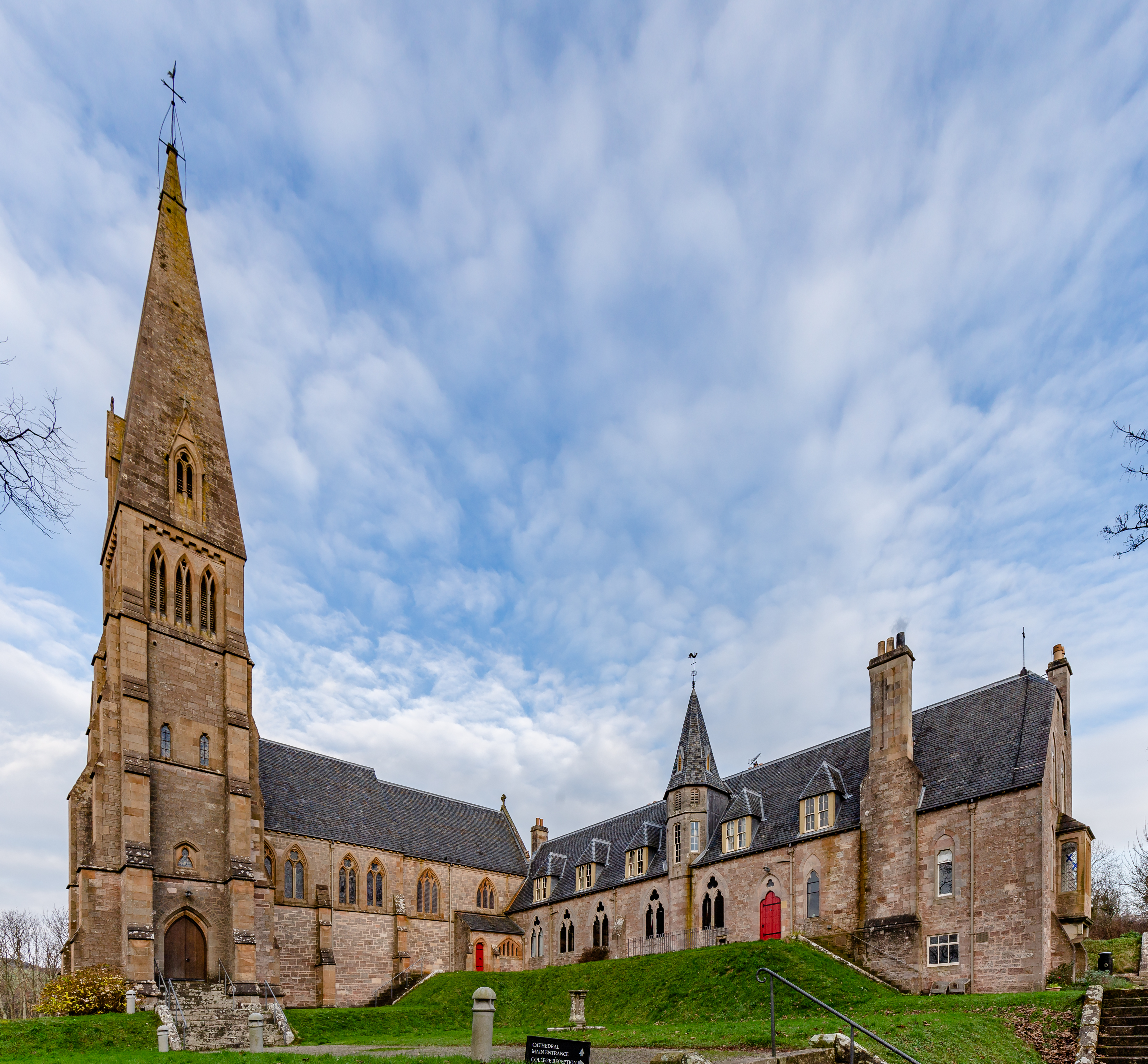
Cathedral of The Isles

The Cathedral of the Isles and Collegiate Church of the Holy Spirit is a Category A listed cathedral of the Scottish Episcopal Church in the town of Millport...

Nearby Amenities

Located within 500m of 55.780918,-4.924533
Source: PGS+landsat
Lat/Long: 55.7844039/-4.9288134
Source: survey
Tourism: picnic_site
Lat/Long: 55.7793403/-4.9311681
Tourism: picnic_site
Lat/Long: 55.7825146/-4.9297173
Bench
Source: survey
Lat/Long: 55.7848464/-4.9272252
Little Skate Bay
Natural: bay
Lat/Long: 55.7807014/-4.9323073
Power: pole
Lat/Long: 55.782832/-4.9180312
Power: pole
Lat/Long: 55.7844966/-4.9206325
Power: pole
Lat/Long: 55.7833875/-4.9188993
Power: pole
Lat/Long: 55.7837679/-4.9194937
Power: pole
Lat/Long: 55.7841438/-4.9200812
The data included in this document is from www.openstreetmap.org. The data is made available under ODbL.

Have you been to Gavin's Glen?

Leave your review of Gavin's Glen below (or comments, questions and feedback).