Glac Bhreac

Valley in Ross-shire

Scotland

Glac Bhreac

Camping in Srath Chrombaill NW slopes of Fionn Bheinn, looking towards Slioch and Fisherfield Six
Camping in Srath Chrombaill Credit: Ibn Musa

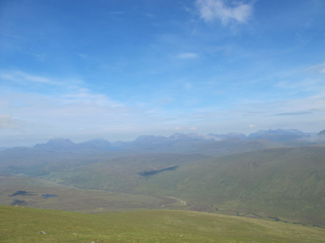
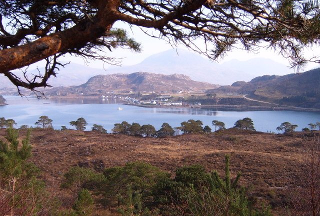
Glac Bhreac is a valley located in Ross-shire, Scotland. The valley is known for its stunning natural beauty, with rolling hills, lush greenery, and the tranquil River Glac running through it. Glac Bhreac is surrounded by mountains, providing a picturesque backdrop for visitors to enjoy.

The valley is home to a variety of wildlife, including deer, birds, and other native species. It is a popular destination for nature lovers and outdoor enthusiasts, who come to explore the many hiking trails and scenic overlooks in the area.

Glac Bhreac is also rich in history, with archaeological sites dating back thousands of years. Visitors can explore ancient ruins, standing stones, and other remnants of the valley's past.

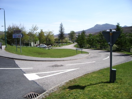
In addition to its natural beauty and historical significance, Glac Bhreac is also a thriving community, with local businesses, farms, and charming villages dotting the landscape. Visitors can enjoy traditional Scottish cuisine, shop for local crafts, and immerse themselves in the unique culture of the area.

Overall, Glac Bhreac is a hidden gem in Ross-shire, offering a peaceful retreat for those looking to escape the hustle and bustle of city life and immerse themselves in the beauty of the Scottish countryside.

If you have any feedback on the listing, please let us know in the comments section below.

Glac Bhreac Images

Images are sourced within 2km of 57.617455/-5.1408459 or Grid Reference NH1262. Thanks to Geograph Open Source API. All images are credited.

Camping in Srath Chrombaill NW slopes of Fionn Bheinn, looking towards Slioch and Fisherfield Six
Camping in Srath Chrombaill
NW slopes of Fionn Bheinn, looking towards Slioch and Fisherfield Six
Along the pipeline
Along the pipeline
North-west ridge of Meall a'Chaorainn Looking to Slioch on the left.
North-west ridge of Meall a'Chaorainn
Looking to Slioch on the left.
North-western ridge of Meall a'Chaorainn Meall a'Chaorainn has an almost flat western ridge, but the northern side has some big crags, just out of sight. Hills visible include, from the left, Slioch, Beinn Lair and the Fisherfield munros.
North-western ridge of Meall a'Chaorainn
Meall a'Chaorainn has an almost flat western ridge, but the northern side has some big crags, just out of sight. Hills visible include, from the left, Slioch, Beinn Lair and the Fisherfield munros.
Allt a' Chlaiginn The Allt a' Chlaiginn just before it is captured by an abstraction sluice <a title="https://www.geograph.org.uk/photo/2446702" href="https://www.geograph.org.uk/photo/2446702">Link</a> and its water diverted along the pipe to Loch Fannich as part of the Conon Hydro-Electric Power Scheme.
Allt a' Chlaiginn
The Allt a' Chlaiginn just before it is captured by an abstraction sluice Link and its water diverted along the pipe to Loch Fannich as part of the Conon Hydro-Electric Power Scheme.
Abstraction sluice on the Allt a' Chlaiginn The waters of the Allt a' Chlaiginn are captured by this dam and abstraction sluice and diverted along the pipe to Loch Fannich as part of the Conon Hydro-Electric Power Scheme.
Abstraction sluice on the Allt a' Chlaiginn
The waters of the Allt a' Chlaiginn are captured by this dam and abstraction sluice and diverted along the pipe to Loch Fannich as part of the Conon Hydro-Electric Power Scheme.
Sheep fanks in Srath Chrombaill
Pipeline to Loch Fannich The waters of all the burns and rivers flowing from Lochrosque Forest are captured by abstraction sluices and diverted along this pipe to Loch Fannich as part of the Conon Hydro-Electric Power Scheme.
Pipeline to Loch Fannich
The waters of all the burns and rivers flowing from Lochrosque Forest are captured by abstraction sluices and diverted along this pipe to Loch Fannich as part of the Conon Hydro-Electric Power Scheme.
Fenceline in Srath Chrombaill
Moorland above Srath Chrombaill A nice bit of bog on the slopes below Creag Dhubh.
Moorland above Srath Chrombaill
A nice bit of bog on the slopes below Creag Dhubh.
Western slopes of Fionn Bheinn Descending from the summit, the steep grassy slope begins to ease at this point. The distant view is to the mountains of Torridon.
Western slopes of Fionn Bheinn
Descending from the summit, the steep grassy slope begins to ease at this point. The distant view is to the mountains of Torridon.
Coire Bog Viewed from around 650m height on the west side of Fionn Bheinn. The hill to the right is the 705m Meall a' Chaorainn.
Coire Bog
Viewed from around 650m height on the west side of Fionn Bheinn. The hill to the right is the 705m Meall a' Chaorainn.
View From Fionn Bheinn Looking towards the remote mountains of Fisherfield.
View From Fionn Bheinn
Looking towards the remote mountains of Fisherfield.
Dry-stone dyke, Strath Chrombuill This substantial wall runs from the river well up the hill on the north side of the Strath.   The remains of an old fence meet it on the other side of the river.   This suggests to me that the wall may mark the march or boundary between two estates.
Dry-stone dyke, Strath Chrombuill
This substantial wall runs from the river well up the hill on the north side of the Strath. The remains of an old fence meet it on the other side of the river. This suggests to me that the wall may mark the march or boundary between two estates.
Allt na Slataich, Strath Chrombuill
Loch a’ Bhric Chàim
Loch a’ Bhric Chàim
Abstraction dam and pipeline, Allt a' Chlaiginn
Allt a' Chlaiginn
Allt a' Chlaiginn
Show me another place!

Glac Bhreac is located at Grid Ref: NH1262 (Lat: 57.617455, Lng: -5.1408459)

Unitary Authority: Highland

Police Authority: Highlands and Islands

What 3 Words

///cape.barbarian.hoofs. Near Achnasheen, Highland

Nearby Locations

Glac Bhreac

Related Wikis

Fionn Bheinn

Fionn Bheinn is a mountain located south of Loch Fannich in the northwestern Scottish Highlands. It has a height of 933 m (3061 ft) and is listed as a...

Achnasheen

Achnasheen (Gaelic Achadh na Sìne) is a small village in Ross-shire in the Highland council area of Scotland. The village is situated on the River Bran...

Achnasheen railway station

Achnasheen railway station is a remote railway station on the Kyle of Lochalsh Line, serving the village of Achnasheen in the north of Scotland. The station...

Wester Ross

Wester Ross (Scottish Gaelic: Ros an Iar) is an area of the Northwest Highlands of Scotland in the council area of Highland. The area is loosely defined...

Nearby Amenities

Located within 500m of 57.617455,-5.1408459
Ford: yes
Lat/Long: 57.6201545/-5.1396973
The data included in this document is from www.openstreetmap.org. The data is made available under ODbL.

Have you been to Glac Bhreac?

Leave your review of Glac Bhreac below (or comments, questions and feedback).