Altain Glen

Valley in Wigtownshire

Scotland

Altain Glen

Snow on the shore and lying on the sea at Sandhead A heavy snow shower fell on the sand when the tide was out. The incoming tide lifted the snow on top of the water. A rare sight for somewhere that gets snow about once every two or three years.
Snow on the shore and lying on the sea at Sandhead Credit: Colin McDonald

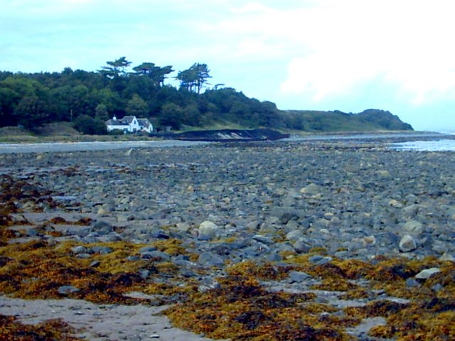
Altain Glen is a picturesque valley located in Wigtownshire, Dumfries and Galloway, Scotland. Nestled amidst the rolling hills and lush green countryside, this enchanting glen is often regarded as one of the hidden gems of the region.

The glen is characterized by its idyllic setting, featuring a meandering river, dense woodlands, and stunning waterfalls. It offers a tranquil and serene environment, making it a perfect destination for nature enthusiasts, hikers, and photographers seeking to capture the beauty of the Scottish landscape.

One of the prominent features of Altain Glen is its impressive waterfall, which cascades down the rocks, creating a mesmerizing sight and a soothing soundtrack of rushing water. The glen is also home to various species of flora and fauna, including oak trees, wildflowers, and a diverse range of birdlife.

Visitors can explore the glen by following the well-maintained walking trails that wind through the valley. These trails offer breathtaking views at every turn, with viewpoints strategically placed to allow visitors to fully appreciate the natural wonders of the glen.

Altain Glen is a popular spot for picnicking and relaxation, with designated areas providing benches and tables for visitors to enjoy a peaceful break amidst the beauty of nature. It is also a favored spot for wildlife enthusiasts, as the glen is known to be home to red squirrels, deer, and various bird species.

Overall, Altain Glen is a hidden oasis of tranquility and natural beauty, offering visitors a chance to escape the bustle of everyday life and immerse themselves in the peaceful serenity of the Scottish countryside.

If you have any feedback on the listing, please let us know in the comments section below.

Altain Glen Images

Images are sourced within 2km of 54.80197/-4.9622634 or Grid Reference NX0949. Thanks to Geograph Open Source API. All images are credited.

Snow on the shore and lying on the sea at Sandhead A heavy snow shower fell on the sand when the tide was out. The incoming tide lifted the snow on top of the water. A rare sight for somewhere that gets snow about once every two or three years.
Snow on the shore and lying on the sea at Sandhead
A heavy snow shower fell on the sand when the tide was out. The incoming tide lifted the snow on top of the water. A rare sight for somewhere that gets snow about once every two or three years.
The Dyemill, Near Sandhead Now a private dwelling, the Dye Mill was once powered by the Alwhibbie Burn to mill seaweed and obtain a brown dye.  Seaweed was one of Scotland's most valuable natural resources.
The Dyemill, Near Sandhead
Now a private dwelling, the Dye Mill was once powered by the Alwhibbie Burn to mill seaweed and obtain a brown dye. Seaweed was one of Scotland's most valuable natural resources.
Shoreline, Sandhead bay This shore is at the south end of Sandhead Bay - part of Luce Bay
Shoreline, Sandhead bay
This shore is at the south end of Sandhead Bay - part of Luce Bay
Summer on the Mull Of Galloway
Farmland near Ardwell Mill
Kirkmadrine Church (disused) This disused church is only just in this square located at NX080484. Housed in the old entrance to the church are some of the earliest Christian sculptured stones some of which date back to the 5th century.
Kirkmadrine Church (disused)
This disused church is only just in this square located at NX080484. Housed in the old entrance to the church are some of the earliest Christian sculptured stones some of which date back to the 5th century.
Sandhead Village, about 8 miles South of Stranraer The village of Sandhead photographed on a dull Autumn day from the beach at low tide.
Sandhead Village, about 8 miles South of Stranraer
The village of Sandhead photographed on a dull Autumn day from the beach at low tide.
Kirkmadrine Church Probably the site of a monastery in the early Christian period and later of a medieval parish church, built as a burial chapel in the late 19th Century by Lady McTaggart Stewart of Ardwell.
Kirkmadrine Church
Probably the site of a monastery in the early Christian period and later of a medieval parish church, built as a burial chapel in the late 19th Century by Lady McTaggart Stewart of Ardwell.
Cross in Kirkmadrine Churchyard
Sandhead beach Looking north east.
Sandhead beach
Looking north east.
Sandhead beach Looking south.
Sandhead beach
Looking south.
Kirkmadrine Church This is no longer used as a church but it is the site of an early Christian community. The Kirkmadrine Stones are fine sculptured stones from the 5th century. They are displayed in a glass-fronted porch at the west of the church.
Kirkmadrine Church
This is no longer used as a church but it is the site of an early Christian community. The Kirkmadrine Stones are fine sculptured stones from the 5th century. They are displayed in a glass-fronted porch at the west of the church.
Church Porch, Kirkmadrine This is a glassed porch which contains early Christian stones [5th century]
Church Porch, Kirkmadrine
This is a glassed porch which contains early Christian stones [5th century]
Playground at Sandhead The main part of the village is on a raised beach. The old sea cliff can be seen behind.
Playground at Sandhead
The main part of the village is on a raised beach. The old sea cliff can be seen behind.
Stoneykirk Old Manse, Sandhead Old manse for the now disused Stoneykirk Free Church (in trees behind manse); both date from 1844. The buildings actually stand to the south of Sandhead at Lake Cottage junction.
Stoneykirk Old Manse, Sandhead
Old manse for the now disused Stoneykirk Free Church (in trees behind manse); both date from 1844. The buildings actually stand to the south of Sandhead at Lake Cottage junction.
Kirkmadrine Stones The 5th century Kirkmadrine Christian sculptured stones are displayed in the glass-fronted west porch of Kirkmadrine Church; they are under the care of Historic Scotland.
Kirkmadrine Stones
The 5th century Kirkmadrine Christian sculptured stones are displayed in the glass-fronted west porch of Kirkmadrine Church; they are under the care of Historic Scotland.
Toskerton Kirk Road Upper part of track (former Kirk Road) that originally led to the medieval Toskerton Parish Church, it was rebuilt on by Kirkmadrine Church <a href="https://www.geograph.org.uk/gridref/NX0848">NX0848</a>.
Toskerton Kirk Road
Upper part of track (former Kirk Road) that originally led to the medieval Toskerton Parish Church, it was rebuilt on by Kirkmadrine Church NX0848.
Overdale Cottage View north on the Clachanmore-Sandhead road.
Overdale Cottage
View north on the Clachanmore-Sandhead road.
Show me another place!

Altain Glen is located at Grid Ref: NX0949 (Lat: 54.80197, Lng: -4.9622634)

Unitary Authority: Dumfries and Galloway

Police Authority: Dumfries and Galloway

What 3 Words

///gloom.chickens.moved. Near Stranraer, Dumfries & Galloway

Related Wikis

Sandhead

Sandhead is a small village in Dumfries and Galloway, south west Scotland. It overlooks Luce Bay, 7 miles south of Stranraer. The old main road, named...

Clachanmore

Clachanmore is a village in the South Rhins of Galloway near Ardwell in the south west of Scotland. It has also been known as Low Ardwell.The name of the...

Ardwell

Ardwell (from Gaelic Àrd Bhaile meaning "high town", pronounced as "Ardwell") is a village in the Scottish unitary council area of Dumfries and Galloway...

Stoneykirk

Stoneykirk (Scottish Gaelic: Eaglais Steafain) is an area and a village in the heart of the Rhins of Galloway, Wigtownshire, in the administrative council...

RAF West Freugh

RAF West Freugh is a former Royal Air Force station located in Wigtownshire, 5 miles (8 km) south east of Stranraer, Dumfries and Galloway, Scotland. It...

Doon Castle Broch

Doon Castle Broch is an iron-age broch located in Dumfries and Galloway, Scotland (grid reference NX 06702 44683). == Location == The Broch is located...

Garthland Castle

Garthland Castle was a castle that was located near Garthland Mains, Dumfries and Galloway, Scotland.The castle was possibly built in 1211, as a datestone...

Logan Botanic Garden

Logan Botanic Garden is a botanical garden near Port Logan on the Rhins of Galloway, at the south-western tip of Scotland. The Botanic Garden was established...

Nearby Amenities

Located within 500m of 54.80197,-4.9622634
Source: PGS
Lat/Long: 54.7993421/-4.9561196
Source: PGS
Lat/Long: 54.799676/-4.9568063
Source: PGS
Lat/Long: 54.7999358/-4.9572354
Source: PGS
Lat/Long: 54.8002821/-4.9576217
Source: PGS
Lat/Long: 54.8008634/-4.9581796
Source: PGS
Lat/Long: 54.8012221/-4.9585658
Source: PGS
Lat/Long: 54.8015313/-4.9590593
Source: PGS
Lat/Long: 54.8019642/-4.9596602
Source: PGS
Lat/Long: 54.8022858/-4.9601751
Source: PGS
Lat/Long: 54.8025208/-4.9605614
Source: PGS
Lat/Long: 54.8029042/-4.9608618
Source: PGS
Lat/Long: 54.8031887/-4.9609262
Source: PGS
Lat/Long: 54.803637/-4.961087
Source: PGS
Lat/Long: 54.804149/-4.961112
Source: PGS
Lat/Long: 54.804405/-4.961124
Source: PGS
Lat/Long: 54.8046975/-4.9610549
Source: PGS
Lat/Long: 54.8051551/-4.9609905
Source: PGS
Lat/Long: 54.805724/-4.9608189
Source: PGS
Lat/Long: 54.8062311/-4.960733
Turning Circle
Lat/Long: 54.8058196/-4.963598
Parking
Lat/Long: 54.8057204/-4.9613409
Power: pole
Lat/Long: 54.8011827/-4.9631435
Power: pole
Lat/Long: 54.8016249/-4.9646723
Power: pole
Lat/Long: 54.8000278/-4.967773
Power: pole
Lat/Long: 54.8007235/-4.9669951
Power: pole
Lat/Long: 54.8013048/-4.9663407
Power: pole
Lat/Long: 54.8021273/-4.9664319
Power: pole
Lat/Long: 54.8026112/-4.9664587
Power: pole
Lat/Long: 54.8034693/-4.9665123
Power: pole
Lat/Long: 54.8042546/-4.9665821
Power: pole
Lat/Long: 54.8049889/-4.9666733
Power: pole
Lat/Long: 54.7995714/-4.9686352
Bench
Lat/Long: 54.8063191/-4.9617897
Beach Cottage
Check Date: 2023-08-12
Contact Facebook: https://www.facebook.com/coastalcottageswigtownshire
Dog: yes
Internet Access: wlan
Internet Access Fee: no
Mobile: +44 7776 248265
Pets: yes
Phone: +44 1776 860228
Reservation: required
Tourism: chalet
Website: https://www.coastalcottageswigtownshire.co.uk/
Lat/Long: 54.8063229/-4.9621634
The data included in this document is from www.openstreetmap.org. The data is made available under ODbL.

Have you been to Altain Glen?

Leave your review of Altain Glen below (or comments, questions and feedback).