Glac Cùilce

Valley in Sutherland

Scotland

Glac Cùilce

B869 around Cnoc an Aodainn
B869 around Cnoc an Aodainn Credit: Jo and Steve Turner

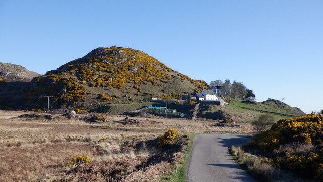
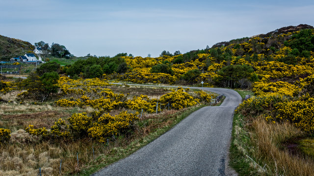
Glac Cùilce, located in Sutherland, Scotland, is a picturesque valley renowned for its stunning natural beauty. Nestled amidst the rugged Scottish Highlands, this valley offers visitors a unique experience of unspoiled wilderness and breathtaking landscapes.

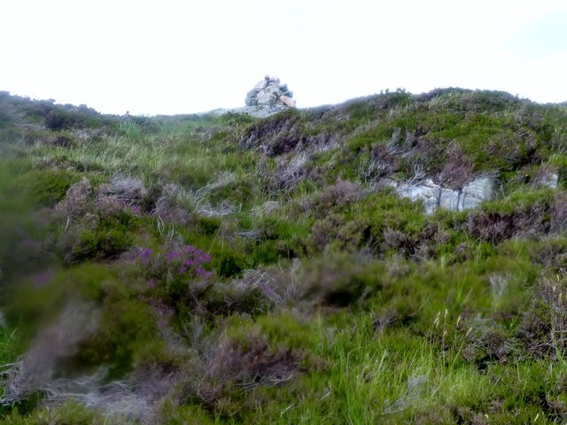
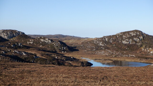
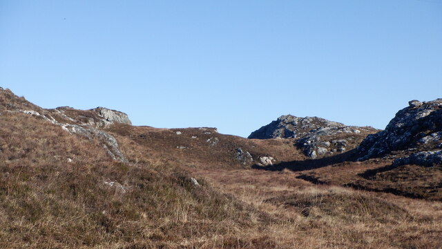
The valley is characterized by its rugged terrain, with towering mountains, steep cliffs, and cascading waterfalls. Glac Cùilce is surrounded by several prominent peaks, including Suilven and Canisp, which add to its dramatic appeal. The valley itself is carpeted with lush greenery, dotted with vibrant wildflowers during the warmer months.

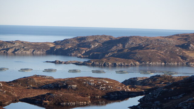
Glac Cùilce is home to a diverse range of wildlife, making it a haven for nature enthusiasts. Visitors may spot red deer, golden eagles, and wildcats, among other species. The valley’s pristine rivers and lochs are also teeming with salmon and trout, attracting fishing enthusiasts from around the world.

Hiking and mountaineering opportunities abound in Glac Cùilce, with numerous trails catering to different skill levels. The challenging ascent of Suilven, with its distinctive twin peaks, is a highlight for many outdoor enthusiasts. Additionally, the valley offers opportunities for camping, bird-watching, and wildlife photography.

Despite its remote location, Glac Cùilce is accessible by road, and there are nearby towns and villages where visitors can find accommodation, restaurants, and other amenities. The valley’s secluded atmosphere, however, ensures a sense of tranquility and escape from the hustle and bustle of daily life.

In conclusion, Glac Cùilce is a captivating valley in Sutherland, Scotland, offering visitors a chance to immerse themselves in a rugged, untouched landscape. With its awe-inspiring natural features and abundant wildlife, it is a destination that promises unforgettable experiences for those seeking a true Highland adventure.

If you have any feedback on the listing, please let us know in the comments section below.

Glac Cùilce Images

Images are sourced within 2km of 58.245035/-5.2493276 or Grid Reference NC0933. Thanks to Geograph Open Source API. All images are credited.

B869 around Cnoc an Aodainn
Loch Eileanach
Loch Eileanach
Sìdhean nan Ealachan,  Oldany Island Boat trip from Lower Badcall to Oldany Island for Ken Whyte's 2977th HuMP celebration, so he has now hit the wall and only 7 from the finish.
Name: Sidhean nan Ealachan
Hill number: 4773
Height: 104m / 341ft
Parent (Ma/M): none
Area: 16E: Scourie to Lairg
Class: Hu,1
Grid ref: NC085348 (est)
Drop: 104m
Col: Sea
Sìdhean nan Ealachan, Oldany Island
Boat trip from Lower Badcall to Oldany Island for Ken Whyte's 2977th HuMP celebration, so he has now hit the wall and only 7 from the finish. Name: Sidhean nan Ealachan Hill number: 4773 Height: 104m / 341ft Parent (Ma/M): none Area: 16E: Scourie to Lairg Class: Hu,1 Grid ref: NC085348 (est) Drop: 104m Col: Sea
Moorland On Oldany Island
Gate to Lòn Ruadh, boggy flats at Oldany
Moorland, Strathcroy Gneiss scenery north of the B869, North Assynt. The sharp hill here <a href="https://www.geograph.org.uk/photo/7489716">NC0831 : Rough grazing, Strathcroy</a>, seen from the side.
Moorland, Strathcroy
Gneiss scenery north of the B869, North Assynt. The sharp hill here NC0831 : Rough grazing, Strathcroy, seen from the side.
A peat track A break from the sometimes hard going on the moors, a little used track to a bog.
A peat track
A break from the sometimes hard going on the moors, a little used track to a bog.
Summit near Strathcroy 106m high hill in the North Assynt gneiss country. An easy walk from the road thanks to a peat road. As usual with these rocky and heathery hills the quality of view is out of proportion to their height.
Summit near Strathcroy
106m high hill in the North Assynt gneiss country. An easy walk from the road thanks to a peat road. As usual with these rocky and heathery hills the quality of view is out of proportion to their height.
Loch an Achaidh Bhig View north from about 100m above sea level. A typical North Assynt loch.
Loch an Achaidh Bhig
View north from about 100m above sea level. A typical North Assynt loch.
Loch an Achaidh Bhig The tiny island is a refuge from grazing.
Loch an Achaidh Bhig
The tiny island is a refuge from grazing.
Fish farm by Oldany Island
North Assynt moorland Between Loch an Achaidh Bhig and the coast.
North Assynt moorland
Between Loch an Achaidh Bhig and the coast.
North Assynt moorland Low but rough gneiss hills.
North Assynt moorland
Low but rough gneiss hills.
B869, North Assynt
B869, North Assynt
Rough grazing near Oldany Beside the B869 above Oldany.
Rough grazing near Oldany
Beside the B869 above Oldany.
Lòn Ruadh Wetland by Oldany, North Assynt. Looks like a former loch which has undergone succession.
Lòn Ruadh
Wetland by Oldany, North Assynt. Looks like a former loch which has undergone succession.
B869, Oldany
B869, Oldany
B869 near Oldany
B869 near Oldany
Show me another place!

Glac Cùilce is located at Grid Ref: NC0933 (Lat: 58.245035, Lng: -5.2493276)

Unitary Authority: Highland

Police Authority: Highlands and Islands

What 3 Words

///slowness.supply.paradise. Near Clachtoll, Highland

Nearby Locations

Glac Cùilce

Related Wikis

Oldany Island

Oldany Island (formerly Oldney Island) is an uninhabited island in Assynt, Sutherland, north-west Scotland. The name is Norse in origin and possibly means...

Culkein Drumbeg

Culkein Drumbeg (Scottish Gaelic: Cùl-cinn an Droma Bhig) is a remote village on the north west coast of Scotland. It is located 0.93 miles (1.50 km) north...

Drumbeg, Sutherland

Drumbeg (Scottish Gaelic: An Druim Beag) is a remote crofting village on the north west coast of Scotland in Assynt, Sutherland, Scottish Highlands and...
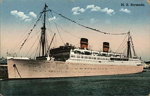
MV Bermuda

MV Bermuda was a passenger motor ship that Furness, Withy's Furness Bermuda Line operated between New York and Bermuda from 1928 until 1931. She was damaged...

Nearby Amenities

Located within 500m of 58.245035,-5.2493276
Source: PGS
Lat/Long: 58.2487809/-5.2514954
Source: PGS
Lat/Long: 58.2486792/-5.2512593
Source: PGS
Lat/Long: 58.2485268/-5.2512379
Source: PGS
Lat/Long: 58.2482276/-5.2522196
Source: PGS
Lat/Long: 58.2479678/-5.252402
Source: PGS
Lat/Long: 58.2479904/-5.2527345
Source: PGS
Lat/Long: 58.2478013/-5.2531369
Created By: almien_coastlines
Source: PGS
Lat/Long: 58.247703/-5.25274
Source: PGS
Lat/Long: 58.2472254/-5.2523859
Source: PGS
Lat/Long: 58.2470362/-5.2521713
Source: PGS
Lat/Long: 58.2467595/-5.251817
Created By: almien_coastlines
Source: PGS
Lat/Long: 58.2468/-5.253168
Source: PGS
Lat/Long: 58.2470137/-5.2535017
Source: PGS
Lat/Long: 58.247296/-5.2546443
Created By: almien_coastlines
Source: PGS
Lat/Long: 58.247387/-5.25612
Source: PGS
Lat/Long: 58.2470842/-5.2567203
The data included in this document is from www.openstreetmap.org. The data is made available under ODbL.

Have you been to Glac Cùilce?

Leave your review of Glac Cùilce below (or comments, questions and feedback).