Cwm-brechfa

Valley in Pembrokeshire

Wales

Cwm-brechfa

The B4313 near Llanycefn
The B4313 near Llanycefn Credit: David Gearing

Cwm-brechfa is a picturesque valley located in the county of Pembrokeshire, Wales. Nestled within the rolling hills and lush countryside, this valley offers breathtaking natural beauty and a tranquil atmosphere.

The name "Cwm-brechfa" translates to "the valley of the speckled land" in Welsh, which reflects the diverse landscape found here. The valley is characterized by its steep slopes, dense woodlands, and meandering streams that flow through the area. It is a haven for nature enthusiasts, providing opportunities for hiking, birdwatching, and exploring the local flora and fauna.

The valley is also home to the Cwm-brechfa Forest, a vast woodland covering over 13,000 acres. This forest is managed by Natural Resources Wales and offers various recreational activities, including mountain biking trails and walking paths. It is a popular destination for outdoor enthusiasts seeking adventure and tranquility.

In addition to its natural beauty, Cwm-brechfa is also known for its rich history. The valley is dotted with remnants of ancient settlements, including the ruins of a 12th-century castle and several Neolithic burial sites. These historical landmarks provide a glimpse into the valley's past and add to its charm.

Overall, Cwm-brechfa is a hidden gem in Pembrokeshire, offering visitors a chance to escape the hustle and bustle of modern life and immerse themselves in the beauty of nature. Whether it's exploring the forest trails, admiring the stunning vistas, or delving into the valley's history, Cwm-brechfa has something to offer for everyone.

If you have any feedback on the listing, please let us know in the comments section below.
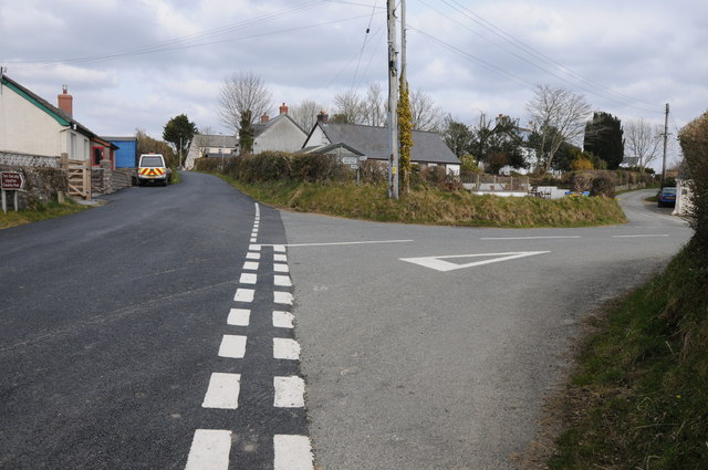
Cwm-brechfa Images

Images are sourced within 2km of 51.866617/-4.7730376 or Grid Reference SN0922. Thanks to Geograph Open Source API. All images are credited.

The B4313 near Llanycefn
Ordnance Survey Cut Mark This OS cut mark can be found on the west parapet of Llandre Bridge. It marks a point 27.426m above mean sea level.
Ordnance Survey Cut Mark
This OS cut mark can be found on the west parapet of Llandre Bridge. It marks a point 27.426m above mean sea level.
Ford at Rhyd-afallen This ford (rhyd) is found at Rhyd-afallen on Afon Rhyd-afallen.
Ford at Rhyd-afallen
This ford (rhyd) is found at Rhyd-afallen on Afon Rhyd-afallen.
Longridge Road The country road named Longridge Road briefly enters the south-west corner of this grid square.
Longridge Road
The country road named Longridge Road briefly enters the south-west corner of this grid square.
Road junction in Penffordd Road junction in the hamlet of Penffordd.
Road junction in Penffordd
Road junction in the hamlet of Penffordd.
Drive to Holloway Farm Drive to Holloway Farm near Penffordd.
Drive to Holloway Farm
Drive to Holloway Farm near Penffordd.
Farm buildings at Rhyd-afallen Farm buildings beside the road at Rhyd-afallen.
Farm buildings at Rhyd-afallen
Farm buildings beside the road at Rhyd-afallen.
View to Posty Farm View to Posty Farm to the north of Penffordd.
View to Posty Farm
View to Posty Farm to the north of Penffordd.
Milk churn stand What appears to be an old milk churn stand opposite the entrance to Posty Farm near Penffordd.
Milk churn stand
What appears to be an old milk churn stand opposite the entrance to Posty Farm near Penffordd.
Track to farmland Track to farmland off the B4313 near Llanycefn.
Track to farmland
Track to farmland off the B4313 near Llanycefn.
The B4313 approaching Llanycefn
Farmland at Llanycefn Farmland at Llanycefn to the east of the B4313.
Farmland at Llanycefn
Farmland at Llanycefn to the east of the B4313.
Uphill road towards Brechfa near Llanycefn A view of the B4313 road which goes to the top of the hill, south of Llanycefn.
Uphill road towards Brechfa near Llanycefn
A view of the B4313 road which goes to the top of the hill, south of Llanycefn.
B4313 heading for Narberth A view of the B4313 road heading for Narberth, near Glancleddau.
B4313 heading for Narberth
A view of the B4313 road heading for Narberth, near Glancleddau.
Road Junction Road junction on the B4313 between Felin Fach Caravan Park and Llandre Bridge.
Road Junction
Road junction on the B4313 between Felin Fach Caravan Park and Llandre Bridge.
Llanycefn Crossroads Crossroads on the B4313 on 3 miles outside Maenclochog.
Llanycefn Crossroads
Crossroads on the B4313 on 3 miles outside Maenclochog.
St Non's Church, Llanycefn Built of Preseli stone, but little is medieval, most of the church being rebuilt in 1904.  Before that the bellcote was of brick and there were sash windows. The small red rectangle on the west wall is intriguing.
St Non's Church, Llanycefn
Built of Preseli stone, but little is medieval, most of the church being rebuilt in 1904. Before that the bellcote was of brick and there were sash windows. The small red rectangle on the west wall is intriguing.
Penffordd This is the nearest thing to a village in Bletherston parish, which mostly consists of scattered farms.
Penffordd
This is the nearest thing to a village in Bletherston parish, which mostly consists of scattered farms.
Show me another place!

Cwm-brechfa is located at Grid Ref: SN0922 (Lat: 51.866617, Lng: -4.7730376)

Unitary Authority: Pembrokeshire

Police Authority: Dyfed Powys

What 3 Words

///rust.tadpoles.betrayed. Near Narberth, Pembrokeshire

Nearby Locations

Cwm-brechfa

Related Wikis

Bletherston

Bletherston (Welsh: Trefelen) is a small settlement and parish in Pembrokeshire, Wales. It is in the middle of eastern Pembrokeshire, 6 miles (9.7 km)...

Llanycefn railway station

Llanycefn railway station, also known as Llan-y-cefn railway station, served the hamlet of Llanycefn, Pembrokeshire in the parish of Maenclochog, Wales...

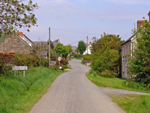
Penffordd, Pembrokeshire

Penffordd or Pen-ffordd is a small village in the community of New Moat, Pembrokeshire, Wales, in the parish of Bletherston. It lies approximately 10.8...

Beag Fair Siding railway station

Beag Fair Siding railway station served the village of Clynderwen, Pembrokeshire, Wales, from 1878 to 1949 on the Narberth Road and Maenclochog Railway...

Nearby Amenities

Located within 500m of 51.866617,-4.7730376
The data included in this document is from www.openstreetmap.org. The data is made available under ODbL.

Have you been to Cwm-brechfa?

Leave your review of Cwm-brechfa below (or comments, questions and feedback).