Blood Glen

Valley in Ayrshire

Scotland

Blood Glen

Carlock House, Glen App Yes it's in the trees. Viewed from the A77.
Carlock House, Glen App Credit: Billy McCrorie

Blood Glen is a picturesque valley located in Ayrshire, Scotland. Nestled amidst rolling hills and lush greenery, this enchanting glen is a haven for nature enthusiasts and those seeking a tranquil escape from the bustling city life.

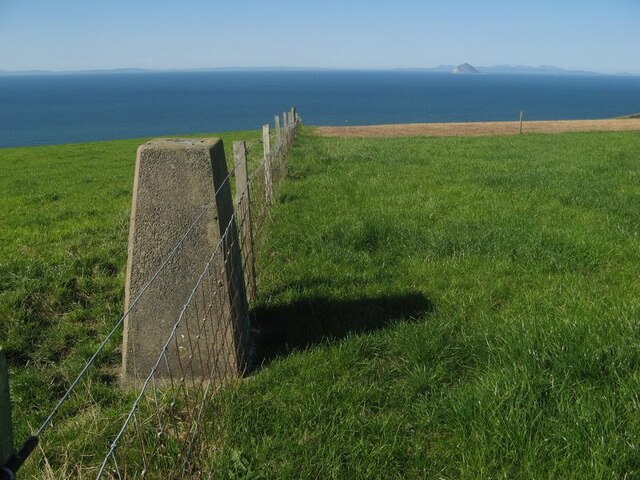
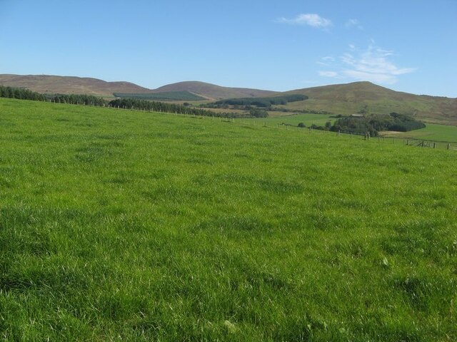
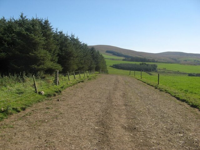
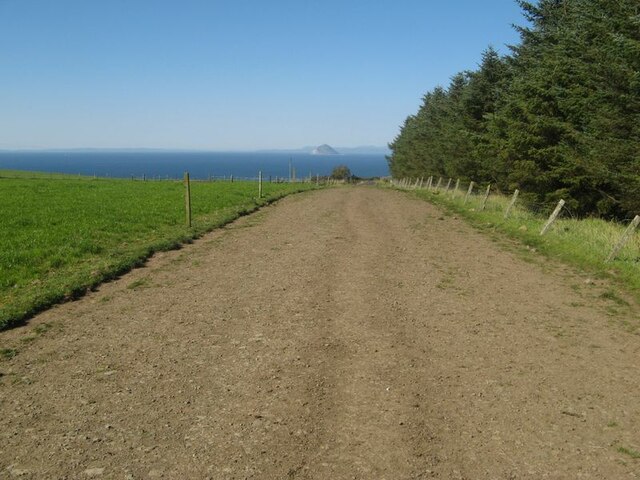
Covering an area of approximately 2 square miles, Blood Glen is renowned for its breathtaking natural beauty. The glen is characterized by its dense woodland, consisting of a variety of indigenous trees such as oak, birch, and rowan. The vibrant foliage provides a stunning display of colors throughout the seasons, with vibrant greens in spring and summer, and rich hues of red, orange, and gold in autumn.

At the heart of Blood Glen flows a meandering river, its crystal-clear waters reflecting the surrounding landscape. The river is home to various species of fish, including salmon and trout, making it a popular spot for fishing enthusiasts. For those who prefer a leisurely stroll, there are several walking trails that wind through the glen, offering stunning views of the valley and its abundant wildlife.

The peaceful ambiance of Blood Glen is further enhanced by the absence of any major roads or urban developments. This secluded location provides a serene environment, perfect for picnics, photography, or simply unwinding in nature's embrace. Visitors often spot a variety of bird species, including buzzards, kestrels, and owls, as well as other wildlife such as deer, foxes, and squirrels.

Overall, Blood Glen in Ayrshire is a hidden gem, offering a retreat from the fast-paced modern world. Its natural beauty and tranquility make it a must-visit destination for nature lovers and those seeking a peaceful respite.

If you have any feedback on the listing, please let us know in the comments section below.

Blood Glen Images

Images are sourced within 2km of 55.062631/-5.0002811 or Grid Reference NX0878. Thanks to Geograph Open Source API. All images are credited.

Carlock House, Glen App Yes it's in the trees. Viewed from the A77.
Carlock House, Glen App
Yes it's in the trees. Viewed from the A77.
Stubble field The harvest is done, and there are distant sounds of baling the straw. Just visible are some of the great flock of birds gleaning the remains of the crop.
Stubble field
The harvest is done, and there are distant sounds of baling the straw. Just visible are some of the great flock of birds gleaning the remains of the crop.
Farming landscape A view over stubble to Meadow Park and Craigalbert farms.
Farming landscape
A view over stubble to Meadow Park and Craigalbert farms.
Turning the straw Turning barley straw and rowing-up for baling.
Turning the straw
Turning barley straw and rowing-up for baling.
Trig point with fence The triangulation pillar at Girlaverie, which affords a fine view of Ailsa Craig.
Trig point with fence
The triangulation pillar at Girlaverie, which affords a fine view of Ailsa Craig.
Farmed grassland I once heard a commentator refer to the 'emerald desert' of the intensively-cropped grasslands which support beef and dairy cows in southwest Scotland. I get the point, and the ecology is not diverse. Distant, heather moorland on gentle hills provides a contrast.
Farmed grassland
I once heard a commentator refer to the 'emerald desert' of the intensively-cropped grasslands which support beef and dairy cows in southwest Scotland. I get the point, and the ecology is not diverse. Distant, heather moorland on gentle hills provides a contrast.
Cow track (1) Running alongside a conifer plantation is one of many local walking routes for cows to take themselves to milking parlours, guided by fringing electric fences. The track is descending towards the glen of the Ballochdowan Burn.
Cow track (1)
Running alongside a conifer plantation is one of many local walking routes for cows to take themselves to milking parlours, guided by fringing electric fences. The track is descending towards the glen of the Ballochdowan Burn.
Cow track (2) Looking northward to Ailsa Craig along a cattle walking route. See also <a href="https://www.geograph.org.uk/photo/7611731">NX0778 : Cow track (1)</a>.
Cow track (2)
Looking northward to Ailsa Craig along a cattle walking route. See also NX0778 : Cow track (1).
Hawthorn hedge Hedges are not common in this wide, cow-dominated landscape so it is nice to see hawthorn with a good crop of berries.
Hawthorn hedge
Hedges are not common in this wide, cow-dominated landscape so it is nice to see hawthorn with a good crop of berries.
Auchencrosh Trail
Auchencrosh Trail
Small Burn
Small Burn
Farmland at Auchencrosh
Auchencrosh Trail With Wind Turbine on the left.
Auchencrosh Trail
With Wind Turbine on the left.
Auchencrosh Trail
Auchencrosh Trail
Farmland at Auchencrosh With a view of the Ailsa Craig in the distance.
Farmland at Auchencrosh
With a view of the Ailsa Craig in the distance.
Track to Kilantringan
Sheep in a turnip field Looking SE from position
Sheep in a turnip field
Looking SE from position
Memorial stone to Robert Cunningham, postman This memorial on Killantringan Moor was to a postman who perished in a snowstorm in 1908. It has since been refurbished by the Communication Workers Union.
Memorial stone to Robert Cunningham, postman
This memorial on Killantringan Moor was to a postman who perished in a snowstorm in 1908. It has since been refurbished by the Communication Workers Union.
Show me another place!

Blood Glen is located at Grid Ref: NX0878 (Lat: 55.062631, Lng: -5.0002811)

Unitary Authority: South Ayrshire

Police Authority: Ayrshire

What 3 Words

///unspoiled.suddenly.photo. Near Cairnryan, Dumfries & Galloway

Related Wikis

Glenapp Castle

Glenapp Castle, formerly the family seat of the Earl of Inchcape, is now a luxury hotel and restaurant located about 1+1⁄2 miles (2.5 kilometres) southeast...

River Stinchar

The River Stinchar ( STIN-shər) is a river in South Ayrshire, Scotland. It flows south west from the Galloway Forest Park to enter the Firth of Clyde at...

Ballantrae

Ballantrae is a community in Carrick, South Ayrshire, Scotland. The name probably comes from the Scottish Gaelic Baile na Tràgha, meaning the "town by...

Ballantrae Windmill

The Ballantrae Windmill, on Mill Hill was a late 17th or early 18th century vaulted tower windmill, the ruins of which are located above the old raised...

Nearby Amenities

Located within 500m of 55.062631,-5.0002811
Power: pole
Lat/Long: 55.0644998/-5.0057128
Power: pole
Lat/Long: 55.0642294/-5.0047982
Power: pole
Lat/Long: 55.0639576/-5.0038889
Power: pole
Lat/Long: 55.0635229/-5.0024352
Power: pole
Lat/Long: 55.0632341/-5.0014105
Power: pole
Lat/Long: 55.0628347/-5.0000507
Power: pole
Lat/Long: 55.0641864/-4.9932647
Power: pole
Lat/Long: 55.0633892/-4.9936187
Power: pole
Lat/Long: 55.0628132/-4.9939245
Power: pole
Lat/Long: 55.0618486/-4.9944019
Power: pole
Lat/Long: 55.0624185/-4.9986962
Power: pole
Lat/Long: 55.0616612/-4.9959147
Power: pole
Lat/Long: 55.0613493/-4.9946487
Power: pole
Lat/Long: 55.0610237/-4.9935544
Power: pole
Lat/Long: 55.062734/-5.0018988
Power: pole
Lat/Long: 55.062194/-5.0024703
Power: pole
Lat/Long: 55.0616512/-5.0030629
Power: pole
Lat/Long: 55.0610977/-5.0036649
Power: pole
Lat/Long: 55.0605306/-5.0042411
Power: pole
Lat/Long: 55.0600188/-5.0047773
Power: pole
Lat/Long: 55.0593548/-5.0055063
The data included in this document is from www.openstreetmap.org. The data is made available under ODbL.

Have you been to Blood Glen?

Leave your review of Blood Glen below (or comments, questions and feedback).