An Caorann Beag

Valley in Ross-shire

Scotland

An Caorann Beag

Cluanie Inn - Glen Shiel Cluanie Inn, started 1787. An isolated staging post situated where drovers of old turned south for Tomdoun via Loch Loyne, built on the instructions of Macdonell of Glengarry. Despite additions by George Rhind, 1842 , and 20th century accretions, it is still recognisable as the typical two-storey, threebay change house associated with the coming of improved routes through the glens. This was one of two inns in the parish (the other being at Shielhouse) built "for the comfort of travellers". In Glen Shiel, a bypassed bridge on the old road, Telford, 1815, marks the site of the battle of Glenshiel, 1719.

Taken from "Western Seaboard: An Illustrated Architectural Guide", by Mary Miers, 2008. Published by the Rutland Press.

Canmore ID 12072 <span class="nowrap"><a title="http://canmore.org.uk/site/12072" rel="nofollow ugc noopener" href="http://canmore.org.uk/site/12072">Link</a><img style="margin-left:2px;" alt="External link" title="External link - shift click to open in new window" src="https://s1.geograph.org.uk/img/external.png" width="10" height="10"/></span>
Cluanie Inn - Glen Shiel Credit: Raibeart MacAoidh

An Caorann Beag, also known as Ross-shire Valley, is a picturesque valley located in the county of Ross-shire, Scotland. Nestled amidst the stunning landscapes of the Scottish Highlands, this valley is renowned for its natural beauty and tranquil surroundings.

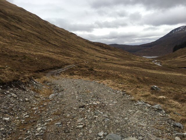
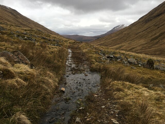
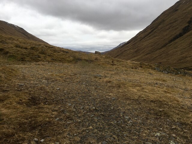
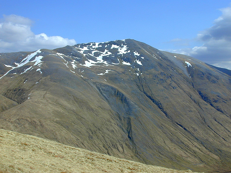
Characterized by rolling hills, verdant meadows, and meandering rivers, An Caorann Beag offers a breathtaking panorama of the surrounding mountains, often capped with snow during the winter months. The valley is dotted with clusters of charming cottages and traditional farms, adding to its idyllic charm.

The area is home to an abundance of wildlife, including red deer, golden eagles, and otters, making it a haven for nature enthusiasts and wildlife photographers. The pristine rivers that flow through the valley also attract fly fishermen from far and wide, drawn by the promise of Atlantic salmon and brown trout.

An Caorann Beag is also steeped in history, with numerous archaeological sites scattered throughout the valley. Ancient standing stones, burial cairns, and Iron Age hillforts serve as reminders of the area's rich past.

Visitors to An Caorann Beag can explore its natural wonders through a network of walking trails that crisscross the valley, offering stunning vistas at every turn. The valley's proximity to the nearby town of Ullapool provides easy access to amenities such as accommodations, restaurants, and shops.

In conclusion, An Caorann Beag, Ross-shire Valley, is a captivating destination that combines breathtaking natural beauty, abundant wildlife, and a rich historical heritage. Whether seeking outdoor adventures, tranquility, or a glimpse into Scotland's past, this valley offers a truly unforgettable experience for visitors.

If you have any feedback on the listing, please let us know in the comments section below.

An Caorann Beag Images

Images are sourced within 2km of 57.168978/-5.1905417 or Grid Reference NH0713. Thanks to Geograph Open Source API. All images are credited.

Cluanie Inn - Glen Shiel Cluanie Inn, started 1787. An isolated staging post situated where drovers of old turned south for Tomdoun via Loch Loyne, built on the instructions of Macdonell of Glengarry. Despite additions by George Rhind, 1842 , and 20th century accretions, it is still recognisable as the typical two-storey, threebay change house associated with the coming of improved routes through the glens. This was one of two inns in the parish (the other being at Shielhouse) built "for the comfort of travellers". In Glen Shiel, a bypassed bridge on the old road, Telford, 1815, marks the site of the battle of Glenshiel, 1719.

Taken from "Western Seaboard: An Illustrated Architectural Guide", by Mary Miers, 2008. Published by the Rutland Press.

Canmore ID 12072 <span class="nowrap"><a title="http://canmore.org.uk/site/12072" rel="nofollow ugc noopener" href="http://canmore.org.uk/site/12072">Link</a><img style="margin-left:2px;" alt="External link" title="External link - shift click to open in new window" src="https://s1.geograph.org.uk/img/external.png" width="10" height="10"/></span>
Cluanie Inn - Glen Shiel
Cluanie Inn, started 1787. An isolated staging post situated where drovers of old turned south for Tomdoun via Loch Loyne, built on the instructions of Macdonell of Glengarry. Despite additions by George Rhind, 1842 , and 20th century accretions, it is still recognisable as the typical two-storey, threebay change house associated with the coming of improved routes through the glens. This was one of two inns in the parish (the other being at Shielhouse) built "for the comfort of travellers". In Glen Shiel, a bypassed bridge on the old road, Telford, 1815, marks the site of the battle of Glenshiel, 1719. Taken from "Western Seaboard: An Illustrated Architectural Guide", by Mary Miers, 2008. Published by the Rutland Press. Canmore ID 12072 LinkExternal link
Cluanie Inn beside the A87 Road
Bridge over the River Cluanie The bridge is on the old road to Tomdoun and Cluanie Lodge
Bridge over the River Cluanie
The bridge is on the old road to Tomdoun and Cluanie Lodge
The River Cluanie on its way towards Loch Cluanie
Marsh to the south and west of the Cluanie Inn
The River Cluanie on its way towards Loch Cluanie Viewed from the bridge in image <a href="https://www.geograph.org.uk/photo/7039184">NH0711 : Bridge over the River Cluanie</a>
The River Cluanie on its way towards Loch Cluanie
Viewed from the bridge in image NH0711 : Bridge over the River Cluanie
Layby on the A87, Glenshiel Forest The A87 is a primary route  in the Highland region of Scotland. It runs west for 99 miles from its junction with the A82 at Invergarry, along the north shores of Loch Garry and Loch Cluanie, then through Glen Shiel and along Loch Duich to Kyle of Lochalsh before crossing the Skye Bridge to Kyleakin, Broadford, and Portree, before terminating at Uig in the north of the Isle of Skye.
Layby on the A87, Glenshiel Forest
The A87 is a primary route in the Highland region of Scotland. It runs west for 99 miles from its junction with the A82 at Invergarry, along the north shores of Loch Garry and Loch Cluanie, then through Glen Shiel and along Loch Duich to Kyle of Lochalsh before crossing the Skye Bridge to Kyleakin, Broadford, and Portree, before terminating at Uig in the north of the Isle of Skye.
A87 near Cluanie Inn The A87 is a primary route  in the Highland region of Scotland. It runs west for 99 miles from its junction with the A82 at Invergarry, along the north shores of Loch Garry and Loch Cluanie, then through Glen Shiel and along Loch Duich to Kyle of Lochalsh before crossing the Skye Bridge to Kyleakin, Broadford, and Portree, before terminating at Uig in the north of the Isle of Skye.
A87 near Cluanie Inn
The A87 is a primary route in the Highland region of Scotland. It runs west for 99 miles from its junction with the A82 at Invergarry, along the north shores of Loch Garry and Loch Cluanie, then through Glen Shiel and along Loch Duich to Kyle of Lochalsh before crossing the Skye Bridge to Kyleakin, Broadford, and Portree, before terminating at Uig in the north of the Isle of Skye.
A87 passing Cluanie Inn
A87, Glen Shiel The A87 is a primary route  in the Highland region of Scotland. It runs west for 99 miles from its junction with the A82 at Invergarry, along the north shores of Loch Garry and Loch Cluanie, then through Glen Shiel and along Loch Duich to Kyle of Lochalsh before crossing the Skye Bridge to Kyleakin, Broadford, and Portree, before terminating at Uig in the north of the Isle of Skye.
A87, Glen Shiel
The A87 is a primary route in the Highland region of Scotland. It runs west for 99 miles from its junction with the A82 at Invergarry, along the north shores of Loch Garry and Loch Cluanie, then through Glen Shiel and along Loch Duich to Kyle of Lochalsh before crossing the Skye Bridge to Kyleakin, Broadford, and Portree, before terminating at Uig in the north of the Isle of Skye.
The A87 alongside Loch Cluanie
Looking across the loch towards Cluanie Lodge
Track in An Caorann Mor
Track, An Caorann Mor
Boggy track, An Caorann Mor
Turning area on the track, An Caorann Mor
A87 near Cluanie Inn
A87 approaching The Cluanie Inn The A87 runs 99 miles from Invergarry to Uig on the Isle of Skye <a href="https://www.geograph.org.uk/photo/7374675">NG3863 : End of the A87, Uig</a>.
<span class="nowrap"><a title="https://www.sabre-roads.org.uk/wiki/index.php?title=A87" rel="nofollow ugc noopener" href="https://www.sabre-roads.org.uk/wiki/index.php?title=A87">Link</a><img style="margin-left:2px;" alt="External link" title="External link - shift click to open in new window" src="https://s1.geograph.org.uk/img/external.png" width="10" height="10"/></span>
A87 approaching The Cluanie Inn
The A87 runs 99 miles from Invergarry to Uig on the Isle of Skye NG3863 : End of the A87, Uig. LinkExternal link
Show me another place!

An Caorann Beag is located at Grid Ref: NH0713 (Lat: 57.168978, Lng: -5.1905417)

Unitary Authority: Highland

Police Authority: Highlands and Islands

What 3 Words

///pinks.linguists.expect. Near Glenelg, Highland

Nearby Locations

An Caorann Beag

Related Wikis

Am Bàthach

Am Bàthach is a Scottish mountain situated at the head of Glen Shiel, at the western end of Loch Cluanie some 38 km (24 mi) south east of Kyle of Lochalsh...

Aonach Meadhoin

Aonach Meadhoin is a Munro mountain situated in the Kintail region of Scotland. It stands on the northern side of Glen Shiel some 31 kilometres south east...

A' Chràlaig

A' Chralaig (Scottish Gaelic: A' Chràileag) is a mountain in the Northwest Highlands of Scotland, north of Loch Cluanie and south of Glen Affric. It is...

Ciste Dhubh

Ciste Dhubh is a mountain in the Scottish Highlands, between Glen Shiel and Glen Affric. With a height of 979 metres (3,212 ft), it is classed as a Munro...

Have you been to An Caorann Beag?

Leave your review of An Caorann Beag below (or comments, questions and feedback).