Aldouran Glen

Valley in Wigtownshire

Scotland

Aldouran Glen

Garchrie Moss Here mosses are bogs, and this is probably a raised bog. Looking southwest from High Weirston.
Garchrie Moss Credit: M J Richardson

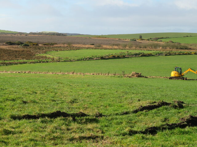
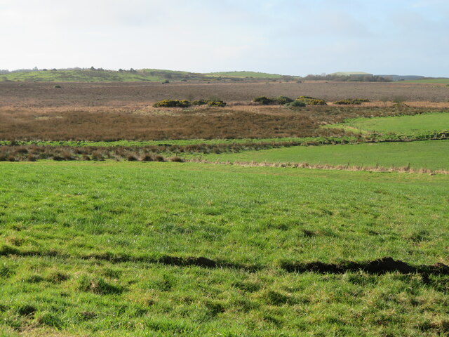
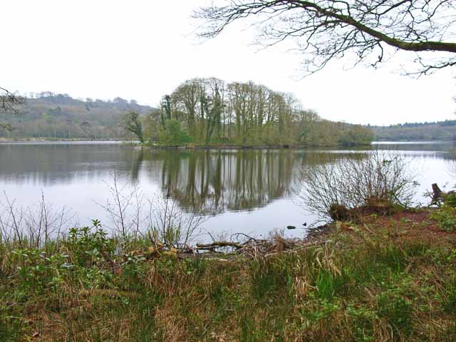
Aldouran Glen is a picturesque valley located in Wigtownshire, Scotland. Situated in the southernmost part of the country, this glen offers stunning natural beauty and a tranquil atmosphere. The glen is characterized by its rolling hills, lush greenery, and meandering river, which adds to its scenic charm.

The landscape of Aldouran Glen is dominated by a variety of flora and fauna, making it a haven for nature lovers and wildlife enthusiasts. The area is home to various species of birds, including buzzards, red kites, and owls, as well as mammals such as foxes, badgers, and deer. The glen's diverse ecosystem also supports a wide range of plant life, including wildflowers and ancient oak woodlands.

Visitors to Aldouran Glen can explore its many walking trails, which offer different levels of difficulty and cater to various fitness levels. These paths wind through the glen, allowing visitors to immerse themselves in the tranquil surroundings and enjoy the breathtaking views.

In addition to its natural beauty, Aldouran Glen is also steeped in history. The glen is home to several ancient archaeological sites, including standing stones and burial cairns, which provide a glimpse into its rich cultural heritage.

Overall, Aldouran Glen offers a serene and idyllic escape for those seeking to connect with nature and experience the beauty of the Scottish countryside. Whether it's hiking, birdwatching, or simply enjoying a peaceful picnic, this valley has something to offer for everyone.

If you have any feedback on the listing, please let us know in the comments section below.

Aldouran Glen Images

Images are sourced within 2km of 54.926839/-5.1044012 or Grid Reference NX0163. Thanks to Geograph Open Source API. All images are credited.

Garchrie Moss Here mosses are bogs, and this is probably a raised bog. Looking southwest from High Weirston.
Garchrie Moss
Here mosses are bogs, and this is probably a raised bog. Looking southwest from High Weirston.
Garchrie Moss Here mosses are bogs, and this is probably a raised bog. Looking southwest from High Weirston.
Garchrie Moss
Here mosses are bogs, and this is probably a raised bog. Looking southwest from High Weirston.
Loch Naw An 11th century castle once stood on the island in the middle of the loch. The current 16th century Lochnaw Castle, ancestral home of the Agnew clan, lies directly beyond the island on the far shore.
Loch Naw
An 11th century castle once stood on the island in the middle of the loch. The current 16th century Lochnaw Castle, ancestral home of the Agnew clan, lies directly beyond the island on the far shore.
Entrance to Drumlochart Caravan Park The caravan park is set in attractive surroundings near Lochnaw Castle. <span class="nowrap"><a title="http://www.drumlochart.co.uk/" rel="nofollow ugc noopener" href="http://www.drumlochart.co.uk/">Link</a><img style="margin-left:2px;" alt="External link" title="External link - shift click to open in new window" src="https://s1.geograph.org.uk/img/external.png" width="10" height="10"/></span>
Entrance to Drumlochart Caravan Park
The caravan park is set in attractive surroundings near Lochnaw Castle. LinkExternal link
Garchrie Moss An area of low moorland to the west of Leswalt. The coniferous woodland is an extension of Glenlochart Wood.
Garchrie Moss
An area of low moorland to the west of Leswalt. The coniferous woodland is an extension of Glenlochart Wood.
Lochnaw Loch Looking across a large raft of aquatic vegetation towards Lochnaw Castle on the far shore.
Lochnaw Loch
Looking across a large raft of aquatic vegetation towards Lochnaw Castle on the far shore.
Road to Leswalt at Drumlochart Wood
Road to Portpatrick at Drumlochart Wood
Belties at Lochnaw
Belties at Lochnaw
Lochnaw Castle Walk
Lochnaw Castle Walk
Exit Road from Lochnaw Castle
Small Pond at Lochnaw
Lochnaw Castle Walk With marker post just to the right of track.
Lochnaw Castle Walk
With marker post just to the right of track.
Estate Road, Lochnaw
Exit Road from Lochnaw Castle
Lochnaw Castle Walk
Lochnaw Castle Walk
Fork in Road The waymarked trail is on the right.
Fork in Road
The waymarked trail is on the right.
Woodland Track
Woodland Track
Show me another place!

Aldouran Glen is located at Grid Ref: NX0163 (Lat: 54.926839, Lng: -5.1044012)

Unitary Authority: Dumfries and Galloway

Police Authority: Dumfries and Galloway

What 3 Words

///thigh.tonight.hotspots. Near Stranraer, Dumfries & Galloway

Related Wikis

Leswalt

Leswalt (Scottish Gaelic: Lios Uillt) is a village and civil parish in Dumfries and Galloway, south-west Scotland. It lies between Portpatrick and Stranraer...

Galdenoch Castle

Galdenoch Castle is a tower house near the Scottish village of Leswalt in the Council Area Dumfries and Galloway . The ruin is listed as a Scheduled Monument...

Ervie

Ervie is a small village in Dumfries and Galloway, Scotland, in the Rhins of Galloway, just outside Stranraer.

RAF Wig Bay

Royal Air Force Wig Bay, or more simply RAF Wig Bay, is a former Royal Air Force station near Stranraer, Dumfries and Galloway, Scotland The following...

Stranraer railway station

Stranraer railway station (formerly known as Stranraer Harbour railway station) is a railway station that serves the town of Stranraer, Dumfries and Galloway...

Kirkcolm

Kirkcolm (Scots: Kirkcoam) is a village and civil parish on the northern tip of the Rhinns of Galloway peninsula, south-west Scotland. It is in Dumfries...

Old Town Hall, Stranraer

The Old Town Hall is a municipal structure in George Street, Stranraer, Dumfries and Galloway, Scotland. The structure, which is used as a local history...

Stranraer Sheriff Court

Stranraer Sheriff Court is a judicial building in Lewis Street, Stranraer, Dumfries and Galloway, Scotland. The building, which continues to be used as...

Nearby Amenities

Located within 500m of 54.926839,-5.1044012
Power: pole
Lat/Long: 54.9246041/-5.098414
Power: pole
Lat/Long: 54.9242196/-5.099503
Power: pole
Lat/Long: 54.9238519/-5.1005074
Power: pole
Lat/Long: 54.9232809/-5.1020068
Power: pole
Lat/Long: 54.9228616/-5.1032192
Power: pole
Lat/Long: 54.9225055/-5.1041673
Power: pole
Lat/Long: 54.9239544/-5.1097879
Power: pole
Lat/Long: 54.9241733/-5.1086774
Power: pole
Lat/Long: 54.9244338/-5.1074624
Power: pole
Lat/Long: 54.924497/-5.1060784
Power: pole
Lat/Long: 54.9245556/-5.104689
Power: pole
Lat/Long: 54.9246141/-5.1034337
Power: pole
Lat/Long: 54.9246635/-5.1021034
Power: pole
Lat/Long: 54.9247236/-5.1008561
Power: pole
Lat/Long: 54.9248099/-5.099676
Power: pole
Lat/Long: 54.9248947/-5.0985172
Power: pole
Lat/Long: 54.9249764/-5.0974309
Power: pole
Lat/Long: 54.9234914/-5.0995492
Power: pole
Lat/Long: 54.9308926/-5.1068573
Power: pole
Lat/Long: 54.9302424/-5.1063009
Power: pole
Lat/Long: 54.9294237/-5.1055896
Power: pole
Lat/Long: 54.9310625/-5.1062892
The data included in this document is from www.openstreetmap.org. The data is made available under ODbL.

Have you been to Aldouran Glen?

Leave your review of Aldouran Glen below (or comments, questions and feedback).