Lacasdail

Settlement in Ross-shire

Scotland

Lacasdail

Isle of Lewis War Memorial
Isle of Lewis War Memorial Credit: Sandy Gerrard

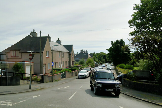
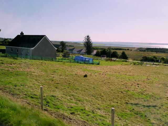
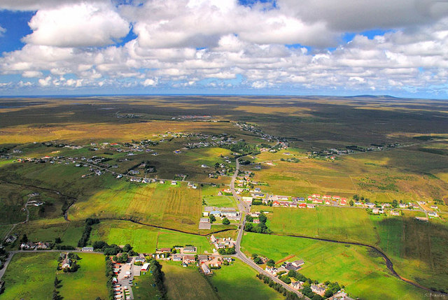
Lacasdail is a small village located in Ross-shire, a historic county in the Scottish Highlands. Situated on the western coast of Scotland, Lacasdail enjoys a picturesque setting with stunning views of the surrounding countryside and the nearby Loch Ewe. With a population of around 300 residents, it is a close-knit community that exudes a peaceful and tranquil atmosphere.

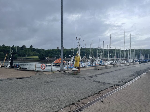
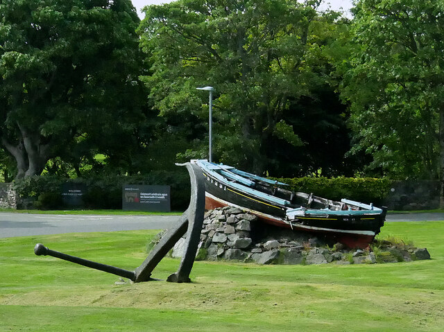
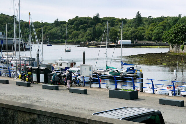
The village is known for its rich history and strong ties to the fishing industry. In the past, Lacasdail was a bustling fishing port, and remnants of this heritage can still be seen in the harbor area. Today, the village is mostly residential, with a few local businesses catering to the needs of the community.

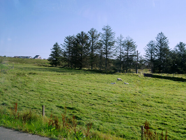
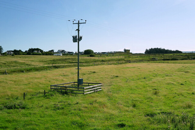
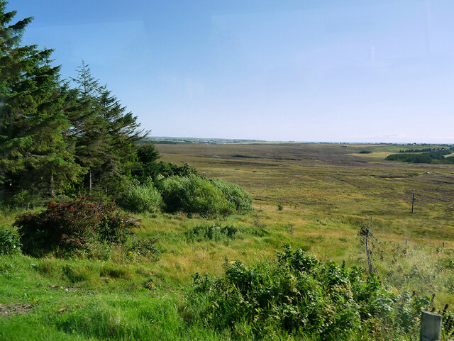
Nature enthusiasts will find themselves in paradise in Lacasdail, as the village is surrounded by breathtaking landscapes. The rugged coastline, rolling hills, and nearby nature reserves offer ample opportunities for outdoor activities such as hiking, birdwatching, and wildlife spotting.

Despite its small size, Lacasdail has a strong sense of community spirit, with various events and gatherings organized throughout the year. These include local festivals, sports tournaments, and charity events, which bring the residents together and contribute to the close bonds within the village.

In summary, Lacasdail is a charming village situated in Ross-shire, Scotland. With its stunning natural beauty, rich history, and warm community spirit, it offers residents and visitors a peaceful retreat in the heart of the Scottish Highlands.

If you have any feedback on the listing, please let us know in the comments section below.
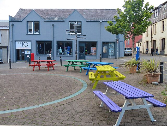
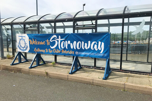
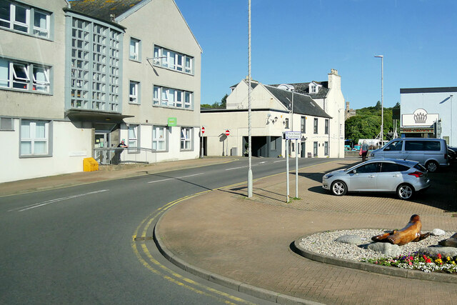
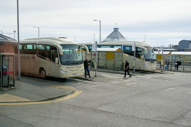
Lacasdail Images

Images are sourced within 2km of 58.224315/-6.3860374 or Grid Reference NB4234. Thanks to Geograph Open Source API. All images are credited.

Isle of Lewis War Memorial
Fisherman in Stornoway
Pedestrian Precinct Enlived by a colourful floral display, this is one of Stornoway's main shopping streets.
Pedestrian Precinct
Enlived by a colourful floral display, this is one of Stornoway's main shopping streets.
Traditional Houses On the corner of Keith Street and Francis Street, these are very much in keeping with the sort of late 18th and early 19th century houses found in most parts of Scotland - and they have little in common with the black houses of most of the Hebrides.
Traditional Houses
On the corner of Keith Street and Francis Street, these are very much in keeping with the sort of late 18th and early 19th century houses found in most parts of Scotland - and they have little in common with the black houses of most of the Hebrides.
Colourful Benches Bench tables in bright colours make a cheerful sight in the grey streets of Stornoway.
Colourful Benches
Bench tables in bright colours make a cheerful sight in the grey streets of Stornoway.
Stornoway - Gateway to the Outer Hebrides
Stornoway, Castle Street
Stornoway Bus Station
Stornoway, Willowglen Road
Boat and Anchor A typical 1940/50s West Coast fishing boat, Scalpay, now featured as one of the ornamental displays around Stornoway.
Boat and Anchor
A typical 1940/50s West Coast fishing boat, Scalpay, now featured as one of the ornamental displays around Stornoway.
Horse and Carriage near Lews Castle This sculpture of a horse, carriage and its driver carved from wood, stands near the entrance to Lews Castle in Stornoway. More details may be found at <span class="nowrap"><a title="https://treecarving.co.uk/lews-castle-carriage-driver-sculpture/" rel="nofollow ugc noopener" href="https://treecarving.co.uk/lews-castle-carriage-driver-sculpture/">Link</a><img style="margin-left:2px;" alt="External link" title="External link - shift click to open in new window" src="https://s1.geograph.org.uk/img/external.png" width="10" height="10"/></span> , the website of the sculptor, Simon O'Rourke.
Horse and Carriage near Lews Castle
This sculpture of a horse, carriage and its driver carved from wood, stands near the entrance to Lews Castle in Stornoway. More details may be found at LinkExternal link , the website of the sculptor, Simon O'Rourke.
The Boatman's Tower, Stornoway Built in 1847-51 by Sir James Matheson in the Neo-Gothic style popular in the Victorian era and substantially altered by Lord Leverhulme. After being used as a school, it re-opened in 2016 with the addition of a modern extension for the museum/archives (<span class="nowrap"><a title="https://www.visitouterhebrides.co.uk/see-and-do/2-the-boatmans-tower-p560881" rel="nofollow ugc noopener" href="https://www.visitouterhebrides.co.uk/see-and-do/2-the-boatmans-tower-p560881">Link</a><img style="margin-left:2px;" alt="External link" title="External link - shift click to open in new window" src="https://s1.geograph.org.uk/img/external.png" width="10" height="10"/></span> Visit the Outer Hebrides).
The Boatman's Tower, Stornoway
Built in 1847-51 by Sir James Matheson in the Neo-Gothic style popular in the Victorian era and substantially altered by Lord Leverhulme. After being used as a school, it re-opened in 2016 with the addition of a modern extension for the museum/archives (LinkExternal link Visit the Outer Hebrides).
Stornoway Harbour
Stornoway Harbour
Sheep Grazing in a Field near Lacasdal
Lacasdal Bus Stop
Lacasdal Bus Stop
Laxdale
Laxdale
House at Newmarket
House at Newmarket
Moorland north of Newmarket
Show me another place!

Lacasdail is located at Grid Ref: NB4234 (Lat: 58.224315, Lng: -6.3860374)

Unitary Authority: Na h-Eileanan an Iar

Police Authority: Highlands and Islands

Also known as: Laxdale

What 3 Words

///standing.firework.singers. Near Stornoway, Na h-Eileanan Siar

Related Wikis

Western Isles Hospital

The Western Isles Hospital (Scottish Gaelic: Ospadal nan Eilean Siar) is a rural general hospital in Stornoway on Lewis in the Western Isles of Scotland...

Laxdale

Laxdale (Scottish Gaelic: Lacasdal) is a village in the Scottish Outer Hebrides, on the Isle of Lewis. Although nominally a distinct village, Laxdale is...
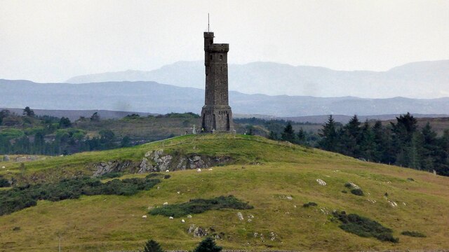
Lewis War Memorial

The Lewis War Memorial is a war memorial dedicated to the men from the Lewis area (Outer Hebrides, Scotland) who lost their lives in World War I and those...

Newmarket, Lewis

Newmarket (; Scottish Gaelic: An Margaidh Ùr [ən̪ˠ ˈmaɾakaj ˈuːɾ]) is a village in the Outer Hebrides of Scotland, on the Isle of Lewis near Stornoway...

Newvalley, Lewis

Newvalley (Scottish Gaelic: An Gleann Ùr) is a hamlet on the Isle of Lewis in the Outer Hebrides, Scotland. Newvalley is within the parish of Stornoway...

Lewis Loom Centre

The Lewis Loom Centre is located in Stornoway, Lewis, in Scotland

Lews Castle College

UHI North, West, and Hebrides (formerly UHI Outer Hebrides and Lews Castle College (Scottish Gaelic: Colaisde a' Chaisteil [ˈkʰɔl̪ˠɪʃtʲə ə ˈkʰaʃtʰal],...

Stornoway Free Presbyterian Church

The Stornoway Free Presbyterian Church, is a place of worship of the Free Presbyterian Church of Scotland in Stornoway. The church was built in 1895.

Nearby Amenities

Located within 500m of 58.224315,-6.3860374
Bus Stop
Guershader
Bus: yes
Naptan AtcoCode: 6010731683
Naptan Bearing: S
Naptan CommonName: Guershader
Naptan Indicator: Village
Naptan Landmark: Village
Naptan NaptanCode: 94723876
Naptan Street: Village
Naptan Verified: no
Public Transport: platform
Source: naptan_import
Lat/Long: 58.2248959/-6.3932734
Bus Stop
Stornoway - Cearns Phonebox
Bus: yes
Naptan AtcoCode: 6010731829
Naptan Bearing: N
Naptan CommonName: Stornoway (Lewis)
Naptan Indicator: Cearns Phonebox
Naptan Landmark: Cearns Phonebox
Naptan NaptanCode: 94723872
Naptan Street: Cearns Phonebox
Naptan Verified: no
Public Transport: platform
Source: naptan_import
Lat/Long: 58.2231302/-6.3872639
Bus Stop
Stornoway - Stewart Drive
Bus: yes
Naptan AtcoCode: 6010731840
Naptan Bearing: E
Naptan CommonName: Stornoway (Lewis)
Naptan Indicator: Stewart Drive
Naptan Landmark: Stewart Drive
Naptan NaptanCode: 94723865
Naptan Street: Stewart Drive
Naptan Verified: no
Public Transport: platform
Source: naptan_import
Lat/Long: 58.2205587/-6.3905653
Bus Stop
Stornoway - Western Isles Hospital
Bus: yes
Naptan AtcoCode: 601033
Naptan Bearing: N
Naptan CommonName: Western Isles Hospital
Naptan Indicator: opp
Naptan Landmark: W I Hospital
Naptan NaptanCode: 94724547
Naptan Street: Macaulay Road
Naptan Verified: no
Public Transport: platform
Shelter: yes
Source: naptan_import
Lat/Long: 58.221867/-6.3862688
Turning Circle
Noexit: yes
Lat/Long: 58.2226434/-6.3872709
Turning Circle
Noexit: yes
Lat/Long: 58.2219652/-6.3908547
Turning Circle
Noexit: yes
Lat/Long: 58.2222336/-6.3830419
Turning Circle
Noexit: yes
Lat/Long: 58.2229203/-6.3855894
Noexit: yes
Lat/Long: 58.2218295/-6.388554
Turning Circle
Noexit: yes
Lat/Long: 58.2229002/-6.390056
Noexit: yes
Lat/Long: 58.2215421/-6.3864286
Turning Circle
Lat/Long: 58.2227386/-6.3838163
Turning Circle
Noexit: yes
Lat/Long: 58.2250334/-6.3837937
Turning Circle
Noexit: yes
Lat/Long: 58.2226087/-6.3843918
Turning Circle
Lat/Long: 58.2220322/-6.3844371
Turning Circle
Turning Circle: hammer
Lat/Long: 58.2221013/-6.3824737
Turning Circle
Lat/Long: 58.2221986/-6.385635
Foot: yes
Noexit: yes
Lat/Long: 58.2218356/-6.3922374
Noexit: yes
Lat/Long: 58.2232192/-6.3889015
Turning Circle
Lat/Long: 58.2219847/-6.3834511
Lacasdal
Name En: Laxdale
Name Gd: Lacasdal
Place: village
Wikidata: Q13642858
Wikipedia: en:Laxdale
Lat/Long: 58.2276738/-6.3889307
Crossing
Crossing: uncontrolled
Lat/Long: 58.2211916/-6.38408
Bus Stop
Bus: yes
Naptan AtcoCode: 6010279
Naptan NaptanCode: 94725262
Public Transport: platform
Lat/Long: 58.2277182/-6.3890474
Turning Circle
Noexit: yes
Lat/Long: 58.222639/-6.3896395
Bus Stop
Stornoway - Western Isles Hostpital
Bus: yes
Naptan AtcoCode: 6010731841
Naptan Bearing: S
Naptan CommonName: Western Isles Hospital
Naptan Indicator: nr
Naptan NaptanCode: 94723869
Naptan Street: Macaulay Road
Naptan Verified: no
Public Transport: platform
Shelter: yes
Lat/Long: 58.2209379/-6.3860388
Cearns
Alt Name: Na Cearns
Alt Name En: The Cearns
Is In City: Steòrnabhagh
Note: "Cearns" is the name in both English and Gaelic. 'S e "Cearns" a tha an t-ainm air, ann an dà chuid Beurla is Gàidhlig.
Place: neighbourhood
Lat/Long: 58.2224298/-6.3910327
Giubhairsiadar
Name En: Guershader
Name Gd: Giubhairsiadar
Place: hamlet
Lat/Long: 58.2247385/-6.3934359
Generator Method: photovoltaic
Generator Output Electricity: yes
Generator Source: solar
Generator Type: solar_photovoltaic_panel
Location: roof
Power: generator
Lat/Long: 58.2225907/-6.3924759
Turning Circle
Lat/Long: 58.2248917/-6.3811226
Noexit: yes
Lat/Long: 58.2219247/-6.3833436
Entrance: yes
Foot: yes
Lat/Long: 58.2226942/-6.3871432
Entrance: yes
Foot: yes
Lat/Long: 58.2227242/-6.3873949
Post Box
Post Box Type: lamp
Royal Cypher: scottish_crown
Lat/Long: 58.2228085/-6.3879785
Man Made: chimney
Lat/Long: 58.2211407/-6.3823217
Entrance: yes
Foot: yes
Lat/Long: 58.2225534/-6.3932372
Power: pole
Lat/Long: 58.226059/-6.3931079
Power: pole
Lat/Long: 58.2255516/-6.3926531
Power: pole
Lat/Long: 58.2250074/-6.3922002
Power: pole
Lat/Long: 58.2249132/-6.3931226
Power: pole
Lat/Long: 58.2284995/-6.3890048
Power: pole
Lat/Long: 58.2282565/-6.3874958
Power: pole
Lat/Long: 58.2222536/-6.3814423
Power: pole
Lat/Long: 58.2226339/-6.3823866
Power: pole
Lat/Long: 58.2229737/-6.3832789
Power: pole
Lat/Long: 58.2234225/-6.384135
Power: pole
Lat/Long: 58.2238594/-6.3842289
Power: pole
Lat/Long: 58.2244247/-6.3843496
Power: pole
Lat/Long: 58.2249049/-6.3846656
Power: pole
Lat/Long: 58.2253465/-6.3850471
Power: pole
Lat/Long: 58.2262141/-6.3853117
Power: pole
Lat/Long: 58.2269243/-6.3855146
Power: pole
Lat/Long: 58.2275834/-6.385717
Power: pole
Lat/Long: 58.2282711/-6.3859264
Power: pole
Lat/Long: 58.2278765/-6.3870066
Power: pole
Lat/Long: 58.2279314/-6.3868525
Power: pole
Lat/Long: 58.2246118/-6.3868752
Power: pole
Lat/Long: 58.2250131/-6.3870546
Power: pole
Lat/Long: 58.2253846/-6.3872242
Power: pole
Lat/Long: 58.225804/-6.3874012
Power: pole
Lat/Long: 58.2261763/-6.3875514
Power: pole
Lat/Long: 58.2252765/-6.3835032
Power: pole
Lat/Long: 58.2251635/-6.3824033
Power: pole
Lat/Long: 58.2251924/-6.3816538
Power: pole
Lat/Long: 58.2210772/-6.3815889
Power: pole
Lat/Long: 58.2206204/-6.3811844
Charging Station
Access: yes
Capacity: 2
Fee: no
Operator: ChargePlace Scotland
Operator Wikidata: Q105359316
Socket Type2 Output: 22 kW
Lat/Long: 58.2204204/-6.3821056
Barrier: cattle_grid
Lat/Long: 58.2247858/-6.381159
Power: pole
Lat/Long: 58.227486/-6.3878263
Noexit: yes
Lat/Long: 58.2218852/-6.3821408
Crossing
Button Operated: yes
Crossing: traffic_signals
Crossing Island: no
Tactile Paving: yes
Lat/Long: 58.2211588/-6.3861995
Generator Method: photovoltaic
Generator Output Electricity: small_installation
Generator Source: solar
Generator Type: solar_photovoltaic_panel
Power: generator
Lat/Long: 58.2247467/-6.3928122
Street Lamp
Lamp Type: electric
Lat/Long: 58.2239678/-6.3835479
Street Lamp
Lamp Type: electric
Lat/Long: 58.2243399/-6.3845591
Street Lamp
Lamp Type: electric
Lat/Long: 58.2243089/-6.3847858
Street Lamp
Lamp Type: electric
Lat/Long: 58.2241147/-6.3846785
Street Lamp
Lamp Type: electric
Lat/Long: 58.2241316/-6.3844049
Street Lamp
Lamp Type: electric
Lat/Long: 58.2241796/-6.3840214
Street Lamp
Lamp Type: electric
Lat/Long: 58.2242234/-6.3836807
Street Lamp
Lamp Type: electric
Lat/Long: 58.224311/-6.3835077
Street Lamp
Lamp Type: electric
Lat/Long: 58.2242262/-6.3830303
Street Lamp
Lamp Type: electric
Lat/Long: 58.2242594/-6.3832435
Street Lamp
Lamp Type: electric
Lat/Long: 58.2244053/-6.3859774
Street Lamp
Lamp Type: electric
Lat/Long: 58.2241574/-6.385917
Street Lamp
Lamp Type: electric
Lat/Long: 58.2239279/-6.3858392
Street Lamp
Lamp Type: electric
Lat/Long: 58.2244589/-6.384757
Street Lamp
Lamp Type: electric
Lat/Long: 58.2243954/-6.3852652
Street Lamp
Lamp Type: electric
Lat/Long: 58.2243325/-6.3857098
Street Lamp
Lamp Type: electric
Lat/Long: 58.2245796/-6.3833625
Noexit: yes
Lat/Long: 58.221985/-6.3870861
Turning Circle
Turning Circle: hammer
Lat/Long: 58.2231968/-6.3888679
Telephone
Booth: KX100
Covered: booth
Lat/Long: 58.2231149/-6.3871738
Noexit: yes
Lat/Long: 58.2233553/-6.3879856
Access: private
Entrance: yes
Lat/Long: 58.2231249/-6.3901927
Access: private
Entrance: yes
Lat/Long: 58.2230184/-6.3900359
Barrier: bollard
Bollard: foldable
Material: steel
Width: 1
Lat/Long: 58.222122/-6.3931439
Barrier: bollard
Bollard: foldable
Material: steel
Width: 1
Lat/Long: 58.2221111/-6.3931469
Street Lamp
Lamp Type: electric
Lat/Long: 58.2210473/-6.3912552
Street Lamp
Lamp Type: electric
Lat/Long: 58.2208292/-6.3912756
Street Lamp
Lamp Type: electric
Lat/Long: 58.2212763/-6.3912186
Street Lamp
Lamp Type: electric
Lat/Long: 58.2217234/-6.3912696
Street Lamp
Lamp Type: electric
Lat/Long: 58.2219046/-6.3909704
Street Lamp
Lamp Type: electric
Lat/Long: 58.2205495/-6.3904979
Street Lamp
Lamp Type: electric
Lat/Long: 58.2215623/-6.3927108
Street Lamp
Lamp Type: electric
Lat/Long: 58.2217813/-6.3928878
Street Lamp
Lamp Type: electric
Lat/Long: 58.2222248/-6.3928663
Street Lamp
Lamp Type: electric
Lat/Long: 58.2223993/-6.3924318
Street Lamp
Lamp Type: electric
Lat/Long: 58.2224642/-6.3912114
Street Lamp
Lamp Type: electric
Lat/Long: 58.2225885/-6.3913992
Street Lamp
Lamp Type: electric
Lat/Long: 58.2222298/-6.3908862
Street Lamp
Lamp Type: electric
Lat/Long: 58.222965/-6.3915655
Street Lamp
Lamp Type: electric
Lat/Long: 58.223179/-6.3915158
Noexit: yes
Lat/Long: 58.2227594/-6.3919973
Street Lamp
Lamp Type: electric
Lat/Long: 58.222888/-6.3899065
Street Lamp
Lamp Type: electric
Lat/Long: 58.2225935/-6.3891971
Street Lamp
Lamp Type: electric
Lat/Long: 58.2224805/-6.389535
Street Lamp
Lamp Type: electric
Lat/Long: 58.2223526/-6.3900594
Street Lamp
Lamp Type: electric
Lat/Long: 58.2234339/-6.3900916
Street Lamp
Lamp Type: electric
Lat/Long: 58.2233386/-6.3908882
Street Lamp
Lamp Type: electric
Lat/Long: 58.2234989/-6.3895847
Street Lamp
Lamp Type: electric
Lat/Long: 58.2235723/-6.3889677
Street Lamp
Lamp Type: electric
Lat/Long: 58.2236528/-6.388328
Street Lamp
Lamp Type: electric
Lat/Long: 58.2237326/-6.3877326
Street Lamp
Lamp Type: electric
Lat/Long: 58.2237192/-6.3870513
Street Lamp
Lamp Type: electric
Lat/Long: 58.2237736/-6.386075
Street Lamp
Lamp Type: electric
Lat/Long: 58.2232785/-6.3861259
Street Lamp
Lamp Type: electric
Lat/Long: 58.2230271/-6.385957
Street Lamp
Lamp Type: electric
Lat/Long: 58.2227623/-6.3861756
Street Lamp
Lamp Type: electric
Lat/Long: 58.2225066/-6.3861903
Street Lamp
Lamp Type: electric
Lat/Long: 58.2223046/-6.3859985
Street Lamp
Lamp Type: electric
Lat/Long: 58.2231161/-6.3868689
Street Lamp
Lamp Type: electric
Lat/Long: 58.2233273/-6.3878157
Street Lamp
Lamp Type: electric
Lat/Long: 58.2233626/-6.3870111
Street Lamp
Lamp Type: electric
Lat/Long: 58.2229466/-6.3856834
Street Lamp
Lamp Type: electric
Lat/Long: 58.2225688/-6.3843771
Street Lamp
Lamp Type: electric
Lat/Long: 58.2225998/-6.3850021
Street Lamp
Lamp Type: electric
Lat/Long: 58.2224953/-6.3857706
Street Lamp
Lamp Type: electric
Lat/Long: 58.2224819/-6.3854728
Street Lamp
Lamp Type: electric
Lat/Long: 58.2217869/-6.3860482
Street Lamp
Lamp Type: electric
Lat/Long: 58.2220602/-6.386242
Street Lamp
Lamp Type: electric
Lat/Long: 58.2211386/-6.3863204
Street Lamp
Lamp Type: electric
Lat/Long: 58.2214006/-6.3860254
Street Lamp
Lamp Type: electric
Lat/Long: 58.2208765/-6.3860026
Street Lamp
Lamp Type: electric
Lat/Long: 58.2198277/-6.3863392
Street Lamp
Lamp Type: electric
Lat/Long: 58.2200897/-6.3863231
Street Lamp
Lamp Type: electric
Lat/Long: 58.2206315/-6.386303
Street Lamp
Lamp Type: electric
Lat/Long: 58.2204415/-6.3861273
Street Lamp
Lamp Type: electric
Lat/Long: 58.220683/-6.3905677
Street Lamp
Lamp Type: electric
Lat/Long: 58.2209429/-6.3905596
Street Lamp
Lamp Type: electric
Lat/Long: 58.2212071/-6.3905516
Street Lamp
Lamp Type: electric
Lat/Long: 58.2214592/-6.3904859
Street Lamp
Lamp Type: electric
Lat/Long: 58.221503/-6.3900084
Street Lamp
Lamp Type: electric
Lat/Long: 58.2214733/-6.389464
Street Lamp
Lamp Type: electric
Lat/Long: 58.2214486/-6.3889986
Street Lamp
Lamp Type: electric
Lat/Long: 58.2214204/-6.3885104
Street Lamp
Lamp Type: electric
Lat/Long: 58.2213957/-6.3880571
Street Lamp
Lamp Type: electric
Lat/Long: 58.2213406/-6.3875797
Street Lamp
Lamp Type: electric
Lat/Long: 58.2211336/-6.3874697
Street Lamp
Lamp Type: electric
Lat/Long: 58.2208271/-6.3874818
Direction: 75
Height: 6
Man Made: mast
Tower Construction: freestanding
Tower Type: lighting
Lat/Long: 58.2230126/-6.3921837
Direction: 75
Height: 6
Man Made: mast
Tower Construction: freestanding
Tower Type: lighting
Lat/Long: 58.2228506/-6.3921032
Direction: 345
Height: 6
Man Made: mast
Tower Construction: freestanding
Tower Type: lighting
Lat/Long: 58.2227838/-6.3919054
Direction: 165
Height: 6
Man Made: mast
Tower Construction: freestanding
Tower Type: lighting
Lat/Long: 58.2231168/-6.3920778
Street Lamp
Lamp Type: electric
Lat/Long: 58.2225388/-6.393663
Street Lamp
Lamp Type: electric
Lat/Long: 58.2220515/-6.3922728
Street Lamp
Lamp Type: electric
Lat/Long: 58.222221/-6.3918356
Street Lamp
Lamp Type: electric
Lat/Long: 58.2224463/-6.3917229
Street Lamp
Lamp Type: electric
Lat/Long: 58.2225059/-6.3903061
Street Lamp
Lamp Type: electric
Lat/Long: 58.2226757/-6.3906074
Street Lamp
Lamp Type: electric
Lat/Long: 58.2224846/-6.3906926
Street Lamp
Lamp Type: electric
Lat/Long: 58.2221954/-6.3904358
Street Lamp
Lamp Type: electric
Lat/Long: 58.2223692/-6.3898215
Street Lamp
Lamp Type: electric
Lat/Long: 58.2227121/-6.3903546
Street Lamp
Lamp Type: electric
Lat/Long: 58.2229162/-6.390655
Street Lamp
Lamp Type: electric
Lat/Long: 58.223103/-6.3894004
Street Lamp
Lamp Type: electric
Lat/Long: 58.2229522/-6.3892321
Street Lamp
Lamp Type: electric
Lat/Long: 58.223223/-6.3889284
Street Lamp
Lamp Type: electric
Lat/Long: 58.2227958/-6.3889881
Street Lamp
Lamp Type: electric
Lat/Long: 58.2227569/-6.3886816
Street Lamp
Lamp Type: electric
Lat/Long: 58.2229402/-6.3886622
Street Lamp
Lamp Type: electric
Lat/Long: 58.2226944/-6.3881204
Street Lamp
Lamp Type: electric
Lat/Long: 58.2215563/-6.3863088
Manor House
Addr City: Steòrnabhagh
Addr Housename: Manor House
Addr Housenumber: 52
Addr Street: Rathad MhicAmhlaidh
Guest House: bed_and_breakfast
Operator: Christine and Henry MacInnes
Phone: +44 1851 703653
Tourism: guest_house
Website: https://stornoway.co/
Lat/Long: 58.220895/-6.3867541
Street Lamp
Lamp Type: electric
Lat/Long: 58.223356/-6.3903424
Street Lamp
Lamp Type: electric
Lat/Long: 58.2229773/-6.3897681
Street Lamp
Lamp Type: electric
Lat/Long: 58.2229201/-6.3882191
Street Lamp
Lamp Type: electric
Lat/Long: 58.2228562/-6.3878041
Street Lamp
Lamp Type: electric
Lat/Long: 58.2227174/-6.387442
Street Lamp
Lamp Type: electric
Lat/Long: 58.2219688/-6.3870396
Street Lamp
Lamp Type: electric
Lat/Long: 58.2224615/-6.3866315
Street Lamp
Lamp Type: electric
Lat/Long: 58.2223139/-6.3867099
Street Lamp
Lamp Type: electric
Lat/Long: 58.2219798/-6.388113
Street Lamp
Lamp Type: electric
Lat/Long: 58.2225159/-6.3889325
Street Lamp
Lamp Type: electric
Lat/Long: 58.222428/-6.3887755
Street Lamp
Lamp Type: electric
Lat/Long: 58.2220621/-6.3896882
Street Lamp
Lamp Type: electric
Lat/Long: 58.2220748/-6.3899577
Street Lamp
Lamp Type: electric
Lat/Long: 58.2221871/-6.3898457
Street Lamp
Lamp Type: electric
Lat/Long: 58.2219202/-6.3896748
Street Lamp
Lamp Type: electric
Lat/Long: 58.2234679/-6.3858852
Street Lamp
Lamp Type: electric
Lat/Long: 58.2257115/-6.3865369
Street Lamp
Lamp Type: electric
Lat/Long: 58.2254488/-6.3864498
Street Lamp
Lamp Type: electric
Lat/Long: 58.2251699/-6.386372
Street Lamp
Lamp Type: electric
Lat/Long: 58.2249051/-6.3862902
Street Lamp
Lamp Type: electric
Lat/Long: 58.2246487/-6.3862419
Street Lamp
Lamp Type: electric
Lat/Long: 58.2242349/-6.3861239
Street Lamp
Lamp Type: electric
Lat/Long: 58.2227437/-6.3849336
Street Lamp
Lamp Type: electric
Lat/Long: 58.2227768/-6.3855143
Street Lamp
Lamp Type: electric
Lat/Long: 58.2219434/-6.3835226
Street Lamp
Lamp Type: electric
Lat/Long: 58.2221732/-6.3854079
Street Lamp
Lamp Type: electric
Lat/Long: 58.2224367/-6.3851404
Street Lamp
Lamp Type: electric
Lat/Long: 58.2220699/-6.3844448
Street Lamp
Lamp Type: electric
Lat/Long: 58.2223013/-6.3849989
Aeroway: windsock
Height: 4.5
Lit: no
Lat/Long: 58.2213231/-6.381621
Street Lamp
Lamp Type: electric
Lat/Long: 58.22148/-6.3820381
Street Lamp
Lamp Type: electric
Lat/Long: 58.2213913/-6.3819382
Street Lamp
Lamp Type: electric
Lat/Long: 58.2214186/-6.3822879
Street Lamp
Lamp Type: electric
Lat/Long: 58.221252/-6.3823323
The data included in this document is from www.openstreetmap.org. The data is made available under ODbL.

Have you been to Lacasdail?

Leave your review of Lacasdail below (or comments, questions and feedback).