Coire a' Chùil Mhàim

Valley in Argyllshire

Scotland

Coire a' Chùil Mhàim

Slopes of Fuar Bheinn
Slopes of Fuar Bheinn Credit: Steven Brown

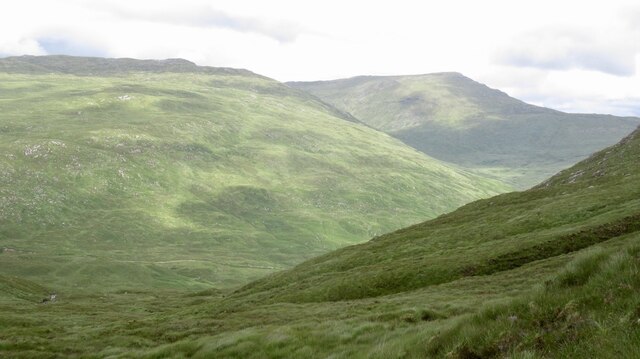
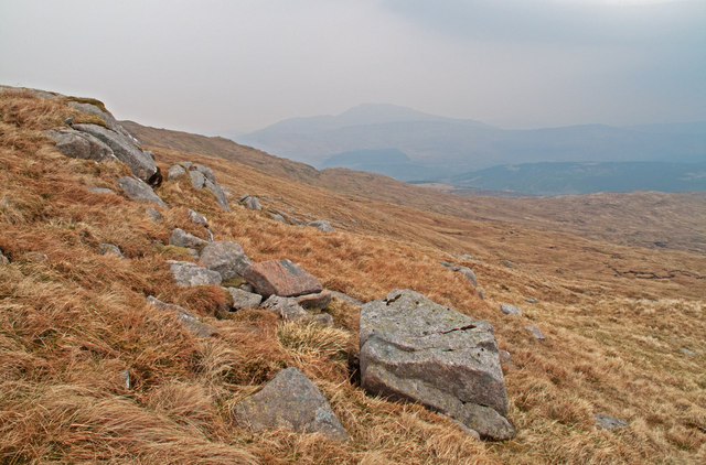
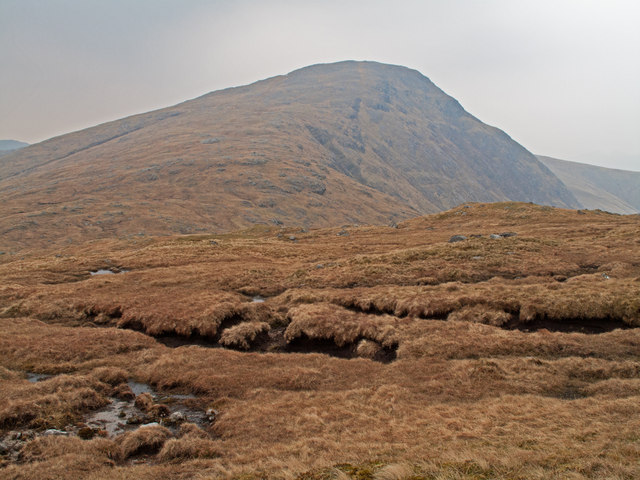
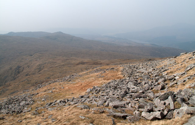
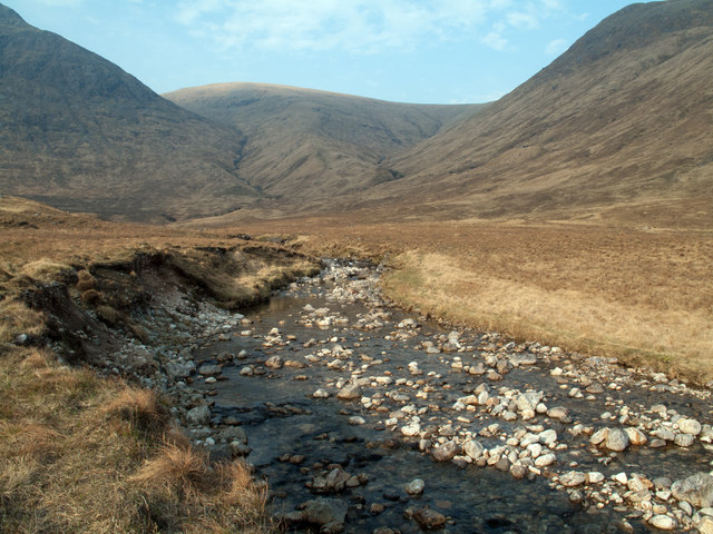
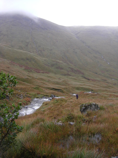
Coire a' Chùil Mhàim is a stunning valley located in Argyllshire, a region in the western part of Scotland. Nestled amidst the magnificent Scottish Highlands, this valley is a haven for nature enthusiasts and hikers alike.

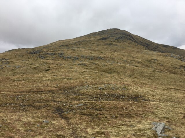
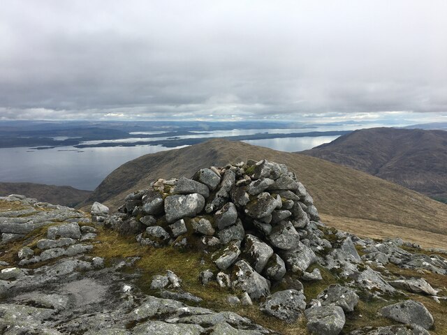
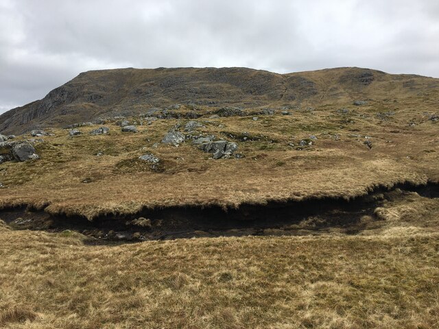
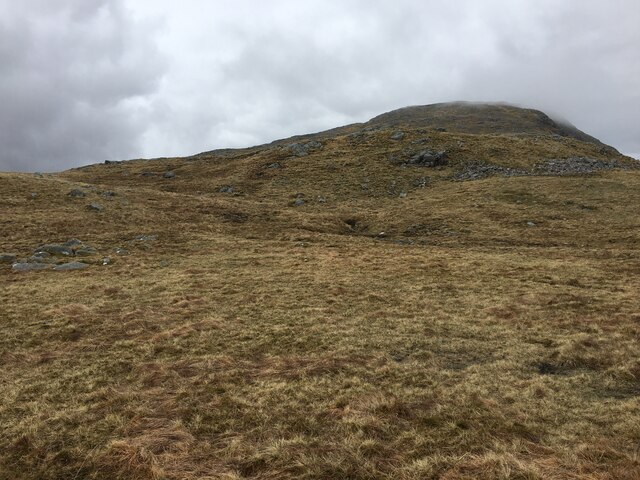
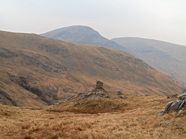
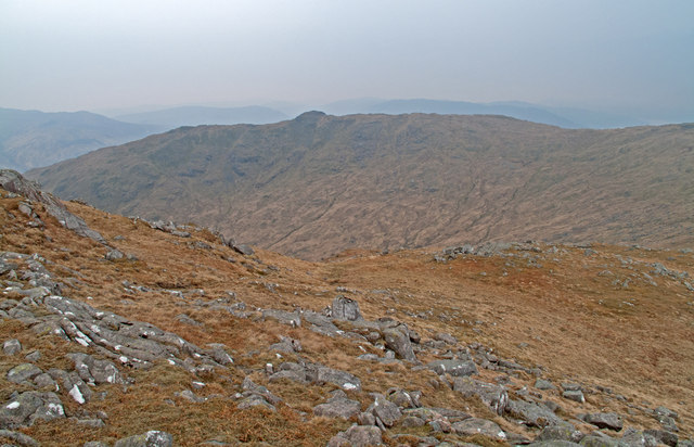
The valley is surrounded by towering mountains that create a dramatic backdrop, with its highest peak, also named Coire a' Chùil Mhàim, reaching an impressive height of 928 meters (3,045 feet). The scenery is awe-inspiring, with rugged cliffs, steep slopes, and a rich variety of flora and fauna.

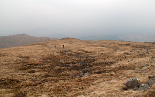
The valley is renowned for its exceptional hiking trails, attracting visitors from all over the world. One of the most popular routes is the Coire a' Chùil Mhàim Circular, which takes hikers on a challenging yet rewarding journey through the valley and up to the summit. Along the way, hikers can enjoy breathtaking views of the surrounding mountains, sparkling lochs, and lush greenery.

Wildlife enthusiasts will be delighted to spot various species in the area, including red deer, golden eagles, and ptarmigans. The valley is also home to a diverse range of plant life, such as heather, mosses, and wildflowers.

Coire a' Chùil Mhàim is not only a paradise for outdoor enthusiasts but also a place of tranquility and serenity. With its untouched natural beauty and peaceful atmosphere, it offers a perfect escape from the hustle and bustle of everyday life. Whether you are an avid hiker or simply seeking a peaceful retreat, this valley is truly a gem in the heart of Argyllshire.

If you have any feedback on the listing, please let us know in the comments section below.

Coire a' Chùil Mhàim Images

Images are sourced within 2km of 56.655865/-5.4937641 or Grid Reference NM8557. Thanks to Geograph Open Source API. All images are credited.

Slopes of Fuar Bheinn
Summit cairn of Fuar Bheinn
Peat hag, Cùl Mhàm
Peat hag, Cùl Mhàm
Slopes of Creach Bheinn
Camp, Creach Bheinn
Camp, Creach Bheinn
Fuar Bheinn The very hilly area if Kingairloch seen from the northern slopes of Beinn Mheadhoin above Loch Uisge.
Fuar Bheinn
The very hilly area if Kingairloch seen from the northern slopes of Beinn Mheadhoin above Loch Uisge.
Cairn overlooking Coire an t-Seasglaich Coire an t-Seasglaich lies beyond the cairn and between the mountains Beinn na Cille and Fuar Bheinn. The mountains beyond are Creach Bheinn and Maol Odhar.
Cairn overlooking Coire an t-Seasglaich
Coire an t-Seasglaich lies beyond the cairn and between the mountains Beinn na Cille and Fuar Bheinn. The mountains beyond are Creach Bheinn and Maol Odhar.
Ground north-west of Fuar Bheinn This broad ridge descends gradually to the north-west from the summit of Fuar Bheinn.
Ground north-west of Fuar Bheinn
This broad ridge descends gradually to the north-west from the summit of Fuar Bheinn.
Rocks on grassy slope declining towards Coire Odhar Ghlas-bheinne The broad north-west ridge of Fuar Bheinn has slopes descending towards Coire Odhar Ghlas-bheinne; The hill beyond the corrie is Glas Bheinn.
Rocks on grassy slope declining towards Coire Odhar Ghlas-bheinne
The broad north-west ridge of Fuar Bheinn has slopes descending towards Coire Odhar Ghlas-bheinne; The hill beyond the corrie is Glas Bheinn.
Minor rock outcrop with grassy slopes east of Bealach a'Mhonmhuir The north-west ridge of Fuar Bheinn descends to Bealach a'Mhonmhuir; these minor rocks lie to the north of that ridge, east of the bealach. The view is north of east.
Minor rock outcrop with grassy slopes east of Bealach a'Mhonmhuir
The north-west ridge of Fuar Bheinn descends to Bealach a'Mhonmhuir; these minor rocks lie to the north of that ridge, east of the bealach. The view is north of east.
Peat banks with Creach Bheinn beyond The Corbett, Creach Bheinn is seen here over peat banks on the descent towards Cul Mham, the col between that Corbett and another, Fuar Bheinn.
Peat banks with Creach Bheinn beyond
The Corbett, Creach Bheinn is seen here over peat banks on the descent towards Cul Mham, the col between that Corbett and another, Fuar Bheinn.
Boulder rash on west ridge of Creach Bheinn The day's first glimmer of sunshine illuminates these boulders on the west ridge of the Corbett, Creach Bheinn. The ridge descends gradually to the bealach, Cul Mham.
Boulder rash on west ridge of Creach Bheinn
The day's first glimmer of sunshine illuminates these boulders on the west ridge of the Corbett, Creach Bheinn. The ridge descends gradually to the bealach, Cul Mham.
'Camp' at col north-east of summit of Creach Bheinn The summit dome of the Corbett Creach Bheinn has a twin dome, slightly lower, to the north-east; at the col between the two domes OS maps indicate 'camp'; on the ground this is now seen to be organised collections of rocks. The camp appears to have been connected the Primary Triangulation Station on Creach Bheinn. <span class="nowrap"><a title="http://canmore.rcahms.gov.uk/en/site/23114/details/creach+bheinn/" rel="nofollow ugc noopener" href="http://canmore.rcahms.gov.uk/en/site/23114/details/creach+bheinn/">Link</a><img style="margin-left:2px;" alt="External link" title="External link - shift click to open in new window" src="https://s1.geograph.org.uk/img/external.png" width="10" height="10"/></span>
'Camp' at col north-east of summit of Creach Bheinn
The summit dome of the Corbett Creach Bheinn has a twin dome, slightly lower, to the north-east; at the col between the two domes OS maps indicate 'camp'; on the ground this is now seen to be organised collections of rocks. The camp appears to have been connected the Primary Triangulation Station on Creach Bheinn. LinkExternal link
South ridge of Maol Odhar A grassy apron with scattered rocks descends southwards from Maol Odhar eventually resolving itself into this, the south ridge. The view is uphill towards Maol Odhar itself.
South ridge of Maol Odhar
A grassy apron with scattered rocks descends southwards from Maol Odhar eventually resolving itself into this, the south ridge. The view is uphill towards Maol Odhar itself.
Glengalmadale River The Glengalmadale River is seen here looking upstream; the Corbett Creach Bheinn rises to the left, Meall nan Each to the right whilst the ridge ahead climbs to Maol Odhar.
Glengalmadale River
The Glengalmadale River is seen here looking upstream; the Corbett Creach Bheinn rises to the left, Meall nan Each to the right whilst the ridge ahead climbs to Maol Odhar.
Valley of Allt a' Chuil Mhaim
Creach Bheinn
Creach Bheinn
Fuar Bheinn View from the west.
Fuar Bheinn
View from the west.
Show me another place!

Coire a' Chùil Mhàim is located at Grid Ref: NM8557 (Lat: 56.655865, Lng: -5.4937641)

Unitary Authority: Highland

Police Authority: Highlands and Islands

What 3 Words

///blazed.hurt.caused. Near Lochaline, Highland

Nearby Locations

Coire a' Chùil Mhàim

Related Wikis

Creach Bheinn (Morvern)

Creach Bheinn is a prominent mountain in the Morvern area in the west of Scotland. It is less steep and even less frequently climbed than its northern...

A861 road

The A861 road is a circuitous, primarily coastal, road in Lochaber, within the Highland council area of Scotland.The A861 serves the communities of the...

Sunart

Sunart ( SOO-nart, Scottish Gaelic: Suaineart [ˈs̪uəɲərˠʃt̪]) is a rural district and community in the south west of Lochaber in Highland, Scotland, on...

Strontian

Strontian (;Scottish Gaelic: Sròn an t-Sìthein [s̪ɾɔːn̪ˠ ən̪ˠ ˈtʲiː.ɪn]) is the main village in Sunart, an area in western Lochaber, Highland, Scotland...

Have you been to Coire a' Chùil Mhàim?

Leave your review of Coire a' Chùil Mhàim below (or comments, questions and feedback).