Coire nan Capull

Valley in Argyllshire

Scotland

Coire nan Capull

B8001 road from Claonaig towards Kennacraig
B8001 road from Claonaig towards Kennacraig Credit: Chris Morgan

The requested URL returned error: 429 Too Many Requests

If you have any feedback on the listing, please let us know in the comments section below.

Coire nan Capull Images

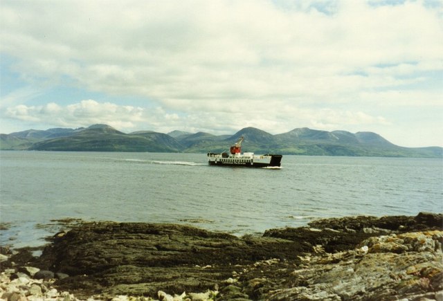
Images are sourced within 2km of 55.792134/-5.4190346 or Grid Reference NR8560. Thanks to Geograph Open Source API. All images are credited.

B8001 road from Claonaig towards Kennacraig
Allt Mhic-an t-Saoir Wet ground beside the single track road which crosses Kintyre between the ferry terminals at Claonaig and Kennacraig.
Allt Mhic-an t-Saoir
Wet ground beside the single track road which crosses Kintyre between the ferry terminals at Claonaig and Kennacraig.
Wetland, Kintyre An old iron gate gives access to some distinctly wet pasture.
Wetland, Kintyre
An old iron gate gives access to some distinctly wet pasture.
Wetland, Gartavaich Typical of ground beside the Claonaig to Kennacraig road.
Wetland, Gartavaich
Typical of ground beside the Claonaig to Kennacraig road.
B8001 to Skipness
B8001 to Skipness
Gartavaich shepherd's cottage near Claonaig, Kintyre.
Road (B8001) between Gartavaich and Redesdale Looking north-westward.
Road (B8001) between Gartavaich and Redesdale
Looking north-westward.
Road (B8001) between Redesdale and Gartavaich Looking south-eastward.
Road (B8001) between Redesdale and Gartavaich
Looking south-eastward.
Bridge across the Allt Mhic an t-Saoir, Argyll The bridge carries the B8001 across the burn.

According to the OS Name Book of 1868-1878, Allt Mhic an t-Saoir means Burn of the Carpenter's Son.
Bridge across the Allt Mhic an t-Saoir, Argyll
The bridge carries the B8001 across the burn. According to the OS Name Book of 1868-1878, Allt Mhic an t-Saoir means Burn of the Carpenter's Son.
B8001 at "Spion Kop" house
B8001 to Skipness
B8001 to Skipness
Road (B8001) approaching Spion Kop Looking north-westward.
Road (B8001) approaching Spion Kop
Looking north-westward.
Road (B8001) at the entrance to Lonlia and Redesdale House Looking south-eastward.
Road (B8001) at the entrance to Lonlia and Redesdale House
Looking south-eastward.
Cup marked rock by the Whitehouse Burn, Argyll This is one of four cup marked rocks in the immediate vicinity.
Cup marked rock by the Whitehouse Burn, Argyll
This is one of four cup marked rocks in the immediate vicinity.
Hills of Isle of Arran View of the Isle of Arran from the road between Whitehouse and Clonaig, north Kintyre with Lochranza, Catacol and Goat Fell in the background.
Hills of Isle of Arran
View of the Isle of Arran from the road between Whitehouse and Clonaig, north Kintyre with Lochranza, Catacol and Goat Fell in the background.
View looking west from the B8001Clanoig to Redhouse, Kintyre.
Winter view of hills from B8001 Kintyre.
View from the B8001 Kintyre looking to Arran.
Show me another place!

Coire nan Capull is located at Grid Ref: NR8560 (Lat: 55.792134, Lng: -5.4190346)

Unitary Authority: Argyll and Bute

Police Authority: Argyll and West Dunbartonshire

What 3 Words

///toolkit.oven.spearhead. Near Tarbert, Argyll & Bute

Nearby Locations

Coire nan Capull

Related Wikis

Kennacraig

Kennacraig (Scottish Gaelic: Ceann na Creige) is a hamlet situated on West Loch Tarbert, a five miles (eight kilometres) southwest of Tarbert on the Kintyre...

Whitehouse, Argyll

Whitehouse (Scottish Gaelic: An Taigh Bàn, pronounced [ən̪ˠ t̪ʰɤj ˈpaːn]) is a hamlet on the Kintyre peninsula of Argyll and Bute, Scotland. It is located...

Claonaig

Claonaig (Scottish Gaelic: Claonaig, pronounced [ˈkʰl̪ˠɯːnɛkʲ]) is a hamlet on the east coast of the Kintyre peninsula in western Scotland, linked to Lochranza...

Eilean Ceann na Creige

Eilean Ceann na Creige is a small island near Kennacraig in West Loch Tarbert in Scotland. Ceann na Creige is Gaelic for head of the rock.Eilean Ceann...

Have you been to Coire nan Capull?

Leave your review of Coire nan Capull below (or comments, questions and feedback).