Barcasdale

Valley in Ross-shire

Scotland

Barcasdale

Loch Brathan Mor
Loch Brathan Mor Credit: Philip

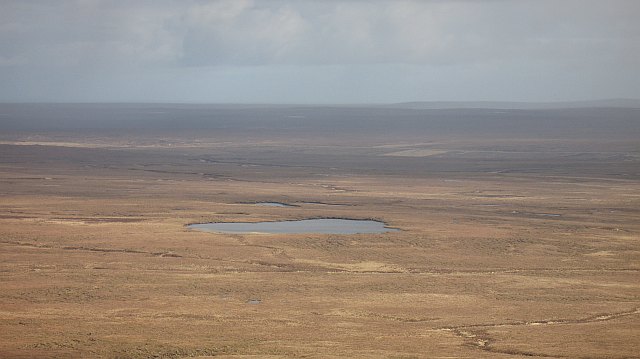
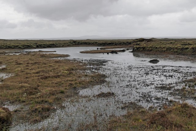
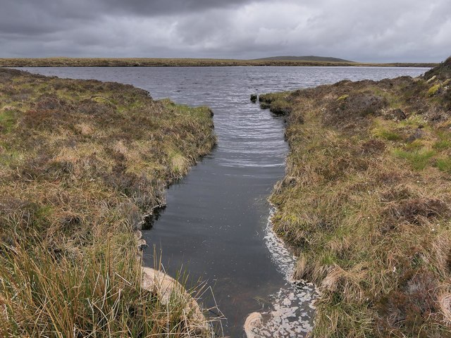
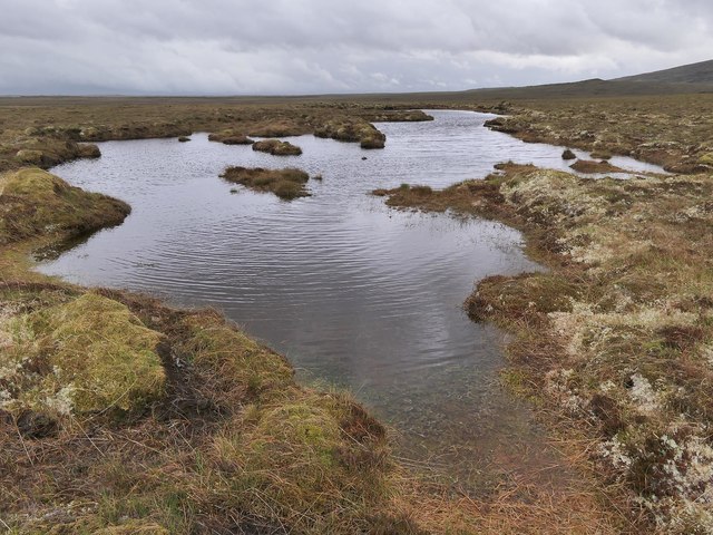
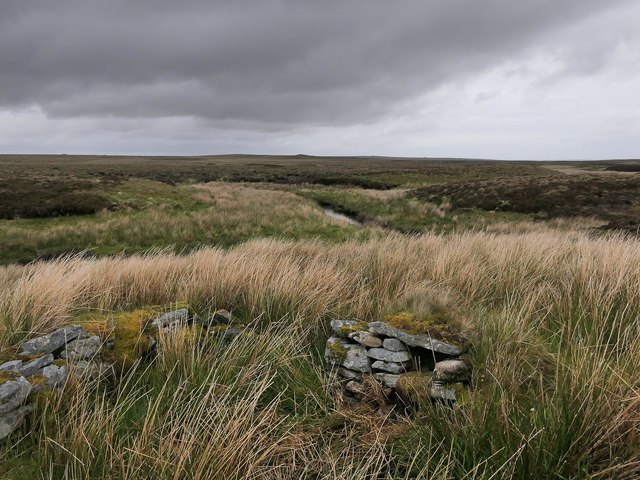
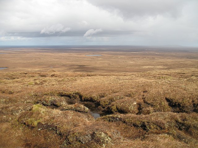
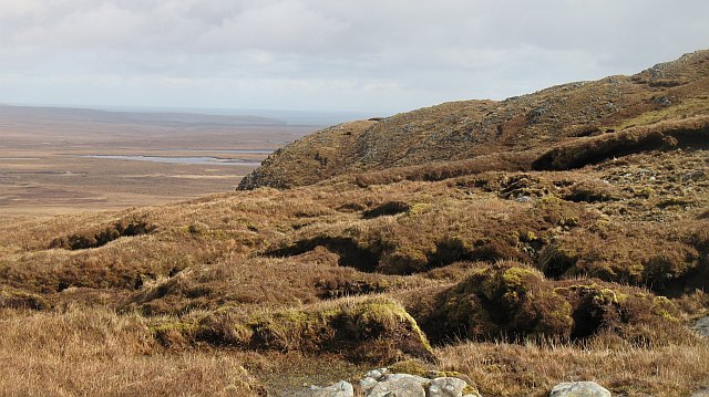
Barcasdale is a small valley located in the county of Ross-shire, Scotland. Situated in the northern highlands, Barcasdale is known for its stunning natural beauty and rugged landscape. The valley is surrounded by rolling hills, lush green forests, and picturesque rivers that wind their way through the countryside.

Barcasdale is a popular destination for outdoor enthusiasts, offering a variety of activities such as hiking, cycling, and fishing. The valley is home to a diverse range of wildlife, including red deer, otters, and various bird species, making it a haven for nature lovers.

The small community of Barcasdale is made up of a few scattered houses and farms, giving it a peaceful and remote atmosphere. The residents of Barcasdale are known for their warm hospitality and strong sense of community.

Overall, Barcasdale is a hidden gem in the Scottish highlands, offering visitors a tranquil escape from the hustle and bustle of city life. Whether you are looking to explore the great outdoors or simply relax in a peaceful setting, Barcasdale is the perfect destination for nature lovers and adventure seekers alike.

If you have any feedback on the listing, please let us know in the comments section below.

Barcasdale Images

Images are sourced within 2km of 58.273676/-6.4772451 or Grid Reference NB3740. Thanks to Geograph Open Source API. All images are credited.

Loch Brathan Mor
Loch Brathan Mor
Loch Chlachan a' Choire One of the many small lochs on the flat moors of Lewis.
Loch Chlachan a' Choire
One of the many small lochs on the flat moors of Lewis.
Inflow to Loch na Cartach, Isle of Lewis The inflow is the Allt Lag a' Bhainne which the map shows to be a relatively short burn with a total length of less than 500m.
Inflow to Loch na Cartach, Isle of Lewis
The inflow is the Allt Lag a' Bhainne which the map shows to be a relatively short burn with a total length of less than 500m.
Standing stone below Tom a' Rùisg, Isle of Lewis Looking towards Ròiseal Mòr.
Standing stone below Tom a' Rùisg, Isle of Lewis
Looking towards Ròiseal Mòr.
Natural foam on Loch Mòr an Stàrr, Isle of Lewis The loch is a reservoir which supplies the Stornoway water works.
Natural foam on Loch Mòr an Stàrr, Isle of Lewis
The loch is a reservoir which supplies the Stornoway water works.
Warning sign, Loch Mòr an Stàrr, Isle of Lewis Loch Mòr an Stàrr was converted in the 1930s to a reservoir which supplies the Stornoway waterworks.
Warning sign, Loch Mòr an Stàrr, Isle of Lewis
Loch Mòr an Stàrr was converted in the 1930s to a reservoir which supplies the Stornoway waterworks.
Shieling hut, Gleann Airigh na Faing, Isle of Lewis Looking towards the Beinn Mholach group of hills.
Shieling hut, Gleann Airigh na Faing, Isle of Lewis
Looking towards the Beinn Mholach group of hills.
Bog to the east of Loch Sgarabhat Mhòr, Isle of Lewis The hill in the distance is Muirneag.
Bog to the east of Loch Sgarabhat Mhòr, Isle of Lewis
The hill in the distance is Muirneag.
Outflow from Loch Sgarabhat Beag, Isle of Lewis The outflow is the source of the Eidhbhat Loch Sgaravat Beag.  Current large-scale OS maps show the Gaelic version of the word Sgarabhat for the loch name and the Anglicised word Sgaravat for the name of the burn.
Outflow from Loch Sgarabhat Beag, Isle of Lewis
The outflow is the source of the Eidhbhat Loch Sgaravat Beag. Current large-scale OS maps show the Gaelic version of the word Sgarabhat for the loch name and the Anglicised word Sgaravat for the name of the burn.
Moorland pool, Tom Dhonnachaidh, Isle of Lewis The small hill on the right is Tom a' Rùisg with the eastern slopes of Beinn Bharabhais behind.

According to the OS Name Book of 1848-1852, Tom Dhonnachaidh means Duncan's Hillock.
Moorland pool, Tom Dhonnachaidh, Isle of Lewis
The small hill on the right is Tom a' Rùisg with the eastern slopes of Beinn Bharabhais behind. According to the OS Name Book of 1848-1852, Tom Dhonnachaidh means Duncan's Hillock.
Moorland pool, Tom Dhonnachaidh, Isle of Lewis According to the OS Name Book of 1848-1852, Tom Dhonnachaidh means Duncan's Hillock.
Moorland pool, Tom Dhonnachaidh, Isle of Lewis
According to the OS Name Book of 1848-1852, Tom Dhonnachaidh means Duncan's Hillock.
Barcasdail, Isle of Lewis The OS Name Book of 1848-1852 says that Barcasdail (then spelled Bárcasdal) is the name of the burn, rather than the glen through which it flows. On modern maps it is written in black type, not blue, and so presumably is now considered to be the name of the glen, not the burn.
Barcasdail, Isle of Lewis
The OS Name Book of 1848-1852 says that Barcasdail (then spelled Bárcasdal) is the name of the burn, rather than the glen through which it flows. On modern maps it is written in black type, not blue, and so presumably is now considered to be the name of the glen, not the burn.
Shieling hut, Airigh na Faing, Isle of Lewis Shielings were moorland summer grazings for cattle.  Shieling huts (often also referred to as shielings) were dwellings located within the shieling.  They were usually occupied from May until the “flitting” in September.  In early May the men of a village would go onto the moor to check and repair the shieling huts.  They would be joined by the women and children for one night before the men returned to the village to tend to crops or to travel away for summer work such as fishing.  The women and children would spend the summer at the shielings tending the cattle and making cheese and butter, some of which was for immediate use but most was salted to preserve it for the winter.  Peat cutting for fuel would also be done.  Evenings would be spent making music and story telling.  Visits were made between the shielings of different villages.

The shieling huts were made from materials available in the immediate vicinity.  They usually had walls made of stone or turf, turf roofs and compacted earth or clay floors.  In coastal areas and on the islands rafters would be made from locally collected driftwood.  Usually there would be a single doorway, facing away from the prevailing wind (although some shieling huts have two doors opposite each other), and often no windows.  Furniture built into shieling huts included stone or turf beds covered with heather, turf seats and cupboards and niches built into the stone wall, often one above the door.  Other furniture would be carried out onto the moor for the season.  In places where the practice of using shielings continued into the 20th century, shieling huts can be found which are constructed making more extensive use of timber than in the traditional type, along with other materials such as tin and bitumen.  There are also examples of buses and caravans used as shieling huts.

The Clearances and ongoing changes in agricultural methods meant that the shieling tradition had generally ended by the close of the nineteenth century.  In places it continued for longer and, particularly on Lewis, some shieling huts are still used today during the peat cutting season and as summer retreats.

The remains of shieling huts can be seen as

changes in vegetation: <a href="https://www.geograph.org.uk/photo/1962348">ND1340 : Shieling site by the Allt a' Cheracher</a> ;
shieling mounds where successive shieling huts have been built on the same site: <a href="https://www.geograph.org.uk/photo/5238987">NB5059 : Shieling mounds by the Abhainn Dhail, Isle of Lewis</a> ;
footings: <a href="https://www.geograph.org.uk/photo/5027765">NB5357 : Shieling footings beside the Feadan Mòr, Isle of Lewis</a> ; and
more substantial remains: <a href="https://www.geograph.org.uk/photo/5238993">NB3040 : Shieling above Gleann Leitir, Isle of Lewis</a> .

Examples of modern shielings are shown at:

<a href="https://www.geograph.org.uk/photo/5238999">NB5458 : Shieling, Airigh A' Bhealaich, Isle of Lewis</a> and <a href="https://www.geograph.org.uk/photo/5048077">NB5458 : Disused shieling, Airigh A' Bhealaich, Isle of Lewis</a> .
Shieling hut, Airigh na Faing, Isle of Lewis
Shielings were moorland summer grazings for cattle. Shieling huts (often also referred to as shielings) were dwellings located within the shieling. They were usually occupied from May until the “flitting” in September. In early May the men of a village would go onto the moor to check and repair the shieling huts. They would be joined by the women and children for one night before the men returned to the village to tend to crops or to travel away for summer work such as fishing. The women and children would spend the summer at the shielings tending the cattle and making cheese and butter, some of which was for immediate use but most was salted to preserve it for the winter. Peat cutting for fuel would also be done. Evenings would be spent making music and story telling. Visits were made between the shielings of different villages. The shieling huts were made from materials available in the immediate vicinity. They usually had walls made of stone or turf, turf roofs and compacted earth or clay floors. In coastal areas and on the islands rafters would be made from locally collected driftwood. Usually there would be a single doorway, facing away from the prevailing wind (although some shieling huts have two doors opposite each other), and often no windows. Furniture built into shieling huts included stone or turf beds covered with heather, turf seats and cupboards and niches built into the stone wall, often one above the door. Other furniture would be carried out onto the moor for the season. In places where the practice of using shielings continued into the 20th century, shieling huts can be found which are constructed making more extensive use of timber than in the traditional type, along with other materials such as tin and bitumen. There are also examples of buses and caravans used as shieling huts. The Clearances and ongoing changes in agricultural methods meant that the shieling tradition had generally ended by the close of the nineteenth century. In places it continued for longer and, particularly on Lewis, some shieling huts are still used today during the peat cutting season and as summer retreats. The remains of shieling huts can be seen as changes in vegetation: ND1340 : Shieling site by the Allt a' Cheracher ; shieling mounds where successive shieling huts have been built on the same site: NB5059 : Shieling mounds by the Abhainn Dhail, Isle of Lewis ; footings: NB5357 : Shieling footings beside the Feadan Mòr, Isle of Lewis ; and more substantial remains: NB3040 : Shieling above Gleann Leitir, Isle of Lewis . Examples of modern shielings are shown at: NB5458 : Shieling, Airigh A' Bhealaich, Isle of Lewis and NB5458 : Disused shieling, Airigh A' Bhealaich, Isle of Lewis .
Moorland north of Beinn Bharabhais Looking down from the high ground on the Beinn Mholach group of hills towards Loch Clachan a' Choire and the flat moors of North Lewis.
Moorland north of Beinn Bharabhais
Looking down from the high ground on the Beinn Mholach group of hills towards Loch Clachan a' Choire and the flat moors of North Lewis.
North side of Beinn Bharabhais Steep ground above the vast bogs of Lewis.
North side of Beinn Bharabhais
Steep ground above the vast bogs of Lewis.
Loch Scarabhat Mhòr seen from Beinn Mholach Looking over the bogs to one of the larger of many lochs on the Lewis Moors.
Loch Scarabhat Mhòr seen from Beinn Mholach
Looking over the bogs to one of the larger of many lochs on the Lewis Moors.
Show me another place!

Barcasdale is located at Grid Ref: NB3740 (Lat: 58.273676, Lng: -6.4772451)

Unitary Authority: Na h-Eileanan an Iar

Police Authority: Highlands and Islands

What 3 Words

///boomer.dissolve.handbags. Near Stornoway, Na h-Eileanan Siar

Nearby Locations

Barcasdale Loch Breun

Related Wikis

Newvalley, Lewis

Newvalley (Scottish Gaelic: An Gleann Ùr) is a hamlet on the Isle of Lewis in the Outer Hebrides, Scotland. Newvalley is within the parish of Stornoway...

Lewis Peatlands

Lewis Peatlands (Scottish Gaelic: mòinteach Leòdhais) is a large area of blanket bog covering more than one third of the Isle of Lewis, off the west coast...

Newmarket, Lewis

Newmarket (; Scottish Gaelic: An Margaidh Ùr [ən̪ˠ ˈmaɾakaj ˈuːɾ]) is a village in the Outer Hebrides of Scotland, on the Isle of Lewis near Stornoway...

Marybank, Lewis

Marybank (Scottish Gaelic: Bruach Màiri, IPA:[ˈpɾuəxˈmaːɾʲɪ]) is a settlement on the outskirts of Stornoway, Isle of Lewis in the Outer Hebrides of Scotland...

Have you been to Barcasdale?

Leave your review of Barcasdale below (or comments, questions and feedback).