Skid Hill

Hill, Mountain in East Lothian

Scotland

Skid Hill

Barley bales and barn at Garleton With the Firth of Forth in the distance.
Barley bales and barn at Garleton Credit: M J Richardson

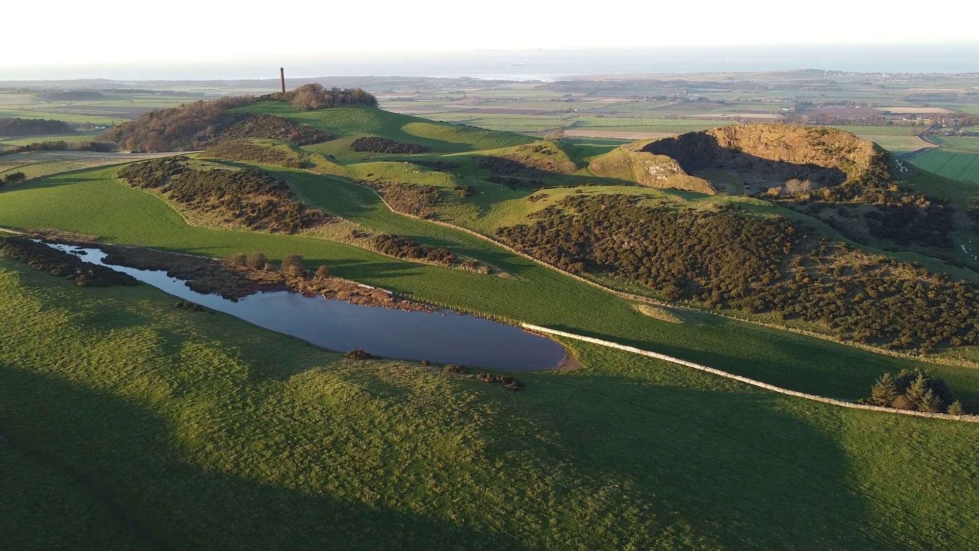
Skid Hill is a prominent hill located in East Lothian, Scotland. Situated in the southern part of the county, it forms part of the Lammermuir Hills, a range of rolling hills that stretch across the Scottish Borders and into East Lothian. Skid Hill stands at an elevation of approximately 370 meters (1,214 feet) and offers breathtaking views of the surrounding countryside.

The hill is covered in heather and grass, creating a picturesque landscape that changes with the seasons. It is a popular destination for hiking and walking enthusiasts, attracting both locals and visitors alike. The terrain is relatively gentle, making it accessible to people of various fitness levels. On a clear day, it is possible to see as far as the Firth of Forth and the North Sea from the summit.

Skid Hill is also home to a diverse range of wildlife, including birds, rabbits, and deer. It forms part of a larger conservation area that aims to protect the natural habitat and biodiversity of the Lammermuir Hills. The area is carefully managed to ensure the preservation of the unique flora and fauna that call it home.

Overall, Skid Hill offers a tranquil and scenic escape from the bustling towns and cities of East Lothian. Whether you are a nature lover, a keen hiker, or simply seeking a peaceful retreat, Skid Hill is a wonderful destination to explore and immerse yourself in the beauty of Scotland's countryside.

If you have any feedback on the listing, please let us know in the comments section below.
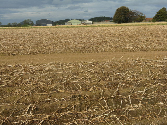
Skid Hill Images

Images are sourced within 2km of 55.978376/-2.7911139 or Grid Reference NT5076. Thanks to Geograph Open Source API. All images are credited.

Barley bales and barn at Garleton With the Firth of Forth in the distance.
Barley bales and barn at Garleton
With the Firth of Forth in the distance.
Potato field at Byres farm With tops burnt down prior to harvest and to prevent the spread of potato blight to the tubers.
Potato field at Byres farm
With tops burnt down prior to harvest and to prevent the spread of potato blight to the tubers.
Rye Hill from Byres Farm road With the Hopetoun Monument on Byres Hill beyond.
Rye Hill from Byres Farm road
With the Hopetoun Monument on Byres Hill beyond.
Garleton Lodge from the top of Bangly Brae Accommodation available for holidays, weddings, self-catering and corporate events.
Garleton Lodge from the top of Bangly Brae
Accommodation available for holidays, weddings, self-catering and corporate events.
Wind turbine at Alderston Looking southeast from near Garleton Lodge. It was generating.
Wind turbine at Alderston
Looking southeast from near Garleton Lodge. It was generating.
Garleton Lodge Accommodation available for holidays, weddings, self-catering and corporate events.
Garleton Lodge
Accommodation available for holidays, weddings, self-catering and corporate events.
Garleton Lodge on Bangly Hill Accommodation available for holidays, weddings, self-catering and corporate events.
Garleton Lodge on Bangly Hill
Accommodation available for holidays, weddings, self-catering and corporate events.
East Lothian Architecture : Rural Building at West Garleton There are similar looking buildings at several different locations in the Garleton Hills area.

It would be interesting to know whether they were built at the same time (probably sometime between 1930 and 1950) and by the same company.
East Lothian Architecture : Rural Building at West Garleton
There are similar looking buildings at several different locations in the Garleton Hills area. It would be interesting to know whether they were built at the same time (probably sometime between 1930 and 1950) and by the same company.
Rural East Lothian : Roadside Building at West Garleton One of several similar buildings in the Garleton Hills area.
Rural East Lothian : Roadside Building at West Garleton
One of several similar buildings in the Garleton Hills area.
East Lothian Farms : Alderston Mains, near Haddington
East Lothian Landscape : Late Summer Near Blackmains Toll West Garleton in the distant background.
East Lothian Landscape : Late Summer Near Blackmains Toll
West Garleton in the distant background.
East Lothian Landscape : Power Lines Near Blackmains Toll "I am a linesman for the county..........."
East Lothian Landscape : Power Lines Near Blackmains Toll
"I am a linesman for the county..........."
Rural East Lothian : Shed at Woodlea
Rural East Lothian : Crumple Zone at Woodlea
Rural East Lothian : Alderston Mains Road-end This track is a good pedestrian short-cut back to Haddington, passing, en route, Alderston Mains, Alderston Mains dairy and Alderston House.
Rural East Lothian : Alderston Mains Road-end
This track is a good pedestrian short-cut back to Haddington, passing, en route, Alderston Mains, Alderston Mains dairy and Alderston House.
Rural East Lothian : Alderston Mains Farm Sign This farm sign must be half blind - it has an "I" missing!
Rural East Lothian : Alderston Mains Farm Sign
This farm sign must be half blind - it has an "I" missing!
Garleton Hills A big field with a view to the Hopetoun Monument on Byres Hill.
Garleton Hills
A big field with a view to the Hopetoun Monument on Byres Hill.
A ruined building at Byres Farm This was viewed from the Hopetoun Monument on Byres Hill.
A ruined building at Byres Farm
This was viewed from the Hopetoun Monument on Byres Hill.
Show me another place!

Skid Hill is located at Grid Ref: NT5076 (Lat: 55.978376, Lng: -2.7911139)

Unitary Authority: East Lothian

Police Authority: The Lothians and Scottish Borders

Also known as: Garleton Hills

What 3 Words

///puzzled.bookshelf.magnitude. Near Haddington, East Lothian

Related Wikis

Garleton Hills

The Garleton Hills, in East Lothian, Scotland, are a range of igneous hills, to the north of Haddington. == Geography == Although Skid Hill, the highest...

Skid Hill

Skid Hill is a 186 metres high hill of eastern Scotland, the highest of the Garleton Hills. == Geology == The hill origin is volcanic and it shows both...
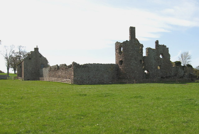
Garleton Castle

Garleton Castle is a courtyard castle, dating from the sixteenth century, about 1.5 miles (2.4 km) north of Haddington, just north of the Garleton Hills...

Hopetoun Monument

The Hopetoun Monument is a monument in the Garleton Hills, near Camptoun, East Lothian, Scotland. It is 95 feet (29 m) tall and is situated on Byres Hill...

Byres Castle

Byres Castle was a castle located at Byres, in East Lothian, Scotland. The castle was a stronghold of the Lindsay family, known as Lord Lindsay of the...

Chesters Hill Fort

Chesters Hill Fort is an Iron Age hill fort in East Lothian, Scotland. It lies 1 mile (2 kilometres) south of Drem, 1+1⁄2 mi (2.5 km) east of Ballencrieff...

Herdmanflat Hospital

Herdmanflat Hospital was a psychiatric hospital in Aberlady Road, Haddington, Scotland. It was operated by NHS Lothian. == History == The hospital was...

Barnes Castle

Barnes Castle is an unfinished castle, with a number of defensive banks, located 5 kilometres (3.1 mi) north-east of Haddington in East Lothian, Scotland...

Nearby Amenities

Located within 500m of 55.978376,-2.7911139
Bus Stop
East Garleton
Naptan AtcoCode: 627007010005
Naptan Bearing: E
Naptan BusStopType: CUS
Naptan CommonName: East Garleton
Naptan Indicator: opposite Castle
Naptan NaptanCode: 58234947
Naptan Street: B1343
Naptan Verified: no
Source: naptan_import
Lat/Long: 55.981679/-2.7882153
Bus Stop
East Garleton
Naptan AtcoCode: 627007020005
Naptan Bearing: W
Naptan BusStopType: CUS
Naptan CommonName: East Garleton
Naptan Indicator: at Castle
Naptan NaptanCode: 58234948
Naptan Street: B1343
Naptan Verified: no
Source: naptan_import
Lat/Long: 55.9815451/-2.7880843
Skid Hill
Natural: peak
Wikidata: Q56465417
Wikipedia: en:Skid Hill
Lat/Long: 55.9783355/-2.7914957
Man Made: survey_point
Lat/Long: 55.9783847/-2.7911375
Garleton Hills
Place: locality
Wikidata: Q5523455
Wikipedia: en:Garleton Hills
Lat/Long: 55.976008/-2.7870089
Craigy Hill
Natural: peak
Lat/Long: 55.9792858/-2.7864075
Generator Method: photovoltaic
Generator Output Electricity: yes
Generator Source: solar
Generator Type: solar_photovoltaic_panel
Power: generator
Lat/Long: 55.9822299/-2.7879565
The data included in this document is from www.openstreetmap.org. The data is made available under ODbL.

Have you been to Skid Hill?

Leave your review of Skid Hill below (or comments, questions and feedback).