Bennachie

Hill, Mountain in Aberdeenshire

Scotland

Bennachie

Back into the forest On the way back down from the summit on the Maiden Causeway. This is where the tree line is.
Back into the forest Credit: Ralph Greig

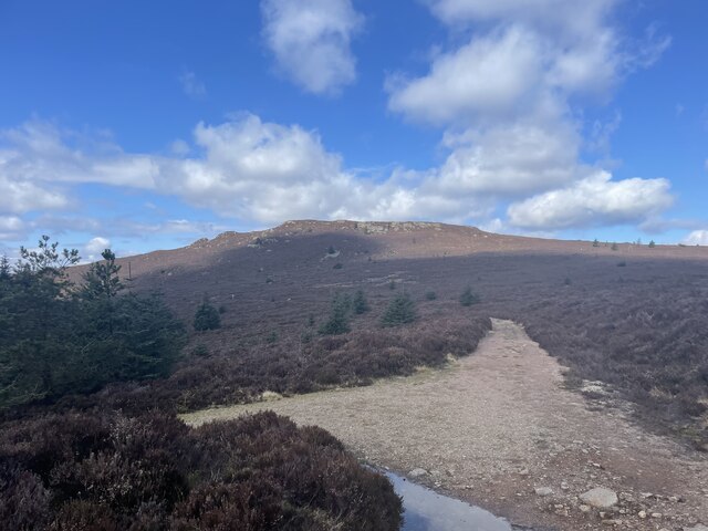
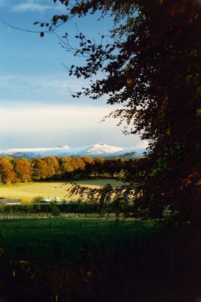
Bennachie is a prominent hill range located in Aberdeenshire, Scotland. It is a popular destination for hikers, walkers, and nature enthusiasts due to its stunning views and diverse wildlife. The highest peak, Oxen Craig, stands at 528 meters (1,732 feet) above sea level.

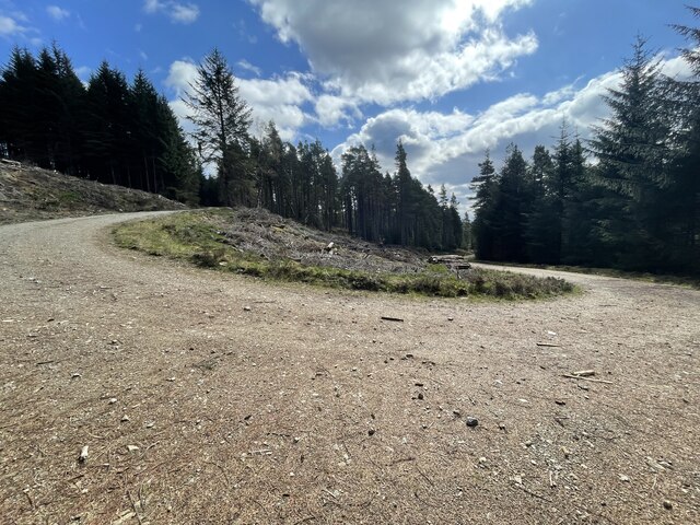
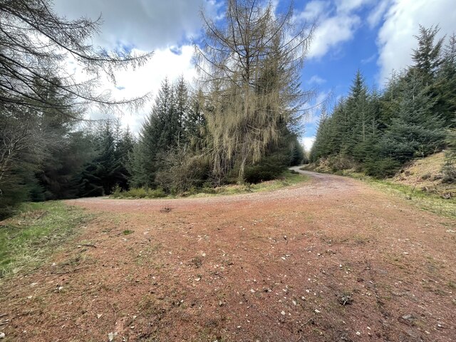
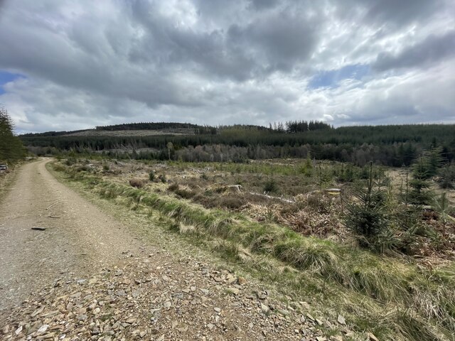
Bennachie is known for its distinctive shape, with several peaks and ridges creating a unique silhouette against the Aberdeenshire skyline. The hill range is covered in a mix of heather, grasslands, and woodlands, providing habitat for a variety of plant and animal species.

The area has a rich history, with evidence of human settlement dating back thousands of years. There are several ancient sites on Bennachie, including the remains of a hill fort and a Pictish symbol stone. The hill range has also been a source of inspiration for artists and writers, with its dramatic landscape featuring in many works of art and literature.

Overall, Bennachie is a special place that offers visitors a chance to connect with nature, explore its history, and enjoy breathtaking views of the surrounding countryside.

If you have any feedback on the listing, please let us know in the comments section below.

Bennachie Images

Images are sourced within 2km of 57.293143/-2.5607361 or Grid Reference NJ6622. Thanks to Geograph Open Source API. All images are credited.

Back into the forest On the way back down from the summit on the Maiden Causeway. This is where the tree line is.
Back into the forest
On the way back down from the summit on the Maiden Causeway. This is where the tree line is.
Oxen Craig Summit The Summit of this Marilyn looking towards the Mither Tap which most people incorrectly think is the highest point of the range.
Oxen Craig Summit
The Summit of this Marilyn looking towards the Mither Tap which most people incorrectly think is the highest point of the range.
Burntwood Tap The Gordon Way starts at the Bennachie Centre and runs for 11.5 miles (18.5 km) along the southern side of Bennachie and on to the Suie car park, 3 miles south east of Rhynie. You walk through forests, farmland and open moorland, stout boots are recommended as some sections are muddy.
Burntwood Tap
The Gordon Way starts at the Bennachie Centre and runs for 11.5 miles (18.5 km) along the southern side of Bennachie and on to the Suie car park, 3 miles south east of Rhynie. You walk through forests, farmland and open moorland, stout boots are recommended as some sections are muddy.
The Gordon Way The Gordon Way starts at the Bennachie Centre and runs for 11.5 miles (18.5 km) along the southern side of Bennachie and on to the Suie car park, 3 miles south east of Rhynie. You walk through forests, farmland and open moorland, stout boots are recommended as some sections are muddy.
The Gordon Way
The Gordon Way starts at the Bennachie Centre and runs for 11.5 miles (18.5 km) along the southern side of Bennachie and on to the Suie car park, 3 miles south east of Rhynie. You walk through forests, farmland and open moorland, stout boots are recommended as some sections are muddy.
Hairpin Forest Bends Bennachie is a range of hills in Aberdeenshire, Scotland.It has several tops, the highest of which, Oxen Craig, has a height of 528 metres (1,732 ft). Though not particularly high, compared to other peaks within Scotland, the mountain is very prominent, owing to its isolation and the relative flatness of the surrounding terrain, and dominates the skyline from several viewpoints.
Hairpin Forest Bends
Bennachie is a range of hills in Aberdeenshire, Scotland.It has several tops, the highest of which, Oxen Craig, has a height of 528 metres (1,732 ft). Though not particularly high, compared to other peaks within Scotland, the mountain is very prominent, owing to its isolation and the relative flatness of the surrounding terrain, and dominates the skyline from several viewpoints.
More forest hairpin bends Bennachie is a range of hills in Aberdeenshire, Scotland.It has several tops, the highest of which, Oxen Craig, has a height of 528 metres (1,732 ft). Though not particularly high, compared to other peaks within Scotland, the mountain is very prominent, owing to its isolation and the relative flatness of the surrounding terrain, and dominates the skyline from several viewpoints.
More forest hairpin bends
Bennachie is a range of hills in Aberdeenshire, Scotland.It has several tops, the highest of which, Oxen Craig, has a height of 528 metres (1,732 ft). Though not particularly high, compared to other peaks within Scotland, the mountain is very prominent, owing to its isolation and the relative flatness of the surrounding terrain, and dominates the skyline from several viewpoints.
Forest roads around Bennachie Bennachie is a range of hills in Aberdeenshire, Scotland.It has several tops, the highest of which, Oxen Craig, has a height of 528 metres (1,732 ft). Though not particularly high, compared to other peaks within Scotland, the mountain is very prominent, owing to its isolation and the relative flatness of the surrounding terrain, and dominates the skyline from several viewpoints.
Forest roads around Bennachie
Bennachie is a range of hills in Aberdeenshire, Scotland.It has several tops, the highest of which, Oxen Craig, has a height of 528 metres (1,732 ft). Though not particularly high, compared to other peaks within Scotland, the mountain is very prominent, owing to its isolation and the relative flatness of the surrounding terrain, and dominates the skyline from several viewpoints.
Mither tap fae Craigshannoch Mid-winter 2003
Mither tap fae Craigshannoch
Mid-winter 2003
Early Snow on Bennachie from near Drumrossie, Insch Looking over to early snow on Craigshannoch
Early Snow on Bennachie from near Drumrossie, Insch
Looking over to early snow on Craigshannoch
The path up Craigshannoch
Footpath junction north-west of Mither Tap The main tops of the Bennachie range of hills are connected by a network of constructed paths mainly with a surface of granite gravel; the routes are well signposted too. Here the path leaving to the right heads for Mither Tap and the one ahead for Craigshannoch. Oxen Craig, the main summit of the Bennachie range lies to the left.
Footpath junction north-west of Mither Tap
The main tops of the Bennachie range of hills are connected by a network of constructed paths mainly with a surface of granite gravel; the routes are well signposted too. Here the path leaving to the right heads for Mither Tap and the one ahead for Craigshannoch. Oxen Craig, the main summit of the Bennachie range lies to the left.
Craigshannoch The path approaching Craigshannoch from the south is a well constructed and well maintained route with signposting of a high quality too - though not necessarily to everyone's taste! The path is surfaced with a granite gravel, the boulders and outcropping rocks ahead are also of that rock.
Craigshannoch
The path approaching Craigshannoch from the south is a well constructed and well maintained route with signposting of a high quality too - though not necessarily to everyone's taste! The path is surfaced with a granite gravel, the boulders and outcropping rocks ahead are also of that rock.
Heather moorland on north side of Bennachie The view northwards over wisps of grass and heather from a path between Craigshannoch and Oxen Craig is across farmland to Hill of Foundland and other minor hills of Aberdeenshire.
Heather moorland on north side of Bennachie
The view northwards over wisps of grass and heather from a path between Craigshannoch and Oxen Craig is across farmland to Hill of Foundland and other minor hills of Aberdeenshire.
Heather slope rising towards Bruntwood Tap The word tap, it seems, is used locally, (on hills of the minor range of Bennachie), to denote a rock tor. Bruntwood Tap lies on the south side of the main hilltop of the group which is Oxen Craig; its rocky nature is not apparent in this image of course. The view here is from one of the many excellent paths in the district, this one being known as Gordon Way.
Heather slope rising towards Bruntwood Tap
The word tap, it seems, is used locally, (on hills of the minor range of Bennachie), to denote a rock tor. Bruntwood Tap lies on the south side of the main hilltop of the group which is Oxen Craig; its rocky nature is not apparent in this image of course. The view here is from one of the many excellent paths in the district, this one being known as Gordon Way.
Ascent of Mither Tap
Cave near summit of Craigshannoch Cave situated below summit of Craigshannoch, room for about 6 people to shelter out of the rain
Cave near summit of Craigshannoch
Cave situated below summit of Craigshannoch, room for about 6 people to shelter out of the rain
Little Oxen Craig quarry Bennachie Little Oxen Craig lintel quarry operation for about 40 years closing in 1891.  The quarry stopped working overnight when a serious build up of water burst and washed away the tracks leading to the rockface.  With no transport routes the quarry was unable to function.  The information is on the info board seen in the photo.
Little Oxen Craig quarry Bennachie
Little Oxen Craig lintel quarry operation for about 40 years closing in 1891. The quarry stopped working overnight when a serious build up of water burst and washed away the tracks leading to the rockface. With no transport routes the quarry was unable to function. The information is on the info board seen in the photo.
Show me another place!

Bennachie is located at Grid Ref: NJ6622 (Lat: 57.293143, Lng: -2.5607361)

Unitary Authority: Aberdeenshire

Police Authority: North East

Also known as: Oxen Craig

What 3 Words

///work.blink.mirror. Near Insch, Aberdeenshire

Nearby Locations

Oxen Craig Bennachie

Related Wikis

Bennachie

Bennachie ( ben-ə-HEE; Scottish Gaelic: Beinn na Cìche) is a range of hills in Aberdeenshire, Scotland. It has several tops, the highest of which, Oxen...

Oyne

Oyne is a small village in rural Aberdeenshire at the bottom of Bennachie in Scotland. == Locality == The village has limited local resources. It once...

Oyne railway station

Oyne railway station is a former railway station serving the small village of Oyne, Aberdeenshire. == History == Oyne station was built by the Great North...
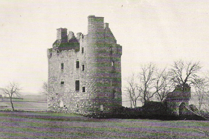
Harthill Castle

Harthill Castle is a large 17th-century Z-plan castle, about 5.5 miles (8.9 km) north-west of Inverurie, Aberdeenshire, Scotland, south of Kirkton of Oyne...

Nearby Amenities

Located within 500m of 57.293143,-2.5607361
Oxen Craig
Corbett: no
Ele: 529
Graham: no
Marilyn: yes
Munro: no
Natural: peak
Prominence: 314
Source: Bing
Tourism: viewpoint
Wikidata: Q817811
Wikipedia: en:Bennachie
Lat/Long: 57.2929363/-2.5607589
Information: map
Map Type: toposcope
Tourism: information
Lat/Long: 57.2926961/-2.5610877
Moss Grieve
Place County: locality
Lat/Long: 57.2929769/-2.5535202
The data included in this document is from www.openstreetmap.org. The data is made available under ODbL.

Have you been to Bennachie?

Leave your review of Bennachie below (or comments, questions and feedback).