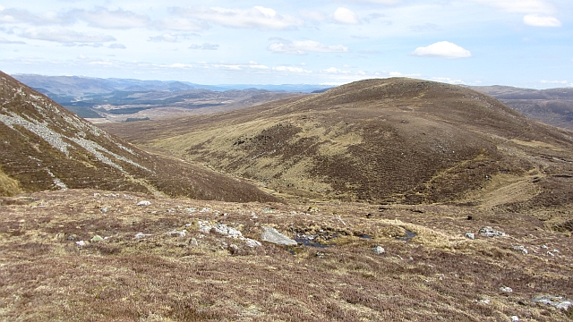
Mullach Coire an Iubhair

Hill, Mountain in Inverness-shire

Scotland

Mullach Coire an Iubhair

Trig point on Geal Charn
Trig point on Geal Charn Credit: Steven Brown

The requested URL returned error: 429 Too Many Requests

If you have any feedback on the listing, please let us know in the comments section below.

Mullach Coire an Iubhair Images

Images are sourced within 2km of 56.897849/-4.4571587 or Grid Reference NN5081. Thanks to Geograph Open Source API. All images are credited.

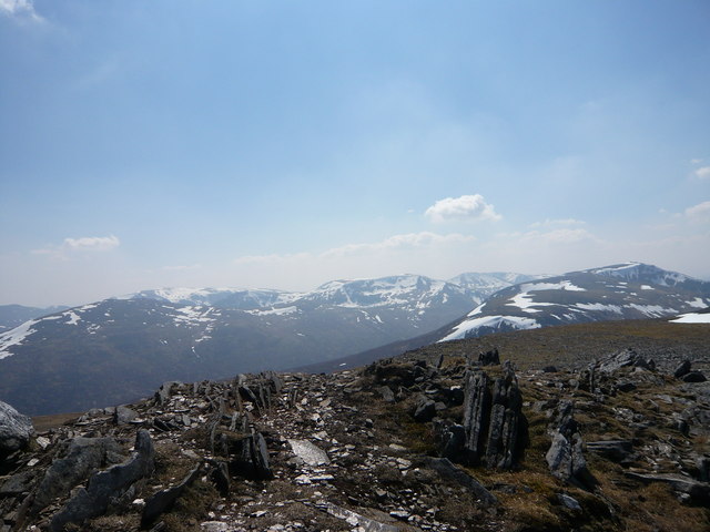
Trig point on Geal Charn
Loch a'Bhealaich Leamhain Looking down to the loch on an ascent of Creag Pitridh and Geal Charn from the north shore.
Loch a'Bhealaich Leamhain
Looking down to the loch on an ascent of Creag Pitridh and Geal Charn from the north shore.
Lochan a Bhealaich Leamhain Taken from the stalkers' path contouring round the end of Beinn A' Chlachair.
Lochan a Bhealaich Leamhain
Taken from the stalkers' path contouring round the end of Beinn A' Chlachair.
Declining western ridge of Creag Pitridh From the summit of Creag Pitridh a broad ridge descends initially to the west.
Beyond is relatively low lying moorland with extensive forestry plantings.
The snowed mountains include Chno Dearg and the Easains extending away to ever higher ones, ultimately reaching Ben Nevis, but that, probably, is obscured by the bulk of the Aonachs.
Declining western ridge of Creag Pitridh
From the summit of Creag Pitridh a broad ridge descends initially to the west. Beyond is relatively low lying moorland with extensive forestry plantings. The snowed mountains include Chno Dearg and the Easains extending away to ever higher ones, ultimately reaching Ben Nevis, but that, probably, is obscured by the bulk of the Aonachs.
Beinn a' Chlachair from Geal Charn View south west from the summit of Geal Charn.
Beinn a' Chlachair from Geal Charn
View south west from the summit of Geal Charn.
View from Geal Charn  (Laggan) towards Geal-charn (Ben Alder group) There are a number of hills with some variation of the name Geal Charn (meaning white stone or cairn) in the Scottish Highlands.  These are high hills and still carried a lot of snow in this day in early May.  Beinn a'Chlachair ('the stonemason's hill') also appears on the right of the photo.
View from Geal Charn (Laggan) towards Geal-charn (Ben Alder group)
There are a number of hills with some variation of the name Geal Charn (meaning white stone or cairn) in the Scottish Highlands. These are high hills and still carried a lot of snow in this day in early May. Beinn a'Chlachair ('the stonemason's hill') also appears on the right of the photo.
Leaving the summit of Creag Pitridh Binnein Shuas, on the opposite side of Lochan na h-Earba is the smaller hill on the right of the photo.
Leaving the summit of Creag Pitridh
Binnein Shuas, on the opposite side of Lochan na h-Earba is the smaller hill on the right of the photo.
Coire a' Mhaigh A big and gentle corrie on the Ardverikie Estate. There is a very good pony path running up it almost to the summit of Mullach Coire an Iubhair, and this path is still used to bring deer off the hill.
Coire a' Mhaigh
A big and gentle corrie on the Ardverikie Estate. There is a very good pony path running up it almost to the summit of Mullach Coire an Iubhair, and this path is still used to bring deer off the hill.
On Meall Buidhe Meall Buidhe is a top of Mullach Coire an Iubhair (aka Geal Charn). Here at over 800m, gentle slopes fall towards the Pattack with a big view across Badenoch. A view about to be "enhanced" by a row of big pylons.
On Meall Buidhe
Meall Buidhe is a top of Mullach Coire an Iubhair (aka Geal Charn). Here at over 800m, gentle slopes fall towards the Pattack with a big view across Badenoch. A view about to be "enhanced" by a row of big pylons.
Pony path, Mullach Coire an Iubhair The path runs across the face of Coire an Iubhair Mòr and on to the plateau at 1000m. However today it was buried under a massive hanging drift which had avalanche written all over it in big unfriendly letters, so I went up and down the easy ridge on the northern side of the corrie.  The snow bank here is a familiar landmark in Badenoch and can be seen from a long way off.

The path shows signs of still being used by ponies to bring shot deer off the hill. Some of the Ardverikie paths are disappearing into the peat, but most are still in very good condition.
Pony path, Mullach Coire an Iubhair
The path runs across the face of Coire an Iubhair Mòr and on to the plateau at 1000m. However today it was buried under a massive hanging drift which had avalanche written all over it in big unfriendly letters, so I went up and down the easy ridge on the northern side of the corrie. The snow bank here is a familiar landmark in Badenoch and can be seen from a long way off. The path shows signs of still being used by ponies to bring shot deer off the hill. Some of the Ardverikie paths are disappearing into the peat, but most are still in very good condition.
Erratic, Mullach Coire an Iubhair From above it is obvious that the lower part of the ridge on the north side of Coire an Iubhair Mòr is a moraine. This is one of the bigger lumps of rock in the moraine and is a long way from any granite bedrock.  The hill is made of slabby schists and some quartzite. The rock is about 3 x 2 x 2m in size.

There is a pony path here and it runs across the face of Coire an Iubhair Mòr and on to the plateau at 1000m. However today it was buried under a massive hanging drift which looked distinctly unstable on a warm day, so I went up and down the easy ridge on the northern side of the corrie.  The snow bank here is a familiar landmark in Badenoch.
Erratic, Mullach Coire an Iubhair
From above it is obvious that the lower part of the ridge on the north side of Coire an Iubhair Mòr is a moraine. This is one of the bigger lumps of rock in the moraine and is a long way from any granite bedrock. The hill is made of slabby schists and some quartzite. The rock is about 3 x 2 x 2m in size. There is a pony path here and it runs across the face of Coire an Iubhair Mòr and on to the plateau at 1000m. However today it was buried under a massive hanging drift which looked distinctly unstable on a warm day, so I went up and down the easy ridge on the northern side of the corrie. The snow bank here is a familiar landmark in Badenoch.
Summit, Mullach Coire an Iubhair ... or yet another Geal Charn if seen from the west.  The triangulation pillar is overshadowed by a huge and very well built cairn. There is no ambiguity about this summit.
Summit, Mullach Coire an Iubhair
... or yet another Geal Charn if seen from the west. The triangulation pillar is overshadowed by a huge and very well built cairn. There is no ambiguity about this summit.
Mullach Coire an Iubhair triangulation pillar Named Mullach Iubhair in the OS database this is a Vanessa tube pillar in quite good shape, 1049m above sea level. High enough to be snowed up after a very cold Spring.  The snow was doing that strange trick of feeling hot, due to it reflecting the Sun's infra red radiation. I was well covered up - there is a lot of ultra violet flying around in late May too!
Mullach Coire an Iubhair triangulation pillar
Named Mullach Iubhair in the OS database this is a Vanessa tube pillar in quite good shape, 1049m above sea level. High enough to be snowed up after a very cold Spring. The snow was doing that strange trick of feeling hot, due to it reflecting the Sun's infra red radiation. I was well covered up - there is a lot of ultra violet flying around in late May too!
Summit of Geal Charn ... also known as Mullach Coire an Iubhair. Someone is approaching the top by the usual approach route from the west. My route from  Gallovie was over 30km long.
Distances can be great in Ardverikie, but good tracks and paths speed you along the way.
The quantity of snow was unusual for the time of year.
Summit of Geal Charn
... also known as Mullach Coire an Iubhair. Someone is approaching the top by the usual approach route from the west. My route from Gallovie was over 30km long. Distances can be great in Ardverikie, but good tracks and paths speed you along the way. The quantity of snow was unusual for the time of year.
Summit of Sròn Garbh Jagged rocks decorate the eastern summit of Mullach Coire an Iubhair, perched above the very steep Sròn Garbh spur.
Summit of Sròn Garbh
Jagged rocks decorate the eastern summit of Mullach Coire an Iubhair, perched above the very steep Sròn Garbh spur.
Big hills, Ardverikie The plateau of Mullach Coire an Iubhair and a very Scandinavian scene of big flat topped hills under Summer snow. Solar radiation was being reflected from the snow giving a strange feeling of being heated from below.

The view is of the hills either side of An Larig: Ben Alder, Geal Charn (1132m - Mullach Coire an Iubhair is also known as Geal Charn), Aonach Beag and Beinn Eibhinn on the south side of the Larig and Beinn a' Chlachair on the right side.
Big hills, Ardverikie
The plateau of Mullach Coire an Iubhair and a very Scandinavian scene of big flat topped hills under Summer snow. Solar radiation was being reflected from the snow giving a strange feeling of being heated from below. The view is of the hills either side of An Larig: Ben Alder, Geal Charn (1132m - Mullach Coire an Iubhair is also known as Geal Charn), Aonach Beag and Beinn Eibhinn on the south side of the Larig and Beinn a' Chlachair on the right side.
Sròn Garbh A view along the lip of Coire an Iubhair Mòr towards the summit above Sròn Garbh. This is the eastern of the two tops which gives Mullach Coire an Iubhair its distinctive appearance when seen from Badenoch.

The huge drift has concealed the pony path which runs up from Moy.
Sròn Garbh
A view along the lip of Coire an Iubhair Mòr towards the summit above Sròn Garbh. This is the eastern of the two tops which gives Mullach Coire an Iubhair its distinctive appearance when seen from Badenoch. The huge drift has concealed the pony path which runs up from Moy.
Meall na Brachdlach A heathery top of Mullach Coire an Iubhair.  Here a pony path crosses the lip of Coire an Iubhair Mòr at the head of the Allt Mhainisteir.
Meall na Brachdlach
A heathery top of Mullach Coire an Iubhair. Here a pony path crosses the lip of Coire an Iubhair Mòr at the head of the Allt Mhainisteir.
Show me another place!

Mullach Coire an Iubhair is located at Grid Ref: NN5081 (Lat: 56.897849, Lng: -4.4571587)

Unitary Authority: Highland

Police Authority: Highlands and Islands

Also known as: Geal Charn

What 3 Words

///count.neckline.perplexed. Near Newtonmore, Highland

Related Wikis

Geal Charn (Loch Laggan)

Geal Charn (1,049 m) is a mountain in the Grampian Mountains of Scotland. It is situated in the Highlands, on the southern shore of Loch Laggan. A large...

Lochan na h-Earba

The single name Lochan na h-Earba is applied to two lochs to the south of Loch Laggan in Highland, Scotland, close to the historic boundary between Lochaber...

Binnein Shuas

Binnein Shuas (747 m) is a mountain in the Grampian Mountains of Scotland. It lies between Loch Laggan and Lochan na h-Earba in Inverness-shire. A steep...

Beinn a' Chlachair

Beinn a' Chlachair (1,087 m) is a mountain in the Grampian Mountains of Scotland. It lies south of Loch Laggan, near the remote hamlet of Kinloch Laggan...

Nearby Amenities

Located within 500m of 56.897849,-4.4571587
Geal Chàrn
Description: White hill
Ele: 1049
Marilyn: yes
Munro: yes
Munro Number: M081
Natural: peak
Prominence: 310
Source: GPS
Wikidata: Q13128596
Lat/Long: 56.8977787/-4.4571979
The data included in this document is from www.openstreetmap.org. The data is made available under ODbL.

Have you been to Mullach Coire an Iubhair?

Leave your review of Mullach Coire an Iubhair below (or comments, questions and feedback).