Knockan

Settlement in Argyllshire

Scotland

Knockan

The end of the public road, Assapol
The end of the public road, Assapol Credit: Andy Waddington

Knockan is a small village located in the region of Argyllshire, Scotland. Situated in the western part of the country, it is nestled amidst the picturesque scenery of the Scottish Highlands. With a population of around 150 residents, it is known for its tranquility and natural beauty.

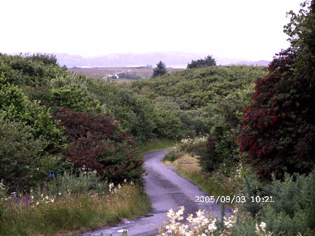
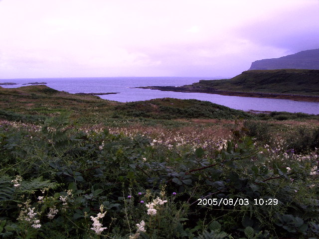
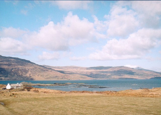
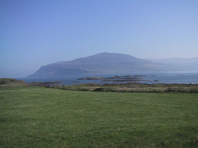
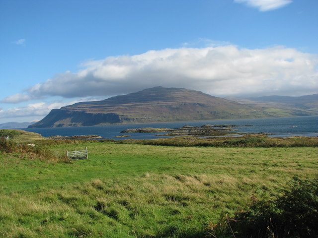
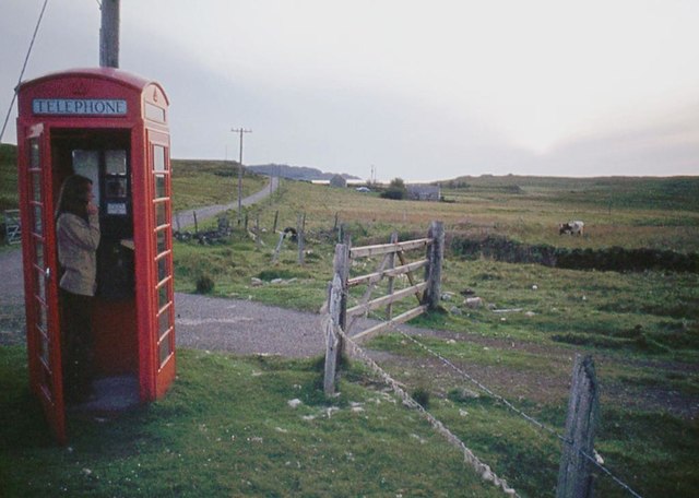
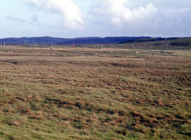
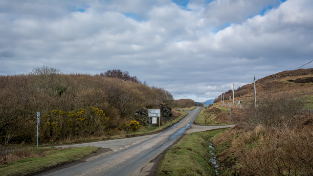
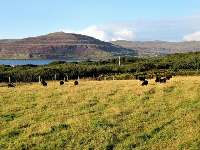
The village is blessed with stunning landscapes, characterized by rolling hills, lush greenery, and breathtaking views of nearby Loch Fyne. The surrounding area is a haven for outdoor enthusiasts, offering opportunities for hiking, fishing, and wildlife spotting. Knockan is also home to several walking trails, allowing visitors to explore the area's natural wonders at their own pace.

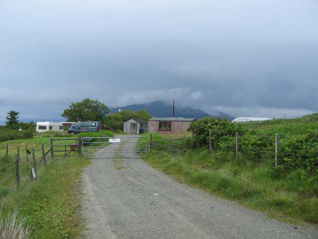
Despite its small size, Knockan boasts a strong sense of community. The village is home to a primary school, a local pub, and a community center that hosts various events and activities throughout the year. The residents take pride in their village and are known for their warm hospitality and friendly nature.

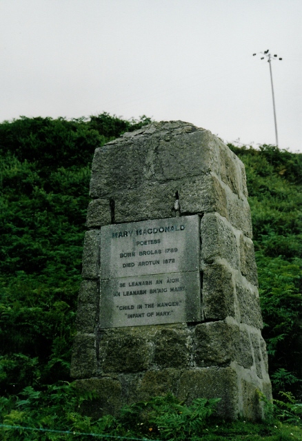
For those interested in history, Knockan offers a glimpse into the past. The village is dotted with ancient ruins, including standing stones and burial cairns, which serve as reminders of the area's rich heritage.

In summary, Knockan, Argyllshire, is a charming village nestled in the Scottish Highlands. Its natural beauty, outdoor activities, and friendly community make it an ideal destination for those seeking tranquility and a taste of Scotland's scenic countryside.

If you have any feedback on the listing, please let us know in the comments section below.

Knockan Images

Images are sourced within 2km of 56.327793/-6.2073999 or Grid Reference NM4023. Thanks to Geograph Open Source API. All images are credited.

The end of the public road, Assapol
The Road to Knockan, Ross of Mull The unclassified road to the hamlet of Knockan just north of its junction with the A849.
The Road to Knockan, Ross of Mull
The unclassified road to the hamlet of Knockan just north of its junction with the A849.
Loch na Corrobha, Ross of Mull A small sea loch Taken from the A849, the single track road, across the Ross of Mull.
Loch na Corrobha, Ross of Mull
A small sea loch Taken from the A849, the single track road, across the Ross of Mull.
Not the Rabbit Farm This is marked on the OS as a rabbit farm. It was once a combination of tourist attraction and angora production - but no longer.
Not the Rabbit Farm
This is marked on the OS as a rabbit farm. It was once a combination of tourist attraction and angora production - but no longer.
Coastal scene, Knockan, Mull Looking across croft land at Knockan towards Loch Scridain.
Coastal scene, Knockan, Mull
Looking across croft land at Knockan towards Loch Scridain.
Monument to Mary MacDonald Mary MacDonald wrote the Gaelic words to a hymn, which became an English favourite ("Child in a manger"). The tune was re-used for "Morning has broken" - probably the most famous Gaelic tune in the world now!  Beside the main road, near Ardtun where she died.
Monument to Mary MacDonald
Mary MacDonald wrote the Gaelic words to a hymn, which became an English favourite ("Child in a manger"). The tune was re-used for "Morning has broken" - probably the most famous Gaelic tune in the world now! Beside the main road, near Ardtun where she died.
Loch Scridain from Knockan
Rough Grazing, N of L.Assapol, Mull Competition between the bracken and the grass just becoming evident
Rough Grazing, N of L.Assapol, Mull
Competition between the bracken and the grass just becoming evident
Dense wild roadside shrubbery along the main road of the Ross of Mull
Countryside along the main road on the Ross of Mull
Bracken choked expanse with Loch na Corrobha beyond Photographer is on top of the main road along the Ross of Mull. These bracken invasions are the consequence of centuries of man's disturbance to the island, including the cycle of deforestation, livestock introduction and livestock reduction.
Bracken choked expanse with Loch na Corrobha beyond
Photographer is on top of the main road along the Ross of Mull. These bracken invasions are the consequence of centuries of man's disturbance to the island, including the cycle of deforestation, livestock introduction and livestock reduction.
The Berg from Knockan
Phone box at Ardtun
Phone box at Ardtun
Moor at Faoileann
Moor at Faoileann
Left for Knockan, right for Lee
Allt Loch Arm below crags on Beinn Lighe
Looking down on the farm of High Lee
Hebridean Sheep Grazing Black Hebridean sheep in a field by Drinnan with the headland of Ardmenach in the distance.
Hebridean Sheep Grazing
Black Hebridean sheep in a field by Drinnan with the headland of Ardmenach in the distance.
Show me another place!

Knockan is located at Grid Ref: NM4023 (Lat: 56.327793, Lng: -6.2073999)

Unitary Authority: Argyll and Bute

Police Authority: Argyll and West Dunbartonshire

Also known as: An Cnocan

What 3 Words

///arrived.campers.distilled. Near Fionnphort, Argyll & Bute

Related Wikis

Ardtun

Ardtun (Scottish Gaelic: Àird Tunna) is a settlement on the Isle of Mull, in Argyll and Bute, Scotland. Ardtun is within the parish of Kilfinichen and...

Knockan

Knockan (Scottish Gaelic: An Cnocan) is a township of six crofts in the community of Ardtun, in the south of the Isle of Mull off the west coast of Scotland...

Bunessan

Bunessan (Scottish Gaelic: Bun Easain) is a small village on the Ross of Mull in the south-west of the Isle of Mull, off the west coast of Scotland. The...

Suidhe

Suidhe (Scottish Gaelic: Suidhe) is a ruined township located on the southwestern peninsula of the Isle of Mull, Scotland. It lies just over 1 km to the...

Related Videos

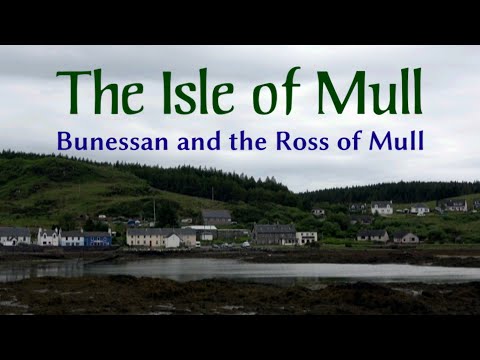
The Isle of Mull | Bunessan and the Ross of Mull

Bunessan, a small village in the south-west of the Isle of Mull, Scotland, is the base for our visit to the Ross of Mull. We look at the ...

Archie's Mull (remix)

A 2021 remix of an earlier upload, with the story of how the tune "Archie's Mull" was inspired. Photographs of Bunessan and ...

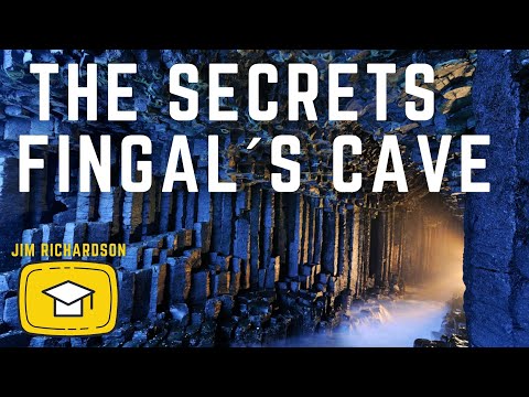
🎥 DISCOVER the SECRETS of FINGAL´s CAVE | SCOTLAND with JIM RICHARDSON 🎥

National Geographic photographer Jim Richardson explains the secrets behind his iconic photograph of Fingal´s Cave in the Isle ...

THE DAY WHEN OUR SOULS ARE CLEANSED AND WE REFLECT THE PERFECT IMAGE OF GOD

The Feast of Theophany, when God the Trinity reveals Himself to us. --- T O S U P P O R T T H E M O N A S T E R Y: By PayPal ...

Nearby Amenities

Located within 500m of 56.327793,-6.2073999
Passing Place
Lat/Long: 56.3309162/-6.2108751
Post Box
Post Box Type: lamp
Ref: PA70 122
Royal Cypher: scottish_crown
Lat/Long: 56.3279781/-6.1999032
Telephone
Booth: K6
Covered: booth
Lat/Long: 56.3279781/-6.1996627
Place: farm
Lat/Long: 56.3274123/-6.2030446
Place: farm
Lat/Long: 56.3312073/-6.2115633
Generator Method: photovoltaic
Generator Output Electricity: yes
Generator Source: solar
Generator Type: solar_photovoltaic_panel
Location: roof
Power: generator
Lat/Long: 56.3315753/-6.2078735
Power: pole
Lat/Long: 56.3313448/-6.2043665
Power: pole
Lat/Long: 56.3311188/-6.206008
Power: pole
Lat/Long: 56.3309552/-6.207203
Power: pole
Lat/Long: 56.3307626/-6.2085937
Power: pole
Lat/Long: 56.3315106/-6.2031636
Power: pole
Lat/Long: 56.3309396/-6.2020947
Power: pole
Lat/Long: 56.3294377/-6.2022154
Power: pole
Lat/Long: 56.3304154/-6.2018627
Power: pole
Lat/Long: 56.3297641/-6.2015261
Power: pole
Lat/Long: 56.3290719/-6.2011787
Power: pole
Lat/Long: 56.3282815/-6.2007912
Power: pole
Lat/Long: 56.3277669/-6.2005229
Power: pole
Lat/Long: 56.327816/-6.1995251
Power: pole
Lat/Long: 56.3277439/-6.1996593
Power: pole
Lat/Long: 56.3276472/-6.1998591
Power: pole
Lat/Long: 56.3274799/-6.2001944
Power: pole
Lat/Long: 56.3269973/-6.2011452
Power: pole
Lat/Long: 56.3263645/-6.2024112
Power: pole
Lat/Long: 56.3248647/-6.2048359
Power: pole
Lat/Long: 56.3242311/-6.2060925
Power: pole
Lat/Long: 56.323605/-6.2073572
Power: pole
Lat/Long: 56.3276201/-6.2003513
Power: pole
Lat/Long: 56.3272375/-6.2000281
Shop: storage_rental
Lat/Long: 56.3253185/-6.2034024
Shop: storage_rental
Lat/Long: 56.3308091/-6.2053754
Power: pole
Lat/Long: 56.3302193/-6.2134336
Power: pole
Lat/Long: 56.3303803/-6.2117336
Power: pole
Lat/Long: 56.3305088/-6.2103081
Power: pole
Lat/Long: 56.329587/-6.2145686
Power: pole
Lat/Long: 56.3299179/-6.2139718
The data included in this document is from www.openstreetmap.org. The data is made available under ODbL.

Have you been to Knockan?

Leave your review of Knockan below (or comments, questions and feedback).