Cefn Digoll

Hill, Mountain in Montgomeryshire

Wales

Cefn Digoll

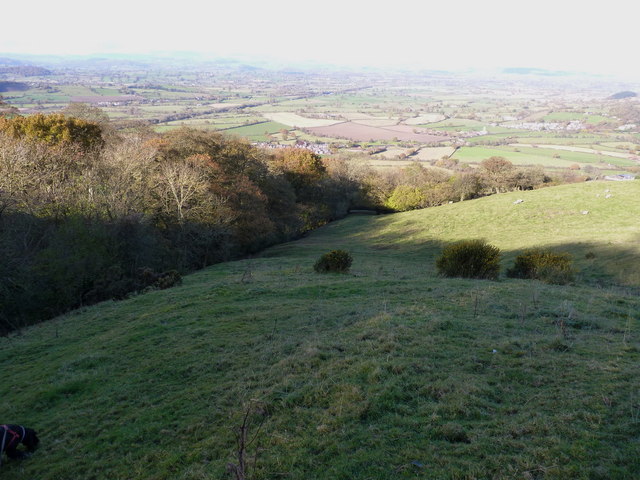
Heading across Heldre Hill Much of this part of the hill is mapped as CROW Access Land, and this sheep-track avoids the need to lose a couple of hundred feet following the footpath down to Brunant and back up. Which is rather handy.
Heading across Heldre Hill Credit: Richard Law

The requested URL returned error: 429 Too Many Requests

If you have any feedback on the listing, please let us know in the comments section below.

Cefn Digoll Images

Images are sourced within 2km of 52.662956/-3.0687585 or Grid Reference SJ2707. Thanks to Geograph Open Source API. All images are credited.

Heading across Heldre Hill Much of this part of the hill is mapped as CROW Access Land, and this sheep-track avoids the need to lose a couple of hundred feet following the footpath down to Brunant and back up. Which is rather handy.
Heading across Heldre Hill
Much of this part of the hill is mapped as CROW Access Land, and this sheep-track avoids the need to lose a couple of hundred feet following the footpath down to Brunant and back up. Which is rather handy.
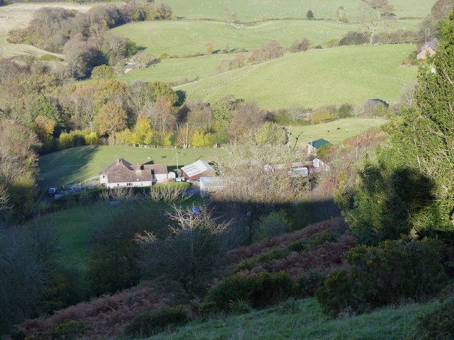
The settlement at Brunant From high on Heldre Hill above the farms.
The settlement at Brunant
From high on Heldre Hill above the farms.
Sheep grazing above Upper Heldre An unnamed stream flows off the hill in the gully behind the sheep, then crosses the lane just west of the farm of Upper Heldre.
Sheep grazing above Upper Heldre
An unnamed stream flows off the hill in the gully behind the sheep, then crosses the lane just west of the farm of Upper Heldre.
Fields and woodland above Upper Heldre
In the upper gully of the stream A sheep track crosses the tiny watercourse that flows down towards Upper Heldre.
In the upper gully of the stream
A sheep track crosses the tiny watercourse that flows down towards Upper Heldre.
A stile and a scrawny hedge The fallen tree of <a href="https://www.geograph.org.uk/photo/581476">SJ2808 : Obstacle course</a> has been removed, and so has the fingerpost beside the stile.
A stile and a scrawny hedge
The fallen tree of SJ2808 : Obstacle course has been removed, and so has the fingerpost beside the stile.
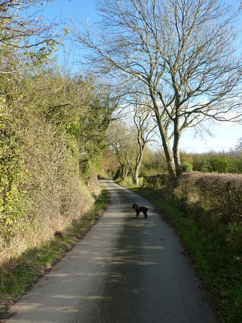
Along the Roman Road Part of the ancient routeway across the Long Mountain.
Along the Roman Road
Part of the ancient routeway across the Long Mountain.
Roadside ash trees near Welsh Harp Farm Here's hoping these trees, and many others of their species, survive the Ash dieback disease that appears to be breaking out across the UK in late 2012.
Roadside ash trees near Welsh Harp Farm
Here's hoping these trees, and many others of their species, survive the Ash dieback disease that appears to be breaking out across the UK in late 2012.
Long Mountain Farm track The track leads to the farm at the top of the hill, whilst a public footpath heads leftwards across the field from this gateway.
Long Mountain Farm track
The track leads to the farm at the top of the hill, whilst a public footpath heads leftwards across the field from this gateway.
Bungalow on Long Mountain Close to the road junction at Harp Woods, this looks like a fairly modern house.
Bungalow on Long Mountain
Close to the road junction at Harp Woods, this looks like a fairly modern house.
Road junction on Long Mountain The 'main' lane drops steeply 900' towards the A458 Welshpool to Shrewsbury road, whilst the junction to the left takes NCN81 down a similar drop to the B4388 just south of Buttington.
Road junction on Long Mountain
The 'main' lane drops steeply 900' towards the A458 Welshpool to Shrewsbury road, whilst the junction to the left takes NCN81 down a similar drop to the B4388 just south of Buttington.
Upper Monksfields Farm The farm nestles in a sheltered cwm on the south-facing side of Long Mountain, but at an altitude of 1000', it'll see its share of cold & wet weather.
Upper Monksfields Farm
The farm nestles in a sheltered cwm on the south-facing side of Long Mountain, but at an altitude of 1000', it'll see its share of cold & wet weather.
Ash trees on the lane towards Rhos Farm
Crossroads outside Rhos Farm The track on the right leads into Rhos Farm, the one to the left leads to Upper Monksfields, whilst the lane itself heads down to Tantree Bank and Rowley village.
Crossroads outside Rhos Farm
The track on the right leads into Rhos Farm, the one to the left leads to Upper Monksfields, whilst the lane itself heads down to Tantree Bank and Rowley village.
Beef cattle in a field south of Rhos Farm The view is almost directly south to Corndon Hill (just to right of the shot) in <a href="https://www.geograph.org.uk/gridref/SJ3096">SJ3096</a>.
Beef cattle in a field south of Rhos Farm
The view is almost directly south to Corndon Hill (just to right of the shot) in SJ3096.
What's happened to the seasons this year? A November-flowering foxglove (Digitalis purpurea) in the verge of the lane; I normally think of them as flowers of April & May - this one's 6 months adrift.
What's happened to the seasons this year?
A November-flowering foxglove (Digitalis purpurea) in the verge of the lane; I normally think of them as flowers of April & May - this one's 6 months adrift.
The track to Pound House An isolated house on the south-facing side of the Long Mountain.
The track to Pound House
An isolated house on the south-facing side of the Long Mountain.
Up a steep hill The photo doesn't do it justice - it warrants two arrows from the OS map, so it's a good 'un.
Up a steep hill
The photo doesn't do it justice - it warrants two arrows from the OS map, so it's a good 'un.
Show me another place!

Cefn Digoll is located at Grid Ref: SJ2707 (Lat: 52.662956, Lng: -3.0687585)

Unitary Authority: Powys

Police Authority: Dyfed Powys

Also known as: Long Mountain

What 3 Words

///prude.fabricate.complains. Near Welshpool, Powys

Nearby Locations

Cefn Digoll Long Mountain

Related Wikis

Siege of Exeter (c. 630)

According to some early medieval sources, the siege of Exeter or siege of Caer-Uisc was a military conflict that took place in or around 630 CE, between...

Long Mountain (Powys)

Long Mountain (Welsh: Cefn Digoll) is a hill straddling the boundary between Powys (Wales) and Shropshire (England) to the east of Welshpool though the...

Battle of Cefn Digoll

The Battle of Cefn Digoll, also known as the Battle of the Long Mynd was a battle fought in 630 at Long Mountain near Welshpool in modern-day Wales. The...

Battle of Buttington

The Battle of Buttington was fought in 893 between a Viking army and an alliance of Anglo-Saxons and Welsh. The annals for 893 reported that a large Viking...

Nearby Amenities

Located within 500m of 52.662956,-3.0687585
Give Way
Direction: forward
Lat/Long: 52.6629787/-3.0687893
Give Way
Direction: backward
Lat/Long: 52.6629593/-3.0687216
Give Way
Direction: backward
Lat/Long: 52.663099/-3.0693693
The data included in this document is from www.openstreetmap.org. The data is made available under ODbL.

Have you been to Cefn Digoll?

Leave your review of Cefn Digoll below (or comments, questions and feedback).