Haltonlea Fell

Hill, Mountain in Cumberland Carlisle

England

Haltonlea Fell

Sheep grazing at Midgeholme The sheep, possibly Suffolks, are on rough grazing south of the A689.
Sheep grazing at Midgeholme Credit: Trevor Littlewood

Haltonlea Fell is a prominent hill located in the county of Cumberland, in the northwestern region of England. Situated within the Lake District National Park, it is part of the Cumberland Fells, a range of hills renowned for their natural beauty and scenic landscapes.

Rising to an elevation of approximately 331 meters (1,085 feet), Haltonlea Fell offers breathtaking panoramic views of the surrounding countryside. Its distinctive shape and rugged terrain make it a popular destination for hikers, nature enthusiasts, and photographers alike.

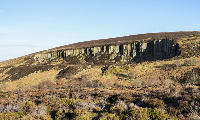
The hill is characterized by its steep slopes, which are covered in heather, grasses, and scattered rocks. The terrain is varied, with rocky outcrops and craggy areas adding to its charm. The summit of Haltonlea Fell provides a perfect vantage point to admire the picturesque valleys, rolling hills, and distant mountains.

In addition to its natural beauty, Haltonlea Fell also holds historical significance. The area is dotted with remnants of ancient settlements, including stone circles and burial mounds, which offer a glimpse into the region's rich past.

Access to Haltonlea Fell is relatively easy, with several footpaths leading to its summit. The hill is located near the village of Caldbeck, which provides amenities and services for visitors. Furthermore, the surrounding area offers a range of outdoor activities, such as walking, hiking, and birdwatching, making Haltonlea Fell an ideal destination for those seeking to explore the natural wonders of Cumberland.

If you have any feedback on the listing, please let us know in the comments section below.

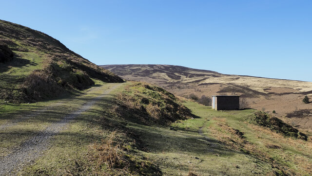
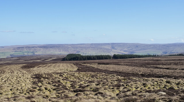
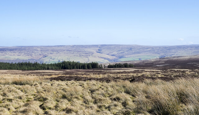
Haltonlea Fell Images

Images are sourced within 2km of 54.909119/-2.5678899 or Grid Reference NY6357. Thanks to Geograph Open Source API. All images are credited.

Sheep grazing at Midgeholme The sheep, possibly Suffolks, are on rough grazing south of the A689.
Sheep grazing at Midgeholme
The sheep, possibly Suffolks, are on rough grazing south of the A689.
Brick building below road to disused quarry The small building lies below the access road for the disused quarry above the Black Burn near Midgeholme.
Brick building below road to disused quarry
The small building lies below the access road for the disused quarry above the Black Burn near Midgeholme.
Colliery waste at Midgeholme Midgeholme is a small settlement along the A689 at the northern edge of the North Pennines. There's been coal mining in the area in the past in the 'Midgeholme Coalfield'. The tip is on the south side of the Black Burn which flows past the near bushes.
Colliery waste at Midgeholme
Midgeholme is a small settlement along the A689 at the northern edge of the North Pennines. There's been coal mining in the area in the past in the 'Midgeholme Coalfield'. The tip is on the south side of the Black Burn which flows past the near bushes.
Quarry near to Black Burn A striking, disused quarry north-west of Byers Pike seen from the west across the valley of the Black Burn. There's little remaining on the site, just the ruins of a concrete building and the access road.
Les Hull names the feature as Raven Crag Quarry - <a title="https://www.geograph.org.uk/photo/1481511" href="https://www.geograph.org.uk/photo/1481511">Link</a> .
Quarry near to Black Burn
A striking, disused quarry north-west of Byers Pike seen from the west across the valley of the Black Burn. There's little remaining on the site, just the ruins of a concrete building and the access road. Les Hull names the feature as Raven Crag Quarry - Link .
Moorland with 'pile of stones' OS mapping names this feature as a 'pile of stones' which surely doesn't do justice to what is a carefully constructed cairn lying north-west of the trig point on Byers Pike.
Moorland with 'pile of stones'
OS mapping names this feature as a 'pile of stones' which surely doesn't do justice to what is a carefully constructed cairn lying north-west of the trig point on Byers Pike.
Moorland with coniferous plantation The general area of moorland appears to be known as Hartleyburn Common (South Side), with the nearer ground more specifically named Haltonlea Fell. The coniferous plantation is shown on the OS Landranger map as extending further to the north, (left in the image), reaching the A689.
The distant moorland is on the eastern side of the valley of the River South Tyne.
Moorland with coniferous plantation
The general area of moorland appears to be known as Hartleyburn Common (South Side), with the nearer ground more specifically named Haltonlea Fell. The coniferous plantation is shown on the OS Landranger map as extending further to the north, (left in the image), reaching the A689. The distant moorland is on the eastern side of the valley of the River South Tyne.
Coniferous plantation on moorland slope The slope with the trees declines gradually reaching the Glendue Burn in the valley named Glen Due - unusual south of the border!
The distant moorland is on the eastern side of the valley of the River South Tyne.
Coniferous plantation on moorland slope
The slope with the trees declines gradually reaching the Glendue Burn in the valley named Glen Due - unusual south of the border! The distant moorland is on the eastern side of the valley of the River South Tyne.
Fences above Butt of Blackburn Butt of Blackburn is a location along the course of the Black Burn; it appears to be a name referring to the sharp change of direction of the stream which runs in the obvious cleft at the left side of the image. There's a boundary stone at the fence junction with a letter K cut into the visible face; it possibly refers to the Knarsdale Estate which has land hereabouts.
Fences above Butt of Blackburn
Butt of Blackburn is a location along the course of the Black Burn; it appears to be a name referring to the sharp change of direction of the stream which runs in the obvious cleft at the left side of the image. There's a boundary stone at the fence junction with a letter K cut into the visible face; it possibly refers to the Knarsdale Estate which has land hereabouts.
Heather on slope of Cold Fell The heather slopes are descending from Cold Fell towards the valley of the Black Burn. Unlike the ground on the far side of the valley there's been no management for grouse shooting here and heather growth has been vigorous! There are numerous shallow grooves on the slope to enter and climb from, broken only by more significant ones filled with rushes. The traverse of the ground was arduous.
Heather on slope of Cold Fell
The heather slopes are descending from Cold Fell towards the valley of the Black Burn. Unlike the ground on the far side of the valley there's been no management for grouse shooting here and heather growth has been vigorous! There are numerous shallow grooves on the slope to enter and climb from, broken only by more significant ones filled with rushes. The traverse of the ground was arduous.
Birch-lined track between Midgeholm and Halton-Lea-Gate The track follows the former route of industrial railways later part of the Brampton Branch.

This photograph was taken during the Coronavirus (COVID-19) pandemic of 2020/21/22.
Birch-lined track between Midgeholm and Halton-Lea-Gate
The track follows the former route of industrial railways later part of the Brampton Branch. This photograph was taken during the Coronavirus (COVID-19) pandemic of 2020/21/22.
A689 at Midgeholme
A689 at Midgeholme
Welcome to Cumbria: A689 enters Midgeholme
Benchmark on Byers Pike trig point Ordnance Survey flush bracket (serial identifier S6442) levelled at 458.114m above Newlyn Datum in 1953
Benchmark on Byers Pike trig point
Ordnance Survey flush bracket (serial identifier S6442) levelled at 458.114m above Newlyn Datum in 1953
Byers Pike triangulation pillar There is an OS benchmark <a href="https://www.geograph.org.uk/photo/6189779">NY6357 : Benchmark on Byers Pike trig point</a> set in the right hand face of the pillar which is described at <span class="nowrap"><a title="http://trigpointing.uk/trig/1829" rel="nofollow ugc noopener" href="http://trigpointing.uk/trig/1829">Link</a><img style="margin-left:2px;" alt="External link" title="External link - shift click to open in new window" src="https://s1.geograph.org.uk/img/external.png" width="10" height="10"/></span>
Byers Pike triangulation pillar
There is an OS benchmark NY6357 : Benchmark on Byers Pike trig point set in the right hand face of the pillar which is described at LinkExternal link
On Haltonlea Fell looking towards Halton-Lea-Gate
Sheep on frosty ground near Midgeholme Bridge
Black Burn emerging from a conduit under Lord Carlisle's Railway The (former) railway, part of which was in use in the 18th C, was built by Lord Carlisle without an Act of Parliament as it was built on his own land. It carried coal from the various collieries along the line of what is now the A689 to Brampton. By the mid-19th C, the line connected the Haltwhistle to Alston line (at Lambley) with Brampton on the Newcastle to Carlisle line. It was one of the first non-Stephenson railways to convert and adopt the standard gauge of 4’8½" and in 1836 the ‘new railway’ opened officially under steam traction with the Rocket <span class="nowrap"><a title="http://www.bbc.co.uk/history/british/victorians/launch_ani_rocket.shtml" rel="nofollow ugc noopener" href="http://www.bbc.co.uk/history/british/victorians/launch_ani_rocket.shtml">Link</a><img style="margin-left:2px;" alt="External link" title="External link - shift click to open in new window" src="https://s1.geograph.org.uk/img/external.png" width="10" height="10"/></span>  in use from the following year. For more info see <span class="nowrap"><a title="http://www.cumbria-railways.co.uk/brampton_railway.html" rel="nofollow ugc noopener" href="http://www.cumbria-railways.co.uk/brampton_railway.html">Link</a><img style="margin-left:2px;" alt="External link" title="External link - shift click to open in new window" src="https://s1.geograph.org.uk/img/external.png" width="10" height="10"/></span>.
Black Burn emerging from a conduit under Lord Carlisle's Railway
The (former) railway, part of which was in use in the 18th C, was built by Lord Carlisle without an Act of Parliament as it was built on his own land. It carried coal from the various collieries along the line of what is now the A689 to Brampton. By the mid-19th C, the line connected the Haltwhistle to Alston line (at Lambley) with Brampton on the Newcastle to Carlisle line. It was one of the first non-Stephenson railways to convert and adopt the standard gauge of 4’8½" and in 1836 the ‘new railway’ opened officially under steam traction with the Rocket LinkExternal link in use from the following year. For more info see LinkExternal link.
The trackbed of Lord Carlisle's Railway near Midgeholme The (former) railway, part of which was in use in the 18th C, was built by Lord Carlisle without an Act of Parliament as it was built on his own land. It carried coal from the various collieries along the line of what is now the A689 to Brampton. By the mid-19th C, the line connected the Haltwhistle to Alston line (at Lambley) with Brampton on the Newcastle to Carlisle line. It was one of the first non-Stephenson railways to convert and adopt the standard gauge of 4'8½" and in 1836 the ‘new railway’ opened officially under steam traction with the Rocket <span class="nowrap"><a title="http://www.bbc.co.uk/history/british/victorians/launch_ani_rocket.shtml" rel="nofollow ugc noopener" href="http://www.bbc.co.uk/history/british/victorians/launch_ani_rocket.shtml">Link</a><img style="margin-left:2px;" alt="External link" title="External link - shift click to open in new window" src="https://s1.geograph.org.uk/img/external.png" width="10" height="10"/></span> in use from the following year. For more info see <span class="nowrap"><a title="http://www.cumbria-railways.co.uk/brampton_railway.html" rel="nofollow ugc noopener" href="http://www.cumbria-railways.co.uk/brampton_railway.html">Link</a><img style="margin-left:2px;" alt="External link" title="External link - shift click to open in new window" src="https://s1.geograph.org.uk/img/external.png" width="10" height="10"/></span>.

There are currently plans (approved on appeal) to mine 140,000 tonnes of coal from an opencast site at Halton-Lea-Gate (about half a mile to the east). This is understandably not very popular with the residents  - see <span class="nowrap"><a title="http://www.journallive.co.uk/north-east-news/todays-news/2012/08/27/halton-lea-gate-opencast-is-a-national-issue-say-residents-61634-31703401/" rel="nofollow ugc noopener" href="http://www.journallive.co.uk/north-east-news/todays-news/2012/08/27/halton-lea-gate-opencast-is-a-national-issue-say-residents-61634-31703401/">Link</a><img style="margin-left:2px;" alt="External link" title="External link - shift click to open in new window" src="https://s1.geograph.org.uk/img/external.png" width="10" height="10"/></span>.
The trackbed of Lord Carlisle's Railway near Midgeholme
The (former) railway, part of which was in use in the 18th C, was built by Lord Carlisle without an Act of Parliament as it was built on his own land. It carried coal from the various collieries along the line of what is now the A689 to Brampton. By the mid-19th C, the line connected the Haltwhistle to Alston line (at Lambley) with Brampton on the Newcastle to Carlisle line. It was one of the first non-Stephenson railways to convert and adopt the standard gauge of 4'8½" and in 1836 the ‘new railway’ opened officially under steam traction with the Rocket LinkExternal link in use from the following year. For more info see LinkExternal link. There are currently plans (approved on appeal) to mine 140,000 tonnes of coal from an opencast site at Halton-Lea-Gate (about half a mile to the east). This is understandably not very popular with the residents - see LinkExternal link.
Show me another place!

Haltonlea Fell is located at Grid Ref: NY6357 (Lat: 54.909119, Lng: -2.5678899)

Administrative County: Cumbria

District: Carlisle

Police Authority: Cumbria

Also known as: Byers Pike

What 3 Words

///flopping.straws.internal. Near Greenhead, Northumberland

Related Wikis

Midgeholme Coalfield

The Midgeholme Coalfield is a coalfield in Midgeholme, on the border of Cumbria with Northumberland in northern England. It is the largest of a series...

Halton Lea Gate

Halton Lea Gate is a small village in Northumberland, England, on the A689 road close to the boundary of the counties of Northumberland and Cumbria. The...

Tindale, Cumbria

Tindale or Tindale Fell is a hamlet in the parish of Farlam in the City of Carlisle district of the English county of Cumbria. It is to the south of the...

Midgeholme

Midgeholme is a hamlet and civil parish in City of Carlisle district, Cumbria, England. At the 2001 census the parish had a population of 67. The parish...

Nearby Amenities

Located within 500m of 54.909119,-2.5678899
Byers Pike
Ele: 458
Natural: peak
Lat/Long: 54.9092714/-2.5689099
The data included in this document is from www.openstreetmap.org. The data is made available under ODbL.

Have you been to Haltonlea Fell?

Leave your review of Haltonlea Fell below (or comments, questions and feedback).