Mynydd Maentwrog

Hill, Mountain in Merionethshire

Wales

Mynydd Maentwrog

Cattle grid near Tomen-y-mûr, Trawsfynydd
Cattle grid near Tomen-y-mûr, Trawsfynydd Credit: Meirion

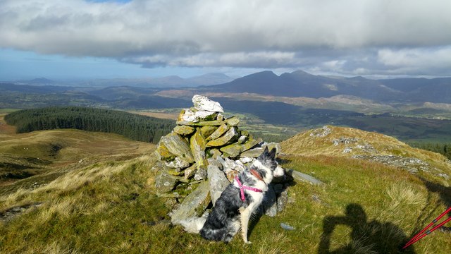
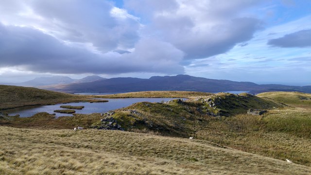
Mynydd Maentwrog is a prominent hill located in the county of Merionethshire, in northwest Wales. Situated within the Snowdonia National Park, it is part of the Moelwynion mountain range, which offers stunning views and excellent hiking opportunities.

Standing at an elevation of 863 meters (2,831 feet), Mynydd Maentwrog is a popular destination for outdoor enthusiasts and nature lovers. Its name translates to "Mountain of Maentwrog," referring to the nearby village of Maentwrog. The hill is composed mainly of slate, a characteristic feature of the region.

The ascent to the summit offers a varied terrain, encompassing grassy slopes, rocky outcrops, and some steeper sections that require a bit of scrambling. From the top, visitors are rewarded with panoramic views of the surrounding landscapes, including the nearby Rhinog Mountains and the picturesque valleys of the River Dwyryd and River Glaslyn.

The hill is rich in flora and fauna, providing a habitat for a variety of plant species and wildlife. It is not uncommon to spot birds of prey soaring above, such as buzzards and kestrels. During the summer months, colorful wildflowers dot the landscape, adding to the area's natural beauty.

Mynydd Maentwrog is easily accessible, with several footpaths and trails leading to its summit. The most popular route starts from the village of Maentwrog, offering a moderate hike that takes around 3-4 hours to complete. Adequate clothing, sturdy footwear, and a map or guidebook are recommended when venturing onto the hill.

If you have any feedback on the listing, please let us know in the comments section below.

Mynydd Maentwrog Images

Images are sourced within 2km of 52.937502/-3.8968016 or Grid Reference SH7239. Thanks to Geograph Open Source API. All images are credited.

Cattle grid near Tomen-y-mûr, Trawsfynydd
Snowdonia National Park marker at Tomen-y-mûr, Trawsfynydd
Amphitheatre information board at Tomen-y-mûr, Trawsfynydd
Information board at Tomen-y-mûr, Trawsfynydd
Stile on footpath near Tomen-y-mûr, Trawsfynydd
Waymark post at Tomen-y-mûr, Trawsfynydd
Wildcamp on Graig Wen Sunrise over Arenig Fawr from our pitch just below the summit of Graig Wen
Wildcamp on Graig Wen
Sunrise over Arenig Fawr from our pitch just below the summit of Graig Wen
Breached dam wall A breached dam wall of an unnamed reservoir now just an upland bog again
Breached dam wall
A breached dam wall of an unnamed reservoir now just an upland bog again
Foel Fawr summit Descending via Foel Fawr after a wildcamp on Graig Wen
Foel Fawr summit
Descending via Foel Fawr after a wildcamp on Graig Wen
Llyn Craig-y-tan One of many small pools and quarry reservoirs on the slopes of Foel Fawr and Graig Wen
Llyn Craig-y-tan
One of many small pools and quarry reservoirs on the slopes of Foel Fawr and Graig Wen
Tuag at Ddolbelydr / Towards Dolbelydr Hen heol yn mynd i gyfeiriad afail o ffarm o'r enw Dolbelydr.

An old road heading towards the ruined Dolbedlydr Farm.
Tuag at Ddolbelydr / Towards Dolbelydr
Hen heol yn mynd i gyfeiriad afail o ffarm o'r enw Dolbelydr. An old road heading towards the ruined Dolbedlydr Farm.
Braich Ddu Heol las yr ucheldir yn arwain at Chwareli Braich Ddu.

A green upland road heading towards Braich Ddu Quarries (black mountain spur).
Braich Ddu
Heol las yr ucheldir yn arwain at Chwareli Braich Ddu. A green upland road heading towards Braich Ddu Quarries (black mountain spur).
Hen Dramffordd / Old Tramway Hen dramffordd chwarel sy bellach yn llwybr.

An old tramway which is today a footpath.
Hen Dramffordd / Old Tramway
Hen dramffordd chwarel sy bellach yn llwybr. An old tramway which is today a footpath.
Tracks near the Roman amphitheatre Looking over moorland near to the amphitheatre.
Tracks near the Roman amphitheatre
Looking over moorland near to the amphitheatre.
Track to Llyn yr Oerfel Looking along a track leading to a lake.
Track to Llyn yr Oerfel
Looking along a track leading to a lake.
Site of the Amphitheatre Looking across the site of the Roman Amphitheatre at Tomen-y-mur.
Site of the Amphitheatre
Looking across the site of the Roman Amphitheatre at Tomen-y-mur.
Roman Amphitheatre Looking across the site of the Roman Amphitheatre at Tomen-y-mur.
Roman Amphitheatre
Looking across the site of the Roman Amphitheatre at Tomen-y-mur.
Tomen-y-mur Amphitheatre  Looking across the site of the Roman Amphitheatre at Tomen-y-mur.
Tomen-y-mur Amphitheatre
Looking across the site of the Roman Amphitheatre at Tomen-y-mur.
Show me another place!

Mynydd Maentwrog is located at Grid Ref: SH7239 (Lat: 52.937502, Lng: -3.8968016)

Unitary Authority: Gwynedd

Police Authority: North Wales

Also known as: Foel Fawr

What 3 Words

///processes.renamed.bouncing. Near Ffestiniog, Gwynedd

Related Wikis

Ffestiniog transmitting station

The Ffestiniog transmitting station is a broadcasting and telecommunications facility located on the slopes of Mynydd Maentwrog about 3 kilometres (1.9...
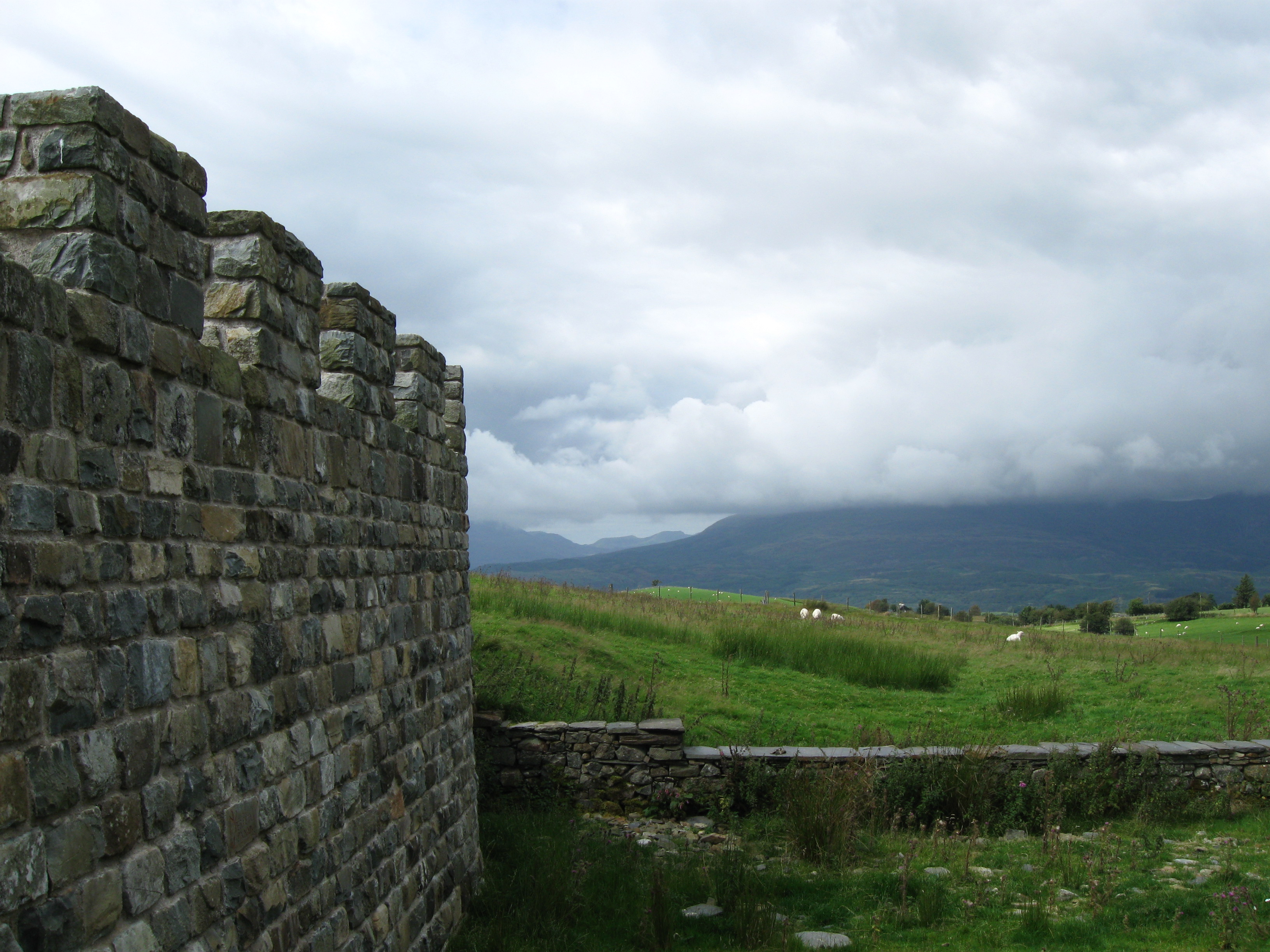
Tomen y Mur

Tomen y Mur is a First Century AD Roman fort in Snowdonia, Gwynedd, Wales. The fortification, which lies on the slope of an isolated spur northeast of...
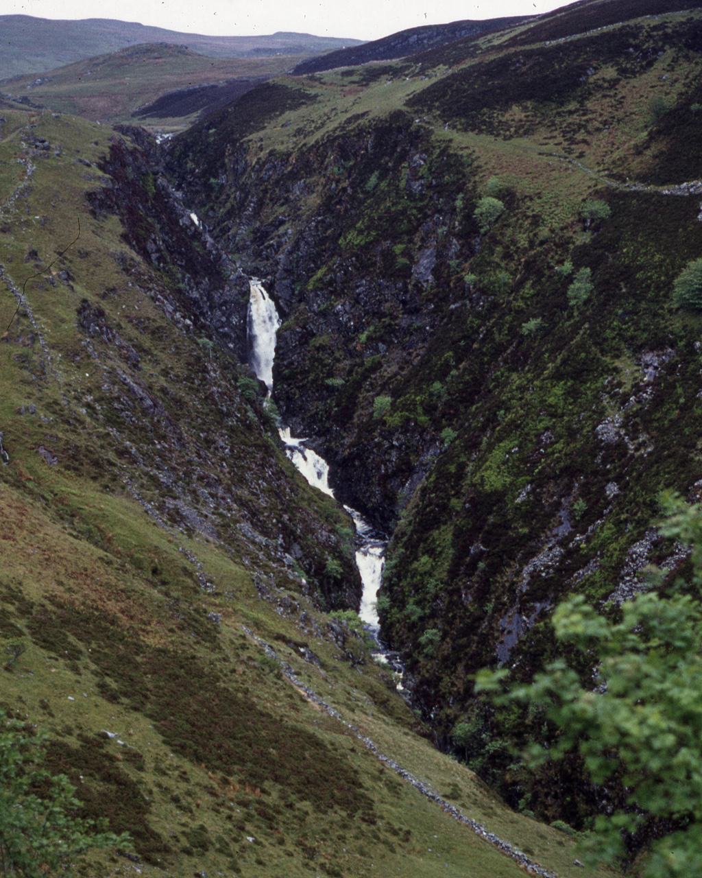
Rhaeadr y Cwm

The Rhaeadr y Cwm is a waterfall on the Afon Cynfal river in Gwynedd, North Wales. The falls are located near the B4391 road, some 3 miles (5 km) east...

Trawsfynydd Lake Halt railway station

Trawsfynydd Lake Halt was a solely passenger railway station near the northeastern tip of Llyn Trawsfynydd, Gwynedd, Wales. Many Nineteenth and early Twentieth...

Nearby Amenities

Located within 500m of 52.937502,-3.8968016
Foel Fawr
Ele: 528
Natural: peak
Wikidata: Q13128468
Wikipedia: cy:Foel Fawr (Mynydd Maentwrog)
Lat/Long: 52.9371846/-3.8968294
The data included in this document is from www.openstreetmap.org. The data is made available under ODbL.

Have you been to Mynydd Maentwrog?

Leave your review of Mynydd Maentwrog below (or comments, questions and feedback).