Carreg naw llyn

Hill, Mountain in Cardiganshire

Wales

Carreg naw llyn

A vast expanse of nothing There is a marker post near the centre of the shot - maybe for a pipeline?
A vast expanse of nothing Credit: David Medcalf

Carreg naw llyn, located in Cardiganshire, Wales, is a prominent hill that stands at an elevation of 485 meters (1,591 feet). The name Carreg naw llyn translates to "rock of the nine lakes" in English, referencing the numerous small lakes and pools that can be found scattered around the hill.

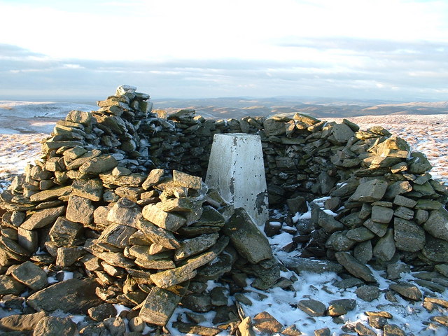
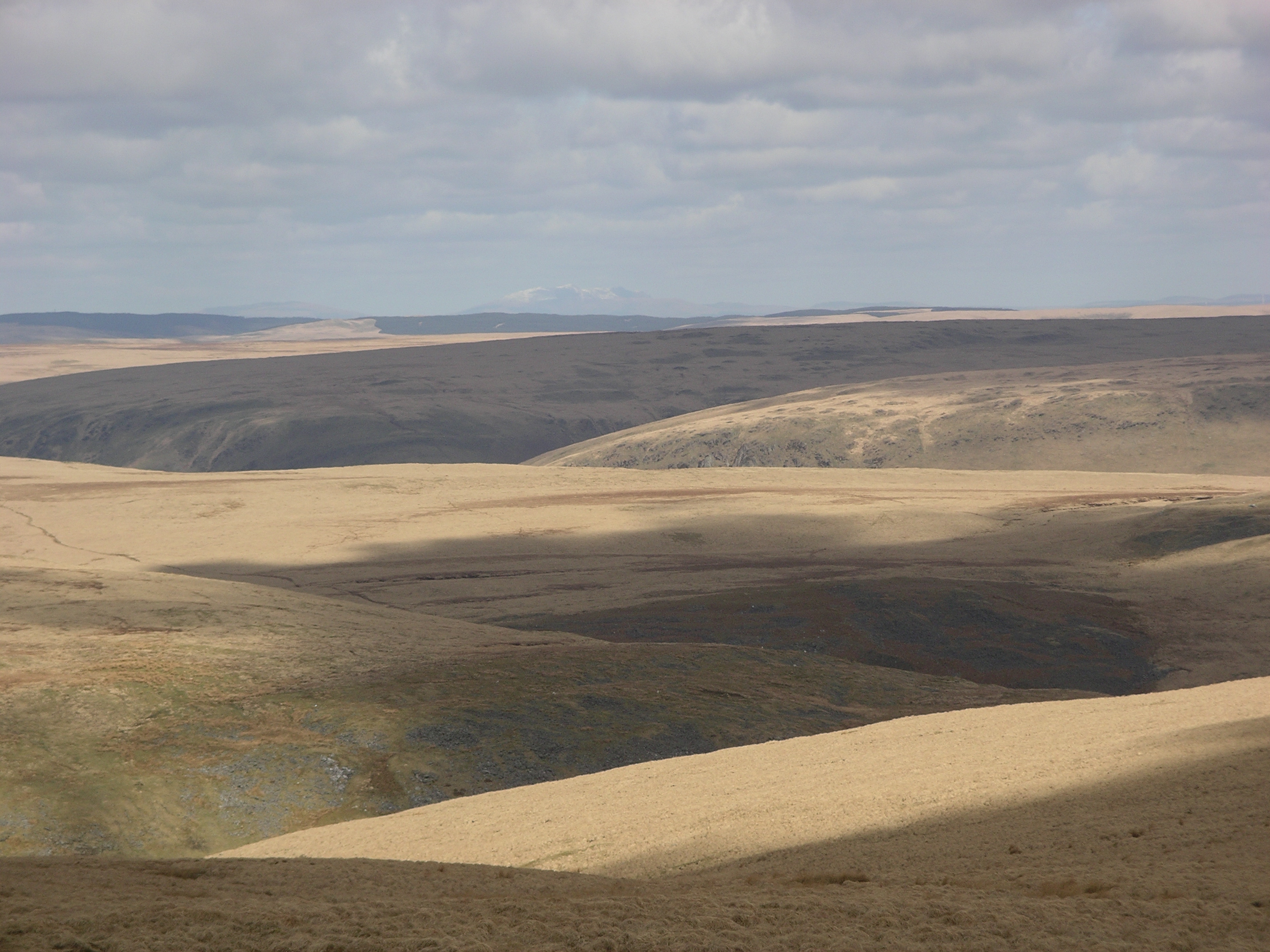
The hill is a popular destination for hikers and outdoor enthusiasts, offering stunning panoramic views of the surrounding countryside and Cardigan Bay. The terrain is mostly rugged and rocky, with heather and grass covering the slopes. The summit of Carreg naw llyn is marked by a cairn, providing a focal point for those reaching the top.

Visitors to Carreg naw llyn can enjoy a challenging but rewarding hike, with various trails and paths leading to the summit. The hill is also home to a diverse range of wildlife, including birds of prey and wild ponies that roam the area.

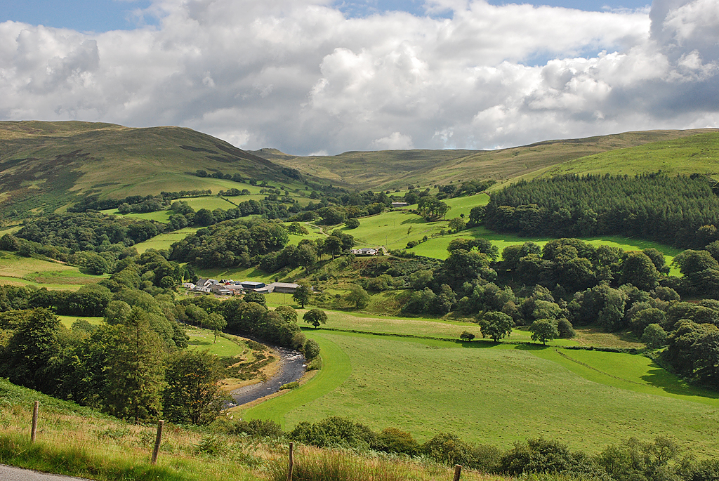
Overall, Carreg naw llyn is a picturesque and tranquil spot for nature lovers and adventurers seeking to explore the beauty of the Welsh countryside.

If you have any feedback on the listing, please let us know in the comments section below.

Carreg naw llyn Images

Images are sourced within 2km of 52.314103/-3.765585 or Grid Reference SN7969. Thanks to Geograph Open Source API. All images are credited.

A vast expanse of nothing There is a marker post near the centre of the shot - maybe for a pipeline?
A vast expanse of nothing
There is a marker post near the centre of the shot - maybe for a pipeline?
The road across the moors
The tarmac has finished Up to this point the road across the moor was metalled.
The tarmac has finished
Up to this point the road across the moor was metalled.
Moorland and drainage lines
The road across Banc Gorweddfa 'Gorwedd' means 'to lie down' and 'Gorweddfa' means 'a lying down place'. Perhaps an ancient staging post across the moors?
The road across Banc Gorweddfa
'Gorwedd' means 'to lie down' and 'Gorweddfa' means 'a lying down place'. Perhaps an ancient staging post across the moors?
Llyn Fyrddon Fawr Llyn Fyrddon Fawr and its outflow, high in the western Elenydd.  The lake here is contained by a rather elderly-looking low stone dam.  It's flanked on the eastern shore by the Cambrian Way, often just a line on the map in these parts but here a reasonably discernible path.
Llyn Fyrddon Fawr
Llyn Fyrddon Fawr and its outflow, high in the western Elenydd. The lake here is contained by a rather elderly-looking low stone dam. It's flanked on the eastern shore by the Cambrian Way, often just a line on the map in these parts but here a reasonably discernible path.
Looking down Llyn Hir One of the smaller Teifi Pools.
Looking down Llyn Hir
One of the smaller Teifi Pools.
An accurate weather forecast The forecast was for clouds and sunny patches, with hail arriving mid-afternoon driven by strong winds. The hail arrived on time, with Groes Fan seen here plastered by the first, heavy, shower. The wind is blowing from right to left.
An accurate weather forecast
The forecast was for clouds and sunny patches, with hail arriving mid-afternoon driven by strong winds. The hail arrived on time, with Groes Fan seen here plastered by the first, heavy, shower. The wind is blowing from right to left.
The Teifi Pools road, after hail Most of the hail has been driven to the right hand side of the road by the wind. The track to Llyn Hir can be seen on the left.
The Teifi Pools road, after hail
Most of the hail has been driven to the right hand side of the road by the wind. The track to Llyn Hir can be seen on the left.
The track to Claerwen The sign suggests that it is legal to drive on the track (but you will need a suitable vehicle). Further ahead it becomes illegal to drive on it.
The track to Claerwen
The sign suggests that it is legal to drive on the track (but you will need a suitable vehicle). Further ahead it becomes illegal to drive on it.
Banc Gorweddfa viewed from Craig Ddu Fach The old route known as the 'Monks' Trod' can be seen winding around the hillside. The route was used by monks travelling between Abbeys at Strata Florida in Ceredigion and Cwm Hir in Radnorshire, although it is said that the route may date from pre-Christian times. The OS has chosen not to name the route, just showing it as an 'ancient road' on the 1:50000 map. The section from here to Bryn Glas <a href="https://www.geograph.org.uk/gridref/SN80826761">SN80826761</a> appears to have no restrictions for motor vehicles, but beyond that is closed to all motors.
Banc Gorweddfa viewed from Craig Ddu Fach
The old route known as the 'Monks' Trod' can be seen winding around the hillside. The route was used by monks travelling between Abbeys at Strata Florida in Ceredigion and Cwm Hir in Radnorshire, although it is said that the route may date from pre-Christian times. The OS has chosen not to name the route, just showing it as an 'ancient road' on the 1:50000 map. The section from here to Bryn Glas SN80826761 appears to have no restrictions for motor vehicles, but beyond that is closed to all motors.
On the Monks' Trod Rounding Banc Dafadbeddol.
On the Monks' Trod
Rounding Banc Dafadbeddol.
Scraggy sheep beside the Monks' Trod Approaching sheering time but given the very cold temperatures of late, they're probably glad that they still have their winter coats!
Scraggy sheep beside the Monks' Trod
Approaching sheering time but given the very cold temperatures of late, they're probably glad that they still have their winter coats!
The moors of Banc Dafadbeddol Another interesting name - 'dafad' means 'sheep' and 'bedd' means 'grave'. There is some history here.
The moors of Banc Dafadbeddol
Another interesting name - 'dafad' means 'sheep' and 'bedd' means 'grave'. There is some history here.
The valley of the Afon Claerddu
A boggy defile between hills Very wet land between the hills to the southwest of Rhos Fign and the low, rounded unnamed lump just to the east.
A boggy defile between hills
Very wet land between the hills to the southwest of Rhos Fign and the low, rounded unnamed lump just to the east.
Llyn y Fign from the east Llyn a Fign collects water from the shallow cwm, and then drains it southeastwards into the Afon Claerwen. It's surrounded by extensive boggy grassland, which gets progressively boggier as you approach the llyn, unless you're the Red Kite which was quartering the area in front of me.
Llyn y Fign from the east
Llyn a Fign collects water from the shallow cwm, and then drains it southeastwards into the Afon Claerwen. It's surrounded by extensive boggy grassland, which gets progressively boggier as you approach the llyn, unless you're the Red Kite which was quartering the area in front of me.
Across Llyn y Fign to nameless hills north of the llyn
Show me another place!

Carreg naw llyn is located at Grid Ref: SN7969 (Lat: 52.314103, Lng: -3.765585)

Unitary Authority: Ceredigion

Police Authority: Dyfed Powys

Also known as: Esgair Garregnawllyn

What 3 Words

///prepare.quoted.litters. Near Cwmystwyth, Ceredigion

Related Wikis

Llan Ddu Fawr

Llan Ddu Fawr or Waun Claerddu is a hill located in Ceredigion, Wales, at 594 metres (1,949 ft) above sea level. It is located about 10 miles south of...

Wales

Wales (Welsh: Cymru [ˈkəm.rɨ] ) is a country that is part of the United Kingdom. It is bordered by England to the east, the Irish Sea to the north and...

Desert of Wales

The Desert of Wales, or Green Desert of Wales, is an archaic term for an area in central Wales, so called for its lack of roads and towns, and its inaccessibility...

Cwmystwyth

Cwmystwyth (also Cwm Ystwyth, Welsh pronunciation: [kʊmˈəstʊɨθ]; English: "valley of the River Ystwyth") is a village in Ceredigion, Wales near Devil's...

Nearby Amenities

Located within 500m of 52.314103,-3.765585
Source: npe
Lat/Long: 52.3184472/-3.7641303
Source: npe
Lat/Long: 52.3146258/-3.7672104
Source: npe
Lat/Long: 52.3147658/-3.7682527
Source: npe
Lat/Long: 52.3178793/-3.7666861
Source: npe
Lat/Long: 52.3178405/-3.7661159
Source: npe
Lat/Long: 52.3151632/-3.7669097
Source: npe
Lat/Long: 52.3155069/-3.7653118
Created By: POI Editor
Source: npe
Lat/Long: 52.3134828/-3.7629698
Created By: POI Editor
Source: npe
Lat/Long: 52.3141654/-3.7622039
Created By: POI Editor
Source: npe
Lat/Long: 52.3127251/-3.7614027
Created By: POI Editor
Source: npe
Lat/Long: 52.3119905/-3.7624298
Created By: POI Editor
Source: npe
Lat/Long: 52.3125729/-3.7629355
The data included in this document is from www.openstreetmap.org. The data is made available under ODbL.

Have you been to Carreg naw llyn?

Leave your review of Carreg naw llyn below (or comments, questions and feedback).