Blotting Raise
Hill, Mountain in Cumberland Eden
England
Blotting Raise

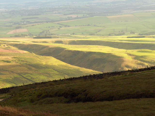
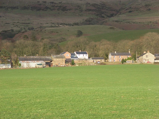
Blotting Raise is a prominent hill located in the Lake District National Park in Cumbria, England. It forms part of the larger Cumberland Hills, which are renowned for their dramatic landscapes and stunning vistas. Rising to an elevation of approximately 1,670 feet (509 meters), Blotting Raise offers breathtaking panoramic views of the surrounding countryside.
The terrain of Blotting Raise is characterized by a mixture of grassy slopes and rocky outcrops, typical of the region's geology. The hill is predominantly covered in heather, giving it a beautiful purple hue during the summer months. The diverse vegetation on Blotting Raise supports a variety of wildlife, including numerous bird species such as curlews and red grouse.
Hiking enthusiasts are drawn to Blotting Raise due to its accessibility and the rewarding views it offers. There are several well-marked trails that lead to the summit, allowing visitors to explore the hill at their own pace. The ascent can be challenging at times, with steep sections and uneven terrain, but the effort is rewarded with breathtaking vistas of the surrounding valleys and mountains.
Blotting Raise is also steeped in local folklore and history. It is said to have been named after an incident involving an ink blot on an important document, which occurred during the time of the Cumberland Enclosures. These enclosures were a series of land disputes in the 18th century, and Blotting Raise became associated with the protest against the enclosures.
In conclusion, Blotting Raise is a picturesque hill in the Cumberland Hills, offering stunning views, diverse flora and fauna, and a rich history. It is a must-visit destination for nature lovers and outdoor enthusiasts visiting the Lake District National Park.
If you have any feedback on the listing, please let us know in the comments section below.
Blotting Raise Images
Images are sourced within 2km of 54.838954/-2.6295117 or Grid Reference NY5949. Thanks to Geograph Open Source API. All images are credited.


Blotting Raise is located at Grid Ref: NY5949 (Lat: 54.838954, Lng: -2.6295117)
Administrative County: Cumbria
District: Eden
Police Authority: Cumbria
Also known as: Croglin Fell
What 3 Words
///headache.dispenser.garages. Near Alston, Cumbria
Nearby Locations
Related Wikis

Croglin
Croglin is the name of a village, former civil parish, beck (stream), and grange now in the parish of Ainstable, in the Westmorland and Furness district...

Newbiggin, Ainstable
Newbiggin is a small hamlet in Cumbria, England. Cumrew beck flows north-west through Newbiggin eventually joining the Eden close to Armathwaite. The village...
Cumrew
Cumrew is a small village and civil parish in north-east Cumbria, England. About 7 miles (11 km) south of Brampton and 13 miles (21 km) east of Carlisle...
Geltsdale
Geltsdale is a hamlet and former civil parish, now in the parish of Castle Carrock, in the Cumberland district, in the ceremonial county of Cumbria, England...

Geltsdale & Glendue Fells
Geltsdale & Glendue Fells is a Site of Special Scientific Interest in the North Pennines, England. The site has an area of 8059 ha, partly in Cumbria...

Carlatton and Cumrew
Carlatton and Cumrew are civil parishes in Cumbria, England with a common parish council.The Eastern boundary of this rural parish is Cardunneth Pike in...

Albyfield
Albyfield is a hamlet in Cumbria, England.

Renwick, Cumbria
Renwick, formerly known as Ravenwick, is a small village and former civil parish, now in the parish of Kirkoswald, in the Eden district, in the county...
Nearby Amenities
Located within 500m of 54.838954,-2.6295117Have you been to Blotting Raise?
Leave your review of Blotting Raise below (or comments, questions and feedback).