Cole's Tump
Hill, Mountain in Herefordshire
England
Cole's Tump

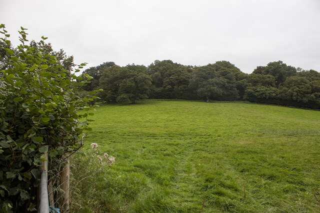
Cole's Tump is a prominent hill located in the county of Herefordshire, England. Rising to a height of approximately 338 meters (1,109 feet), it is considered one of the notable landmarks in the region. Situated near the village of Garway, Cole's Tump offers breathtaking panoramic views of the surrounding countryside, making it a popular destination for locals and visitors alike.
The hill is characterized by its gently sloping sides, covered with a mixture of grass and heather, giving it a picturesque appeal. At the summit, there is a small clump of trees providing shade and shelter to those who reach the top. The terrain is suitable for hiking and walking, making it an ideal spot for outdoor enthusiasts to explore and enjoy nature.
Cole's Tump holds historical significance as well. The hill is believed to have been an ancient burial mound dating back to the Bronze Age, adding an element of archaeological interest to the area. Archaeologists have conducted excavations on the site, uncovering ancient artifacts and remains, providing valuable insights into the region's past.
Access to Cole's Tump is relatively easy, with footpaths and trails leading up to the summit. The hill is well-maintained, ensuring a safe and enjoyable experience for visitors. The area surrounding Cole's Tump is rich in biodiversity, hosting a variety of flora and fauna, contributing to its ecological importance.
In conclusion, Cole's Tump in Herefordshire is a prominent hill offering stunning views, a connection to the past, and opportunities for outdoor activities. It is a cherished natural landmark that attracts both nature enthusiasts and history lovers, making it a must-visit destination in the region.
If you have any feedback on the listing, please let us know in the comments section below.
Cole's Tump Images
Images are sourced within 2km of 51.95024/-2.7780772 or Grid Reference SO4628. Thanks to Geograph Open Source API. All images are credited.


Cole's Tump is located at Grid Ref: SO4628 (Lat: 51.95024, Lng: -2.7780772)
Unitary Authority: County of Herefordshire
Police Authority: West Mercia
Also known as: Orcop Hill
What 3 Words
///missions.flippers.lines. Near Much Birch, Herefordshire
Nearby Locations
Related Wikis
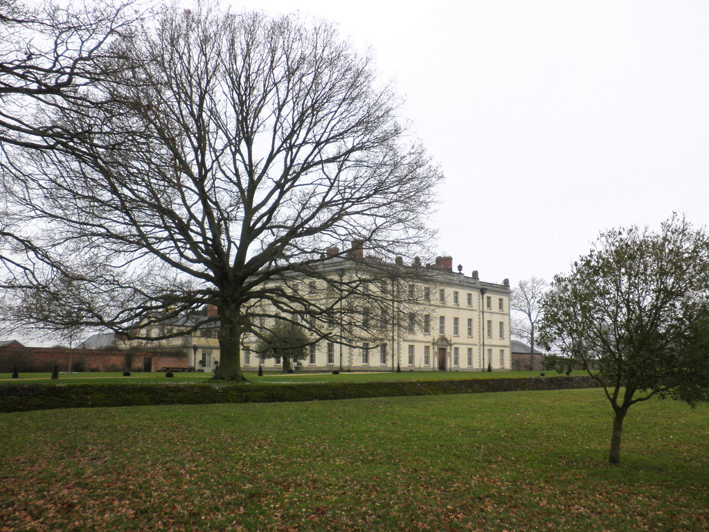
The Mynde
The Mynde is a country house in Much Dewchurch, Herefordshire. Originally built in the 15th and 16th centuries, it was remodelled in the 18th century and...
Orcop
Orcop is a village and civil parish in the county of Herefordshire, England. It lies 14 kilometres (8.7 mi) south of Hereford. It has a well-preserved...

Bagwyllydiart
Bagwyllydiart is a hamlet in Herefordshire, England 16 kilometres (10 mi) south west of Hereford near the Welsh border. It lies between the villages of...

Kilpeck Priory
Kilpeck Priory was a Benedictine priory in Kilpeck, Herefordshire, England, at grid reference SO448303.In 1134, William, son of Norman, gave the church...
Nearby Amenities
Located within 500m of 51.95024,-2.7780772Have you been to Cole's Tump?
Leave your review of Cole's Tump below (or comments, questions and feedback).