Camp Hill

Hill, Mountain in Kincardineshire

Scotland

Camp Hill

Minor road heading towards Laes Looking northward.
Minor road heading towards Laes Credit: Peter Wood

Camp Hill is a prominent hill located in the county of Kincardineshire, Scotland. Situated near the village of Auchenblae, it forms part of the picturesque landscape of the region. Rising to an elevation of approximately 331 meters (1,086 feet), the hill offers stunning panoramic views of the surrounding countryside.

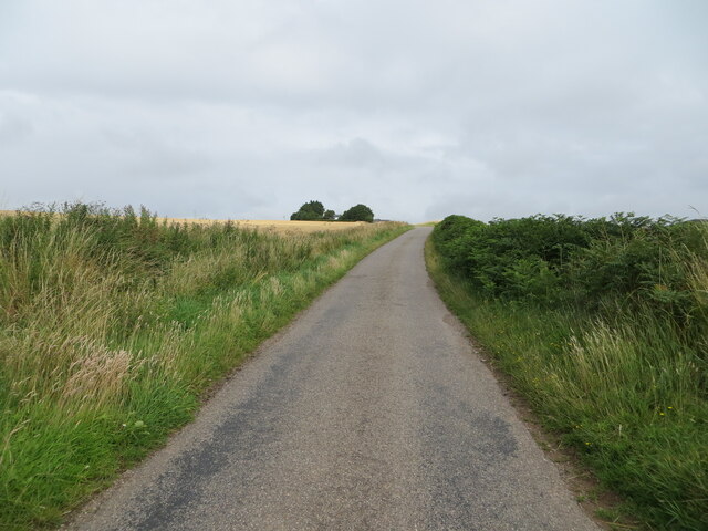
The terrain of Camp Hill is characterized by its gentle slopes and undulating landscape, making it a popular spot for outdoor activities such as hiking, walking, and birdwatching. The hill is home to a diverse range of flora and fauna, including various species of wildflowers, heather, and grasses. Bird enthusiasts can also spot a variety of avian species, including pheasants, kestrels, and buzzards.

Camp Hill holds historical significance as well. The remains of an ancient fort, believed to have been constructed in the Iron Age, can be found at the summit. Archaeological investigations have uncovered remnants of defensive ditches and ramparts, providing valuable insights into the area's past.

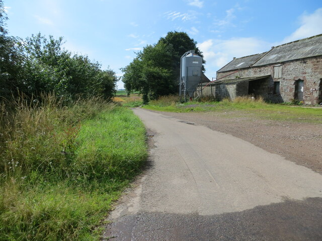
Visitors to Camp Hill can access the hill through well-maintained trails and paths, making it easily accessible for both experienced hikers and casual walkers. The hill offers a tranquil escape from the hustle and bustle of everyday life, providing a serene environment to relax and soak in the natural beauty of Kincardineshire.

Overall, Camp Hill is a noteworthy landmark in Kincardineshire, offering breathtaking views, opportunities for outdoor recreation, and a glimpse into the area's rich history.

If you have any feedback on the listing, please let us know in the comments section below.

Camp Hill Images

Images are sourced within 2km of 56.88606/-2.3025982 or Grid Reference NO8177. Thanks to Geograph Open Source API. All images are credited.

Minor road heading towards Laes Looking northward.
Minor road heading towards Laes
Looking northward.
Minor road at Gobbs Farm Looking southward.
Minor road at Gobbs Farm
Looking southward.
Minor road and farmland near Nether Craig Looking north-westward.
Minor road and farmland near Nether Craig
Looking north-westward.
Minor road between Barras and Pitforthie Looking north-westward.
Minor road between Barras and Pitforthie
Looking north-westward.
Minor road near to Cotbank of Barras Looking north-westward.
Minor road near to Cotbank of Barras
Looking north-westward.
Ploughing at Nether Craighill
Seagulls taking flight with valley beyond This small flock of seagulls were found resting somewhat inland today; they took flight when the photographer walked slowly toward them.
Seagulls taking flight with valley beyond
This small flock of seagulls were found resting somewhat inland today; they took flight when the photographer walked slowly toward them.
Minor road at Cotbank of Barras
Minor road near Little Barras
Fields below Upper Craighill Fields below the farm at Upper Craighill
Fields below Upper Craighill
Fields below the farm at Upper Craighill
Track to Upper Craighill The track leading to the farm at Upper Craighill.
Track to Upper Craighill
The track leading to the farm at Upper Craighill.
Scottish mist
Scottish mist
Scottish mist
Scottish mist
Millplough Recumbent Stone Circle (1) Only this stone, the recumbent, remains, the rest having been cleared away by the middle of the 19th century. It is, however, a rather fine example of a recumbent. See <span class="nowrap"><a title="https://canmore.org.uk/site/36819/millplough" rel="nofollow ugc noopener" href="https://canmore.org.uk/site/36819/millplough">Link</a><img style="margin-left:2px;" alt="External link" title="External link - shift click to open in new window" src="https://s1.geograph.org.uk/img/external.png" width="10" height="10"/></span> for more details. <a href="https://www.geograph.org.uk/photo/5176816">NO8175 : Millplough Recumbent Stone Circle (2)</a>
Millplough Recumbent Stone Circle (1)
Only this stone, the recumbent, remains, the rest having been cleared away by the middle of the 19th century. It is, however, a rather fine example of a recumbent. See LinkExternal link for more details. NO8175 : Millplough Recumbent Stone Circle (2)
Millplough Recumbent Stone Circle (2) This is the recumbent, which is the only stone still in situ. See <span class="nowrap"><a title="https://canmore.org.uk/site/36819/millplough" rel="nofollow ugc noopener" href="https://canmore.org.uk/site/36819/millplough">Link</a><img style="margin-left:2px;" alt="External link" title="External link - shift click to open in new window" src="https://s1.geograph.org.uk/img/external.png" width="10" height="10"/></span> for more details. <a href="https://www.geograph.org.uk/photo/5176819">NO8175 : Millplough Recumbent Stone Circle (3)</a>
Millplough Recumbent Stone Circle (2)
This is the recumbent, which is the only stone still in situ. See LinkExternal link for more details. NO8175 : Millplough Recumbent Stone Circle (3)
Millplough Recumbent Stone Circle (3) The recumbent is a block of conglomerate, probably quarried not far away in the Old Red Sandstone. See <span class="nowrap"><a title="https://canmore.org.uk/site/36819/millplough" rel="nofollow ugc noopener" href="https://canmore.org.uk/site/36819/millplough">Link</a><img style="margin-left:2px;" alt="External link" title="External link - shift click to open in new window" src="https://s1.geograph.org.uk/img/external.png" width="10" height="10"/></span> for more details. <a href="https://www.geograph.org.uk/photo/5176824">NO8175 : Millplough Recumbent Stone Circle (4)</a>
Millplough Recumbent Stone Circle (3)
The recumbent is a block of conglomerate, probably quarried not far away in the Old Red Sandstone. See LinkExternal link for more details. NO8175 : Millplough Recumbent Stone Circle (4)
Millplough Recumbent Stone Circle (4) An end-on view of the sole surviving stone, the recumbent. See <span class="nowrap"><a title="https://canmore.org.uk/site/36819/millplough" rel="nofollow ugc noopener" href="https://canmore.org.uk/site/36819/millplough">Link</a><img style="margin-left:2px;" alt="External link" title="External link - shift click to open in new window" src="https://s1.geograph.org.uk/img/external.png" width="10" height="10"/></span> for more details. <a href="https://www.geograph.org.uk/photo/5176827">NO8175 : Millplough Recumbent Stone Circle (5)</a>
Millplough Recumbent Stone Circle (4)
An end-on view of the sole surviving stone, the recumbent. See LinkExternal link for more details. NO8175 : Millplough Recumbent Stone Circle (5)
Millplough Recumbent Stone Circle (5) Looking at the recumbent end-on, you can see that it stands at a bit of an angle. See <span class="nowrap"><a title="https://canmore.org.uk/site/36819/millplough" rel="nofollow ugc noopener" href="https://canmore.org.uk/site/36819/millplough">Link</a><img style="margin-left:2px;" alt="External link" title="External link - shift click to open in new window" src="https://s1.geograph.org.uk/img/external.png" width="10" height="10"/></span> for more details. <a href="https://www.geograph.org.uk/photo/5176830">NO8175 : Millplough Recumbent Stone Circle (6)</a>
Millplough Recumbent Stone Circle (5)
Looking at the recumbent end-on, you can see that it stands at a bit of an angle. See LinkExternal link for more details. NO8175 : Millplough Recumbent Stone Circle (6)
Show me another place!

Camp Hill is located at Grid Ref: NO8177 (Lat: 56.88606, Lng: -2.3025982)

Unitary Authority: Aberdeenshire

Police Authority: North East

Also known as: Mont Goldrum

What 3 Words

///curry.skimmers.coffee. Near Inverbervie, Aberdeenshire

Nearby Locations

Camp Hill Mont Goldrum

Related Wikis

Arbuthnott

Arbuthnott (Scottish Gaelic: Obar Bhuadhnait, "mouth of the Buadhnat") is a hamlet and parish in the Howe of the Mearns, a low-lying agricultural district...

Arbuthnott Parish Kirk

Arbuthnott Parish Kirk is a church in Arbuthnott, Aberdeenshire, Scotland. Now a Category A listed building, it was built in at least the 13th century...

Allardice Castle

Allardice Castle (also spelled Allardyce) is a sixteenth-century manor house in Kincardineshire, Scotland. It is approximately 1.5 kilometres north-west...

Castle of Fiddes

The Castle of Fiddes is a 16th-century tower house in Aberdeenshire, Scotland, located around 6 kilometres (3.7 mi) south-west of Stonehaven. It is dated...

Nearby Amenities

Located within 500m of 56.88606,-2.3025982
Cluseburn
Generator Method: wind_turbine
Generator Output Electricity: 900 kW
Generator Source: wind
Generator Type: horizontal_axis
Height Hub: 50
Manufacturer: EWT
Power: generator
Rotor Diameter: 54
Lat/Long: 56.8828256/-2.2985373
Power: pole
Lat/Long: 56.886108/-2.3102102
The data included in this document is from www.openstreetmap.org. The data is made available under ODbL.

Have you been to Camp Hill?

Leave your review of Camp Hill below (or comments, questions and feedback).