Calver Hill

Hill, Mountain in Yorkshire Richmondshire

England

Calver Hill

Field barn east of Skelgate Lane Skelgate Lane climbs from the western side of Reeth towards Calver Hill.
Arkengarthdale is beyond the barn with Fremington Edge rising from that valley.
Field barn east of Skelgate Lane Credit: Trevor Littlewood

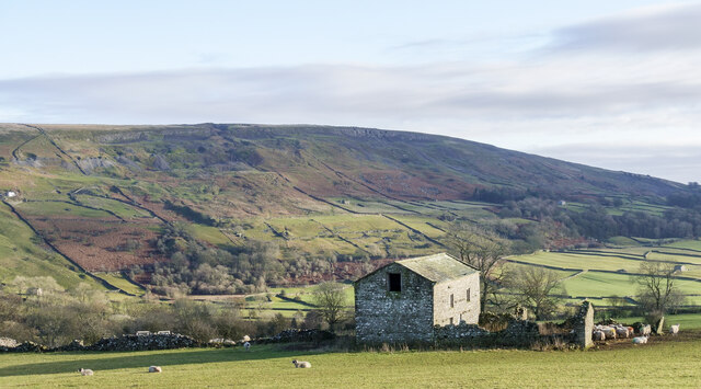
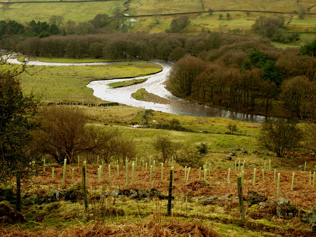
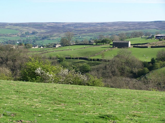
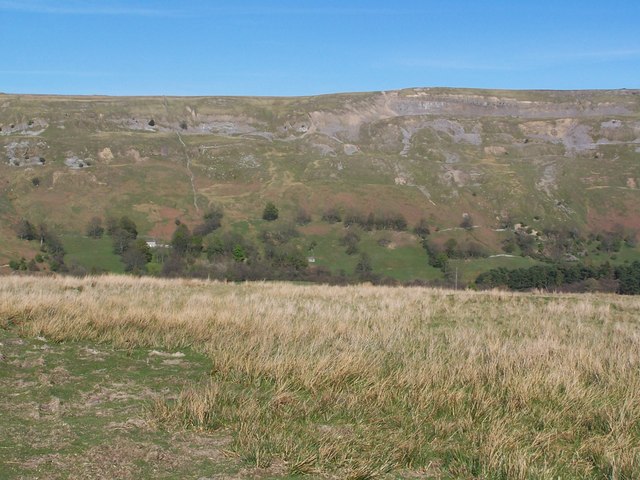
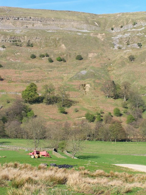
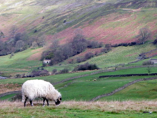
Calver Hill, located in Yorkshire, England, is a prominent hill standing at an elevation of approximately 292 meters (958 feet) above sea level. Situated in the picturesque Peak District National Park, it offers breathtaking panoramic views of the surrounding countryside.

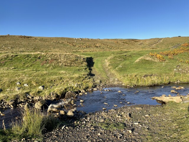
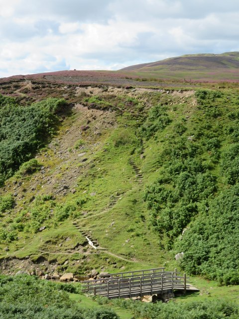
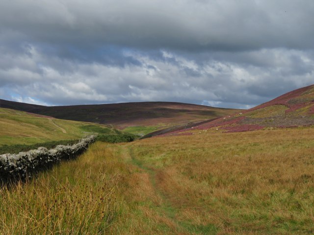
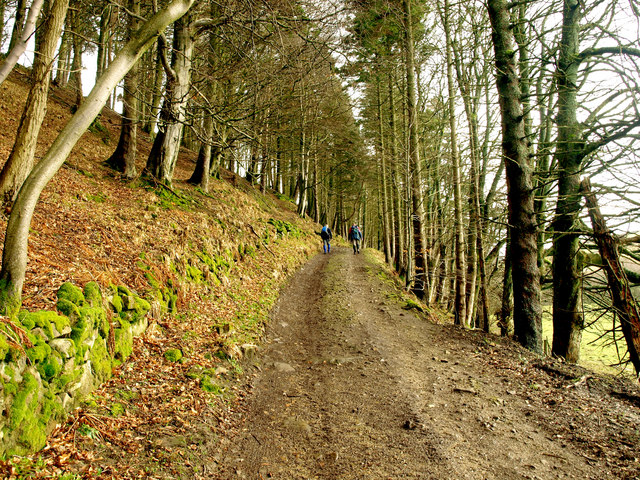
The hill is characterized by its gentle slopes covered in lush greenery, making it a popular destination for outdoor enthusiasts and nature lovers alike. Its location provides a gateway to various walking and hiking trails, allowing visitors to explore the diverse flora and fauna of the region.

Calver Hill is renowned for its historical significance as well. It is believed that the hill was once home to an Iron Age hillfort, serving as a defensive settlement during ancient times. Evidence of this can be seen in the form of ancient earthworks and fortifications that still exist on the hill.

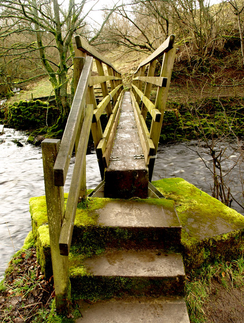
The hill is easily accessible, with a well-maintained footpath leading to its summit. From the top, visitors can admire the stunning views of the nearby River Derwent and the rolling hills of the Peak District. On clear days, one can even catch a glimpse of the distant cities and towns that dot the landscape.

In addition to its natural beauty and historical significance, Calver Hill offers a serene and tranquil environment, making it an ideal spot for a peaceful escape from the hustle and bustle of everyday life. Whether it's a leisurely walk or a challenging hike, Calver Hill promises an unforgettable experience for all who visit.

If you have any feedback on the listing, please let us know in the comments section below.

Calver Hill Images

Images are sourced within 2km of 54.398376/-1.9817758 or Grid Reference NZ0100. Thanks to Geograph Open Source API. All images are credited.

Field barn east of Skelgate Lane Skelgate Lane climbs from the western side of Reeth towards Calver Hill.
Arkengarthdale is beyond the barn with Fremington Edge rising from that valley.
Field barn east of Skelgate Lane
Skelgate Lane climbs from the western side of Reeth towards Calver Hill. Arkengarthdale is beyond the barn with Fremington Edge rising from that valley.
Heather on hill slope above Healaugh in Swaledale The slope rises from Swaledale past the village of Healaugh to Calver Hill.
The main valley of the River Swale extends to the west passing to the right of the central hill, which is Blea Barf.
Heather on hill slope above Healaugh in Swaledale
The slope rises from Swaledale past the village of Healaugh to Calver Hill. The main valley of the River Swale extends to the west passing to the right of the central hill, which is Blea Barf.
Path and wall rising towards summit of Calver Hill The path continues to the hill summit which is ahead to the right, a cairn can just be discerned there. The wall is unusual: it's simply a linear feature beginning at the camera location and ending close to the centre of the image. As it is now there seems to be no real structure to it making it just an elongated pile of stones!
Path and wall rising towards summit of Calver Hill
The path continues to the hill summit which is ahead to the right, a cairn can just be discerned there. The wall is unusual: it's simply a linear feature beginning at the camera location and ending close to the centre of the image. As it is now there seems to be no real structure to it making it just an elongated pile of stones!
Cringley Ford This is another ford on Blueberry Gill.
Cringley Ford
This is another ford on Blueberry Gill.
Bridge and steps at Cringley Bottom The bridge replaces one first erected some 12 years ago. On the far side are some 82 steps which make the ascent to the moor edge rather easier. There could be further improvements here using new funding, as the Coast to Coast path is now designated as an official long distance path.
Bridge and steps at Cringley Bottom
The bridge replaces one first erected some 12 years ago. On the far side are some 82 steps which make the ascent to the moor edge rather easier. There could be further improvements here using new funding, as the Coast to Coast path is now designated as an official long distance path.
Moorland in late summer The view along the wallside above Cringley Bottom, looking towards Fore Gill Gate. On the fellsides the heather is in full bloom.
Moorland in late summer
The view along the wallside above Cringley Bottom, looking towards Fore Gill Gate. On the fellsides the heather is in full bloom.
Arkle Beck Taken from the Langthwaite to Reeth bridleway.  It seems far more like a river than a beck!
Arkle Beck
Taken from the Langthwaite to Reeth bridleway. It seems far more like a river than a beck!
Bridleway to Reeth Taken south east of Langthwaite on the bridleway to Reeth.  Arkle Beck is just to the right of the photograph.
Bridleway to Reeth
Taken south east of Langthwaite on the bridleway to Reeth. Arkle Beck is just to the right of the photograph.
Castle Farm House Taken from the Langthwaite to Reeth bridleway.
Castle Farm House
Taken from the Langthwaite to Reeth bridleway.
Footbridge over Arkle Beck More a small river than a beck!
Footbridge over Arkle Beck
More a small river than a beck!
View across the Arkle Beck
Calver Hill
Calver Hill
View towards Fremington Edge
View from West Raw Croft Farm
View towards Fremington Edge Viewed from footpath on the southwestern side of the valley.
View towards Fremington Edge
Viewed from footpath on the southwestern side of the valley.
Swaledale ewe, Reeth The ewe grazes on the rough hill grasses.
Swaledale ewe, Reeth
The ewe grazes on the rough hill grasses.
Sheep grazing near Reeth Swaledale sheep graze the rough grasses above the valley.
Sheep grazing near Reeth
Swaledale sheep graze the rough grasses above the valley.
Minor road near Reeth There is an Ordnance Survey bench mark on the north east parapet of the bridge.  Watson House is in the distance.
Minor road near Reeth
There is an Ordnance Survey bench mark on the north east parapet of the bridge. Watson House is in the distance.
Show me another place!

Calver Hill is located at Grid Ref: NZ0100 (Lat: 54.398376, Lng: -1.9817758)

Division: North Riding

Administrative County: North Yorkshire

District: Richmondshire

Police Authority: North Yorkshire

Also known as: Reeth Low Moor

What 3 Words

///belong.reply.ascendant. Near Barningham, Co. Durham

Related Wikis

Calver Hill

Calver Hill is a fell in the Yorkshire Dales National Park in North Yorkshire, England. It is composed of limestone and is situated at grid reference NZ012003...

Healaugh, Richmondshire

Healaugh (pronounced "hee-law") is a small village in the civil parish of Reeth, Fremington and Healaugh, in Swaledale in the Yorkshire Dales. It is in...

Arkengarthdale

Arkengarthdale is a dale, or valley, on the east side of the Pennines in North Yorkshire, England. Running roughly north-west to south-east, it is the...

Kearton

Kearton is a hamlet in the Yorkshire Dales, North Yorkshire, England. Kearton is situated near Low Row and Reeth. == References == == External links... ==

Nearby Amenities

Located within 500m of 54.398376,-1.9817758
Calver Hill
Ele: 493
Natural: peak
Source: gps survey
Wikidata: Q5024230
Wikipedia: en:Calver Hill
Lat/Long: 54.3981956/-1.9811735
Man Made: cairn
Lat/Long: 54.398138/-1.980896
Prostrate Cross
Historic: wayside_cross
Lat/Long: 54.398457/-1.98094
Disused: yes
Historic: mine_shaft
Man Made: mineshaft
Lat/Long: 54.398359/-1.98136
Disused: yes
Historic: mine_shaft
Man Made: mineshaft
Lat/Long: 54.398229/-1.981345
Hunting Stand
Hunting Stand: grouse_butt
Source: survey;aerial imagery
Lat/Long: 54.3941427/-1.9798612
Hunting Stand
Hunting Stand: grouse_butt
Source: survey;aerial imagery
Lat/Long: 54.3945332/-1.9798096
Hunting Stand
Hunting Stand: grouse_butt
Source: survey;aerial imagery
Lat/Long: 54.3949342/-1.9797853
Hunting Stand
Hunting Stand: grouse_butt
Source: survey;aerial imagery
Lat/Long: 54.3953352/-1.9797398
The data included in this document is from www.openstreetmap.org. The data is made available under ODbL.

Have you been to Calver Hill?

Leave your review of Calver Hill below (or comments, questions and feedback).