Barnhill

Settlement in Angus

Scotland

Barnhill

Balmossie (Seven Arches) Viaduct The Monifieth Path Network heading westwards to the Seven Arches Viaduct.
Balmossie (Seven Arches) Viaduct Credit: Scott Cormie

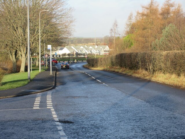
Barnhill is a small village located in the Angus region of Scotland. Situated approximately 12 miles northeast of Dundee, this picturesque village is nestled amidst the rolling hills and lush green fields that characterize the Scottish countryside.

The village of Barnhill is known for its tranquil and serene environment, making it an ideal destination for those seeking an escape from the hustle and bustle of city life. With its quaint cottages, well-manicured gardens, and friendly community, Barnhill exudes a peaceful charm that captivates both residents and visitors alike.

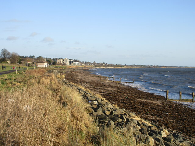
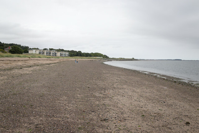
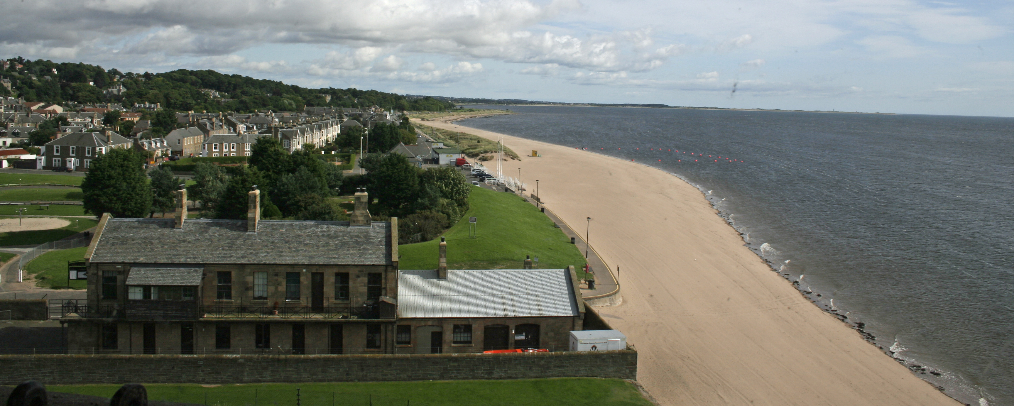
One of the notable features of Barnhill is its proximity to the beautiful Lunan Bay, which is just a short drive away. Lunan Bay is renowned for its stunning sandy beach, crystal-clear waters, and dramatic cliffs, making it a popular spot for outdoor enthusiasts and nature lovers.

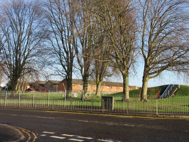
In terms of amenities, Barnhill offers a range of facilities to cater to the needs of its residents. These include a local shop for everyday essentials, a primary school for the education of young children, and various recreational areas such as parks and sports fields.

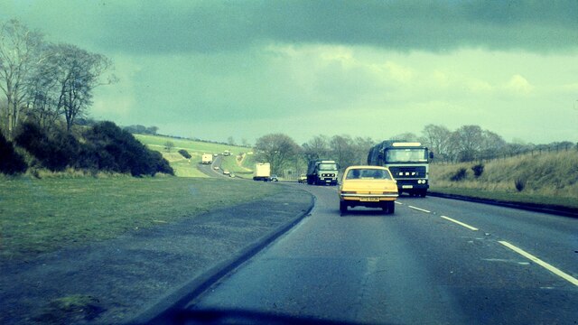
Furthermore, Barnhill benefits from excellent transport links, with regular bus services connecting the village to nearby towns and cities. This allows residents to easily access a wider range of amenities and services.

Overall, Barnhill in Angus is a charming village that offers a peaceful and idyllic lifestyle, surrounded by breathtaking natural beauty.

If you have any feedback on the listing, please let us know in the comments section below.
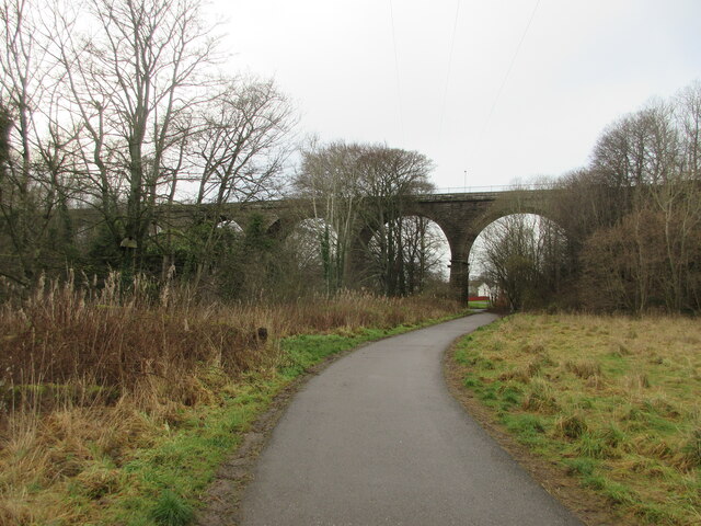
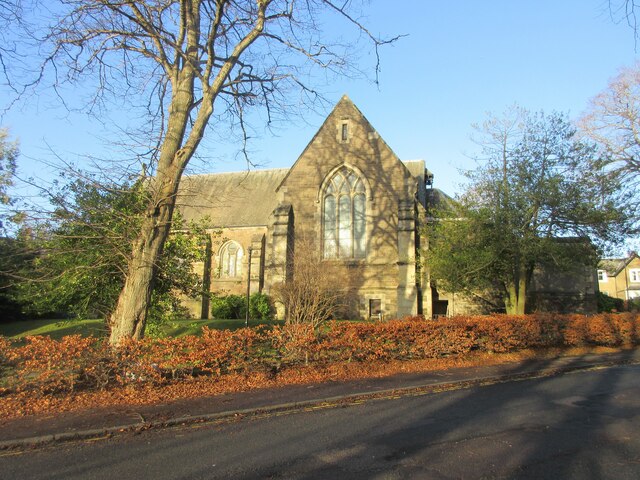
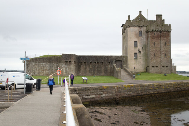
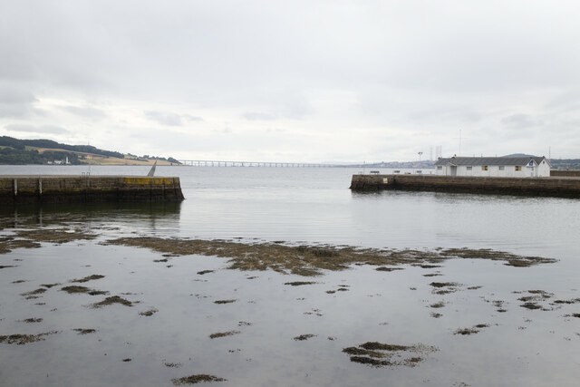
Barnhill Images

Images are sourced within 2km of 56.474689/-2.8575136 or Grid Reference NO4731. Thanks to Geograph Open Source API. All images are credited.

Balmossie (Seven Arches) Viaduct The Monifieth Path Network heading westwards to the Seven Arches Viaduct.
Balmossie (Seven Arches) Viaduct
The Monifieth Path Network heading westwards to the Seven Arches Viaduct.
Broughty Ferry Beach Broughty Ferry beach on the mouth of the Firth of Tay, with Tayport in the distance.
Broughty Ferry Beach
Broughty Ferry beach on the mouth of the Firth of Tay, with Tayport in the distance.
Coastline at Barnhill Looking along the coast at Barnhill towards Monifieth.
Coastline at Barnhill
Looking along the coast at Barnhill towards Monifieth.
Barnhill St Margaret's Church The south elevation of Barnhill St Margaret's Church viewed from Guthrie Terrace.
Barnhill St Margaret's Church
The south elevation of Barnhill St Margaret's Church viewed from Guthrie Terrace.
Dighty Water The Dighty Water looking upstream from the footbridge off Balgillo Road.
Dighty Water
The Dighty Water looking upstream from the footbridge off Balgillo Road.
East Balgillo Road East Balgillo Road heading north towards the roundabout on the A92.
East Balgillo Road
East Balgillo Road heading north towards the roundabout on the A92.
Woodland on the play park Trees on the play park on Forthill Road, looking from Fintry Place.
Woodland on the play park
Trees on the play park on Forthill Road, looking from Fintry Place.
Former Queen Street Church Church and steeple of the former Queen Street United Presbyterian Church in Broughty Ferry, now a restaurant.
Former Queen Street Church
Church and steeple of the former Queen Street United Presbyterian Church in Broughty Ferry, now a restaurant.
Broughty Ferry Library The public library in Broughty Ferry viewed across Queen Street.
Broughty Ferry Library
The public library in Broughty Ferry viewed across Queen Street.
The A92 at Balmossie in 1976 This length of road is now a dual carriageway.
The A92 at Balmossie in 1976
This length of road is now a dual carriageway.
Balmossie Station
Balmossie Station
1E11 Aberdeen to London Kings Cross passing through Broughty Ferry Station Unit 800102
1E11 Aberdeen to London Kings Cross passing through Broughty Ferry Station
Unit 800102
Construction of flood defences, Broughty Ferry
Broughty Castle
Broughty Castle
Harbour, Broughty Ferry
Broughty Ferry Beach
Promenade at James Place, Broughty Ferry
Show me another place!

Barnhill is located at Grid Ref: NO4731 (Lat: 56.474689, Lng: -2.8575136)

Unitary Authority: City of Dundee

Police Authority: Tayside

What 3 Words

///adventure.vital.deduced. Near Monifieth, Angus

Nearby Locations

Barnhill Reres Hill

Related Wikis

Barnhill, Dundee

Barnhill is an area in Dundee, located within the suburb of Broughty Ferry. It is approximately 4½ miles east of Dundee City Centre. Until the late 19th...

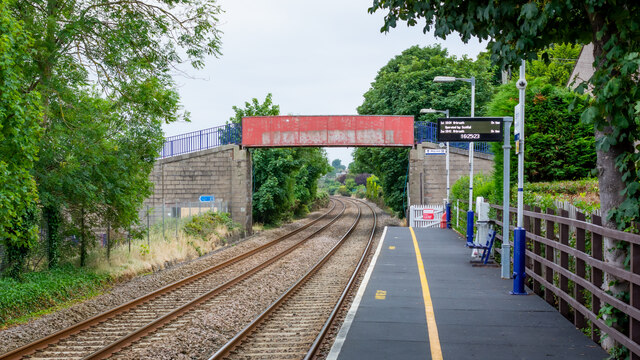
Barnhill railway station (Angus)

Barnhill railway station was a railway station in Scotland serving the suburb of Barnhill, Dundee. == History == The station was opened as Barnhill on...

Forthill

Forthill is a cricket ground in Broughty Ferry, Dundee, Scotland. It has been used for cricket since, at the latest, 1884, when Forfarshire played Aberdeenshire...

Broughty Ferry

Broughty Ferry (; Scottish Gaelic: Bruach Tatha; Scots: Brochtie) is a suburb of Dundee, Scotland. It is situated four miles east of the city centre on...

Nearby Amenities

Located within 500m of 56.474689,-2.8575136
Reres Hill
Created By: Potlatch 0.6b
Natural: peak
Lat/Long: 56.4707658/-2.8562706
East Ferry
Place: suburb
Lat/Long: 56.4721246/-2.8540657
Pub
The Barn
Lat/Long: 56.474477/-2.8576848
Recycling
Created By: Potlatch 0.10b
Lat/Long: 56.4747144/-2.8580769
Fast Food
Campfield Chinese Takeaway
Lat/Long: 56.4743822/-2.8579369
Check Date: 2008-08-06
Disused Amenity: pharmacy
Old Name: Lloyds Pharmacy
Lat/Long: 56.4743377/-2.8580388
Post Box
Created By: Potlatch 0.10b
Lat/Long: 56.4746515/-2.8575518
Post Box
Post Box Type: wall
Royal Cypher: GR
Royal Cypher Wikidata: Q33102273
Lat/Long: 56.4760514/-2.8531409
Telephone
Booth: KX100
Covered: booth
Lat/Long: 56.4759407/-2.8526957
Bus Stop
Dornoch Place
Naptan AtcoCode: 6400PT1385
Naptan CommonName: Dornoch Place
Naptan Indicator: opp
Naptan NaptanCode: 36324949
Operator: Strathtay
Public Transport: platform
Route Ref: 69
Shelter: no
Towards: Broughty Ferry
Lat/Long: 56.4751745/-2.8607234
Bus Stop
Edzell Street
Naptan AtcoCode: 6400PT1382
Naptan CommonName: Edzell Street
Naptan Indicator: near
Naptan NaptanCode: 36324943
Operator: Strathtay
Public Transport: platform
Route Ref: 69
Shelter: no
Towards: Broughty Ferry
Lat/Long: 56.4748945/-2.8580326
Bus Stop
Nursery Road
Naptan AtcoCode: 6400PT1753
Naptan CommonName: Nursery Road
Naptan Indicator: near
Naptan NaptanCode: 36325496
Operator: Strathtay
Public Transport: platform
Route Ref: 69
Shelter: no
Towards: Broughty Ferry
Lat/Long: 56.4749623/-2.8556695
Bus Stop
Abercromby Street
Naptan AtcoCode: 6400PT1491
Naptan CommonName: Abercromby Street
Naptan Indicator: near
Naptan NaptanCode: 36325494
Operator: Strathtay
Public Transport: platform
Route Ref: 69
Shelter: no
Towards: Broughty Ferry
Lat/Long: 56.4755848/-2.8541636
Bus Stop
Montague Street
Naptan AtcoCode: 6400PT1495
Naptan CommonName: Montague Street
Naptan Indicator: opp
Naptan NaptanCode: 36325498
Operator: Strathtay
Public Transport: platform
Route Ref: 69
Shelter: no
Towards: Broughty Ferry
Lat/Long: 56.4765627/-2.8518328
Post Box
Lat/Long: 56.4736563/-2.855876
Bus Stop
Nursery Road
Naptan AtcoCode: 6400PT1796
Naptan CommonName: Nursery Road
Naptan Indicator: at
Naptan NaptanCode: 36325623
Operator: Strathtay
Public Transport: platform
Route Ref: 69
Shelter: no
Towards: Broughty Ferry
Lat/Long: 56.4747726/-2.8558366
Bus Stop
Abercromby Street
Naptan AtcoCode: 6400S310
Naptan CommonName: Abercromby Street
Naptan Indicator: opp
Naptan NaptanCode: 36325497
Operator: Strathtay
Public Transport: platform
Route Ref: 69
Shelter: no
Towards: Broughty Ferry
Lat/Long: 56.4757723/-2.8534355
Shop: convenience
Lat/Long: 56.475843/-2.8525537
Bus Stop
Montague Street
Naptan AtcoCode: 6400L00017
Naptan CommonName: Montague Street
Naptan Indicator: near
Naptan NaptanCode: 36325495
Operator: Strathtay
Public Transport: platform
Route Ref: 69
Shelter: no
Towards: Broughty Ferry
Lat/Long: 56.4769044/-2.8507352
Barnhill
Place: suburb
Population: 4384
Wikidata: Q4861836
Wikipedia: en:Barnhill, Dundee
Lat/Long: 56.4772274/-2.8579403
Co-op Food
Brand: Co-op Food
Brand Wikidata: Q3277439
Brand Wikipedia: en:Co-op Food
Operator: The Co-operative Group
Operator Wikidata: Q117202
Shop: supermarket
Website: https://www.coop.co.uk/store-finder/DD5-2PU/unit-7-campfield-square
Lat/Long: 56.4743496/-2.8581944
Atm
Fee: no
Lat/Long: 56.4745707/-2.8575703
Post Office
Lat/Long: 56.4744149/-2.8583314
Historic: memorial
Inscription: Dudley D. Watkins 1907-1969 cartoonist of Oor Wullie & the Broons lived and worked here
Memorial: plaque
Lat/Long: 56.4704272/-2.8598777
Bus Stop
Torridon Road East
Bus: yes
Naptan AtcoCode: 6400S312
Naptan CommonName: Torridon Road East
Naptan Indicator: opp
Naptan NaptanCode: 36324952
Public Transport: platform
Lat/Long: 56.4744904/-2.8629864
Generator Method: photovoltaic
Generator Output Electricity: yes
Generator Source: solar
Generator Type: solar_photovoltaic_panel
Power: generator
Lat/Long: 56.4740112/-2.8637057
Bus Stop
Campfield Square
Naptan AtcoCode: 640014094
Naptan CommonName: Campfield Square
Naptan Indicator: at
Naptan NaptanCode: 36326252
Naptan Verified: no
Public Transport: platform
Lat/Long: 56.4749951/-2.8592301
Car Rental
Dundee Motorhome Hire
Addr City: Dundee
Addr Housenumber: 11
Addr Postcode: DD5 2QL
Addr Street: Panmure Terrace
Addr Suburb: Broughty Ferry
Email: dundeemotorhomehire@gmail.com
Internet Access: wlan
Opening Hours: 24/7
Phone: +44 1382 724175
Website: https://dundeemotorhomehire.co.uk
Lat/Long: 56.4734333/-2.8523549
Iceland
Addr City: Dundee
Addr Housename: Campfield Square
Addr Postcode: DD5 2PU
Addr Street: Nursery Road
Addr Suburb: Broughty Ferry
Brand: Iceland
Brand Wikidata: Q721810
Shop: frozen_food
Website: https://www.iceland.co.uk/store-finder/store?StoreID=378&StoreName=BARNHILL
Lat/Long: 56.4746399/-2.8587775
The data included in this document is from www.openstreetmap.org. The data is made available under ODbL.

Have you been to Barnhill?

Leave your review of Barnhill below (or comments, questions and feedback).