Braich Ddu

Hill, Mountain in Merionethshire

Wales

Braich Ddu

Gate on the road to Arthog One of several to be found on this mountain road.
Gate on the road to Arthog Credit: John Lucas

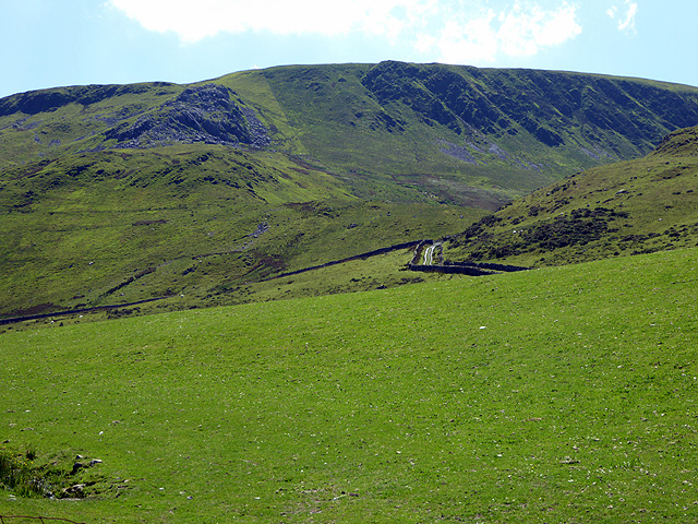
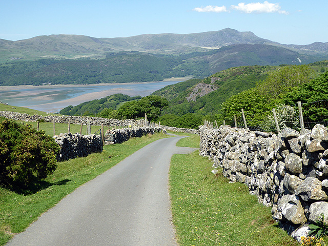
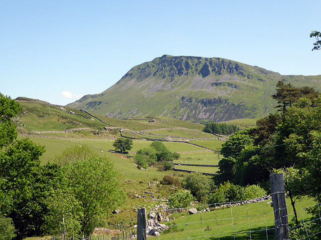
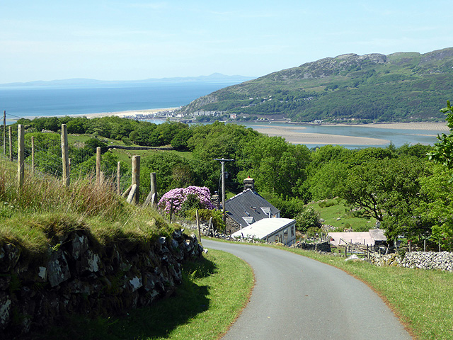
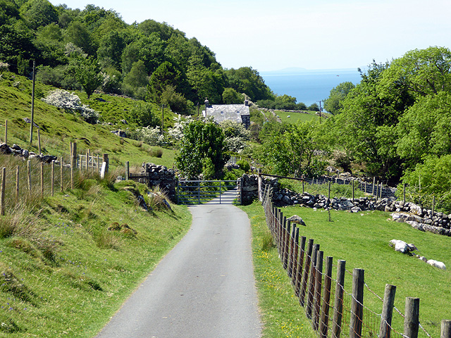
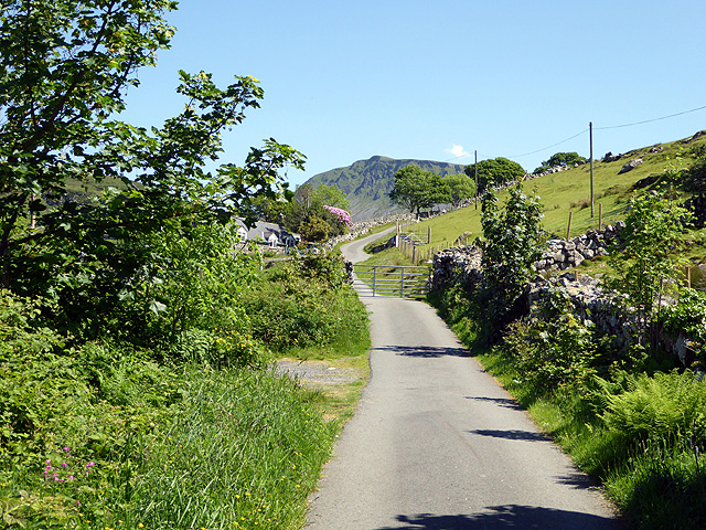
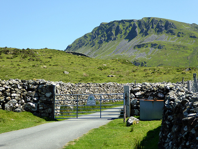
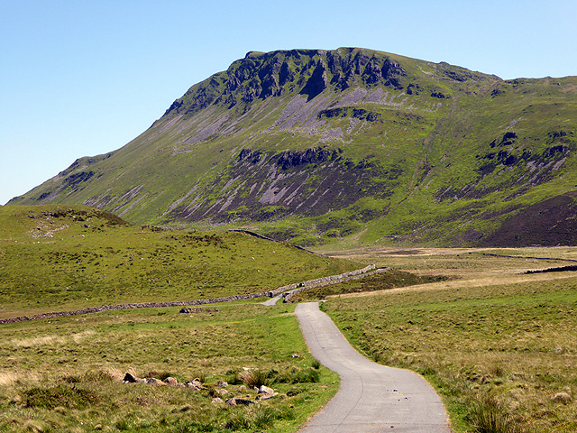
Braich Ddu is a prominent hill located in the county of Merionethshire in Wales. It is situated near the village of Llanbedr and stands at an elevation of 1,860 feet (567 meters) above sea level. The hill is known for its rugged terrain, with steep slopes and rocky outcrops scattered throughout its landscape.

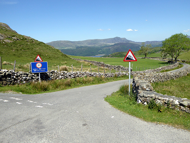
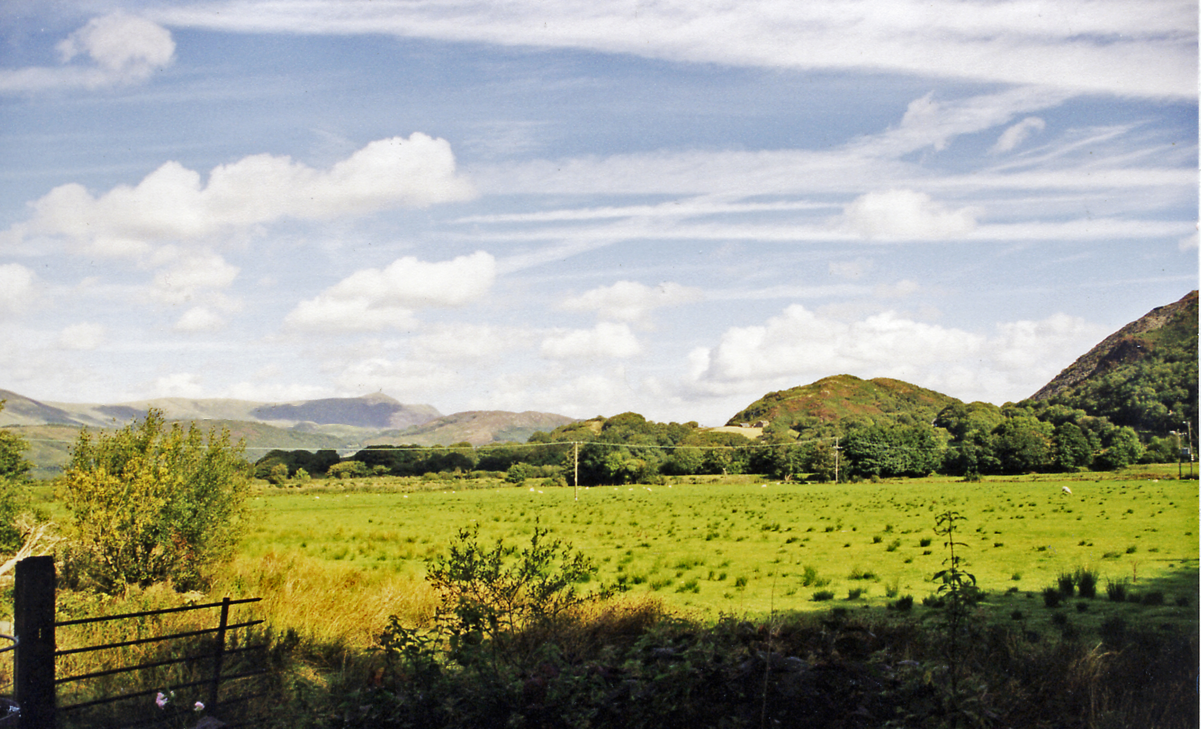
Braich Ddu offers stunning panoramic views of the surrounding countryside, including the nearby Rhinog Mountain Range and the Cardigan Bay coastline. On a clear day, visitors can see as far as Snowdonia National Park and even the Irish Sea.

The hill is a popular destination for hikers and outdoor enthusiasts, with several walking trails leading to the summit. The challenging ascent rewards those who make the trek with breathtaking vistas and a sense of accomplishment. Wildlife such as sheep, birds, and occasionally deer can be spotted along the way.

Overall, Braich Ddu is a beautiful and rugged hill that offers a true taste of the Welsh countryside and is a must-visit for anyone looking to experience the natural beauty of Merionethshire.

If you have any feedback on the listing, please let us know in the comments section below.
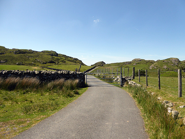
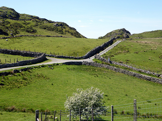
Braich Ddu Images

Images are sourced within 2km of 52.689262/-4.0057262 or Grid Reference SH6412. Thanks to Geograph Open Source API. All images are credited.

Gate on the road to Arthog One of several to be found on this mountain road.
Gate on the road to Arthog
One of several to be found on this mountain road.
Cross roads above Arthog Viewed from the road from Dolgellau.
Cross roads above Arthog
Viewed from the road from Dolgellau.
Track leading to Braich Ddu and beyond
The road to Arthog A 25% gradient and a 3T weight limit. Very steep and not the most pleasant road to walk as it gets nearer to Arthog. At least I was within the weight limit - even with my girth! The Mawddach estuary is just glimpsed in the middle distance.
The road to Arthog
A 25% gradient and a 3T weight limit. Very steep and not the most pleasant road to walk as it gets nearer to Arthog. At least I was within the weight limit - even with my girth! The Mawddach estuary is just glimpsed in the middle distance.
Walking down to Arthog With the Mawddach Estuary in view.
Walking down to Arthog
With the Mawddach Estuary in view.
Craig-las viewed across Pant-y-llan
Walking down to Arthog With the Mawddach Estuary and Barmouth in view.
Walking down to Arthog
With the Mawddach Estuary and Barmouth in view.
Gate on the road down to Arthog By Cregennen.
Gate on the road down to Arthog
By Cregennen.
Uphill from Arthog A gate by Cregennen with Craig-las in the distance.
Uphill from Arthog
A gate by Cregennen with Craig-las in the distance.
Gate on the mountain road from Arthog to Dolgellau With Craig-las dominating.
Gate on the mountain road from Arthog to Dolgellau
With Craig-las dominating.
The road to Dolgellau With Craig-las above.
The road to Dolgellau
With Craig-las above.
Bryn Seward stone row Largest stone in the stone row with Pared y Cefn Hir beyond.
<span class="nowrap"><a title="https://stonerows.wordpress.com/gazetteer/region/wales/bryn-seward/" rel="nofollow ugc noopener" href="https://stonerows.wordpress.com/gazetteer/region/wales/bryn-seward/">Link</a><img style="margin-left:2px;" alt="External link" title="External link - shift click to open in new window" src="https://s1.geograph.org.uk/img/external.png" width="10" height="10"/></span>
Bryn Seward stone row
Largest stone in the stone row with Pared y Cefn Hir beyond. LinkExternal link
Unsurfaced track NCN82 below Braich Ddu National cycle network route 82, Ffordd Ddu, climbs to an eventual spectacular view of the Mawddach estuary.
Unsurfaced track NCN82 below Braich Ddu
National cycle network route 82, Ffordd Ddu, climbs to an eventual spectacular view of the Mawddach estuary.
NCN82 track looking over to the ridge west of Cadair Idris Relatively steep section of national cycle network route 82.
NCN82 track looking over to the ridge west of Cadair Idris
Relatively steep section of national cycle network route 82.
NCN82 track overlooking the Mawddach estuary A section of national cycle network route 82 with great views of the Mawddach estuary.
NCN82 track overlooking the Mawddach estuary
A section of national cycle network route 82 with great views of the Mawddach estuary.
NCN82 track below Graig Cwm-llwyd A section of Ffordd Ddu, and national cycle network route 82 with great views.
NCN82 track below Graig Cwm-llwyd
A section of Ffordd Ddu, and national cycle network route 82 with great views.
A section of NCN82 on Ffordd Ddu Just prior to the national cycle network route 82 becoming an unsurfaced track, and beyond a junction with the tarred road leading to Arthog.
A section of NCN82 on Ffordd Ddu
Just prior to the national cycle network route 82 becoming an unsurfaced track, and beyond a junction with the tarred road leading to Arthog.
Fence line descending alongside crag rim The fence line follows the edge of Craig-y-llyn before reaching Twll yr Ogof.
Fence line descending alongside crag rim
The fence line follows the edge of Craig-y-llyn before reaching Twll yr Ogof.
Show me another place!

Braich Ddu is located at Grid Ref: SH6412 (Lat: 52.689262, Lng: -4.0057262)

Unitary Authority: Gwynedd

Police Authority: North Wales

Also known as: Craig Cwm-llwyd

What 3 Words

///shoelaces.gather.masts. Near Barmouth, Gwynedd

Nearby Locations

Braich Ddu Craig Cwm-llwyd

Related Wikis

Arthog

Arthog () is a village, post town and community in the Meirionnydd area in Gwynedd, north Wales including the villages of Fairbourne and Friog. It is located...

Friog

Friog (Welsh: Y Friog) is a small village in North Wales, near Fairbourne. Its lake and beach are a tourist attraction to over 1,000 visitors a year. Friog...

Morfa Mawddach railway station

Morfa Mawddach railway station (formerly Barmouth Junction) is an unstaffed station located on the outskirts of the village of Arthog in Gwynedd, Wales...

Arthog railway station

Arthog railway station in Gwynedd, Wales, was a station on the Dolgelly [sic] branch of the Aberystwith and Welsh Coast Railway (part of the Ruabon to...

Nearby Amenities

Located within 500m of 52.689262,-4.0057262
Braich Ddu
Alt Name: Craig Cwm-Llwyd
Ele: 546
Natural: peak
Source: npe
Wikidata: Q20583740
Wikipedia: cy:Braich Ddu (Craig Cwm-llwyd)
Lat/Long: 52.6892665/-4.0057412
Barrier: stile
Lat/Long: 52.6893247/-4.0008822
Barrier: stile
Foot: yes
Stile: stepover
Lat/Long: 52.6918616/-4.010085
Barrier: stile
Lat/Long: 52.6893518/-4.0057503
The data included in this document is from www.openstreetmap.org. The data is made available under ODbL.

Have you been to Braich Ddu?

Leave your review of Braich Ddu below (or comments, questions and feedback).