Blackstone

Hill, Mountain in Yorkshire Richmondshire

England

Blackstone

Hill Top There must be a viewpoint in the main dale (Swaledale) below, from where this farmhouse appears to be on top of a hill, but from each of the roads on either side of Oxnop Gill, it seems to be down in the valley and since these are the only ways to get to the farm, the name seems somehow wrong. The tops of the moors, Oxnop Common in the view, and Crackpot Moor behind the photographer, are 150 to 200m higher than Hill Top.
Hill Top Credit: Andy Waddington

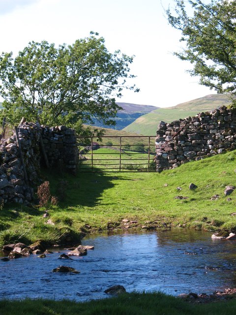
Blackstone is a prominent hill located in the county of Yorkshire, England. Situated in the picturesque Yorkshire Dales National Park, it is renowned for its natural beauty and stunning panoramic views. Rising to an elevation of approximately 535 meters (1,755 feet), Blackstone is considered one of the highest peaks in the region.

The hill is composed mainly of limestone, which contributes to its distinctive appearance and provides a habitat for a diverse range of flora and fauna. Visitors to Blackstone can expect to witness a variety of plant species, including heather, bracken, and wildflowers, which thrive in the hill's unique ecosystem.

Climbing Blackstone is a popular activity for outdoor enthusiasts, offering a challenging but rewarding experience. There are several walking trails and footpaths that lead up the hill, providing opportunities for hikers of all levels to explore its scenic surroundings. On a clear day, the summit of Blackstone offers breathtaking views that span across the vast Yorkshire countryside, with rolling hills and valleys stretching as far as the eye can see.

Aside from its natural attractions, Blackstone is also home to a rich history. The area has evidence of ancient settlements, such as burial mounds and stone circles, suggesting human activity dating back thousands of years. These historical remnants add an additional layer of intrigue to the already captivating landscape.

Overall, Blackstone in Yorkshire is a must-visit destination for nature lovers, hikers, and those seeking a glimpse into the region's fascinating past. Its combination of rugged charm, stunning vistas, and cultural heritage make it a truly captivating place to explore.

If you have any feedback on the listing, please let us know in the comments section below.
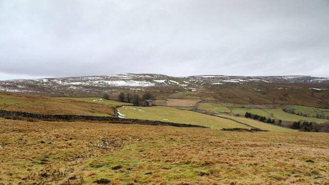
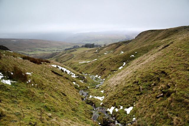
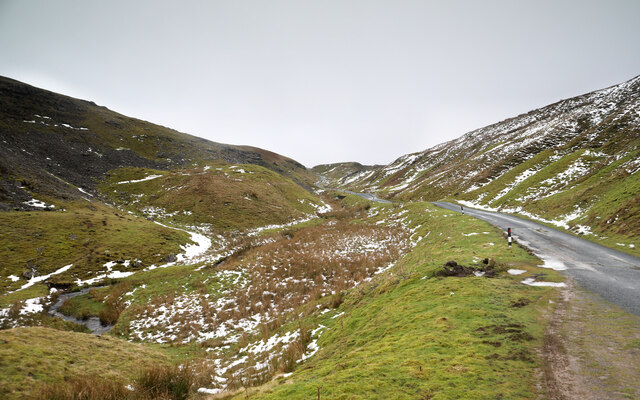
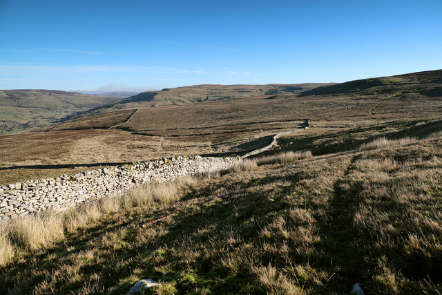
Blackstone Images

Images are sourced within 2km of 54.347813/-2.1175745 or Grid Reference SD9294. Thanks to Geograph Open Source API. All images are credited.

Hill Top There must be a viewpoint in the main dale (Swaledale) below, from where this farmhouse appears to be on top of a hill, but from each of the roads on either side of Oxnop Gill, it seems to be down in the valley and since these are the only ways to get to the farm, the name seems somehow wrong. The tops of the moors, Oxnop Common in the view, and Crackpot Moor behind the photographer, are 150 to 200m higher than Hill Top.
Hill Top
There must be a viewpoint in the main dale (Swaledale) below, from where this farmhouse appears to be on top of a hill, but from each of the roads on either side of Oxnop Gill, it seems to be down in the valley and since these are the only ways to get to the farm, the name seems somehow wrong. The tops of the moors, Oxnop Common in the view, and Crackpot Moor behind the photographer, are 150 to 200m higher than Hill Top.
Stotter Gill The number of gates to open and close on the tiny and rather sketchy minor road on the south side of the Oxnop Gill valley, give ample opportunity to be out and taking photos. The view down Stotter Gill was therefore as obvious to me as to the previous contributor <a href="https://www.geograph.org.uk/photo/6629777">SD9395 : Stotter Gill</a>. The farmhouse, less visible in low contrast lighting than in the previous view, is <a href="https://www.geograph.org.uk/photo/7066397">SD9396 : Hill Top</a>.
Stotter Gill
The number of gates to open and close on the tiny and rather sketchy minor road on the south side of the Oxnop Gill valley, give ample opportunity to be out and taking photos. The view down Stotter Gill was therefore as obvious to me as to the previous contributor SD9395 : Stotter Gill. The farmhouse, less visible in low contrast lighting than in the previous view, is SD9396 : Hill Top.
Askrigg Common road ascends Oxnop Gill This is one of the two "main" roads, from mid-Swaledale to Askrigg in Wensleydale, and if you think it looks a bit narrow, try the far sketchier tiny road on the north side of Oxnop Gill (above the horizon left in this view). It's clear that it doesn't take a lot of snow to block these roads, and as there are no farms this high, ploughing the road (needed for milk tankers to reach dairy farms) is very low priority. They are steep at both ends near the main valley floors - very hard work on a bike and no safe way to enjoy a speedy descent either !
Askrigg Common road ascends Oxnop Gill
This is one of the two "main" roads, from mid-Swaledale to Askrigg in Wensleydale, and if you think it looks a bit narrow, try the far sketchier tiny road on the north side of Oxnop Gill (above the horizon left in this view). It's clear that it doesn't take a lot of snow to block these roads, and as there are no farms this high, ploughing the road (needed for milk tankers to reach dairy farms) is very low priority. They are steep at both ends near the main valley floors - very hard work on a bike and no safe way to enjoy a speedy descent either !
Descending to Routin Gill The gamekeeper's path along the south side of the intake wall starts to get a bit vague here as it starts to descend into the drainage of Routin Gill. Partly that's because it now has two destinations:- traps laid on bridges over the small gills and sikes close to the wall (where it gets boggy) and a shooting hut further up the hillside. We stuck quite close to the wall, which may not have been the easiest option, and definitely didn't reach the track to the shooting hut shown on the 1:25000 map, but was at least the shortest way down to the minor road above Oxnop Gill.
Descending to Routin Gill
The gamekeeper's path along the south side of the intake wall starts to get a bit vague here as it starts to descend into the drainage of Routin Gill. Partly that's because it now has two destinations:- traps laid on bridges over the small gills and sikes close to the wall (where it gets boggy) and a shooting hut further up the hillside. We stuck quite close to the wall, which may not have been the easiest option, and definitely didn't reach the track to the shooting hut shown on the 1:25000 map, but was at least the shortest way down to the minor road above Oxnop Gill.
Satron Tarn This small tarn lies half a mile west of the much larger Summer Lodge Tarn.
Satron Tarn
This small tarn lies half a mile west of the much larger Summer Lodge Tarn.
Footpath at Oxnop Footpath across pastures near Oxnop Gill, a side valley to the south of Swaledale.
Footpath at Oxnop
Footpath across pastures near Oxnop Gill, a side valley to the south of Swaledale.
Footbridge, Oxnop Gill The footpath from the road to Hill Top crosses Oxnop Beck at this point by a YDNPA timber beam bridge.
Footbridge, Oxnop Gill
The footpath from the road to Hill Top crosses Oxnop Beck at this point by a YDNPA timber beam bridge.
Across Oxnop Beck Oxnop Beck is a lively little stream that collects water from Oxnop Common and Satron Moor. The view across the beck is towards the distant slopes of Kisdon above Muker.
Across Oxnop Beck
Oxnop Beck is a lively little stream that collects water from Oxnop Common and Satron Moor. The view across the beck is towards the distant slopes of Kisdon above Muker.
Hole Bottom, Oxnop Stone built property nestling in the bottom of Oxnop Gill.
Hole Bottom, Oxnop
Stone built property nestling in the bottom of Oxnop Gill.
Cattle at Oxnop Beef herd at Oxnop. The view is north across Swaledale towards Gunnerside Pasture.
Cattle at Oxnop
Beef herd at Oxnop. The view is north across Swaledale towards Gunnerside Pasture.
High Oxnop Recently renovated house [see my 2000 photograph] on the hillside above Oxnop Gill.
High Oxnop
Recently renovated house [see my 2000 photograph] on the hillside above Oxnop Gill.
Satron Tarn
Satron Tarn
Whity Gill Whity Gill meanders for a mile through rough moorland before entering a small ravine.
Whity Gill
Whity Gill meanders for a mile through rough moorland before entering a small ravine.
Stotter Gill Looking down to a distant house called Hill Top.
Stotter Gill
Looking down to a distant house called Hill Top.
Boundary of open access land, Stotter Gill Miles Pasture, to the left of the wall is open access land. The field to the right is not.
Boundary of open access land, Stotter Gill
Miles Pasture, to the left of the wall is open access land. The field to the right is not.
Fence along the watershed Separating Wensleydale's Askrigg Common from Swaledale's Oxnop Beck Head.
Fence along the watershed
Separating Wensleydale's Askrigg Common from Swaledale's Oxnop Beck Head.
Cattle grid on the watershed between two dales At just under 500 metres above sea level [and 270 metres above Swaledale].
Cattle grid on the watershed between two dales
At just under 500 metres above sea level [and 270 metres above Swaledale].
The road to Wensleydale With snow poles along the left-hand verge.
The road to Wensleydale
With snow poles along the left-hand verge.
Show me another place!

Blackstone is located at Grid Ref: SD9294 (Lat: 54.347813, Lng: -2.1175745)

Division: North Riding

Administrative County: North Yorkshire

District: Richmondshire

Police Authority: North Yorkshire

Also known as: Blackstone Edge

What 3 Words

///upset.copy.nicely. Near Leyburn, North Yorkshire

Nearby Locations

Blackstone Edge Blackstone

Related Wikis

Low Abbotside

Low Abbotside is a civil parish in the Richmondshire district of North Yorkshire, England. It is a rural parish on the north side of Wensleydale. There...

Satron

Satron is a hamlet in Swaledale, North Yorkshire, England. It lies 0.6 miles (1 km) south west of Gunnerside on the opposite bank of the River Swale. It...

Muker

Muker is a village and civil parish at the western end of Swaledale in North Yorkshire, England, within the Yorkshire Dales. The parish includes the hamlets...

Ivelet

Ivelet is a hamlet in the Yorkshire Dales, North Yorkshire, England about a mile west of Gunnerside in Swaledale. Ivelet Bridge crosses the River Swale...

Nearby Amenities

Located within 500m of 54.347813,-2.1175745
The data included in this document is from www.openstreetmap.org. The data is made available under ODbL.

Have you been to Blackstone?

Leave your review of Blackstone below (or comments, questions and feedback).