Beinn Stacath

Hill, Mountain in Perthshire

Scotland

Beinn Stacath

Pool on east ridge of Stob Fear-tomhais Stob Fear-tomhais is unnamed on OS maps and has been known by at least three names in recent times. The lochan is one of a number along that mountain's knobbly east ridge.
The distant view is to the north-west where Stob Binnein is the central mountain. To the right of it but partly misted is the higher, Ben More.
Pool on east ridge of Stob Fear-tomhais Credit: Trevor Littlewood

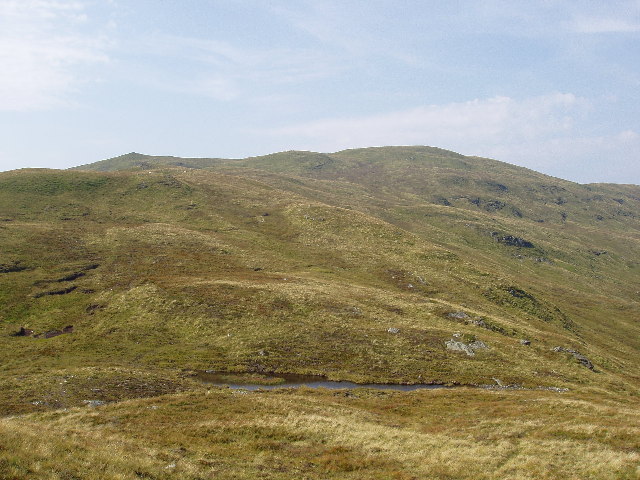
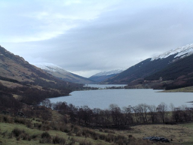
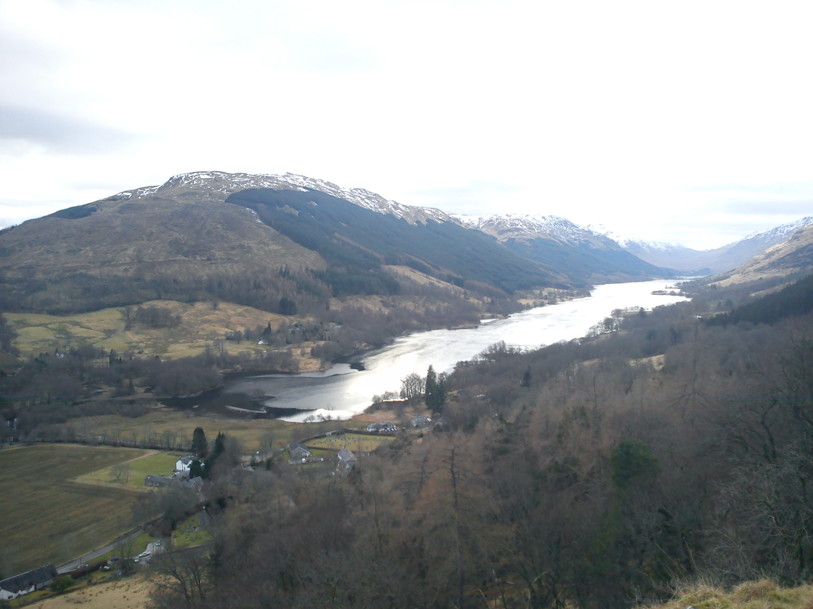
Beinn Stacath is a prominent hill located in Perthshire, Scotland. It is situated near the village of Strathyre and is part of the Ben Ledi range of hills. Standing at a height of 626 meters (2053 feet), Beinn Stacath offers stunning panoramic views of the surrounding countryside and Loch Lubnaig.

The hill is a popular destination for hikers and outdoor enthusiasts, with a well-defined path leading to the summit. The ascent can be challenging in parts, with steep, rocky sections requiring a good level of fitness and sturdy footwear.

Beinn Stacath is known for its diverse flora and fauna, with heather, mosses, and lichens covering the slopes, and various bird species, including peregrine falcons and buzzards, inhabiting the area. The hill is also home to a variety of wildlife, such as red deer and mountain hares.

Overall, Beinn Stacath offers a rewarding hiking experience for those willing to make the climb, with its breathtaking views and natural beauty making it a must-visit destination in Perthshire.

If you have any feedback on the listing, please let us know in the comments section below.

Beinn Stacath Images

Images are sourced within 2km of 56.314658/-4.4681683 or Grid Reference NN4716. Thanks to Geograph Open Source API. All images are credited.

Pool on east ridge of Stob Fear-tomhais Stob Fear-tomhais is unnamed on OS maps and has been known by at least three names in recent times. The lochan is one of a number along that mountain's knobbly east ridge.
The distant view is to the north-west where Stob Binnein is the central mountain. To the right of it but partly misted is the higher, Ben More.
Pool on east ridge of Stob Fear-tomhais
Stob Fear-tomhais is unnamed on OS maps and has been known by at least three names in recent times. The lochan is one of a number along that mountain's knobbly east ridge. The distant view is to the north-west where Stob Binnein is the central mountain. To the right of it but partly misted is the higher, Ben More.
Bivvy on Beinn Bhreac A view down Gleann Dubh from a pleasant midge free perch south of the triangulation pillar on Beinn Bhreac.  The view gives a mirror image of the common view of Ben Vorlich and Stuc a' Chroin seen from lowland Perthshire.
Bivvy on Beinn Bhreac
A view down Gleann Dubh from a pleasant midge free perch south of the triangulation pillar on Beinn Bhreac. The view gives a mirror image of the common view of Ben Vorlich and Stuc a' Chroin seen from lowland Perthshire.
Peaty hillock, Beinn Stacach The guidebooks generally seem to have settled on Beinn Stacach or Beinn Stacath as the name for this hill, although the OS map still has no definitive name for the hill as a whole.  Some publications refer to the summit as Stob Fhear-tomhais ('peak of the surveyor man') seemingly in reference to the OS trig pillar on the summit.

The satellite summit of Ceann na Baintighearna was also used to refer to the entire hill prior to the aforementioned names coming into use.
Peaty hillock, Beinn Stacach
The guidebooks generally seem to have settled on Beinn Stacach or Beinn Stacath as the name for this hill, although the OS map still has no definitive name for the hill as a whole. Some publications refer to the summit as Stob Fhear-tomhais ('peak of the surveyor man') seemingly in reference to the OS trig pillar on the summit. The satellite summit of Ceann na Baintighearna was also used to refer to the entire hill prior to the aforementioned names coming into use.
View towards Beinn Tulaichean and Cruach Ardrain Taken from near the summit of Beinn Stacach.
View towards Beinn Tulaichean and Cruach Ardrain
Taken from near the summit of Beinn Stacach.
View down Allt Fathan Glinne Showers are moving across the Braes of Balquhidder in the distance.
View down Allt Fathan Glinne
Showers are moving across the Braes of Balquhidder in the distance.
Ruined fence, Ceann na Baintighearna This hillside is littered with the remnants of fences which have been unable to withstand the elements.  This view looks over the satellite top of Ceann na Baintighearna ('the lady's head') towards Stob Binnein, the top of which is obscured by cloud.
Ruined fence, Ceann na Baintighearna
This hillside is littered with the remnants of fences which have been unable to withstand the elements. This view looks over the satellite top of Ceann na Baintighearna ('the lady's head') towards Stob Binnein, the top of which is obscured by cloud.
Allt Fathan Glinne Looking across Creag Mhor towards some showers passing through the vicinity of Ben Vorlich and Stuc a' Chroin.
Allt Fathan Glinne
Looking across Creag Mhor towards some showers passing through the vicinity of Ben Vorlich and Stuc a' Chroin.
Snow patch in upper branch of Allt Fathan Glinne A modest-sized remnant of winter drifts clinging on in a defile at just over 700m asl - the higher peaks around Crianlarich still had extensive snowfields on this date.
Snow patch in upper branch of Allt Fathan Glinne
A modest-sized remnant of winter drifts clinging on in a defile at just over 700m asl - the higher peaks around Crianlarich still had extensive snowfields on this date.
In the Frame The remains of an old fence junction on the summit of the Corbett Stob Fear-tomhais frame the munros of Stob Binnein and Ben More. Cruach Ardrain can also be seen at the left of the image.
In the Frame
The remains of an old fence junction on the summit of the Corbett Stob Fear-tomhais frame the munros of Stob Binnein and Ben More. Cruach Ardrain can also be seen at the left of the image.
Old Fenceline Remains of a fence high up on Stob Fear-tomhais looking towards the still snow dappled Cruach Ardrain, Stob Binnean and Ben More.
Old Fenceline
Remains of a fence high up on Stob Fear-tomhais looking towards the still snow dappled Cruach Ardrain, Stob Binnean and Ben More.
Magnificent Spectacle A movement directly above me caught my eye and I watched mesmerised as this pair of Golden Eagles ascended thousands of feet in a few minutes on a thermal with not one wing beat needed by either one - a magical few minutes in the hills.
Magnificent Spectacle
A movement directly above me caught my eye and I watched mesmerised as this pair of Golden Eagles ascended thousands of feet in a few minutes on a thermal with not one wing beat needed by either one - a magical few minutes in the hills.
Peat hag on the East Ridge of hill This long undulating ridge leads to the unnamed 771m point which can be seen in the distance.
Peat hag on the East Ridge of hill
This long undulating ridge leads to the unnamed 771m point which can be seen in the distance.
Trig point on the summit of the hill Looking West from the 771m trig point towards Stob a'Choin.
Trig point on the summit of the hill
Looking West from the 771m trig point towards Stob a'Choin.
Wee waterfalls in Gleann Dubh
Crag at the head of Gleann Dubh
Trig  on the un-named Corbett Looking north, with Stob Creagach very faint in the far distance.
Trig on the un-named Corbett
Looking north, with Stob Creagach very faint in the far distance.
Quartzite outcrop
Quartzite outcrop
More snowy glens. The view from the ridge looking over the corrie of Fathan Glinne. Creag Mhor to the left and Beinn an t-Sidhein in the distance.
More snowy glens.
The view from the ridge looking over the corrie of Fathan Glinne. Creag Mhor to the left and Beinn an t-Sidhein in the distance.
Show me another place!

Beinn Stacath is located at Grid Ref: NN4716 (Lat: 56.314658, Lng: -4.4681683)

Unitary Authority: Stirling

Police Authority: Forth Valley

Also known as: Stob Fear-tomhais

What 3 Words

///emptied.chips.measuring. Near Callander, Stirling

Related Wikis

Loch Doine

Loch Doine is a small freshwater loch that lies to the west of Balquhidder in the Trossachs and Teith ward within Stirling council area of Scotland. It...

Loch Voil

Loch Voil (Scottish Gaelic: Loch a' Bheothail) is a small freshwater loch that lies to the west of Balquhidder in the Stirling council area of Scotland...

Stob a' Choin

Stob a'Choin (869 m) is a mountain in the Grampian Mountains, Scotland, north of Loch Katrine in the Loch Lomond and The Trossachs National Park. The nearest...

Glen Finglas Estate

The Glen Finglas Estate is a property in Glen Finglas in the Trossachs, Scotland managed by The Woodland Trust. The estate extends for over 10,000 acres...

Nearby Amenities

Located within 500m of 56.314658,-4.4681683
Beinn Stacath
Alt Name: Stob Fear-tomhais;Ceann na Baintighearna
Corbett: yes
Ele: 771
Man Made: survey_point
Marilyn: yes
Munro: no
Natural: peak
Prominence: 363
Ref: 6059
Source: survey
Wikidata: Q20598765
Lat/Long: 56.3146602/-4.4680976
The data included in this document is from www.openstreetmap.org. The data is made available under ODbL.

Have you been to Beinn Stacath?

Leave your review of Beinn Stacath below (or comments, questions and feedback).