Bannau Duon

Hill, Mountain in Cardiganshire

Wales

Bannau Duon

B4338 reaches its summit level As befits a road reaching more than 900 feet AMSL this useful 'B' road is now into the base of the low stratus associated with a warm sector depression. This is hill fog, seen as an un-named minor road crosses near Pant-y-grugos. Looking closely the viewer can also make out red-mist; sprayed onto the signposts!
B4338 reaches its summit level Credit: Stuart Logan

Bannau Duon is a prominent hill located in Cardiganshire, Wales. It is part of the Cambrian Mountains range and is situated in the southern region of the county. The hill is known for its stunning natural beauty and offers breathtaking panoramic views of the surrounding landscape.

Standing at an elevation of approximately 484 meters (1,588 feet), Bannau Duon is a popular destination for hikers, nature enthusiasts, and outdoor adventurers. Its distinctive dark, rocky peaks give it its name, which translates to "Black Peaks" in English.

The hill is characterized by its rugged terrain, with steep slopes and rocky outcrops. It is covered in a mix of heather, grasses, and other vegetation, providing habitats for various wildlife species. Visitors to Bannau Duon may encounter a range of animals, including wild ponies, red kites, and mountain hares.

The summit of Bannau Duon offers incredible views of the surrounding landscape, including the Cambrian Mountains and the nearby valleys. On clear days, visitors can see as far as the Cardigan Bay coastline to the west and the Brecon Beacons to the south.

Due to its remote location and challenging terrain, Bannau Duon is best explored by experienced hikers or those accompanied by a knowledgeable guide. The hill offers a peaceful and tranquil escape, allowing visitors to immerse themselves in the natural beauty of Cardiganshire's countryside.

If you have any feedback on the listing, please let us know in the comments section below.
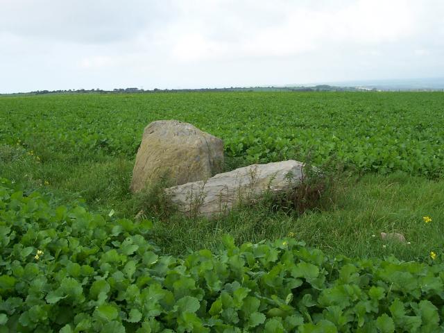
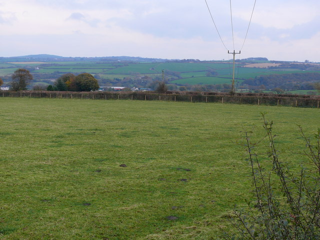
Bannau Duon Images

Images are sourced within 2km of 52.164055/-4.3001066 or Grid Reference SN4254. Thanks to Geograph Open Source API. All images are credited.

B4338 reaches its summit level As befits a road reaching more than 900 feet AMSL this useful 'B' road is now into the base of the low stratus associated with a warm sector depression. This is hill fog, seen as an un-named minor road crosses near Pant-y-grugos. Looking closely the viewer can also make out red-mist; sprayed onto the signposts!
B4338 reaches its summit level
As befits a road reaching more than 900 feet AMSL this useful 'B' road is now into the base of the low stratus associated with a warm sector depression. This is hill fog, seen as an un-named minor road crosses near Pant-y-grugos. Looking closely the viewer can also make out red-mist; sprayed onto the signposts!
Hedge and Fences enclosing a Triangulation Pillar at Moel Rhydeinon Looking north-westward.
Hedge and Fences enclosing a Triangulation Pillar at Moel Rhydeinon
Looking north-westward.
Crossroads south of Synod Inn Crossroads on the A4338 to the south of Synod Inn.
Crossroads south of Synod Inn
Crossroads on the A4338 to the south of Synod Inn.
Farmland near Synod Inn Farmland to the south of Synod Inn.
Farmland near Synod Inn
Farmland to the south of Synod Inn.
Banc Rhosgoch Fach Two standing stones at Banc Rhosgoch Fach between the villages of Mydroilyn and Llanarth. They lie just north of a footpath.
Banc Rhosgoch Fach
Two standing stones at Banc Rhosgoch Fach between the villages of Mydroilyn and Llanarth. They lie just north of a footpath.
Telecommunications Mast Telecommunications Mast at Mount Farm near Synod Inn just off the B4338.
Telecommunications Mast
Telecommunications Mast at Mount Farm near Synod Inn just off the B4338.
Fron Hill trig
Fron Hill trig
Water and Power In this photograph I am standing on the grass-covered top of the Nantmeddal Service Reservoir, about 210 metres above sea level. The water is pumped into the tank below my feet and then flows by gravity to the houses and villages in the area situated at lower elevations. The black vents are to allow the free flow of air into the tank. In the distance you can just see the sea.
Water and Power
In this photograph I am standing on the grass-covered top of the Nantmeddal Service Reservoir, about 210 metres above sea level. The water is pumped into the tank below my feet and then flows by gravity to the houses and villages in the area situated at lower elevations. The black vents are to allow the free flow of air into the tank. In the distance you can just see the sea.
Tai rhwng Synod Inn a Mydroilyn / Houses between Synod Inn and Mydroilyn Byngalos ar fin ffordd wledig rhwng Synod Inn a Mydroilyn/Bungalows alongside a country road between Synod Inn and Mydroilyn
Tai rhwng Synod Inn a Mydroilyn / Houses between Synod Inn and Mydroilyn
Byngalos ar fin ffordd wledig rhwng Synod Inn a Mydroilyn/Bungalows alongside a country road between Synod Inn and Mydroilyn
Cae Amaethyddol ger Mydroilyn / Field Pasture near Mydroilyn Cae Amaethyddol rhwng Pantowen a Rhiwowen ger Mydroilyn / Field Pasture between Pantowen and Rhiwowen near Mydroilyn
Cae Amaethyddol ger Mydroilyn / Field Pasture near Mydroilyn
Cae Amaethyddol rhwng Pantowen a Rhiwowen ger Mydroilyn / Field Pasture between Pantowen and Rhiwowen near Mydroilyn
Pont ffordd dros y Cletwr Fawr / Road bridge over the Cletwr Fawr Ffordd yn croesi bont ger Talgarreg / Road crossing a bridge near Talgarreg
Pont ffordd dros y Cletwr Fawr / Road bridge over the Cletwr Fawr
Ffordd yn croesi bont ger Talgarreg / Road crossing a bridge near Talgarreg
Trac Fferm, Cletwr / Cletwr Farm Track Trac Fferm yn arwain i Cletwr gyda coedwig fach wrth y ymyl / Farm track leading to Cletwr with a small woodland at the edge.
Trac Fferm, Cletwr / Cletwr Farm Track
Trac Fferm yn arwain i Cletwr gyda coedwig fach wrth y ymyl / Farm track leading to Cletwr with a small woodland at the edge.
B4338 rhwng Synod Inn a Talgarreg / B4338 between Synod Inn and Talgarreg B4338 ger Pantrhiwddulais / B4338 near Pantrhiwddulais
B4338 rhwng Synod Inn a Talgarreg / B4338 between Synod Inn and Talgarreg
B4338 ger Pantrhiwddulais / B4338 near Pantrhiwddulais
Lon wledig ger Esgairowen / Country lane near Esgairowen Yn edrych i lawr lon gul islawr i Esgairowen / Looking down a narrow lane below Esgairowen.
Lon wledig ger Esgairowen / Country lane near Esgairowen
Yn edrych i lawr lon gul islawr i Esgairowen / Looking down a narrow lane below Esgairowen.
Abandoned Farmstead Tiny cottage on a traditional farmyard, long abandoned, probably due to the fact that it is within 100 yard of the local landfill site.
Abandoned Farmstead
Tiny cottage on a traditional farmyard, long abandoned, probably due to the fact that it is within 100 yard of the local landfill site.
Road to Cefn-grugos Fawr
Fields above Cefn-grugos fach
Fields above Gafynachfawr Gates to open on this country road
Fields above Gafynachfawr
Gates to open on this country road
Show me another place!

Bannau Duon is located at Grid Ref: SN4254 (Lat: 52.164055, Lng: -4.3001066)

Unitary Authority: Ceredigion

Police Authority: Dyfed Powys

Also known as: Moel Rhydeinon

What 3 Words

///unique.objecting.expecting. Near Llanarth, Ceredigion

Nearby Locations

Moel Rhydeinon Bannau Duon

Related Wikis

Rhyd-y-Beillen

Rhyd-y-Beillen is a hamlet in the community of Llanarth, Ceredigion, Wales, which is 68.5 miles (110.2 km) from Cardiff and 185.1 miles (297.9 km) from...

Pen-cae

Pencae is a village in the community of Llanarth, Ceredigion, Wales, which is 68.2 miles (109.8 km) from Cardiff and 184 miles (296 km) from London. Pencae...

Mydroilyn

Mydroilyn is a village in the parish of Llanarth, Ceredigion, Wales, situated along the B4342 road. The name of the village is derived from the confluence...

Talgarreg

Talgarreg is a small village in the community of Llandysiliogogo, in the county of Ceredigion, Wales. The village is located on a junction of the B4459...

Nearby Amenities

Located within 500m of 52.164055,-4.3001066
Place: farm
Lat/Long: 52.1614283/-4.3023858
Place: farm
Lat/Long: 52.1675224/-4.2980084
Give Way
Direction: forward
Lat/Long: 52.1625551/-4.2961917
Give Way
Direction: backward
Lat/Long: 52.1623756/-4.2962687
Man Made: utility_pole
Lat/Long: 52.1611018/-4.2964375
The data included in this document is from www.openstreetmap.org. The data is made available under ODbL.

Have you been to Bannau Duon?

Leave your review of Bannau Duon below (or comments, questions and feedback).