An Sgurr

Hill, Mountain in Ross-shire

Scotland

An Sgurr

Seana Bhraigh Seana Bhraigh is often regarded as the most remote (though not the most difficult) Munro. Here seen from the summit of Cnoc Bad a' Choille, the large forested area closer to hand is in <a href="https://www.geograph.org.uk/gridref/NC3396">NC3396</a>.

The summit of Seana Bhraigh, 927m, is at the right of the high ground seen. The spiky top of Creag an Duine, to the left, is rather lower at 905m, and so not even a Munro Top. (The altitude limit is 914.4m.)
Seana Bhraigh Credit: Michael Earnshaw

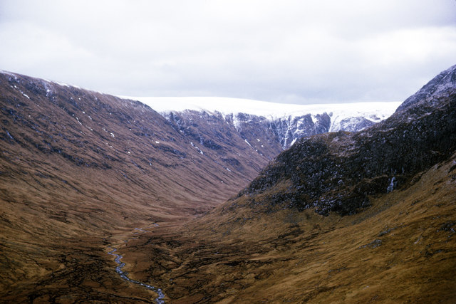
An Sgurr is a prominent hill located in the county of Ross-shire, in the Highlands of Scotland. It is situated on the Isle of Eigg, which is part of the Inner Hebrides archipelago. An Sgurr is a distinct landmark on the island, often referred to as the "Jewel of Eigg," and is one of the most recognizable geological features in Scotland.

Standing at a height of 393 meters (1,289 feet), An Sgurr is a dramatic volcanic rock formation that dominates the skyline of Eigg. It is composed of pitchstone, a type of volcanic glass formed from solidified lava, giving it a dark and jagged appearance. The hill's shape is reminiscent of an upturned boat, with steep and sheer cliffs on its eastern and western sides, while its southern slope is more gradual.

The ascent of An Sgurr is challenging, involving a steep and rocky path that requires a moderate level of fitness and good footwear. However, the effort is rewarded with breathtaking panoramic views from the summit. On clear days, it is possible to see the surrounding islands of Rum, Muck, and Skye, as well as the mainland mountains of the Scottish Highlands.

An Sgurr has significant cultural and historical importance to the residents of Eigg. It has been a symbol of the island for centuries and has featured in many local legends and tales. The hill is also a popular destination for hikers, nature enthusiasts, and geologists who are fascinated by its unique geological formation and the diverse plant and animal life that can be found in its vicinity.

If you have any feedback on the listing, please let us know in the comments section below.

An Sgurr Images

Images are sourced within 2km of 57.848581/-4.8713171 or Grid Reference NH2987. Thanks to Geograph Open Source API. All images are credited.

Seana Bhraigh Seana Bhraigh is often regarded as the most remote (though not the most difficult) Munro. Here seen from the summit of Cnoc Bad a' Choille, the large forested area closer to hand is in <a href="https://www.geograph.org.uk/gridref/NC3396">NC3396</a>.

The summit of Seana Bhraigh, 927m, is at the right of the high ground seen. The spiky top of Creag an Duine, to the left, is rather lower at 905m, and so not even a Munro Top. (The altitude limit is 914.4m.)
Seana Bhraigh
Seana Bhraigh is often regarded as the most remote (though not the most difficult) Munro. Here seen from the summit of Cnoc Bad a' Choille, the large forested area closer to hand is in NC3396. The summit of Seana Bhraigh, 927m, is at the right of the high ground seen. The spiky top of Creag an Duine, to the left, is rather lower at 905m, and so not even a Munro Top. (The altitude limit is 914.4m.)
Crags at head of Cadha Dearg Cadha Dearg appears to be the name given to the head of the valley, Gleann a' Chadha Dheirg; Google Translate suggests that the name means Red Road. The remote Munro, Seana Bhraigh lies to the north along the slope rising  in the image.
Crags at head of Cadha Dearg
Cadha Dearg appears to be the name given to the head of the valley, Gleann a' Chadha Dheirg; Google Translate suggests that the name means Red Road. The remote Munro, Seana Bhraigh lies to the north along the slope rising in the image.
Summit and crags of Seanna Bhraigh An almost monochrome image of Seanna Bhraigh which is a contender for being the most remote of all the Munros. Its summit is the snow dome at the upper centre of the image; a climber can be seen approaching the highest point.
Summit and crags of Seanna Bhraigh
An almost monochrome image of Seanna Bhraigh which is a contender for being the most remote of all the Munros. Its summit is the snow dome at the upper centre of the image; a climber can be seen approaching the highest point.
Coire Mòr Looking down Creag Iobhair into Coire Mòr
Coire Mòr
Looking down Creag Iobhair into Coire Mòr
East of Creag an Duine Looking over Strath Mulzie to the peaks of Assynt
East of Creag an Duine
Looking over Strath Mulzie to the peaks of Assynt
East of Creag an Duine Looking west to Creag an Duine (right) and Seana Bhraigh
East of Creag an Duine
Looking west to Creag an Duine (right) and Seana Bhraigh
Lochan SE of Coire Mhic Mhathain Beinn Dearg in the distance
Lochan SE of Coire Mhic Mhathain
Beinn Dearg in the distance
Coire Mor from Creag an Duine
The head of Loch a’ Choire Mhòir
Coire Mòr, Corriemulzie A view into Coire Mòr before the difficulties began in climbing the NE ridge of Creag an Duine.
Coire Mòr, Corriemulzie
A view into Coire Mòr before the difficulties began in climbing the NE ridge of Creag an Duine.
Camp site by Loch a' Choire Mhòr The camp site was located for access to the ridge of An Sgurr facing the loch.
Camp site by Loch a' Choire Mhòr
The camp site was located for access to the ridge of An Sgurr facing the loch.
Coiremor/Magoo's Bothy Coiremor / Magoo's Bothy overlooking Loch a' Choire Mhòir taken on 20th April 2011. Bothy rebuilt by friends of Mark Maguire who was killed in peacekeeping duties in Kosovo 2001.
Coiremor/Magoo's Bothy
Coiremor / Magoo's Bothy overlooking Loch a' Choire Mhòir taken on 20th April 2011. Bothy rebuilt by friends of Mark Maguire who was killed in peacekeeping duties in Kosovo 2001.
Boggy Ground Boggy ground in the rough country south east of Seana Braigh. The rocky promontory of Creag an Duine <a title="https://www.geograph.org.uk/photo/597659" href="https://www.geograph.org.uk/photo/597659">Link</a> can just be seen.
Boggy Ground
Boggy ground in the rough country south east of Seana Braigh. The rocky promontory of Creag an Duine Link can just be seen.
Northern end of Loch a' Choire Mhoir
Loch a' Choire Mhoir Creag an Duine the peak in the background
Loch a' Choire Mhoir
Creag an Duine the peak in the background
Ruin in Coire Mor Maybe an old sheepfank
Ruin in Coire Mor
Maybe an old sheepfank
Allt a' Choire Mhoir
Peat hags and bogwood abound in Coire Mor
Show me another place!

An Sgurr is located at Grid Ref: NH2987 (Lat: 57.848581, Lng: -4.8713171)

Unitary Authority: Highland

Police Authority: Highlands and Islands

Also known as: Creag an Duine

What 3 Words

///totals.blemishes.studio. Near Ullapool, Highland

Related Wikis

Seana Bhràigh

Seana Bhràigh is a mountain east of Ullapool, in the Highlands of Scotland. == Ascent == The main approach is from the A835 road through the Lael Forest...

Cona' Mheall

Cona' Mheall (978 m) is a mountain in the Northwest Highlands of Scotland. It is located near Ullapool in Wester Ross. Taking the form of a fine rocky...

Beinn Dearg (Ullapool)

Beinn Dearg (one of a number of Scottish hills of that name) is a mountain in the Inverlael area of the Highlands of Scotland. It is most frequently climbed...

Eas Fionn

Eas Fionn is a waterfall of Scotland. == See also == Waterfalls of Scotland == References ==

Nearby Amenities

Located within 500m of 57.848581,-4.8713171
Creag an Duine
Natural: peak
Source: OS_OpenData_StreetView
Lat/Long: 57.8443866/-4.8732917
The data included in this document is from www.openstreetmap.org. The data is made available under ODbL.

Have you been to An Sgurr?

Leave your review of An Sgurr below (or comments, questions and feedback).