Aller Wood

Hill, Mountain in Somerset South Somerset

England

Aller Wood

The Old Pound Inn at Aller
The Old Pound Inn at Aller Credit: Nick Chipchase

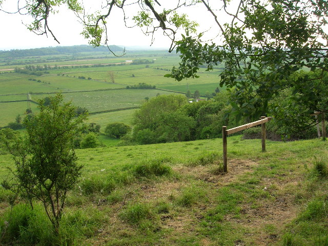
Aller Wood, Somerset is a picturesque hill located in the southwestern part of England, specifically in the county of Somerset. It is situated near the village of Aller, which gives it its name. Offering breathtaking views and serene surroundings, Aller Wood is a popular destination for nature lovers and outdoor enthusiasts.

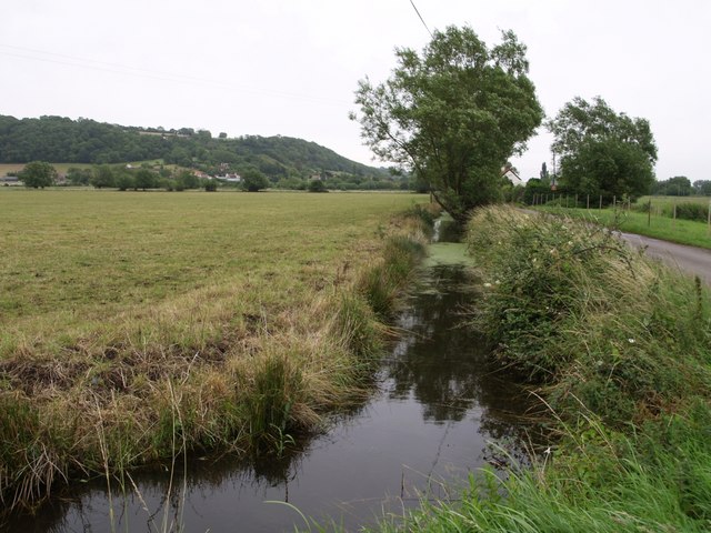
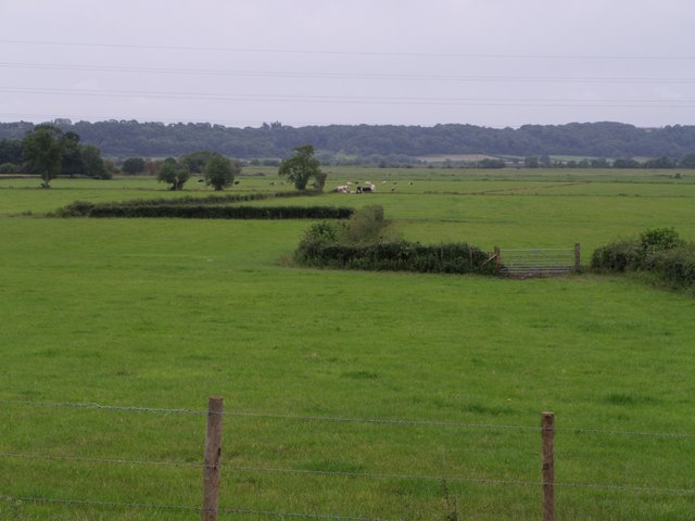
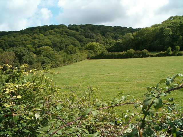
Covering an area of approximately 100 acres, Aller Wood boasts a diverse range of flora and fauna, making it a haven for wildlife. The wood is primarily composed of broadleaf trees such as oak, beech, and ash, which create a dense canopy and provide shade during the summer months. The forest floor is adorned with a carpet of bluebells and other wildflowers during the spring season, adding a vibrant touch to the landscape.

Visitors to Aller Wood can explore numerous walking trails that wind through the hill, allowing them to immerse themselves in the natural beauty of the area. These trails cater to both seasoned hikers and casual strollers, ensuring that everyone can enjoy a visit to the wood. Along the way, visitors may encounter various species of birds, squirrels, and even deer, adding to the allure of the experience.

The hill itself offers panoramic views of the surrounding countryside, including the rolling hills and fields of Somerset. Many visitors choose to bring a picnic and enjoy the scenery from one of the designated viewpoints. Additionally, Aller Wood hosts educational activities and events throughout the year, allowing visitors to learn more about the local ecosystem and its conservation efforts.

Overall, Aller Wood, Somerset is a natural gem that offers a tranquil escape from the bustling city life. Its stunning landscapes, diverse wildlife, and recreational opportunities make it a must-visit destination for those seeking a connection with nature in the heart of Somerset.

If you have any feedback on the listing, please let us know in the comments section below.

Aller Wood Images

Images are sourced within 2km of 51.072919/-2.8463539 or Grid Reference ST4030. Thanks to Geograph Open Source API. All images are credited.

The Old Pound Inn at Aller
Aller The Old Pound Inn
Aller
The Old Pound Inn
St. Andrew's Church The parish church for High Ham.  A very old church with a font which is considered to be from the "Norman" period.
St. Andrew's Church
The parish church for High Ham. A very old church with a font which is considered to be from the "Norman" period.
Sowey River On King's Sedge Moor
Sowey River
On King's Sedge Moor
Wet Levels Flooded plains on King's Sedge Moor, Somerset
Wet Levels
Flooded plains on King's Sedge Moor, Somerset
Wet Levels Flooded plains on King's Sedge Moor, Somerset
Wet Levels
Flooded plains on King's Sedge Moor, Somerset
Nightingale Farm at Beer The old Nightingale Farm has been subdivided into a number of smaller units, but retains its historical identity to the locals.
Nightingale Farm at Beer
The old Nightingale Farm has been subdivided into a number of smaller units, but retains its historical identity to the locals.
Aller Wood View from the A372 near Beer Corner.
Aller Wood
View from the A372 near Beer Corner.
Rhyne at Longstone This continuation of Black Withies Rhyne bends at Longstone to run beside Aller Drove, the lane on the right. In the distance are buildings at Aller, and Aller Hill.
Rhyne at Longstone
This continuation of Black Withies Rhyne bends at Longstone to run beside Aller Drove, the lane on the right. In the distance are buildings at Aller, and Aller Hill.
Middle Moor A view from the A372 just outside Aller across part of the Somerset levels towards the River Parrett. The field to the right of the zigzagging hedge is shown on the 1:10000 map as an orchard, but on no others (including the 1940 1" map).
Middle Moor
A view from the A372 just outside Aller across part of the Somerset levels towards the River Parrett. The field to the right of the zigzagging hedge is shown on the 1:10000 map as an orchard, but on no others (including the 1940 1" map).
Wood Drove This no through road runs along the plateau above Aller Hill. Here the lane is passing Hill Farm.
Wood Drove
This no through road runs along the plateau above Aller Hill. Here the lane is passing Hill Farm.
Hopper by Standhill Road The forbidding outline of the hopper is at Standhill Farm. Standhill Road, on the left, is from Beer to High Ham.
Hopper by Standhill Road
The forbidding outline of the hopper is at Standhill Farm. Standhill Road, on the left, is from Beer to High Ham.
North Moor Cattle graze near a conventional-looking haystack on the eastern part of North Moor, seen from Northmoor Drove.  According to <span class="nowrap"><a title="http://webapp1.somerset.gov.uk/her/details.asp?prn=18892" rel="nofollow ugc noopener" href="http://webapp1.somerset.gov.uk/her/details.asp?prn=18892">Link</a><img style="margin-left:2px;" alt="External link" title="External link - shift click to open in new window" src="https://s1.geograph.org.uk/img/external.png" width="10" height="10"/></span> , this area was actually the site of a number of medieval stack stands.

The building in the background is Black Withies. Aller Wood, on the slopes of Aller Hill, is in ST4030.
North Moor
Cattle graze near a conventional-looking haystack on the eastern part of North Moor, seen from Northmoor Drove. According to LinkExternal link , this area was actually the site of a number of medieval stack stands. The building in the background is Black Withies. Aller Wood, on the slopes of Aller Hill, is in ST4030.
North Moor A meadow at the southeast edge of North Moor, beside Aller Drove. On the left is a barn at Longstone Farm. As elsewhere on the Somerset levels, rhynes, with scattered willows along them, form the field boundaries.
North Moor
A meadow at the southeast edge of North Moor, beside Aller Drove. On the left is a barn at Longstone Farm. As elsewhere on the Somerset levels, rhynes, with scattered willows along them, form the field boundaries.
North Moor Another view of the area shown in <a href="https://www.geograph.org.uk/photo/560686">ST3929 : North Moor</a>, from near Longstone Cottage on Aller Drove - the group of cattle is the same.
North Moor
Another view of the area shown in ST3929 : North Moor, from near Longstone Cottage on Aller Drove - the group of cattle is the same.
Willow on North Moor The weed-covered rhyne by which this willow stands can just be seen at bottom left, but the roadside rhyne (the one shown in <a href="https://www.geograph.org.uk/photo/485751">ST3929 : Rhyne at Longstone</a>) is just out of sight below. Beyond, the levels stretch away for about 7 kilometres to Moorlinch.
Willow on North Moor
The weed-covered rhyne by which this willow stands can just be seen at bottom left, but the roadside rhyne (the one shown in ST3929 : Rhyne at Longstone) is just out of sight below. Beyond, the levels stretch away for about 7 kilometres to Moorlinch.
Longstone Lodge One of several cottages scattered along the southwest side of Aller Drove.
Longstone Lodge
One of several cottages scattered along the southwest side of Aller Drove.
Show me another place!

Aller Wood is located at Grid Ref: ST4030 (Lat: 51.072919, Lng: -2.8463539)

Administrative County: Somerset

District: South Somerset

Police Authority: Avon and Somerset

Also known as: Turn Hill

What 3 Words

///outlooks.dreamers.drain. Near Langport, Somerset

Nearby Locations

Aller Wood Aller Wood

Related Wikis

Aller and Beer Woods

Aller and Beer Woods (grid reference ST404305) is a 56.9 hectares (141 acres) biological Site of Special Scientific Interest. off the A372 Othery to Langport...

Aller Hill

Aller Hill (grid reference ST408291) is an 18.4 hectare (45.4 acre) biological Site of Special Scientific Interest near Aller in Somerset, notified in...

St Andrew's Church, High Ham

The Church of Saint Andrew is an Anglican parish church located on Turnhill Road, in High Ham, Somerset, England. It shows evidence of 12th- and 14th...

High Ham

High Ham is a village and civil parish in Somerset, England. Within the parish of High Ham, there are the villages of High Ham and Low Ham and the hamlets...

Nearby Amenities

Located within 500m of 51.072919,-2.8463539
Give Way
Lat/Long: 51.0752411/-2.8520102
Give Way
Lat/Long: 51.0754879/-2.852077
The data included in this document is from www.openstreetmap.org. The data is made available under ODbL.

Have you been to Aller Wood?

Leave your review of Aller Wood below (or comments, questions and feedback).