Knapwell

Settlement in Cambridgeshire South Cambridgeshire

England

Knapwell

Boxworth, St Peter <span class="nowrap"><a title="http://www.druidic.org/camchurch/churches/boxworth.htm" rel="nofollow ugc noopener" href="http://www.druidic.org/camchurch/churches/boxworth.htm">Link</a><img style="margin-left:2px;" alt="External link" title="External link - shift click to open in new window" src="https://s1.geograph.org.uk/img/external.png" width="10" height="10"/></span>
Boxworth, St Peter Credit: mym

Knapwell is a small village located in the South Cambridgeshire district of Cambridgeshire, England. Situated approximately 8 miles west of Cambridge, it is nestled in the picturesque countryside, providing residents with a tranquil and peaceful environment.

The village is home to a close-knit community, with a population of around 200 people. The local economy mainly revolves around agriculture, with many residents working in farming or related industries. The surrounding fields are often filled with crops such as wheat, barley, and rapeseed.

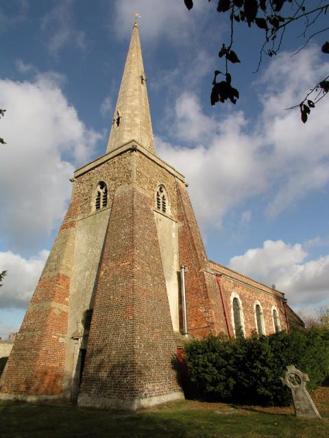
Knapwell boasts a charming rural landscape, with its traditional thatched cottages and historic buildings adding to its timeless appeal. St. Peter's Church, a Grade II listed building, stands proudly at the heart of the village, offering a glimpse into the area's rich history.

For nature enthusiasts, Knapwell provides ample opportunities to explore the great outdoors. The village is surrounded by beautiful walking trails and footpaths, offering stunning views of the countryside and wildlife. The nearby Knapwell Wood provides a peaceful retreat, with its ancient trees and diverse range of flora and fauna.

Despite its rural setting, Knapwell benefits from good transportation links. The village is well-connected to the nearby towns and cities, with regular bus services and major road networks easily accessible.

In summary, Knapwell is a charming and idyllic village in Cambridgeshire, offering a close-knit community, stunning natural landscapes, and a rich agricultural heritage.

If you have any feedback on the listing, please let us know in the comments section below.
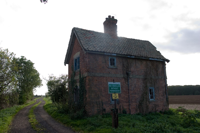
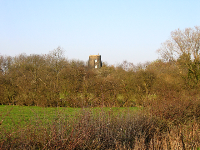
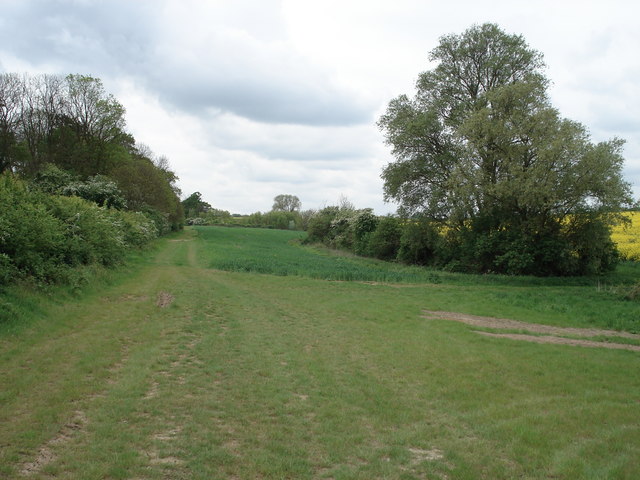
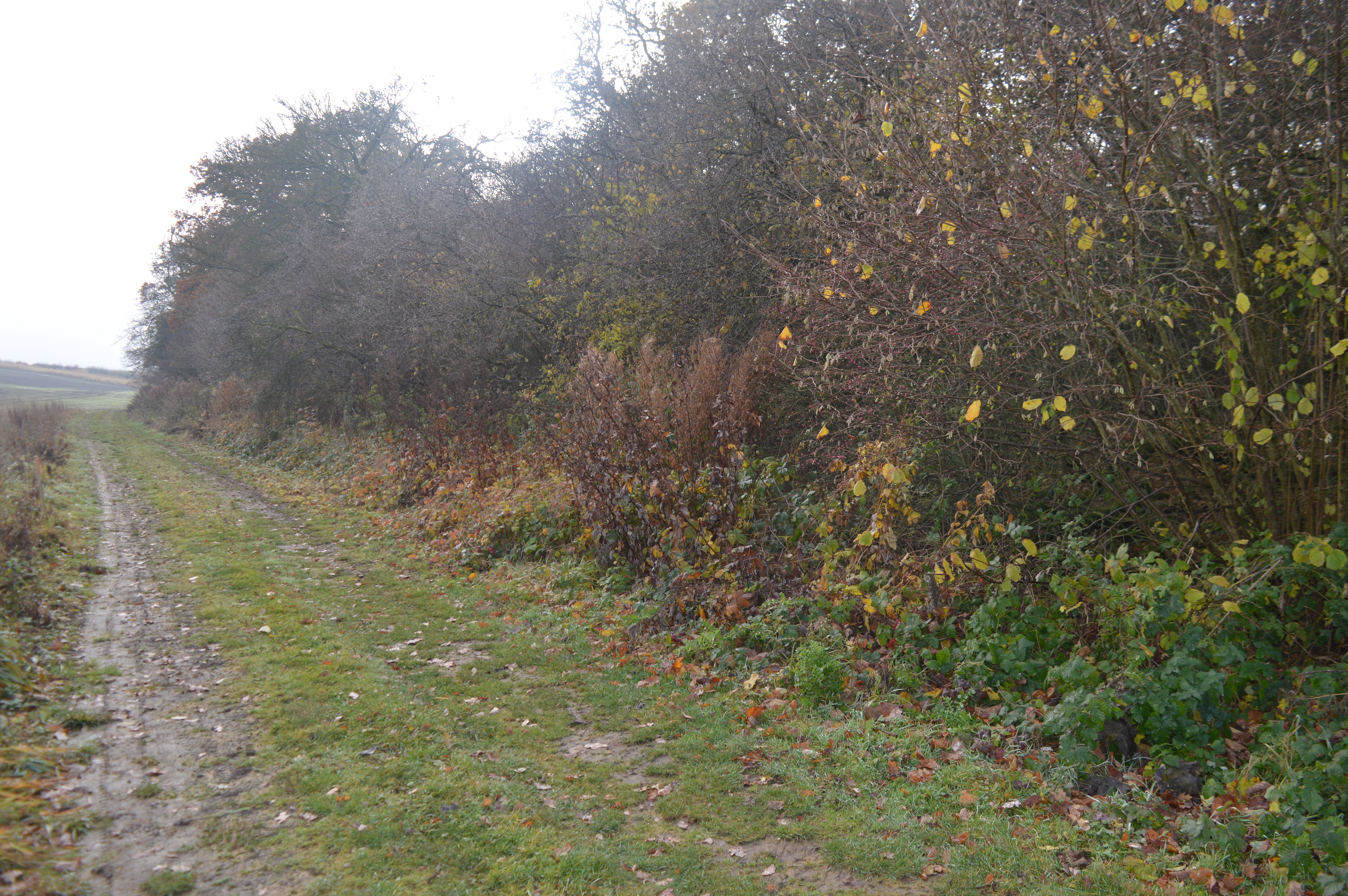
Knapwell Images

Images are sourced within 2km of 52.248659/-0.047057 or Grid Reference TL3362. Thanks to Geograph Open Source API. All images are credited.

Boxworth, St Peter <span class="nowrap"><a title="http://www.druidic.org/camchurch/churches/boxworth.htm" rel="nofollow ugc noopener" href="http://www.druidic.org/camchurch/churches/boxworth.htm">Link</a><img style="margin-left:2px;" alt="External link" title="External link - shift click to open in new window" src="https://s1.geograph.org.uk/img/external.png" width="10" height="10"/></span>
Boxworth, St Peter
Knapwell, All Saints <span class="nowrap"><a title="http://www.druidic.org/camchurch/churches/knapwell.htm" rel="nofollow ugc noopener" href="http://www.druidic.org/camchurch/churches/knapwell.htm">Link</a><img style="margin-left:2px;" alt="External link" title="External link - shift click to open in new window" src="https://s1.geograph.org.uk/img/external.png" width="10" height="10"/></span>
Knapwell, All Saints
Elsworth, Holy Trinity <span class="nowrap"><a title="http://www.druidic.org/camchurch/churches/elsworth.htm" rel="nofollow ugc noopener" href="http://www.druidic.org/camchurch/churches/elsworth.htm">Link</a><img style="margin-left:2px;" alt="External link" title="External link - shift click to open in new window" src="https://s1.geograph.org.uk/img/external.png" width="10" height="10"/></span>
Elsworth, Holy Trinity
Rolling wheat fields An overview of the arable fields that cover much of this grid square (taken from just outside the square looking in).
Rolling wheat fields
An overview of the arable fields that cover much of this grid square (taken from just outside the square looking in).
Power line north of Childerley Hall Probably the most interesting feature of this square! Cambridgeshire certainly has its fair share of flat cornfields.
Power line north of Childerley Hall
Probably the most interesting feature of this square! Cambridgeshire certainly has its fair share of flat cornfields.
Field scale lysimeters A lysimeter measures water penetration in the soil, apparently. The things you learn through Geograph.
Field scale lysimeters
A lysimeter measures water penetration in the soil, apparently. The things you learn through Geograph.
Knapwell village street Showing the handmade sign that is de rigueur for all villages in this area.
Knapwell village street
Showing the handmade sign that is de rigueur for all villages in this area.
Field bean cultivation, Boxworth A bit of relief from the wheat that currently covers most of the land round here.
Field bean cultivation, Boxworth
A bit of relief from the wheat that currently covers most of the land round here.
Derelict building at Battle Gate This is at the end of the southern road out of Boxworth which can be driven down, but not beyond this point. The surrounding fields are on one of the highest parts of the clay 'uplands' (nearby spot height is 67m) which form the southern border of the Fens.
Derelict building at Battle Gate
This is at the end of the southern road out of Boxworth which can be driven down, but not beyond this point. The surrounding fields are on one of the highest parts of the clay 'uplands' (nearby spot height is 67m) which form the southern border of the Fens.
Road from Boxworth to Elsworth Taken from the layby, this shows the Boxworth-Elsworth road on the top of a fenland "hill" dropping 10m in 500m distance is the dip. Beyond are further fields and gentle hills typical of the area.
Road from Boxworth to Elsworth
Taken from the layby, this shows the Boxworth-Elsworth road on the top of a fenland "hill" dropping 10m in 500m distance is the dip. Beyond are further fields and gentle hills typical of the area.
Converted house One of the many converted dwellings in the village, giving the area its own unique character.
Converted house
One of the many converted dwellings in the village, giving the area its own unique character.
Terrace houses A view along the main road through Knapwell, showing terrace houses backing onto the street. The road tarmac is coloured red to help drivers remember that the village is a 30mph zone - a technique used often in local rural villages.
Terrace houses
A view along the main road through Knapwell, showing terrace houses backing onto the street. The road tarmac is coloured red to help drivers remember that the village is a 30mph zone - a technique used often in local rural villages.
Field and pylon There is little to distinguish one field from another!
Field and pylon
There is little to distinguish one field from another!
Footpath and field boundary This is true Cambridgeshire.
Footpath and field boundary
This is true Cambridgeshire.
Elsworth Mill, Elsworth, Cambs A capless tower mill (also known East Mill, Papworth's Mill or the Black Mill) nestling amongst trees along Boxworth Road east of the village. It replaced an earlier wooden smock mill, probably dating from around 1800 and destroyed by fire in 1854. It was converted into a house around 1935.
Elsworth Mill, Elsworth, Cambs
A capless tower mill (also known East Mill, Papworth's Mill or the Black Mill) nestling amongst trees along Boxworth Road east of the village. It replaced an earlier wooden smock mill, probably dating from around 1800 and destroyed by fire in 1854. It was converted into a house around 1935.
Elsworth church Elsworth church, Cambridgeshire, from the south.
Elsworth church
Elsworth church, Cambridgeshire, from the south.
Boxworth
Boxworth
Farmland at Grange Farm, Knapwell Part of the RSPB's 'Hope Farm'.
Farmland at Grange Farm, Knapwell
Part of the RSPB's 'Hope Farm'.
Show me another place!

Knapwell is located at Grid Ref: TL3362 (Lat: 52.248659, Lng: -0.047057)

Administrative County: Cambridgeshire

District: South Cambridgeshire

Police Authority: Cambridgeshire

What 3 Words

///childcare.date.handwriting. Near Cambourne, Cambridgeshire

Nearby Locations

Knapwell The Red Well

Related Wikis

Knapwell

Knapwell is a hamlet in Cambridgeshire situated about 10 miles (16 km) west of Cambridge. It is within the diocese of Ely. Its population was estimated...

Overhall Grove

Overhall Grove is a 17.4-hectare (43-acre) biological Site of Special Scientific Interest to the east of Knapwell in Cambridgeshire. It is a Nature Conservation...

Boxworth

Boxworth is a village in South Cambridgeshire, situated about eight miles to the north-west of Cambridge. It falls under the Papworth Everard and Caxton...

Elsworth

Elsworth is a village and civil parish in South Cambridgeshire, England, 9 miles northwest of Cambridge and 7 miles southeast of Huntingdon. At the 2011...

Childerley

Childerley, also known as Great Childerley and Little Childerly, was a small rural village in the county of Cambridgeshire in the East of England, United...

Elsworth Wood

Elsworth Wood is a 6.9-hectare (17-acre) biological Site of Special Scientific Interest between Cambourne and Elsworth in Cambridgeshire.This site has...

Conington, South Cambridgeshire

Conington (Conington St Mary, or Coningtom-juxta-Cantab) is a small village in the South Cambridgeshire district of Cambridgeshire with about 50 houses...

Cambourne Church

Cambourne Church is a "local ecumenical partnership" between the Church of England, Baptist Union of Great Britain, Methodist Church of Great Britain and...

Nearby Amenities

Located within 500m of 52.248659,-0.047057
Source: Bing
Lat/Long: 52.2487081/-0.0470617
Post Box
Collection Times: Mo-Fr 16:15; Sa 09:15
Operator: Royal Mail
Post Box Mounting: pier
Post Box Type: lamp
Ref: CB23 391
Royal Cypher: EIIR
Royal Cypher Wikidata: Q33102113
Source: survey
Lat/Long: 52.2453535/-0.0478325
Telephone
Booth: K6
Covered: booth
Listed Status: Grade II
Phone: +44 1984 267257
Source: survey
Wikidata: Q26496207
Lat/Long: 52.2453133/-0.0478446
Bus Stop
Note: Stop for 8 and 9. "Bus stop both sides of road"
Shelter: yes
Lat/Long: 52.2487521/-0.0470379
Parking
Source: GPS
Lat/Long: 52.2488858/-0.0454835
Power: tower
Ref: PT 57
Source Ref: interpolation
Lat/Long: 52.2475755/-0.0401716
Addr Housename: Withypool
Addr Street: High Street
Lat/Long: 52.2486687/-0.0466312
Note: powerline crosses road here; looking E, the 3rd pylon has a bend to the right; looking W, one straight-line pylon can be seen
Source: GPS
Lat/Long: 52.2469949/-0.0471375
Bus Stop
All Saints Church
Naptan AtcoCode: 0500SKNAP001
Naptan Bearing: S
Naptan CommonName: All Saints Church
Naptan Indicator: near
Naptan Landmark: All Saints Church
Naptan NaptanCode: cmbgagaj
Naptan Street: High Street
Naptan Verified: no
Source: naptan_import
Lat/Long: 52.2487403/-0.0469686
Direction: backward
Traffic Calming: choker
Lat/Long: 52.2504305/-0.0488568
Power: tower
Ref: PT 55
Source Ref: interpolation
Lat/Long: 52.2469107/-0.0499095
Power: tower
Ref: PT 56
Source Ref: interpolation
Lat/Long: 52.2471861/-0.0455585
Power: pole
Lat/Long: 52.2476333/-0.04578
Access: private
Barrier: chain
Locked: yes
Lat/Long: 52.2511063/-0.0495297
Access: private
Barrier: chain
Locked: yes
Lat/Long: 52.2503953/-0.0487348
Power: pole
Lat/Long: 52.2465379/-0.0458256
Information: board
Operator: Wildlife Trust
Tourism: information
Lat/Long: 52.2503473/-0.0417214
Bench
Lat/Long: 52.2454143/-0.0478151
Addr City: Cambridge
Addr Country: GB
Addr Housename: Red Well Barn
Addr Locality: Knapwell
Addr Postcode: CB23 4NR
Addr Street: High Street
Lat/Long: 52.2452446/-0.0477621
Addr City: Cambridge
Addr Country: GB
Addr Housename: Manor Farm Barn
Addr Locality: Knapwell
Addr Postcode: CB23 4NR
Addr Street: High Street
Lat/Long: 52.2455648/-0.0476883
Direction: forward
Traffic Calming: choker
Lat/Long: 52.2472403/-0.0473403
The data included in this document is from www.openstreetmap.org. The data is made available under ODbL.

Have you been to Knapwell?

Leave your review of Knapwell below (or comments, questions and feedback).