Barrows Hill

Hill, Mountain in Kent Dover

England

Barrows Hill

Oldstairs Bay A small beach at the northern end of the White Cliffs, where the chalk gives way to a low shingle coastline.
Oldstairs Bay Credit: Des Blenkinsopp

Barrows Hill is a prominent hill located in the county of Kent, in southeastern England. Rising to an elevation of 167 meters (548 feet), it is considered one of the highest points in the region. This hill is situated near the village of Barrows Green, about 10 kilometers southeast of the town of Maidstone.

The landscape of Barrows Hill is characterized by its rolling hills, lush green fields, and scattered woodlands. The hill itself offers breathtaking panoramic views of the surrounding countryside, making it a popular destination for hikers, nature enthusiasts, and photographers.

The name "Barrows Hill" is derived from the presence of ancient burial mounds, or barrows, that can be found on its slopes. These archaeological sites are believed to date back to the Bronze Age, and their presence adds a historical and cultural significance to the area.

The hill is accessible via several footpaths and trails that wind through the picturesque countryside. Visitors can enjoy leisurely walks, challenging hikes, or even engage in mountain biking activities. The area is also rich in wildlife, with various bird species, deer, and small mammals often spotted in the vicinity.

Barrows Hill, with its natural beauty, historical significance, and recreational opportunities, attracts both locals and tourists alike. Whether one is seeking a peaceful retreat in nature or an adventure-filled day exploring the outdoors, Barrows Hill offers a diverse range of experiences for all.

If you have any feedback on the listing, please let us know in the comments section below.

Barrows Hill Images

Images are sourced within 2km of 51.179533/1.3827198 or Grid Reference TR3647. Thanks to Geograph Open Source API. All images are credited.

Oldstairs Bay A small beach at the northern end of the White Cliffs, where the chalk gives way to a low shingle coastline.
Oldstairs Bay
A small beach at the northern end of the White Cliffs, where the chalk gives way to a low shingle coastline.
Ripple Mill Grade II listed.
Ripple Mill
Grade II listed.
Ripple Mill Grade II listed.
Ripple Mill
Grade II listed.
Ripple Mill There are three main types of windmill in Great Britain: post mills, smock mills and tower mills.

The smock mill is of a timber-framed construction with weatherboarded, steeply sloping external walls.  It was built on a brick base.  A pivoting wooden top with sails moved independently of the main structure so that the sails could be positioned towards the wind.  This was controlled by a tail fan.

Windmill article <a title="https://www.geograph.org.uk/article/Windmills" href="https://www.geograph.org.uk/article/Windmills">Link</a>
Ripple Mill
There are three main types of windmill in Great Britain: post mills, smock mills and tower mills. The smock mill is of a timber-framed construction with weatherboarded, steeply sloping external walls. It was built on a brick base. A pivoting wooden top with sails moved independently of the main structure so that the sails could be positioned towards the wind. This was controlled by a tail fan. Windmill article Link
Houses on Dover Rd
Houses on Dover Rd
Ripple Mill Ripple Windmill is a Grade II listed <span class="nowrap"><a title="https://historicengland.org.uk/listing/the-list/list-entry/1237017" rel="nofollow ugc noopener" href="https://historicengland.org.uk/listing/the-list/list-entry/1237017">Link</a><img style="margin-left:2px;" alt="External link" title="External link - shift click to open in new window" src="https://s1.geograph.org.uk/img/external.png" width="10" height="10"/></span>  smock mill in Ringwould, that was built in Drellingore and moved to Ringwould in the early nineteenth century. Having been stripped of machinery and used as a television mast, it is now under restoration as a working windmill.
Wikipedia: <span class="nowrap"><a title="https://en.wikipedia.org/wiki/Ripple_Mill,_Ringwould" rel="nofollow ugc noopener" href="https://en.wikipedia.org/wiki/Ripple_Mill,_Ringwould">Link</a><img style="margin-left:2px;" alt="External link" title="External link - shift click to open in new window" src="https://s1.geograph.org.uk/img/external.png" width="10" height="10"/></span>
Ripple Mill
Ripple Windmill is a Grade II listed LinkExternal link smock mill in Ringwould, that was built in Drellingore and moved to Ringwould in the early nineteenth century. Having been stripped of machinery and used as a television mast, it is now under restoration as a working windmill. Wikipedia: LinkExternal link
Footpath to Dover Rd
Houses on Dover Rd
Houses on Dover Rd
Footpath to Dover Rd
Dover Rd The A258 runs 13.5 miles from Dover to Sandwich, via Deal.
<span class="nowrap"><a title="http://www.sabre-roads.org.uk/wiki/index.php?title=A258" rel="nofollow ugc noopener" href="http://www.sabre-roads.org.uk/wiki/index.php?title=A258">Link</a><img style="margin-left:2px;" alt="External link" title="External link - shift click to open in new window" src="https://s1.geograph.org.uk/img/external.png" width="10" height="10"/></span>
Dover Rd
The A258 runs 13.5 miles from Dover to Sandwich, via Deal. LinkExternal link
Ripple Mill Ripple Windmill is a Grade II listed <span class="nowrap"><a title="https://historicengland.org.uk/listing/the-list/list-entry/1237017" rel="nofollow ugc noopener" href="https://historicengland.org.uk/listing/the-list/list-entry/1237017">Link</a><img style="margin-left:2px;" alt="External link" title="External link - shift click to open in new window" src="https://s1.geograph.org.uk/img/external.png" width="10" height="10"/></span>  smock mill in Ringwould, that was built in Drellingore and moved to Ringwould in the early nineteenth century. Having been stripped of machinery and used as a television mast, it is now under restoration as a working windmill.
Wikipedia: <span class="nowrap"><a title="https://en.wikipedia.org/wiki/Ripple_Mill,_Ringwould" rel="nofollow ugc noopener" href="https://en.wikipedia.org/wiki/Ripple_Mill,_Ringwould">Link</a><img style="margin-left:2px;" alt="External link" title="External link - shift click to open in new window" src="https://s1.geograph.org.uk/img/external.png" width="10" height="10"/></span>
Ripple Mill
Ripple Windmill is a Grade II listed LinkExternal link smock mill in Ringwould, that was built in Drellingore and moved to Ringwould in the early nineteenth century. Having been stripped of machinery and used as a television mast, it is now under restoration as a working windmill. Wikipedia: LinkExternal link
Upper Street, Kingsdown Taken looking downhill from near junction with Chalk Hill Road.
Upper Street, Kingsdown
Taken looking downhill from near junction with Chalk Hill Road.
Footpath through Otty Bottom south of Kingsdown
Footpath through sweetcorn near Kingsdown The footpath through the open downland landscape of Otty Bottom ends in this crop of sweetcorn just before it reaches Victoria Road in Kingsdown.
Footpath through sweetcorn near Kingsdown
The footpath through the open downland landscape of Otty Bottom ends in this crop of sweetcorn just before it reaches Victoria Road in Kingsdown.
Oilseed rape
Oilseed rape
A walk from St Margaret’s at Cliffe to Kingsdown and return [9] The path passes through the gate and offers glimpses of the white cliffs in the distance.
Starting from the Dover Patrol Monument, the walk follows the long distance Saxon Shore Way along the top of the cliffs before descending to the bay at Kingsdown.  Heading inland there is an ascent of Wood Hill before various rights of way run across fields to the wonderfully named Otty Bottom, then on to Free Down and a return to the starting point. A little more than 5 miles.
A walk from St Margaret’s at Cliffe to Kingsdown and return [9]
The path passes through the gate and offers glimpses of the white cliffs in the distance. Starting from the Dover Patrol Monument, the walk follows the long distance Saxon Shore Way along the top of the cliffs before descending to the bay at Kingsdown. Heading inland there is an ascent of Wood Hill before various rights of way run across fields to the wonderfully named Otty Bottom, then on to Free Down and a return to the starting point. A little more than 5 miles.
A walk from St Margaret’s at Cliffe to Kingsdown and return [11] The path continues north along the cliff top with the odd glimpse of the white chalk.
Starting from the Dover Patrol Monument, the walk follows the long distance Saxon Shore Way along the top of the cliffs before descending to the bay at Kingsdown.  Heading inland there is an ascent of Wood Hill before various rights of way run across fields to the wonderfully named Otty Bottom, then on to Free Down and a return to the starting point. A little more than 5 miles.
A walk from St Margaret’s at Cliffe to Kingsdown and return [11]
The path continues north along the cliff top with the odd glimpse of the white chalk. Starting from the Dover Patrol Monument, the walk follows the long distance Saxon Shore Way along the top of the cliffs before descending to the bay at Kingsdown. Heading inland there is an ascent of Wood Hill before various rights of way run across fields to the wonderfully named Otty Bottom, then on to Free Down and a return to the starting point. A little more than 5 miles.
A walk from St Margaret’s at Cliffe to Kingsdown and return [12] A view out to sea and a bench for the weary walker.
Starting from the Dover Patrol Monument, the walk follows the long distance Saxon Shore Way along the top of the cliffs before descending to the bay at Kingsdown.  Heading inland there is an ascent of Wood Hill before various rights of way run across fields to the wonderfully named Otty Bottom, then on to Free Down and a return to the starting point. A little more than 5 miles.
A walk from St Margaret’s at Cliffe to Kingsdown and return [12]
A view out to sea and a bench for the weary walker. Starting from the Dover Patrol Monument, the walk follows the long distance Saxon Shore Way along the top of the cliffs before descending to the bay at Kingsdown. Heading inland there is an ascent of Wood Hill before various rights of way run across fields to the wonderfully named Otty Bottom, then on to Free Down and a return to the starting point. A little more than 5 miles.
Show me another place!

Barrows Hill is located at Grid Ref: TR3647 (Lat: 51.179533, Lng: 1.3827198)

Administrative County: Kent

District: Dover

Police Authority: Kent

What 3 Words

///evoke.history.tributes. Near Deal, Kent

Related Wikis

Ringwould with Kingsdown

Ringwould with Kingsdown is a coastal civil parish in the Dover District of Kent, England. The parish contains the villages of Ringwould and Kingsdown...

Ringwould

Ringwould is a village and electoral ward near Deal in Kent, England. The coastal confederation of Cinque Ports during its mediaeval period consisted...

East Kent Sudbury School

East Kent Sudbury is a home education learning community in Deal, Kent in the United Kingdom. The community operates on Sudbury school principles, that...

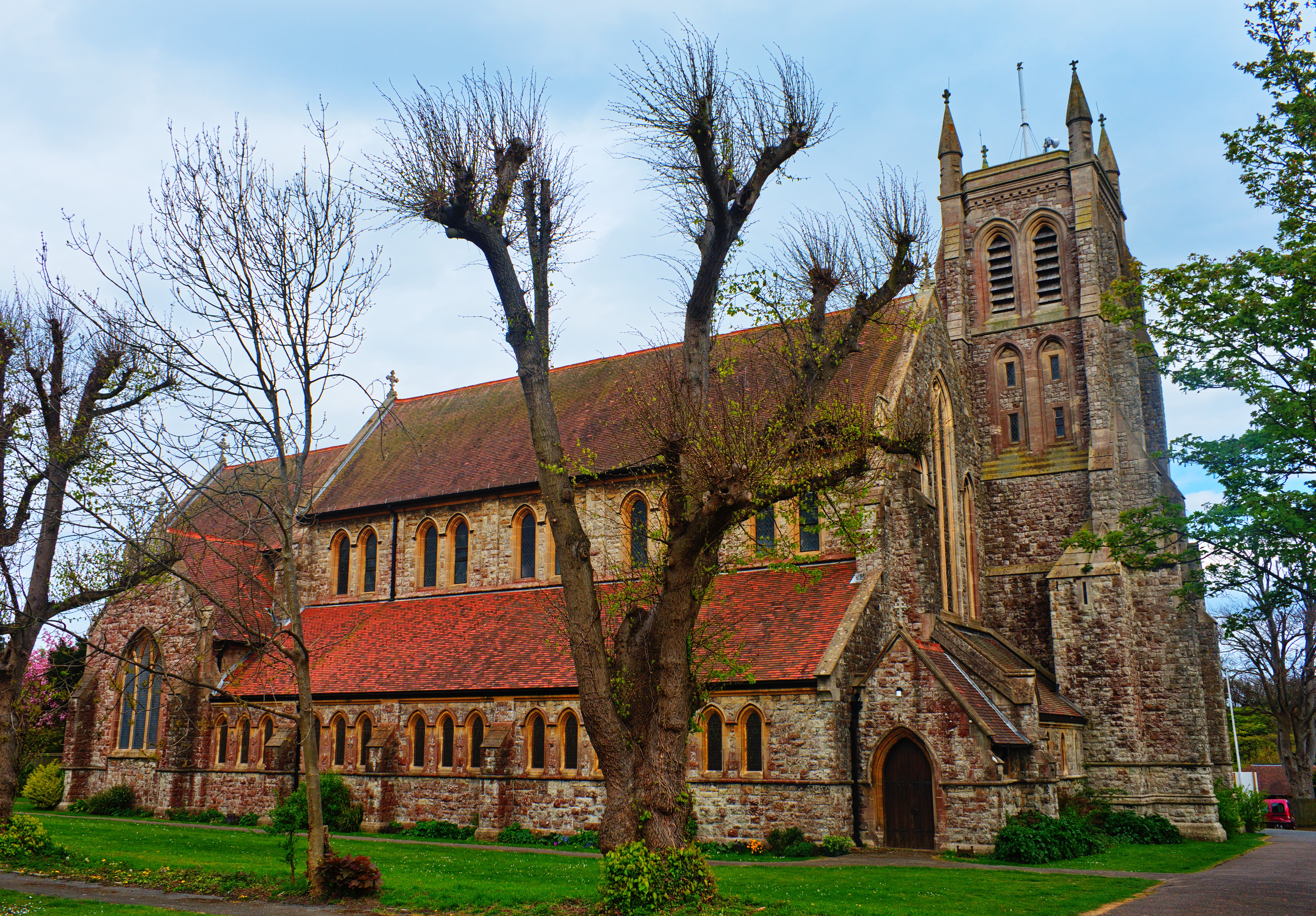
St Nicholas Church, Ringwould

St Nicholas Church is the Church of England parish church of the village of Ringwould in east Kent. A Grade I listed building, it was constructed in the...

Kingsdown, Dover

Kingsdown is a village on the English Channel coast of Kent. Parts of the village are built on or behind the shingle beach that runs north to Deal and...

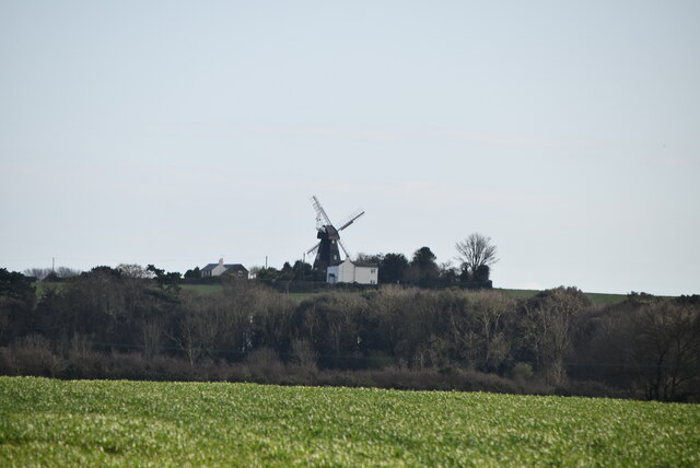
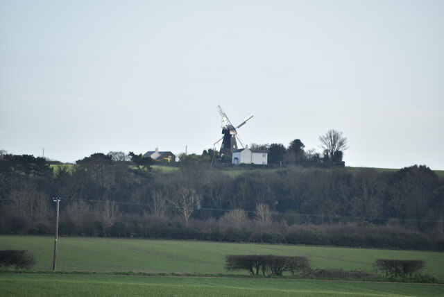
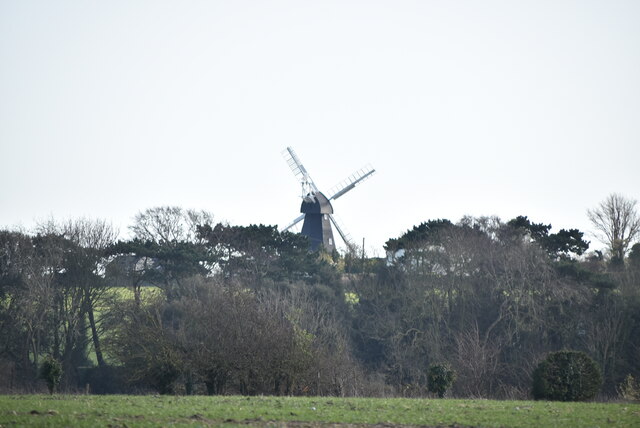
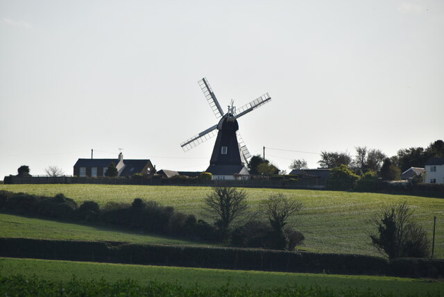
Ripple Mill, Ringwould

Ripple Windmill is a Grade II listed smock mill in Ringwould, Kent, England, that was built in Drellingore and moved to Ringwould in the early nineteenth...

Martin Mill

Martin Mill is a village in east Kent, England. It takes its name from the nearby village of Martin. Martin Mill railway station is on the Dover to Deal...

St Mary's Church, Walmer

The Church of Saint Mary the Virgin, commonly shortened to St Mary's, is a church in the Church of England parish of Walmer, Kent, England. == History... ==

Have you been to Barrows Hill?

Leave your review of Barrows Hill below (or comments, questions and feedback).