Black Hill

Hill, Mountain in Kent Dover

England

Black Hill

The Granary, Sutton Court Farm
The Granary, Sutton Court Farm Credit: N Chadwick

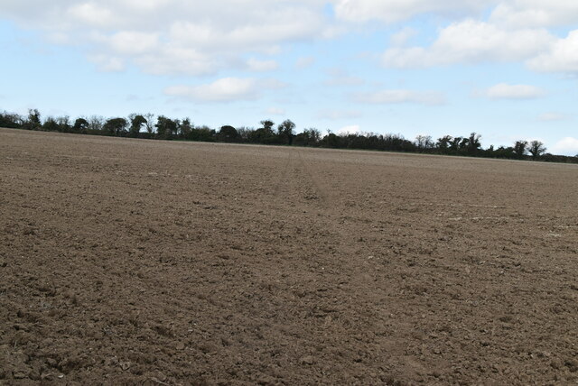
Black Hill is a prominent geological feature located in the county of Kent, England. As its name suggests, it is characterized by its dark coloration, which is a result of the prevalent presence of dense vegetation covering its slopes. Situated in the southeastern part of the county, Black Hill is part of the North Downs, a range of chalk hills that stretches across several counties in southern England.

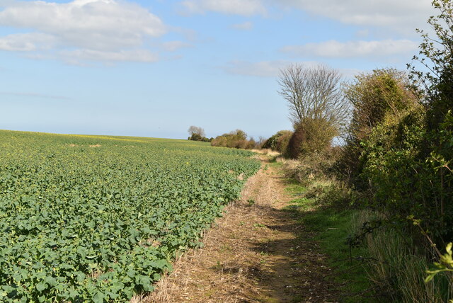
Rising to an elevation of approximately 250 meters (820 feet) above sea level, Black Hill offers stunning panoramic views of the surrounding area. Its summit is adorned with a mixture of grass and heather, providing a serene and picturesque setting for visitors. On a clear day, one can observe the expansive countryside, including lush green fields, quaint villages, and even glimpses of the English Channel in the distance.

The hill is a popular destination for hikers, nature enthusiasts, and photographers alike. Several footpaths and trails traverse its slopes, allowing visitors to explore the diverse flora and fauna that inhabit the area. Black Hill is particularly renowned for its rich biodiversity, with a variety of plant species, including wildflowers, ferns, and mosses, creating a vibrant tapestry of colors.

Additionally, the hill holds historical significance, as it is believed to have been a site of human activity dating back thousands of years. Archaeological evidence suggests that ancient settlements and burial mounds once occupied the hill, providing valuable insights into the region's past.

Overall, Black Hill in Kent offers a captivating blend of natural beauty, recreational opportunities, and historical intrigue, making it a must-visit destination for those seeking to immerse themselves in the enchanting landscape of southeastern England.

If you have any feedback on the listing, please let us know in the comments section below.

Black Hill Images

Images are sourced within 2km of 51.206717/1.3555293 or Grid Reference TR3450. Thanks to Geograph Open Source API. All images are credited.

The Granary, Sutton Court Farm
The Cabin
The Cabin
The Boot Grade II listed.
The Boot
Grade II listed.
Church of St Peter & St Paul A C12 church.
Grade II* listed. <span class="nowrap"><a title="https://historicengland.org.uk/listing/the-list/list-entry/1247673" rel="nofollow ugc noopener" href="https://historicengland.org.uk/listing/the-list/list-entry/1247673">Link</a><img style="margin-left:2px;" alt="External link" title="External link - shift click to open in new window" src="https://s1.geograph.org.uk/img/external.png" width="10" height="10"/></span>
Church of St Peter & St Paul
A C12 church. Grade II* listed. LinkExternal link
Church Hill
Church Hill
Church Hill
Church Hill
Church Hill
Church Hill
Field near Sutton
Field near Sutton
Bare soils
Bare soils
White Cliffs Country Trail The White Cliffs Trails were created in 1987 by Dover District Council to link the towns of Dover, Deal and Sandwich, going along the famous 'white cliffs' to the east of Dover to Deal with an inland return through the beautiful Kent countryside. A link from Deal to Northbourne via Sholden and a loop from Sandwich to Northbourne via Eastry provide a range of options.
The routes are marked on OS mapping but have no apparent current publications.
White Cliffs Country Trail
The White Cliffs Trails were created in 1987 by Dover District Council to link the towns of Dover, Deal and Sandwich, going along the famous 'white cliffs' to the east of Dover to Deal with an inland return through the beautiful Kent countryside. A link from Deal to Northbourne via Sholden and a loop from Sandwich to Northbourne via Eastry provide a range of options. The routes are marked on OS mapping but have no apparent current publications.
Ploughed field
Ploughed field
Farmland near Sutton
White Cliffs Country Trail The White Cliffs Trails were created in 1987 by Dover District Council to link the towns of Dover, Deal and Sandwich, going along the famous 'white cliffs' to the east of Dover to Deal with an inland return through the beautiful Kent countryside. A link from Deal to Northbourne via Sholden and a loop from Sandwich to Northbourne via Eastry provide a range of options.
The routes are marked on OS mapping but have no apparent current publications.
White Cliffs Country Trail
The White Cliffs Trails were created in 1987 by Dover District Council to link the towns of Dover, Deal and Sandwich, going along the famous 'white cliffs' to the east of Dover to Deal with an inland return through the beautiful Kent countryside. A link from Deal to Northbourne via Sholden and a loop from Sandwich to Northbourne via Eastry provide a range of options. The routes are marked on OS mapping but have no apparent current publications.
Footpath along field boundary
Sutton Vale Country Club
Cranswick Cottages
Cranswick Cottages
Show me another place!

Black Hill is located at Grid Ref: TR3450 (Lat: 51.206717, Lng: 1.3555293)

Administrative County: Kent

District: Dover

Police Authority: Kent

What 3 Words

///earful.flashing.rollover. Near Deal, Kent

Nearby Locations

Black Hill

Related Wikis

Great Mongeham

Great Mongeham is a village and civil parish in the Dover District of east Kent, England, on the outskirts of Deal. Its name is derived from Mundelingham...

Ripple, Kent

Ripple, also known as 'Ripple Vale', is a village and civil parish in the Dover District of Kent, England. Ripple parish church is dedicated to St Mary...

Sutton, Kent

Sutton is a village and civil parish near Dover in Kent, England. In 1935 this village became a parish when the small settlements of Studdal, Sutton, Ashley...

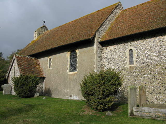
St Peter's and St Paul's Church, Sutton By Dover

All Saints is a parish church in Sutton, Kent. It was begun in the 12th century and is a Grade II listed building.The south porch and vestry was added...

Mill Hill Anglo-Saxon cemetery

Mill Hill Anglo-Saxon cemetery is a place of burial located close to the town of Deal in Kent, South-East England. Belonging to the Middle Anglo-Saxon...

Northbourne, Kent

Northbourne is a village and civil parish near Deal in Kent, England. It has a public house, The Hare and Hounds, a primary school and is the home of the...

Walmer railway station

Walmer railway station serves Walmer in Kent, England. The station and all trains serving it are operated by Southeastern. == Facilities == The station...

New Mill, Northbourne

New Mill is a Grade II listed smock mill in Northbourne, Kent, England that was built in 1848 and which has been converted to residential accommodation...

Nearby Amenities

Located within 500m of 51.206717,1.3555293
The data included in this document is from www.openstreetmap.org. The data is made available under ODbL.

Have you been to Black Hill?

Leave your review of Black Hill below (or comments, questions and feedback).