Beacon Hill
Hill, Mountain in Norfolk North Norfolk
England
Beacon Hill

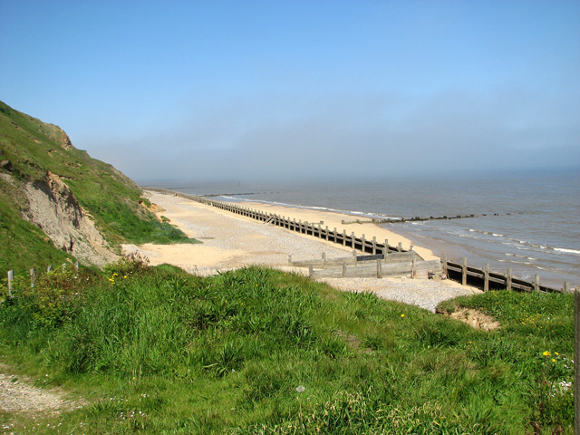
Beacon Hill is a prominent hill located in Norfolk, England. Standing at a height of approximately 103 meters, it is considered the highest point in the county. The hill is situated near the village of West Runton, approximately three miles west of Cromer, a popular coastal town.
Beacon Hill is part of the Norfolk Coast Area of Outstanding Natural Beauty, offering breathtaking panoramic views of the surrounding countryside and the North Sea. At the summit, on clear days, visitors can enjoy vistas that stretch as far as the Norfolk Broads and the Lincolnshire Wolds.
The hill gets its name from the historical use of beacon fires, which were lit on its peak to warn of potential invasions during medieval times. Today, a stone obelisk stands as a monument to this history. The area surrounding the hill is also rich in archaeological finds, with evidence of prehistoric settlements and Roman artifacts discovered in the vicinity.
Beacon Hill is a popular destination for outdoor enthusiasts and nature lovers. The surrounding heathland is home to a diverse range of wildlife, including rare bird species, butterflies, and wildflowers. The hill is crisscrossed by footpaths and bridleways, providing opportunities for hiking, horse riding, and birdwatching.
Visitors to Beacon Hill can also explore the nearby West Runton village, which features charming local shops, cafes, and a beautiful beach. The hill offers a peaceful retreat from the hustle and bustle of nearby towns, making it an ideal spot to relax and soak in the natural beauty of Norfolk.
If you have any feedback on the listing, please let us know in the comments section below.
Beacon Hill Images
Images are sourced within 2km of 52.892882/1.4007721 or Grid Reference TG2838. Thanks to Geograph Open Source API. All images are credited.


Beacon Hill is located at Grid Ref: TG2838 (Lat: 52.892882, Lng: 1.4007721)
Administrative County: Norfolk
District: North Norfolk
Police Authority: Norfolk
What 3 Words
///overdrive.toasters.juggles. Near Mundesley, Norfolk
Nearby Locations
Related Wikis
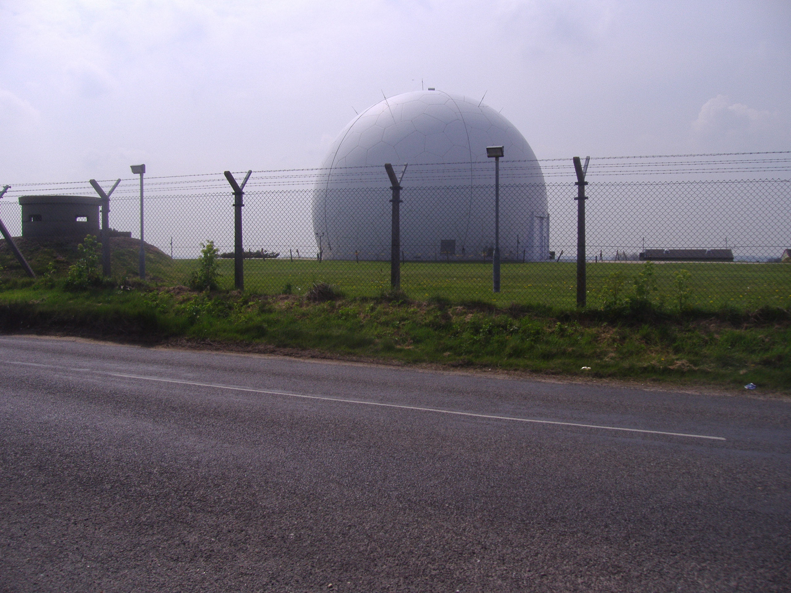
RAF Trimingham
Remote Radar Head Trimingham or RRH Trimingham is a former TPS-77 radar station situated on the coast in the English county of Norfolk. The site is located...
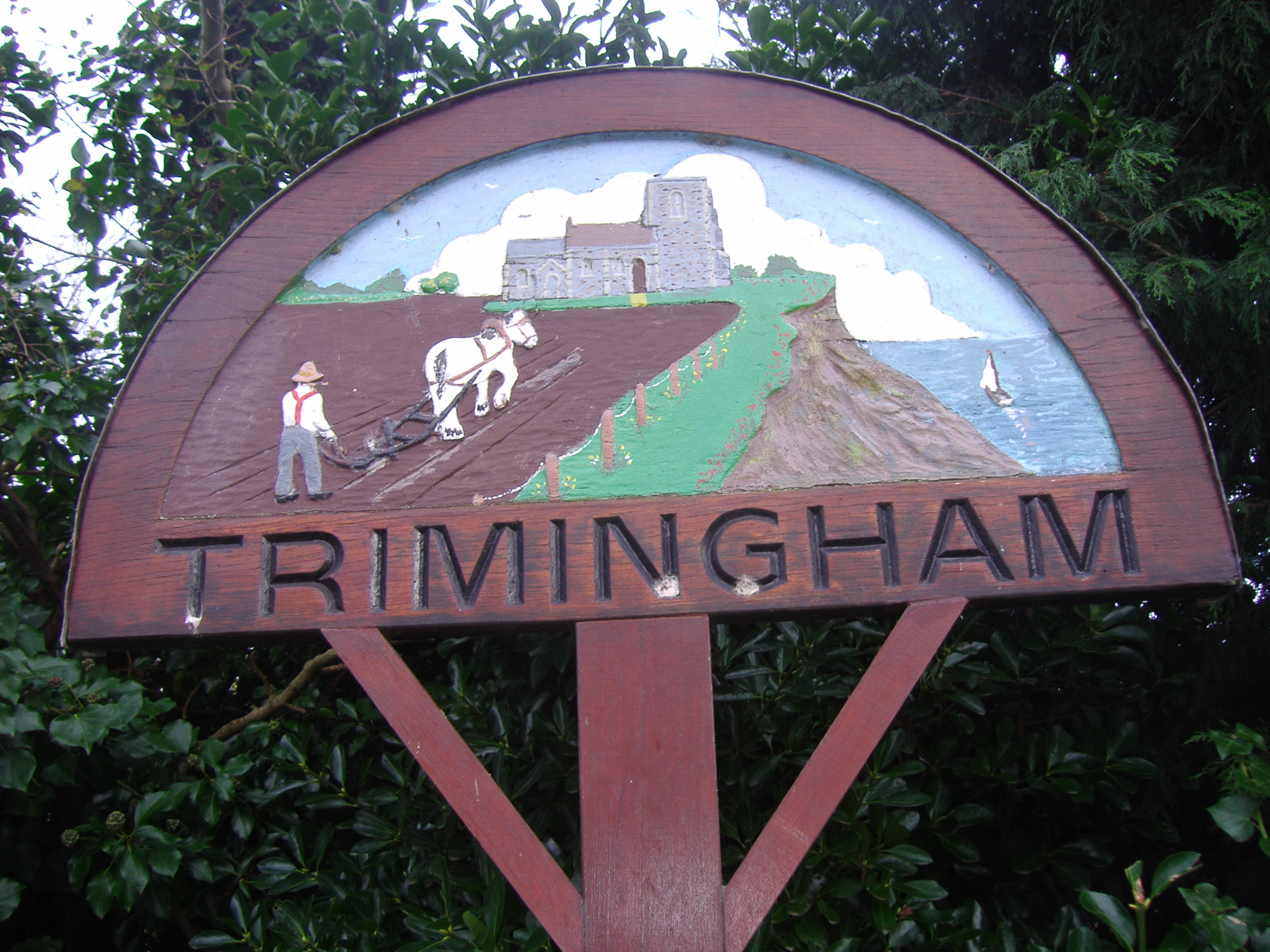
Trimingham
Trimingham is a coastal village and a civil parish in the North Norfolk district of Norfolk, England. The village is 5 miles (8 km) north of North Walsham...

Trimingham railway station
Trimingham railway station was a station in Trimingham, Norfolk on the Norfolk and Suffolk Joint Railway line between Cromer Beach and North Walsham. It...

Gimingham
Gimingham is a village and civil parish in the English county of Norfolk. Gimingham has no shops, but has a Church, a pond and a preserved Water Mill....
Nearby Amenities
Located within 500m of 52.892882,1.4007721Have you been to Beacon Hill?
Leave your review of Beacon Hill below (or comments, questions and feedback).