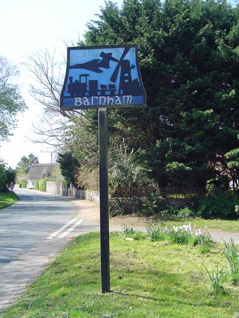
Barnham

Settlement in Suffolk West Suffolk

England

Barnham

Farm on Station Road, Barnham
Farm on Station Road, Barnham Credit: David Howard

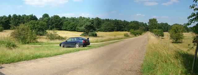
Barnham is a quaint village located in the county of Suffolk, in the eastern part of England. Situated approximately 12 miles northeast of Bury St Edmunds, Barnham is a peaceful and picturesque settlement surrounded by beautiful countryside.

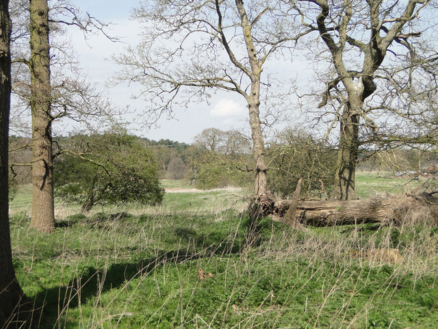
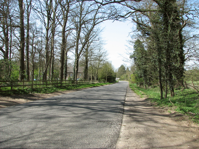
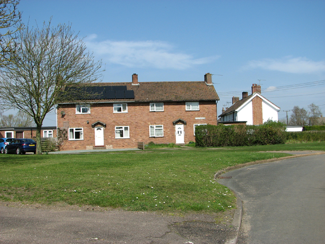
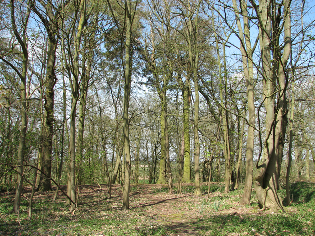
With a population of around 200 residents, Barnham exudes a strong sense of community and offers a tranquil escape from the bustle of larger towns and cities. The village is known for its stunning rural landscapes, characterized by rolling hills, charming meadows, and ancient woodlands.

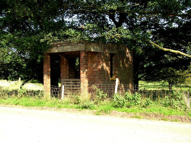
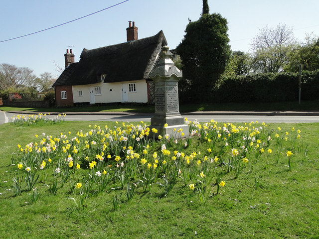
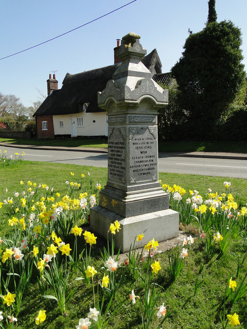
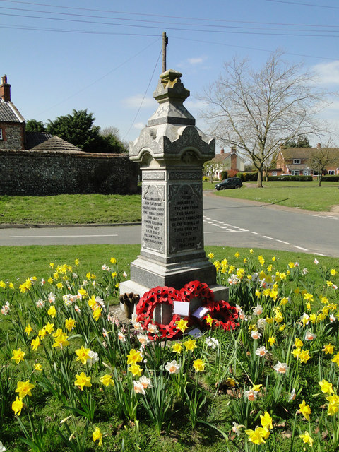
Historically, Barnham is rich in heritage, with evidence of human settlement dating back to the Roman era. The village is home to several notable landmarks, including the Church of St. Gregory, a Grade I listed building that dates back to the 12th century.

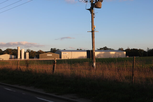
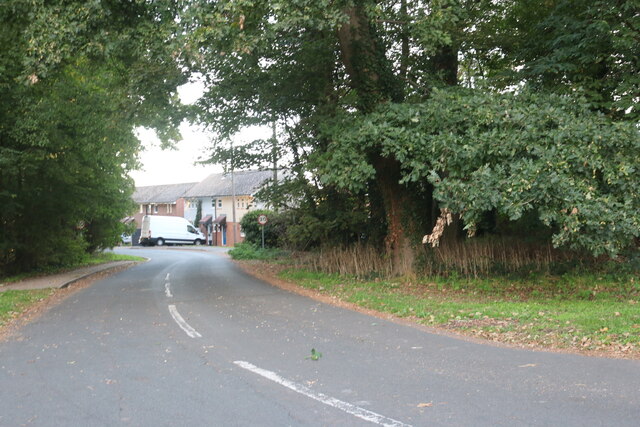
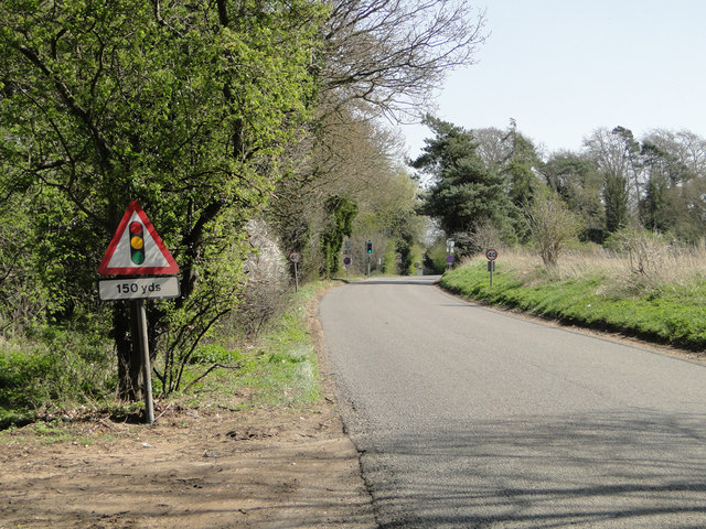
Despite its small size, Barnham benefits from a range of amenities for its residents. These include a village hall, a primary school, and a local pub that serves as a social hub for the community. Additionally, the village is well-connected to neighboring towns and cities via a network of roads, making it easily accessible for both residents and visitors.

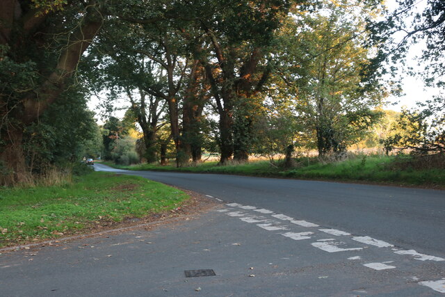
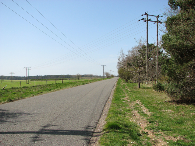
In terms of recreational activities, Barnham offers ample opportunities for outdoor pursuits. The surrounding countryside provides excellent options for walking, cycling, and horse riding, allowing residents to fully immerse themselves in the natural beauty of their surroundings.

Overall, Barnham is a delightful village that offers a tranquil and idyllic lifestyle, making it a desirable place to live or visit for those seeking a peaceful retreat in the heart of Suffolk.

If you have any feedback on the listing, please let us know in the comments section below.
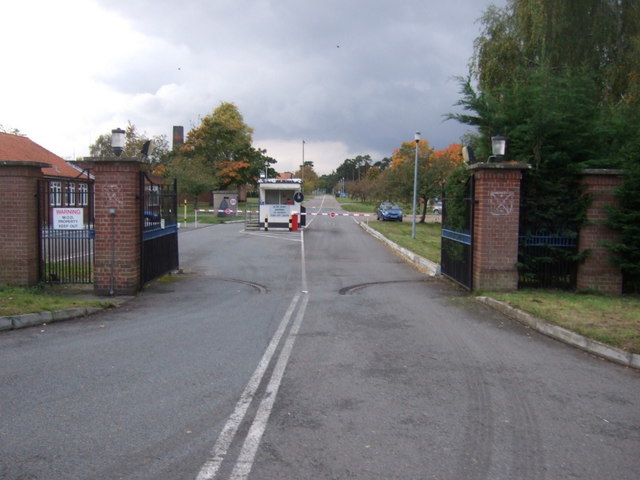
Barnham Images

Images are sourced within 2km of 52.378571/0.74719947 or Grid Reference TL8779. Thanks to Geograph Open Source API. All images are credited.

Farm on Station Road, Barnham
Salmond Drive, Barnham
Barnham Road at the junction of Salmond Drive
Military building, Barnham The small Suffolk village of Barnham has been the home to several military establishments. This was evidently some form of guardhouse or checkpoint (officially a picket apparently) on Station Road, leading to the Little Heath Forward Filling Station. It is opposite Triangle Covert. 

For more details (a little out of date) 
<span class="nowrap"><a title="http://www.subbrit.org.uk/sb-sites/sites/l/little_heath_forward_filling_depot/index.shtml" rel="nofollow ugc noopener" href="http://www.subbrit.org.uk/sb-sites/sites/l/little_heath_forward_filling_depot/index.shtml">Link</a><img style="margin-left:2px;" alt="External link" title="External link - shift click to open in new window" src="https://s1.geograph.org.uk/img/external.png" width="10" height="10"/></span>
Military building, Barnham
The small Suffolk village of Barnham has been the home to several military establishments. This was evidently some form of guardhouse or checkpoint (officially a picket apparently) on Station Road, leading to the Little Heath Forward Filling Station. It is opposite Triangle Covert. For more details (a little out of date) LinkExternal link
Road to Little Heath military site, Barnham This is officially Station Road, although the station was far away at the northern end of it. It leads to the Little Heath military site, used for tank testing in WW1, chemical weapon storage in WW2 and after, then (illegal) storage of old tyres, then a tank museum, and now a company making wooden shavings for horse bedding. This photo was taken from the gate to the site, although the fence on the right encloses a larger ex-military area on that side, full of mysterious earthworks. On the left a dirt track turns off to curve round the western side of the site.

My MG ZS180 makes another Geograph appearance. 

The field on the left is designated as Open Access but the vegetation growth doesn't make access easy, suggesting it is not actually used.
Road to Little Heath military site, Barnham
This is officially Station Road, although the station was far away at the northern end of it. It leads to the Little Heath military site, used for tank testing in WW1, chemical weapon storage in WW2 and after, then (illegal) storage of old tyres, then a tank museum, and now a company making wooden shavings for horse bedding. This photo was taken from the gate to the site, although the fence on the right encloses a larger ex-military area on that side, full of mysterious earthworks. On the left a dirt track turns off to curve round the western side of the site. My MG ZS180 makes another Geograph appearance. The field on the left is designated as Open Access but the vegetation growth doesn't make access easy, suggesting it is not actually used.
Barnham village sign Village signs are typically placed along the principal road or in a prominent location such as a village green or close by the church. The design often depicts a particularly feature of the village or a scene from its history, heritage, or culture. They are typically made of wood or metal or a combination of both, the designs are often made by the local community.
Although they do appear in villages and towns all over the country they are more prominent in East Anglia than elsewhere in the country.
Barnham village sign
Village signs are typically placed along the principal road or in a prominent location such as a village green or close by the church. The design often depicts a particularly feature of the village or a scene from its history, heritage, or culture. They are typically made of wood or metal or a combination of both, the designs are often made by the local community. Although they do appear in villages and towns all over the country they are more prominent in East Anglia than elsewhere in the country.
Traffic lights ahead on the A134 at Barnham
Fallen tree and meadowland behind
The war Memorial at Barnham There are 19 names for WW1 and 3 for WW2 which can be seen here: <a title="https://www.geograph.org.uk/photo/4430279" href="https://www.geograph.org.uk/photo/4430279">Link</a>
The war Memorial at Barnham
There are 19 names for WW1 and 3 for WW2 which can be seen here: Link
The War Memorial at Barnham There are 19 names for WW1 and 3 for WW2 which can be seen here: <a title="https://www.geograph.org.uk/photo/4430279" href="https://www.geograph.org.uk/photo/4430279">Link</a>
The War Memorial at Barnham
There are 19 names for WW1 and 3 for WW2 which can be seen here: Link
High-level Braithwaite water tank by Barnham Camp RAF Barnham near Thetford, also known as the Barnham Camp,  was originally constructed to serve as a bomb dump and during WW2 it had been used for storing chemical weapons such as mustard gas. Part of the site still functions as a satellite unit to nearby RAF Honington. 

A specialist storage area was constructed in 1954, intended to house Britain's first production nuclear free fall bomb, called "Blue Danube". Each one of these bombs was 7.3 metres long  and weighed 10,000 pounds.   The site formed  part of No. 94 Maintenance Sub Unit which was based at RAF Barnham, with its main purpose (along with its sister site at RAF Faldingworth in Lincolnshire serving the bomber airfields in the north) being to serve the RAF's soon to be formed V-bomber squadrons. RAF Barnham  supported No. 3 Group, Bomber Command, and included RAF Wittering, RAF Marham, RAF Cottesmore and RAF Honington.   The base also served as a maintenance depot for the weapons and held a stockpile intended to be used in a 'second-strike' scenario.

The bombs' fissile cores were kept in 55 small fissile core storage igloos, more commonly referred to as "hutches".  RAF Barnham had a total capacity of storing 64 cores (either plutonium or cobalt), kept in stainless steel storage containers.  Each of the buildings containing a fissile store safe was secured by a wooden door reinforced by a sheet of steel.  An electrical door contact sent a signal to the control room to indicate whether the door was open or closed.  There are four distinct areas for storing fissile cores, all located within the danger area.  

RAF Barnham when active was probably one of the most secure locations in the UK.  Access onto the site was via two electric sliding gates, one each at the outer and inner fence, and a split- middle wire gate acting as a vehicle trap for anyone driving in or out, in-between.   In addition to the standard outer fence and a picket post at the main gate there was an inner perimeter fence, and within it an inner concrete wall with another picket post.  The area between these two fences was classed as "sterile" and patrolled by RAF Police (RAFP) dog handlers.  It contained trip wires and flares, placed on the ground as well as on top of the wall, to alert the guard force to intruders.  Pole-mounted lighting was positioned at regular intervals. 

The RAFP station staff manned the five watch towers each with a searchlight on top, believed to have replaced wooden structures in the late 1959/early 1960 and located within the "sterile" zone, on the points of the pentagonal fence.  A field telephone was installed at each tower.  

The buildings in the danger area were grouped  around three large and almost identical non-nuclear component stores housing the high-explosive part of the bomb and its outer casing.  Two of these stores remain in place today and are currently in industrial use. The area contained within the danger area  is now a scheduled monument, containing many listed buildings due to their unique nature and grouping.

By the early 1960s the facility had become obsolete and the last nuclear weapons are believed to have been removed by April 1963. In 1965 the site was purchased by Mr Keith Eldred, who still owns it and thanks to whom almost all of the buildings (some now housing businesses on the Gorse Industrial Estate) have survived until today. 

For much more information go to:
<span class="nowrap"><a title="http://www.gorseindustrialestate.co.uk/military-history.html" rel="nofollow ugc noopener" href="http://www.gorseindustrialestate.co.uk/military-history.html">Link</a><img style="margin-left:2px;" alt="External link" title="External link - shift click to open in new window" src="https://s1.geograph.org.uk/img/external.png" width="10" height="10"/></span> and <span class="nowrap"><a title="http://rafbarnham-nss.weebly.com/history.html" rel="nofollow ugc noopener" href="http://rafbarnham-nss.weebly.com/history.html">Link</a><img style="margin-left:2px;" alt="External link" title="External link - shift click to open in new window" src="https://s1.geograph.org.uk/img/external.png" width="10" height="10"/></span> and <span class="nowrap"><a title="http://services.english-heritage.org.uk/ResearchReportsPdfs/048_2011WEB.pdf" rel="nofollow ugc noopener" href="http://services.english-heritage.org.uk/ResearchReportsPdfs/048_2011WEB.pdf">Link</a><img style="margin-left:2px;" alt="External link" title="External link - shift click to open in new window" src="https://s1.geograph.org.uk/img/external.png" width="10" height="10"/></span>
High-level Braithwaite water tank by Barnham Camp
RAF Barnham near Thetford, also known as the Barnham Camp, was originally constructed to serve as a bomb dump and during WW2 it had been used for storing chemical weapons such as mustard gas. Part of the site still functions as a satellite unit to nearby RAF Honington. A specialist storage area was constructed in 1954, intended to house Britain's first production nuclear free fall bomb, called "Blue Danube". Each one of these bombs was 7.3 metres long and weighed 10,000 pounds. The site formed part of No. 94 Maintenance Sub Unit which was based at RAF Barnham, with its main purpose (along with its sister site at RAF Faldingworth in Lincolnshire serving the bomber airfields in the north) being to serve the RAF's soon to be formed V-bomber squadrons. RAF Barnham supported No. 3 Group, Bomber Command, and included RAF Wittering, RAF Marham, RAF Cottesmore and RAF Honington. The base also served as a maintenance depot for the weapons and held a stockpile intended to be used in a 'second-strike' scenario. The bombs' fissile cores were kept in 55 small fissile core storage igloos, more commonly referred to as "hutches". RAF Barnham had a total capacity of storing 64 cores (either plutonium or cobalt), kept in stainless steel storage containers. Each of the buildings containing a fissile store safe was secured by a wooden door reinforced by a sheet of steel. An electrical door contact sent a signal to the control room to indicate whether the door was open or closed. There are four distinct areas for storing fissile cores, all located within the danger area. RAF Barnham when active was probably one of the most secure locations in the UK. Access onto the site was via two electric sliding gates, one each at the outer and inner fence, and a split- middle wire gate acting as a vehicle trap for anyone driving in or out, in-between. In addition to the standard outer fence and a picket post at the main gate there was an inner perimeter fence, and within it an inner concrete wall with another picket post. The area between these two fences was classed as "sterile" and patrolled by RAF Police (RAFP) dog handlers. It contained trip wires and flares, placed on the ground as well as on top of the wall, to alert the guard force to intruders. Pole-mounted lighting was positioned at regular intervals. The RAFP station staff manned the five watch towers each with a searchlight on top, believed to have replaced wooden structures in the late 1959/early 1960 and located within the "sterile" zone, on the points of the pentagonal fence. A field telephone was installed at each tower. The buildings in the danger area were grouped around three large and almost identical non-nuclear component stores housing the high-explosive part of the bomb and its outer casing. Two of these stores remain in place today and are currently in industrial use. The area contained within the danger area is now a scheduled monument, containing many listed buildings due to their unique nature and grouping. By the early 1960s the facility had become obsolete and the last nuclear weapons are believed to have been removed by April 1963. In 1965 the site was purchased by Mr Keith Eldred, who still owns it and thanks to whom almost all of the buildings (some now housing businesses on the Gorse Industrial Estate) have survived until today. For much more information go to: LinkExternal link and LinkExternal link and LinkExternal link
View along Elveden Road
The War Memorial at Barnham The names on the Memorial for WW1 are: William Clarke, John Catchpole, Frederick Harold Davey, Sidney Charles Davey, John Davey, Edward Debenham, George Gaut, Edgar Gould, William Palfrey, Sidney Charles Pryke, Arthur James Pryke, Herbert Victor Rampley, Sidney Rampley,  Harry Rumsey, Albert Edward Sayer, Alfred William Turner, William Vincent. Names for WW2 are: Gerald Thomas Chamberlain, Arthur Lewis Price, Walter Edward Steward.
The War Memorial at Barnham
The names on the Memorial for WW1 are: William Clarke, John Catchpole, Frederick Harold Davey, Sidney Charles Davey, John Davey, Edward Debenham, George Gaut, Edgar Gould, William Palfrey, Sidney Charles Pryke, Arthur James Pryke, Herbert Victor Rampley, Sidney Rampley, Harry Rumsey, Albert Edward Sayer, Alfred William Turner, William Vincent. Names for WW2 are: Gerald Thomas Chamberlain, Arthur Lewis Price, Walter Edward Steward.
View along Station Road
Houses in Barnham village
Barnham village sign (detail) Not quite sure what the aircraft refers to. It could be RAF Honington or the bomb dump at Barnham Camp, perhaps both. The windmill, built for the Duke of Grafton in 1821 is now part of a private dwelling. The train recalls the days of The Bury and Thetford Railway Company opened on 1st March 1876. The last passenger train left the station in June 1953 and finally closed altogether seven years later.
Barnham village sign (detail)
Not quite sure what the aircraft refers to. It could be RAF Honington or the bomb dump at Barnham Camp, perhaps both. The windmill, built for the Duke of Grafton in 1821 is now part of a private dwelling. The train recalls the days of The Bury and Thetford Railway Company opened on 1st March 1876. The last passenger train left the station in June 1953 and finally closed altogether seven years later.
On the edge of Barnham Heath
Thatched cottage on Water Lane, Barnham
Show me another place!

Barnham is located at Grid Ref: TL8779 (Lat: 52.378571, Lng: 0.74719947)

Administrative County: Suffolk

District: West Suffolk

Police Authority: Suffolk

What 3 Words

///procures.piled.maddening. Near Thetford, Norfolk

Nearby Locations

Barnham

Related Wikis

Barnham, Suffolk

Barnham is a village and civil parish in the West Suffolk district of the English county of Suffolk about 3 miles (4.8 km) south of Thetford and 9 miles...

Barnham Windmill, Suffolk

Barnham Mill is a tower mill at Barnham, Suffolk, England which has been converted to residential accommodation. == History == Barnham Mill was built for...

Brandon Rural District

Brandon was a rural district in Suffolk, England from 1894 to 1935. The district was created in 1894 as the Suffolk part of the Thetford rural sanitary...

Barnham railway station (Suffolk)

Barnham railway station is a former station in Barnham, Suffolk on a now closed line between Thetford and Bury St Edmunds. It was located close to the...

Barnham Heath

Barnham Heath is a 78.6-hectare (194-acre) biological Site of Special Scientific Interest near Barnham, a village south of Thetford in Suffolk. It is a...

RAF Barnham

RAF Barnham (also called Barnham Camp) is a Royal Air Force station situated in the English county of Suffolk 2 miles (3.2 km) south of the Norfolk town...

Little Heath, Barnham

Little Heath, Barnham lies south-west of Barnham, Suffolk. Much of the area is now a Site of Special Scientific Interest, which almost surrounds the former...

Barnham Cross Common

Barnham Cross Common is a 69.1-hectare (171-acre) biological Site of Special Scientific Interest on the southern outskirts of Thetford in Norfolk. It is...

Related Videos

journey towards nunnery lake Thetford #uk #foryou #england #thetford #adventure #vikingshistory #new

a short morning adventure trip to nunnery lake to capture some wildlife creatures at Thetford a country side of England . a very ...

Nunnery Lake | Thetford | Frosty Morning | Sunrise 4K

THETFORD#NORFOLK#FROSTY#DRONE#NUNNERY#LAKE#2022#SUNRISE Hello everyone today beautiful morning over ...

Nearby Amenities

Located within 500m of 52.378571,0.74719947
Traffic Signals
Lat/Long: 52.3786256/0.7405957
Barnham
Created By: Potlatch 0.10b
Place: village
Wikidata: Q946848
Lat/Long: 52.3799406/0.7528073
Mill Lane
Naptan AtcoCode: 390020366
Naptan Bearing: E
Naptan BusStopType: CUS
Naptan CommonName: Mill Lane
Naptan Indicator: adj
Naptan Landmark: Mill Lane
Naptan NaptanCode: sufjdtdj
Naptan Street: The Street
Naptan Verified: no
Source: naptan_import
Lat/Long: 52.3781684/0.7429849
Mill Lane
Naptan AtcoCode: 390020367
Naptan Bearing: W
Naptan BusStopType: CUS
Naptan CommonName: Mill Lane
Naptan Indicator: opp
Naptan Landmark: Mill Lane
Naptan NaptanCode: sufjdtdm
Naptan Street: The Street
Naptan Verified: no
Source: naptan_import
Lat/Long: 52.378116/0.742765
Bus Stop
Naptan AtcoCode: 390050028
Naptan Bearing: SW
Naptan CommonName: School
Naptan Indicator: o/s
Naptan Landmark: Bus Shelter
Naptan NaptanCode: sufgdatj
Naptan Street: The Street
Shelter: yes
Source: naptan_import;survey
Lat/Long: 52.3776487/0.7433421
Bus Stop
Naptan AtcoCode: 390050029
Naptan Bearing: NE
Naptan BusStopType: CUS
Naptan CommonName: School
Naptan Indicator: opp
Naptan Landmark: Bus Shelter
Naptan NaptanCode: sufgdatm
Naptan Street: The Street
Public Transport: platform
Source: naptan_import
Lat/Long: 52.3777644/0.743318
Post Box
Collection Times: Mo-Fr 16:00; Sa 09:00
Post Box Type: lamp
Ref: IP24 3202
Royal Cypher: EIIR
Royal Cypher Wikidata: Q33102113
Lat/Long: 52.3799312/0.7471708
Historic: memorial
Lat/Long: 52.3779392/0.7437226
Barnham
Man Made: village_sign
Lat/Long: 52.3786324/0.7470056
Recycling
Recycling Glass: yes
Recycling Newspaper: yes
Lat/Long: 52.3768602/0.7417031
Waste Basket
Waste: dog_excrement
Lat/Long: 52.378103/0.7435699
East Farm
Place: farm
Source: NLS-OS-1st_Series
Lat/Long: 52.3768438/0.7514686
Defibrillator
Access: yes
Defibrillator Location: On exterior wall of Barnham Village Hall, facing Mill Lane.
Emergency: defibrillator
Ref GB The Circuit: C965A4A9-F776-4077-91A2-ADD60146E3AE
Lat/Long: 52.3770353/0.7423209
Public Bookcase
Booth: K6
Disused Amenity: telephone
Man Made: telephone_box
Public Bookcase Type: phone_box
Lat/Long: 52.379255/0.7435694
Give Way
Lat/Long: 52.3786238/0.7471803
Give Way
Lat/Long: 52.3786005/0.7468095
Bench
Backrest: yes
Seats: 3
Lat/Long: 52.3786766/0.747014
The data included in this document is from www.openstreetmap.org. The data is made available under ODbL.

Have you been to Barnham?

Leave your review of Barnham below (or comments, questions and feedback).