Boughton Hill

Hill, Mountain in Kent Swale

England

Boughton Hill

Horselees Road, by Meadow Wood Looking towards Boughton-under-Blean
Horselees Road, by Meadow Wood Credit: pam fray

Boughton Hill, located in Kent, England, is a prominent hill that forms part of the North Downs range. Rising to an elevation of approximately 196 meters (643 feet), it is a popular destination for outdoor enthusiasts and nature lovers alike. The hill is situated near the village of Boughton under Blean, just a few miles southwest of the city of Canterbury.

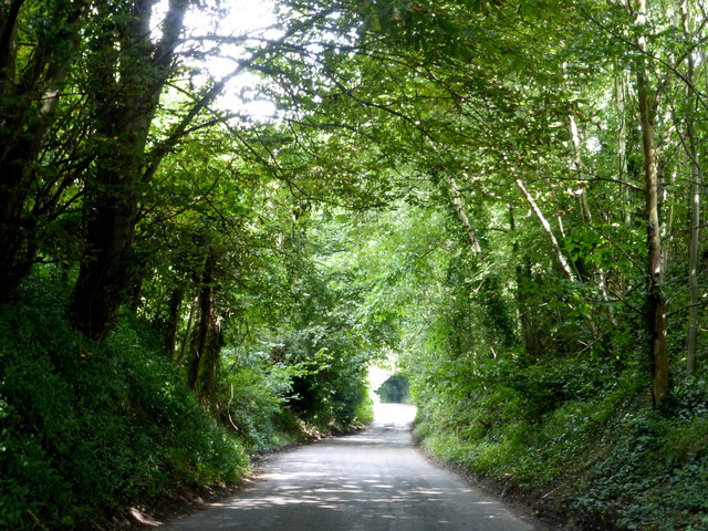
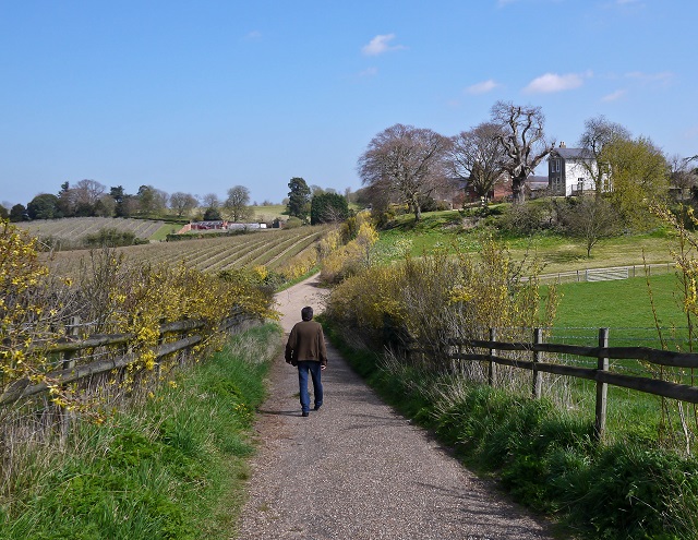
Boughton Hill is characterized by its rolling, grassy slopes, which provide stunning panoramic views of the surrounding countryside. The summit is adorned with a small copse of trees, adding to the scenic beauty of the area. On a clear day, visitors can enjoy vistas that stretch as far as the coastline, the city of Canterbury, and the neighboring countryside.

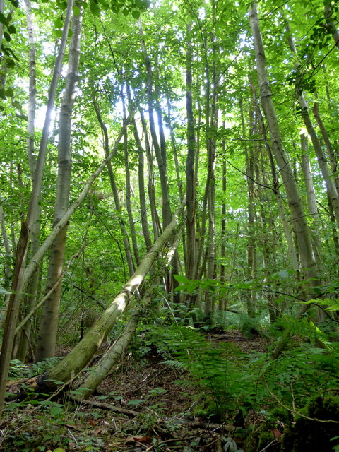
The hill is a designated Area of Outstanding Natural Beauty (AONB), and its diverse flora and fauna make it an important site for conservation. It boasts a rich variety of plant species, including rare orchids, as well as a wide range of wildlife, including birds, butterflies, and small mammals.

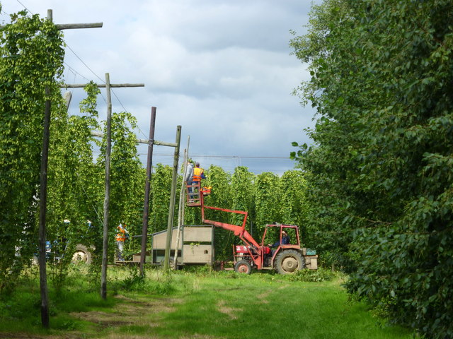
Boughton Hill offers an extensive network of footpaths and bridleways, making it an ideal location for walkers, hikers, and cyclists. The hill is often used as a starting point for exploring the North Downs Way, a long-distance footpath that stretches across the North Downs.

Overall, Boughton Hill is a cherished natural landmark in Kent, renowned for its stunning vistas, diverse ecosystems, and recreational opportunities. It attracts visitors from near and far, who come to immerse themselves in its tranquil beauty and enjoy the wonders of the English countryside.

If you have any feedback on the listing, please let us know in the comments section below.

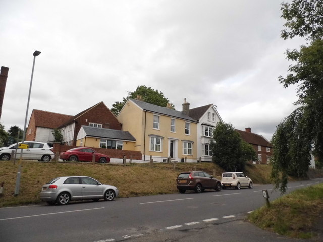
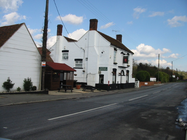
Boughton Hill Images

Images are sourced within 2km of 51.291656/0.97744628 or Grid Reference TR0758. Thanks to Geograph Open Source API. All images are credited.

Horselees Road, by Meadow Wood Looking towards Boughton-under-Blean
Horselees Road, by Meadow Wood
Looking towards Boughton-under-Blean
Meadow Wood, near Boughton-under-Blean Viewed from Horselees Road.
Meadow Wood, near Boughton-under-Blean
Viewed from Horselees Road.
Hop fields, Boughton-under-Blean Situated on the south side of the A2 road from Faversham to Canterbury. It is now hop picking time and Faversham Hop Festival is about to begin.
Hop fields, Boughton-under-Blean
Situated on the south side of the A2 road from Faversham to Canterbury. It is now hop picking time and Faversham Hop Festival is about to begin.
Hops in a field in Boughton-under-Blean Situated on the south side of the A2 road from Faversham to Canterbury. It is now hop picking time and Faversham Hop Festival is about to begin.
Hops in a field in Boughton-under-Blean
Situated on the south side of the A2 road from Faversham to Canterbury. It is now hop picking time and Faversham Hop Festival is about to begin.
Hop picking, modern style. Boughton-under-Blean Situated on the south side of the A2 road from Faversham to Canterbury. Hop picking is now under way and Faversham Hop Festival is about to begin.
Hop picking, modern style. Boughton-under-Blean
Situated on the south side of the A2 road from Faversham to Canterbury. Hop picking is now under way and Faversham Hop Festival is about to begin.
'The Bounds' From Bounds Lane
'The Bounds'
From Bounds Lane
Ordnance Survey Flush Bracket S6173 This can be found on the roadside wall of the former primary school in Dunkirk.
For more detail see : <span class="nowrap"><a title="http://www.bench-marks.org.uk/bm19720" rel="nofollow ugc noopener" href="http://www.bench-marks.org.uk/bm19720">Link</a><img style="margin-left:2px;" alt="External link" title="External link - shift click to open in new window" src="https://s1.geograph.org.uk/img/external.png" width="10" height="10"/></span>
Ordnance Survey Flush Bracket S6173
This can be found on the roadside wall of the former primary school in Dunkirk. For more detail see : LinkExternal link
Ordnance Survey Flush Bracket S6174 This can be found on the wall of the Primary School in Boughton Street.
For more detail see : <span class="nowrap"><a title="http://www.bench-marks.org.uk/bm19721" rel="nofollow ugc noopener" href="http://www.bench-marks.org.uk/bm19721">Link</a><img style="margin-left:2px;" alt="External link" title="External link - shift click to open in new window" src="https://s1.geograph.org.uk/img/external.png" width="10" height="10"/></span>
Ordnance Survey Flush Bracket S6174
This can be found on the wall of the Primary School in Boughton Street. For more detail see : LinkExternal link
Verge by Horselees Road, Boughton-under-Blean
Horselees Road, Boughton-under-Blean Going under the A2
Horselees Road, Boughton-under-Blean
Going under the A2
Horselees Road, Boughton Street
The Street, Boughton Street
Mount Ephraim Gardens The house was originally built in 1695, then rebuilt in 1878 and then extended in 1913. The gardens were laid out in the Edwardian era, but after wartime neglect (when most adult men were enlisted in wartime services) were substantially restored from the early 1950s. See <span class="nowrap"><a title="http://www.mountephraimgardens.co.uk/the-gardens/" rel="nofollow ugc noopener" href="http://www.mountephraimgardens.co.uk/the-gardens/">Link</a><img style="margin-left:2px;" alt="External link" title="External link - shift click to open in new window" src="https://s1.geograph.org.uk/img/external.png" width="10" height="10"/></span>  for more information.
Mount Ephraim Gardens
The house was originally built in 1695, then rebuilt in 1878 and then extended in 1913. The gardens were laid out in the Edwardian era, but after wartime neglect (when most adult men were enlisted in wartime services) were substantially restored from the early 1950s. See LinkExternal link for more information.
View from the tea room at Mount Ephraim Gardens The house was originally built in 1695, then rebuilt in 1878 and then extended in 1913. The gardens were laid out in the Edwardian era, but after wartime neglect (when most adult men were enlisted in wartime services) were substantially restored from the early 1950s. See <span class="nowrap"><a title="http://www.mountephraimgardens.co.uk/the-gardens/" rel="nofollow ugc noopener" href="http://www.mountephraimgardens.co.uk/the-gardens/">Link</a><img style="margin-left:2px;" alt="External link" title="External link - shift click to open in new window" src="https://s1.geograph.org.uk/img/external.png" width="10" height="10"/></span>  for more information.
View from the tea room at Mount Ephraim Gardens
The house was originally built in 1695, then rebuilt in 1878 and then extended in 1913. The gardens were laid out in the Edwardian era, but after wartime neglect (when most adult men were enlisted in wartime services) were substantially restored from the early 1950s. See LinkExternal link for more information.
The Topiary Garden at Mount Ephraim Gardens The house was originally built in 1695, then rebuilt in 1878 and then extended in 1913. The gardens were laid out in the Edwardian era, but after wartime neglect (when most adult men were enlisted in wartime services) were substantially restored from the early 1950s. See <span class="nowrap"><a title="http://www.mountephraimgardens.co.uk/the-gardens/" rel="nofollow ugc noopener" href="http://www.mountephraimgardens.co.uk/the-gardens/">Link</a><img style="margin-left:2px;" alt="External link" title="External link - shift click to open in new window" src="https://s1.geograph.org.uk/img/external.png" width="10" height="10"/></span> for more information.

This is the Topiary Garden looking towards the 1913 extension to the house.
The Topiary Garden at Mount Ephraim Gardens
The house was originally built in 1695, then rebuilt in 1878 and then extended in 1913. The gardens were laid out in the Edwardian era, but after wartime neglect (when most adult men were enlisted in wartime services) were substantially restored from the early 1950s. See LinkExternal link for more information. This is the Topiary Garden looking towards the 1913 extension to the house.
Plaque in the tea room at Mount Ephraim Gardens Anyone visiting the tea room at Mount Ephraim Gardens will find this on the wall and several pictures of the event - see also <a title="https://www.geograph.org.uk/photo/5029135" href="https://www.geograph.org.uk/photo/5029135">Link</a>  in Hernhill Churchyard.

For further details and full accounts see <span class="nowrap"><a title="https://en.wikipedia.org/wiki/Battle_of_Bossenden_Wood" rel="nofollow ugc noopener" href="https://en.wikipedia.org/wiki/Battle_of_Bossenden_Wood">Link</a><img style="margin-left:2px;" alt="External link" title="External link - shift click to open in new window" src="https://s1.geograph.org.uk/img/external.png" width="10" height="10"/></span>   and <span class="nowrap"><a title="http://hernhill.net/about-hernhill/battle-of-bossenden-wood/" rel="nofollow ugc noopener" href="http://hernhill.net/about-hernhill/battle-of-bossenden-wood/">Link</a><img style="margin-left:2px;" alt="External link" title="External link - shift click to open in new window" src="https://s1.geograph.org.uk/img/external.png" width="10" height="10"/></span>
Plaque in the tea room at Mount Ephraim Gardens
Anyone visiting the tea room at Mount Ephraim Gardens will find this on the wall and several pictures of the event - see also Link in Hernhill Churchyard. For further details and full accounts see LinkExternal link and LinkExternal link
Mount Ephraim House Grade II listed <span class="nowrap"><a title="https://www.historicengland.org.uk/listing/the-list/list-entry/1069118" rel="nofollow ugc noopener" href="https://www.historicengland.org.uk/listing/the-list/list-entry/1069118">Link</a><img style="margin-left:2px;" alt="External link" title="External link - shift click to open in new window" src="https://s1.geograph.org.uk/img/external.png" width="10" height="10"/></span>
Mount Ephraim House
Grade II listed LinkExternal link
Track in Bossenden Wood, Dunkirk It was in this wood in 1835 that what is thought to be the last battle on English soil took place. During a period of unrest a group of rural labourers led by John Tom, who called himself Sir William Courtenay, entered into battle with soldiers after Courtenay had murdered a local constable. A total of 11 men were killed including 8 of Courtenay's followers.
Track in Bossenden Wood, Dunkirk
It was in this wood in 1835 that what is thought to be the last battle on English soil took place. During a period of unrest a group of rural labourers led by John Tom, who called himself Sir William Courtenay, entered into battle with soldiers after Courtenay had murdered a local constable. A total of 11 men were killed including 8 of Courtenay's followers.
Show me another place!

Boughton Hill is located at Grid Ref: TR0758 (Lat: 51.291656, Lng: 0.97744628)

Administrative County: Kent

District: Swale

Police Authority: Kent

What 3 Words

///submit.dome.bloodshot. Near Blean, Kent

Nearby Locations

Dunkirk Boughton Hill

Related Wikis

Dunkirk, Kent

Dunkirk is a village and civil parish between Faversham and Canterbury in southeast England. It lies on the Canterbury Road between Boughton under Blean...

Boughton under Blean

Boughton under Blean is a village and civil parish between Faversham and Canterbury in south-east England. "Boughton under Blean" technically refers only...

Battle of Bossenden Wood

The Battle of Bossenden Wood took place on 31 May 1838 near Hernhill in Kent; it has been called the last battle on English soil. The battle was fought...

Mount Ephraim Gardens

Mount Ephraim Gardens is an Edwardian terraced gardens located at Hernhill, near Faversham, in the English county of Kent. == History == The gardens are...

Staplestreet

Staplestreet is a village near the village of Boughton Street, in the Swale District of the English county of Kent. It is east of the town of Faversham...

Hernhill

Hernhill is a village and civil parish between Faversham and Canterbury in southeast England. The parish includes the hamlets of Crockham, Dargate, The...

South Blean

South Blean is a 329-hectare (810-acre) nature reserve near Chartham Hatch, west of Canterbury in Kent. It is owned and managed by the Kent Wildlife Trust...

Oversland

Oversland is a settlement in the Swale district of Kent, England. It is located about 1 mile (1.6 km) to the west of Selling and is situated near Selling...

Nearby Amenities

Located within 500m of 51.291656,0.97744628
Dunkirk
Is In: Kent, England, UK
Place: village
Wikidata: Q388652
Lat/Long: 51.2920326/0.9771246
Post Box
Postal Code: ME13
Ref: ME13 21
Source: survey
Lat/Long: 51.292436/0.9797058
Bus Stop
Courtenay Road
Local Ref: adj
Naptan AtcoCode: 2400A038910A
Naptan Bearing: E
Naptan BusStopType: MKD
Naptan CommonName: Courtenay Road
Naptan Indicator: adj
Naptan Landmark: Courtenay Road
Naptan NaptanCode: kntdpjga
Naptan RevisionNumber: 7
Naptan Status: act
Naptan Street: Canterbury Road
Naptan Verified: no
Public Transport: platform
Ref: kntdpjga
Source: naptan_import
Source Date: 2018-03-22
Lat/Long: 51.2917349/0.9790007
Bus Stop
The Old School
Local Ref: opp
Naptan AtcoCode: 2400A038960A
Naptan Bearing: W
Naptan BusStopType: MKD
Naptan CommonName: The Old School
Naptan Indicator: opp
Naptan Landmark: The Old School
Naptan NaptanCode: kntdpjgt
Naptan RevisionNumber: 7
Naptan ShortCommonName: The Old School
Naptan Status: act
Naptan Street: Canterbury Road
Naptan Verified: no
Public Transport: platform
Ref: kntdpjgt
Source: naptan_import
Source Date: 2018-03-22
Lat/Long: 51.2917952/0.9761104
Traffic Calming: island
Lat/Long: 51.2909976/0.981684
Bus Stop
The Old School
Local Ref: adj
Naptan AtcoCode: 2400A038900A
Naptan Bearing: E
Naptan BusStopType: MKD
Naptan CommonName: The Old School
Naptan Indicator: adj
Naptan Landmark: The Old School
Naptan NaptanCode: kntdpjdw
Naptan RevisionNumber: 7
Naptan ShortCommonName: The Old School
Naptan Status: act
Naptan Street: Canterbury Road
Naptan Verified: no
Public Transport: platform
Ref: kntdpjdw
Source: naptan_import
Source Date: 2018-03-22
Lat/Long: 51.2918943/0.9762711
Bus Stop
Courtenay Road
Local Ref: opp
Naptan AtcoCode: 2400A038950A
Naptan Bearing: W
Naptan BusStopType: MKD
Naptan CommonName: Courtenay Road
Naptan Indicator: opp
Naptan Landmark: Courtenay Road
Naptan NaptanCode: kntdpjgp
Naptan RevisionNumber: 6
Naptan Status: act
Naptan Street: Canterbury Road
Naptan Verified: no
Public Transport: platform
Ref: kntdpjgp
Source: naptan_import
Source Date: 2018-03-22
Lat/Long: 51.2915792/0.9796703
Traffic Calming: island
Lat/Long: 51.2913553/0.9814281
Chain Home: former
Communication Microwave: yes
Communication Mobile Phone: yes
Communication Radio: yes
Man Made: tower
Tower Type: communication
Lat/Long: 51.2927389/0.9791323
Power: pole
Lat/Long: 51.2897425/0.9833737
Power: pole
Lat/Long: 51.2899515/0.9824112
Power: pole
Lat/Long: 51.2901843/0.9813278
Power: pole
Lat/Long: 51.2903592/0.9805099
Communication Mobile Phone: yes
Man Made: mast
Note: Sign said T-Mobile, so I've translated that to EE.
Operator: EE
Tower Type: communication
Lat/Long: 51.2948045/0.9740599
Generator Method: wind_turbine
Generator Output Electricity: yes
Generator Source: wind
Generator Type: horizontal_axis
Power: generator
Lat/Long: 51.2879455/0.9768709
Townhall
Dunkirk Village Hall
Wheelchair: designated
Lat/Long: 51.2916399/0.9777974
Childcare
Bees Knees Playgroup
Addr Housename: Village Hall
Addr Postcode: ME13 9LF
Addr Street: London Road
Fhrs Authority: Swale
Fhrs Id: 714157
Fhrs Inspectiondate: 2015-11-04
Fhrs Rating: 5
Kindergarten: yes
Level: 0
Nursery: yes
Lat/Long: 51.291626/0.977986
Booth: K6
Disused Amenity: telephone
Note: Current use unclear, within compound of car dealer.
Lat/Long: 51.2913793/0.9824534
Noexit: yes
Lat/Long: 51.2922708/0.9760133
Noexit: yes
Lat/Long: 51.2922963/0.975475
Noexit: yes
Lat/Long: 51.2921201/0.9759665
Noexit: yes
Lat/Long: 51.2922172/0.9753598
The data included in this document is from www.openstreetmap.org. The data is made available under ODbL.

Have you been to Boughton Hill?

Leave your review of Boughton Hill below (or comments, questions and feedback).