Bushy Hill
Hill, Mountain in Essex Chelmsford
England
Bushy Hill

Nestled in the county of Essex, in the southeastern part of England, lies the picturesque Bushy Hill. Standing at an elevation of approximately 154 meters above sea level, it is considered one of the highest points in the region and offers breathtaking panoramic views of the surrounding countryside.
Bushy Hill is characterized by its dense vegetation, primarily consisting of lush greenery and a variety of deciduous and coniferous trees. Its name is derived from the abundance of bushes that cover the hill, creating a scenic and tranquil environment. The hill showcases the beauty of nature throughout the year, with vibrant wildflowers in the spring, vibrant autumnal foliage in the fall, and a peaceful snowy landscape during the winter months.
The area surrounding Bushy Hill is known for its rich biodiversity, attracting nature enthusiasts and hikers alike. Several well-marked hiking trails wind their way up the hill, providing opportunities for exploration and discovery. The hill is also home to a diverse range of wildlife, including deer, rabbits, and a variety of bird species, making it a popular spot for birdwatching.
For those seeking outdoor recreational activities, Bushy Hill offers ample opportunities. The hill is a favorite destination for paragliding and hang gliding enthusiasts, who take advantage of the gentle slopes and thermals in the area. Additionally, the hill provides a perfect setting for a peaceful picnic, with designated areas offering stunning views of the surrounding countryside.
In summary, Bushy Hill in Essex is a natural gem, boasting its scenic beauty, diverse wildlife, and recreational opportunities. Whether visitors are seeking a peaceful retreat or an adventurous hike, this hill offers something for everyone.
If you have any feedback on the listing, please let us know in the comments section below.
Bushy Hill Images
Images are sourced within 2km of 51.656903/0.61945419 or Grid Reference TQ8198. Thanks to Geograph Open Source API. All images are credited.


Bushy Hill is located at Grid Ref: TQ8198 (Lat: 51.656903, Lng: 0.61945419)
Administrative County: Essex
District: Chelmsford
Police Authority: Essex
What 3 Words
///bleach.condensed.usage. Near Cold Norton, Essex
Nearby Locations
Related Wikis

South Woodham Ferrers
South Woodham Ferrers is a town and civil parish in the borough of Chelmsford, in the English county of Essex. It is approximately 35 miles (56 km) east...

South Woodham Ferrers railway station
South Woodham Ferrers railway station is on the Crouch Valley Line in the East of England, serving the town of South Woodham Ferrers, Essex. It is 34 miles...

William de Ferrers School
William de Ferrers School is a co-educational British secondary school in the town of South Woodham Ferrers, in the English county of Essex. It is an academy...
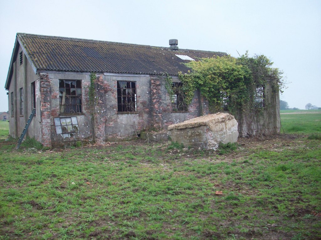
Stow Maries Aerodrome
Stow Maries Aerodrome is a historical airfield located in the village of Stow Maries, Essex, England. The airfield was in use by the Royal Flying Corps...
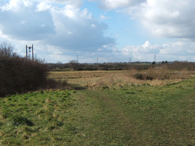
Woodham Fen
Woodham Fen is an 8.1-hectare (20-acre) nature reserve in South Woodham Ferrers in Essex. It is managed by the Essex Wildlife Trust. It is part of the...

Woodham Ferrers
Woodham Ferrers is a small village and former civil parish about 8 miles (13 km) southeast of Chelmsford, located between South Woodham Ferrers and Bicknacre...
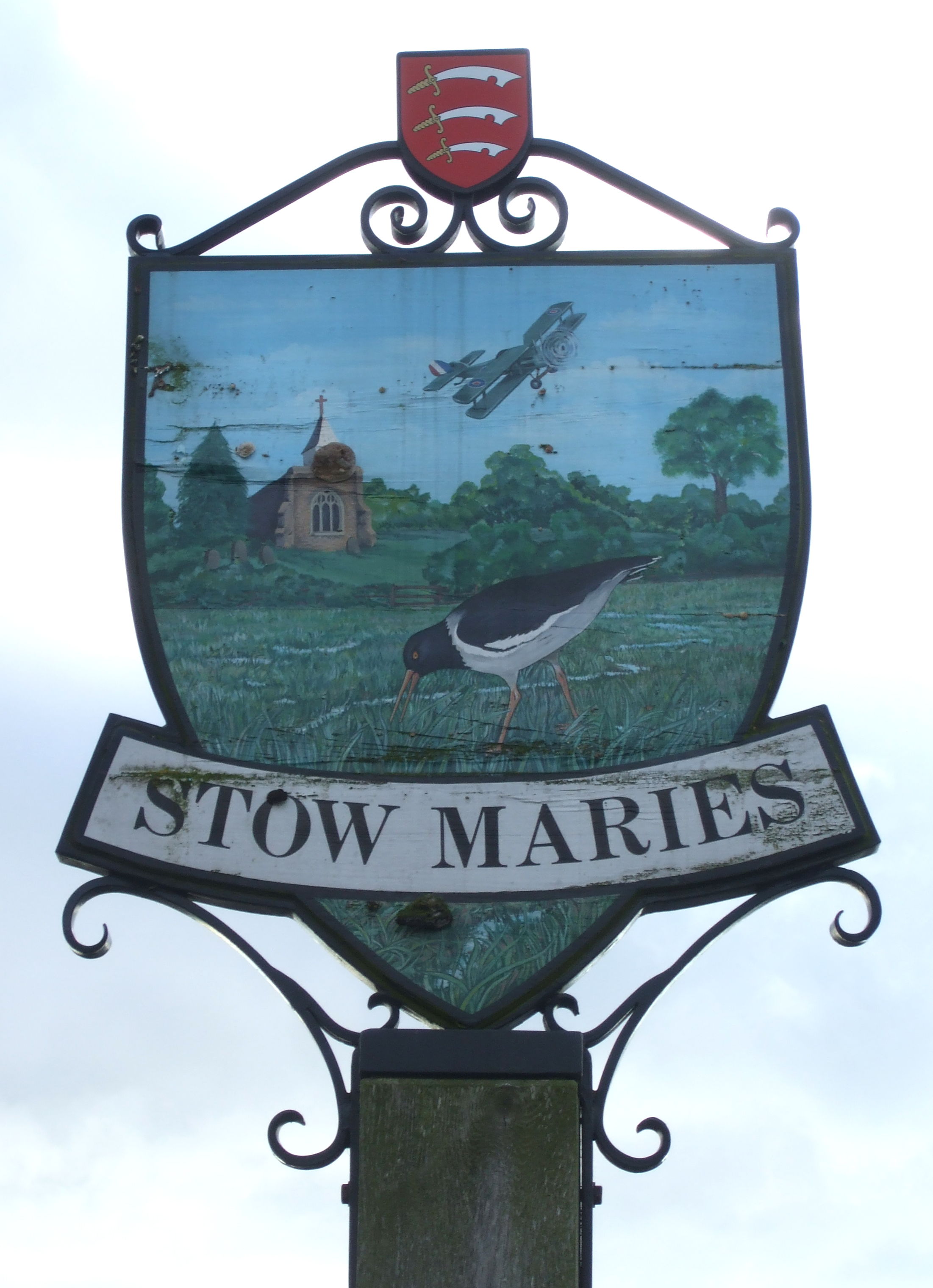
Stow Maries
Stow Maries is a village and civil parish in the English county of Essex. It is located on the western (inland) end of the Dengie peninsula and forms part...
Stow St Mary Halt railway station
Stow St. Mary Halt railway station was a halt that served the village of Stow Maries, Essex. It was opened on 24 September 1928 by the London and North...
Nearby Amenities
Located within 500m of 51.656903,0.61945419Have you been to Bushy Hill?
Leave your review of Bushy Hill below (or comments, questions and feedback).