Weathercock Hill

Hill, Mountain in Suffolk West Suffolk

England

Weathercock Hill

House in Church Road, Chevington
House in Church Road, Chevington Credit: Jonathan Thacker

Weathercock Hill is a prominent landmark located in Suffolk, England. Despite being referred to as a hill, it is more accurately described as a small mountain, as it stands at an impressive height of 155 meters (509 feet) above sea level. Situated on the outskirts of the village of Hacheston, the hill offers panoramic views of the surrounding countryside, making it a popular destination for tourists and locals alike.

The name "Weathercock Hill" originates from the weather vane situated on top of the hill, which serves as a traditional indicator of wind direction. This feature has become an iconic symbol of the area and is visible from miles away. The hill itself boasts a diverse range of vegetation, including grassy slopes, heathland, and patches of woodland, supporting a variety of wildlife.

Weathercock Hill is also steeped in history, with evidence of Iron Age settlements and artifacts found in the vicinity. Archaeological excavations have revealed the presence of ancient burial mounds and fortifications, indicating that the hill played a significant role in the region's past.

Visitors to Weathercock Hill can access the site via a public footpath that winds its way to the summit. The path is well-maintained, providing a relatively easy ascent for hikers and walkers of all abilities. At the top, visitors are rewarded with breathtaking views of the Suffolk countryside, which stretch as far as the eye can see.

In conclusion, Weathercock Hill is a captivating natural feature in Suffolk, offering stunning views, a rich history, and a chance to immerse oneself in the beauty of the English countryside.

If you have any feedback on the listing, please let us know in the comments section below.

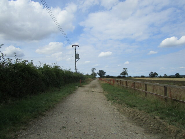
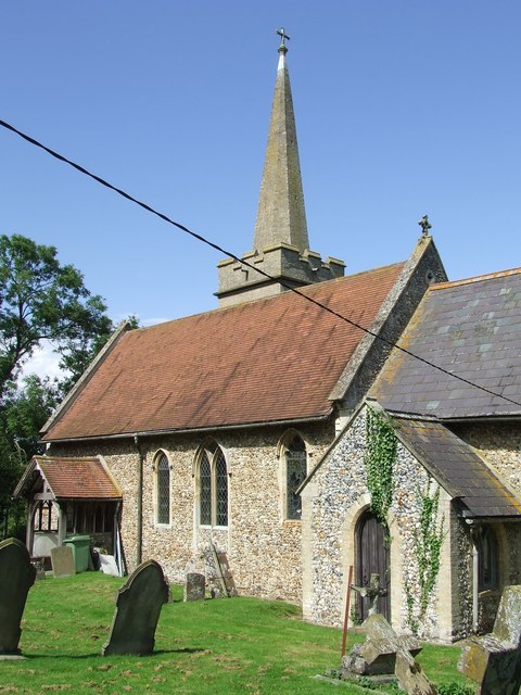
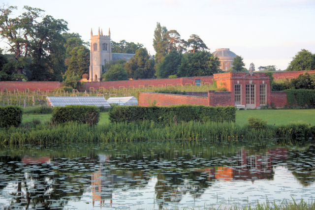
Weathercock Hill Images

Images are sourced within 2km of 52.203298/0.63657969 or Grid Reference TL8059. Thanks to Geograph Open Source API. All images are credited.

House in Church Road, Chevington
Farm track and footpath to Chevington Hill Farm
Houses on Old Post Office Road, Chevington
Fields near Chevington
Grass field, Weathercock Hill
All Saints' church, Chevington The top stage of the tower was only built in about 1800 and because it is unroofed its walls are in effect enormous parapets <span class="nowrap"><a title="https://historicengland.org.uk/listing/the-list/list-entry/1186968" rel="nofollow ugc noopener" href="https://historicengland.org.uk/listing/the-list/list-entry/1186968">Link</a><img style="margin-left:2px;" alt="External link" title="External link - shift click to open in new window" src="https://s1.geograph.org.uk/img/external.png" width="10" height="10"/></span>
All Saints' church, Chevington
The top stage of the tower was only built in about 1800 and because it is unroofed its walls are in effect enormous parapets LinkExternal link
Farm track and footpath to Old Post Office Road
Cottage near the church, Chevington
Chevington War Memorial Listed <span class="nowrap"><a title="https://historicengland.org.uk/listing/the-list/list-entry/1454246" rel="nofollow ugc noopener" href="https://historicengland.org.uk/listing/the-list/list-entry/1454246">Link</a><img style="margin-left:2px;" alt="External link" title="External link - shift click to open in new window" src="https://s1.geograph.org.uk/img/external.png" width="10" height="10"/></span>
Chevington War Memorial
Listed LinkExternal link
All Saints' church, Chevington, chancel interior Re-ordered in 1983-4 <span class="nowrap"><a title="https://historicengland.org.uk/listing/the-list/list-entry/1186968" rel="nofollow ugc noopener" href="https://historicengland.org.uk/listing/the-list/list-entry/1186968">Link</a><img style="margin-left:2px;" alt="External link" title="External link - shift click to open in new window" src="https://s1.geograph.org.uk/img/external.png" width="10" height="10"/></span>
All Saints' church, Chevington, chancel interior
Re-ordered in 1983-4 LinkExternal link
The former school, Chevington Dates from 1847 <span class="nowrap"><a title="https://historicengland.org.uk/listing/the-list/list-entry/1298932" rel="nofollow ugc noopener" href="https://historicengland.org.uk/listing/the-list/list-entry/1298932">Link</a><img style="margin-left:2px;" alt="External link" title="External link - shift click to open in new window" src="https://s1.geograph.org.uk/img/external.png" width="10" height="10"/></span>
The former school, Chevington
Dates from 1847 LinkExternal link
Pumping station, Chevington
Table tombs, Chevington
Footpath to Chevington Field Plantation This was once the road from Chevington to Bury St. Edmunds,
Footpath to Chevington Field Plantation
This was once the road from Chevington to Bury St. Edmunds,
Chevington, former school and All Saints' Church
Chevington Hall Cottage
Wheat field and Chevington Hall Cottage
Chevington, barley field and plantation
Show me another place!

Weathercock Hill is located at Grid Ref: TL8059 (Lat: 52.203298, Lng: 0.63657969)

Administrative County: Suffolk

District: West Suffolk

Police Authority: Suffolk

What 3 Words

///spud.zoom.dreams. Near Bury St Edmunds, Suffolk

Nearby Locations

Weathercock Hill

Related Wikis

Chevington, Suffolk

Chevington is a village and civil parish in the West Suffolk district of Suffolk in East Anglia, England. Located around 10 km south-west of Bury St Edmunds...

Hay Wood, Whepstead

Hay Wood, Whepstead is a 10.4-hectare (26-acre) biological Site of Special Scientific Interest west of Whepstead in Suffolk.This ancient wood on poorly...

Thingoe Rural District

Thingoe Rural District was a rural district in the county of West Suffolk, England between 1894 and 1974. It was named after the ancient Hundred of Thingoe...

St Mary's Church, Ickworth

Ickworth Church (more formally known as St Mary's Church, Ickworth) is a former parish church in Ickworth Park near Bury St Edmunds in Suffolk, England...

Chedburgh

Chedburgh is a village and civil parish in the West Suffolk district of Suffolk in eastern England. Located on the A143 around five miles south-west of...

Ickworth House

Ickworth House is a country house at Ickworth, near Bury St Edmunds, Suffolk, England. It is a neoclassical building set in parkland. The house was the...

RAF Chedburgh

Royal Air Force Chedburgh or more simply RAF Chedburgh is a former Royal Air Force satellite station located near Bury St Edmunds, Suffolk, UK. The Bury...

Ickworth

Ickworth is a small civil parish, almost coextensive with the estate of the National Trust's Ickworth House, in the West Suffolk district of Suffolk, eastern...

Nearby Amenities

Located within 500m of 52.203298,0.63657969
Power: pole
Lat/Long: 52.2059942/0.6404579
Power: pole
Lat/Long: 52.2059833/0.6391333
Power: pole
Lat/Long: 52.2059111/0.6417994
Turning Circle
Lat/Long: 52.2011413/0.6344319
The data included in this document is from www.openstreetmap.org. The data is made available under ODbL.

Have you been to Weathercock Hill?

Leave your review of Weathercock Hill below (or comments, questions and feedback).