Exceat Hill

Hill, Mountain in Sussex Wealden

England

Exceat Hill

Waymarker, Friston Forest An open access forest managed by the Forestry Commission.

Forestry website <span class="nowrap"><a title="http://www.forestry.gov.uk/website/recreation.nsf/LUWebDocsByKey/EnglandEastSussexNoForestFristonForest" rel="nofollow ugc noopener" href="http://www.forestry.gov.uk/website/recreation.nsf/LUWebDocsByKey/EnglandEastSussexNoForestFristonForest">Link</a><img style="margin-left:2px;" alt="External link" title="External link - shift click to open in new window" src="https://s1.geograph.org.uk/img/external.png" width="10" height="10"/></span>
Waymarker, Friston Forest Credit: N Chadwick

Exceat Hill is a picturesque hill located in the county of Sussex, England. Situated within the South Downs National Park, the hill offers stunning views of the surrounding countryside and is a popular destination for nature lovers, hikers, and outdoor enthusiasts.

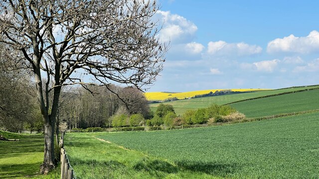
With an elevation of approximately 91 meters (298 feet), Exceat Hill is not particularly high, but it still provides a sense of height and perspective due to its location within the otherwise flat landscape of the Sussex countryside. The hill is covered with lush green grass and is dotted with small trees and shrubs, creating a serene and peaceful atmosphere.

One of the highlights of Exceat Hill is its proximity to the Cuckmere Valley, a designated Area of Outstanding Natural Beauty. The Cuckmere River flows through the valley, meandering its way towards the English Channel, and adds to the charm of the landscape. The valley is known for its meadows, wetlands, and chalk cliffs, attracting a wide variety of wildlife including birds, butterflies, and wildflowers.

Exceat Hill is easily accessible, with a car park located at its base. From there, visitors can follow well-marked footpaths that lead to the top of the hill, offering panoramic views of the surrounding area. The hill is also a starting point for longer walks and hikes, including the famous South Downs Way, a long-distance footpath that stretches for 160 kilometers (100 miles) along the South Downs.

Overall, Exceat Hill is a hidden gem in Sussex, offering visitors the chance to immerse themselves in the natural beauty of the South Downs National Park and enjoy breathtaking views of the countryside.

If you have any feedback on the listing, please let us know in the comments section below.
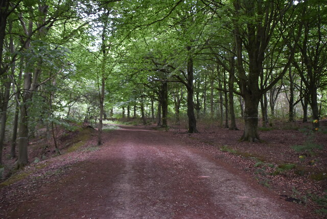
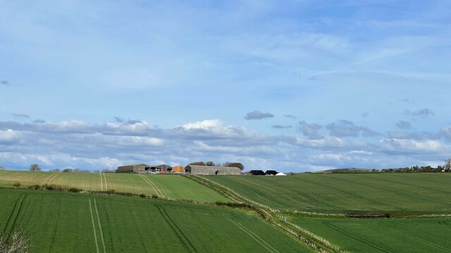
Exceat Hill Images

Images are sourced within 2km of 50.770988/0.16072564 or Grid Reference TV5299. Thanks to Geograph Open Source API. All images are credited.

Waymarker, Friston Forest An open access forest managed by the Forestry Commission.

Forestry website <span class="nowrap"><a title="http://www.forestry.gov.uk/website/recreation.nsf/LUWebDocsByKey/EnglandEastSussexNoForestFristonForest" rel="nofollow ugc noopener" href="http://www.forestry.gov.uk/website/recreation.nsf/LUWebDocsByKey/EnglandEastSussexNoForestFristonForest">Link</a><img style="margin-left:2px;" alt="External link" title="External link - shift click to open in new window" src="https://s1.geograph.org.uk/img/external.png" width="10" height="10"/></span>
Waymarker, Friston Forest
An open access forest managed by the Forestry Commission. Forestry website LinkExternal link
Track, Friston Forest An open access forest managed by the Forestry Commission.

Forestry website <span class="nowrap"><a title="http://www.forestry.gov.uk/website/recreation.nsf/LUWebDocsByKey/EnglandEastSussexNoForestFristonForest" rel="nofollow ugc noopener" href="http://www.forestry.gov.uk/website/recreation.nsf/LUWebDocsByKey/EnglandEastSussexNoForestFristonForest">Link</a><img style="margin-left:2px;" alt="External link" title="External link - shift click to open in new window" src="https://s1.geograph.org.uk/img/external.png" width="10" height="10"/></span>
Track, Friston Forest
An open access forest managed by the Forestry Commission. Forestry website LinkExternal link
Fate at edge of Friston Forest An open access forest managed by the Forestry Commission.

Forestry website <span class="nowrap"><a title="http://www.forestry.gov.uk/website/recreation.nsf/LUWebDocsByKey/EnglandEastSussexNoForestFristonForest" rel="nofollow ugc noopener" href="http://www.forestry.gov.uk/website/recreation.nsf/LUWebDocsByKey/EnglandEastSussexNoForestFristonForest">Link</a><img style="margin-left:2px;" alt="External link" title="External link - shift click to open in new window" src="https://s1.geograph.org.uk/img/external.png" width="10" height="10"/></span>
Fate at edge of Friston Forest
An open access forest managed by the Forestry Commission. Forestry website LinkExternal link
Chalk grassland
Chalk grassland
Chalk downland The South Downs is one of the four areas of chalk downland in southern England. They extend from the eastern side of Hampshire through Sussex, culminating in the cliffs at Beachy Head.
The South Downs is England's newest National Park, its designation taking effect on March 31, 2010. There are many Sites of Special Scientific Interest within the park.
The area is relatively unpopulated, although along its southern periphery there is an almost uninterrupted ribbon of seaside towns. It is extremely popular with walkers, having one principal long distance footpath, the South Downs Way, and many interconnecting ones. There are three principal gaps in the upland through which rivers flow; and there are also many dry valleys along its length.
The South Downs have a long history; there are archaeological remains from Neolithic times. Until the middle of the 20th century, sheep-rearing was the main occupation of those living on the Downs.

At 886ft, Butser Hill is the highest point of the South Downs.

Extract from Wikipedia <span class="nowrap"><a title="http://en.wikipedia.org/wiki/South_Downs" rel="nofollow ugc noopener" href="http://en.wikipedia.org/wiki/South_Downs">Link</a><img style="margin-left:2px;" alt="External link" title="External link - shift click to open in new window" src="https://s1.geograph.org.uk/img/external.png" width="10" height="10"/></span>
Chalk downland
The South Downs is one of the four areas of chalk downland in southern England. They extend from the eastern side of Hampshire through Sussex, culminating in the cliffs at Beachy Head. The South Downs is England's newest National Park, its designation taking effect on March 31, 2010. There are many Sites of Special Scientific Interest within the park. The area is relatively unpopulated, although along its southern periphery there is an almost uninterrupted ribbon of seaside towns. It is extremely popular with walkers, having one principal long distance footpath, the South Downs Way, and many interconnecting ones. There are three principal gaps in the upland through which rivers flow; and there are also many dry valleys along its length. The South Downs have a long history; there are archaeological remains from Neolithic times. Until the middle of the 20th century, sheep-rearing was the main occupation of those living on the Downs. At 886ft, Butser Hill is the highest point of the South Downs. Extract from Wikipedia LinkExternal link
Edge of Friston Forest An open access forest managed by the Forestry Commission.

Forestry website <span class="nowrap"><a title="http://www.forestry.gov.uk/website/recreation.nsf/LUWebDocsByKey/EnglandEastSussexNoForestFristonForest" rel="nofollow ugc noopener" href="http://www.forestry.gov.uk/website/recreation.nsf/LUWebDocsByKey/EnglandEastSussexNoForestFristonForest">Link</a><img style="margin-left:2px;" alt="External link" title="External link - shift click to open in new window" src="https://s1.geograph.org.uk/img/external.png" width="10" height="10"/></span>
Edge of Friston Forest
An open access forest managed by the Forestry Commission. Forestry website LinkExternal link
Edge of Friston Forest
Friston Forest An open access forest managed by the Forestry Commission.

Forestry website <span class="nowrap"><a title="http://www.forestry.gov.uk/website/recreation.nsf/LUWebDocsByKey/EnglandEastSussexNoForestFristonForest" rel="nofollow ugc noopener" href="http://www.forestry.gov.uk/website/recreation.nsf/LUWebDocsByKey/EnglandEastSussexNoForestFristonForest">Link</a><img style="margin-left:2px;" alt="External link" title="External link - shift click to open in new window" src="https://s1.geograph.org.uk/img/external.png" width="10" height="10"/></span>
Friston Forest
An open access forest managed by the Forestry Commission. Forestry website LinkExternal link
Bridleway, Friston Forest An open access forest managed by the Forestry Commission.

Forestry website <span class="nowrap"><a title="http://www.forestry.gov.uk/website/recreation.nsf/LUWebDocsByKey/EnglandEastSussexNoForestFristonForest" rel="nofollow ugc noopener" href="http://www.forestry.gov.uk/website/recreation.nsf/LUWebDocsByKey/EnglandEastSussexNoForestFristonForest">Link</a><img style="margin-left:2px;" alt="External link" title="External link - shift click to open in new window" src="https://s1.geograph.org.uk/img/external.png" width="10" height="10"/></span>
Bridleway, Friston Forest
An open access forest managed by the Forestry Commission. Forestry website LinkExternal link
Friston Forest
Friston Forest
Bridleway, Friston Forest An open access forest managed by the Forestry Commission.

Forestry website <span class="nowrap"><a title="http://www.forestry.gov.uk/website/recreation.nsf/LUWebDocsByKey/EnglandEastSussexNoForestFristonForest" rel="nofollow ugc noopener" href="http://www.forestry.gov.uk/website/recreation.nsf/LUWebDocsByKey/EnglandEastSussexNoForestFristonForest">Link</a><img style="margin-left:2px;" alt="External link" title="External link - shift click to open in new window" src="https://s1.geograph.org.uk/img/external.png" width="10" height="10"/></span>
Bridleway, Friston Forest
An open access forest managed by the Forestry Commission. Forestry website LinkExternal link
The Lane to West Dean
View NNE towards Clapham Barn
View NW from the Charleston Bottom bridleway "Charleston Bottom" is the name given to the upper part of this valley - behind the camera.
View NW from the Charleston Bottom bridleway
"Charleston Bottom" is the name given to the upper part of this valley - behind the camera.
Bridleway heading east along Charleston Bottom Friston Forest lies ahead.
Bridleway heading east along Charleston Bottom
Friston Forest lies ahead.
View south towards Charleston Bottom and Friston Forest
Charleston Bottom from High and Over Hill High and Over Hill provides 360 degree views, including this view into Charleston Bottom (valley) - the house, once the home of royal artist Oswald Birley, though visible in winter is  obscured by trees in summer. Friston Forest in the distance
Charleston Bottom from High and Over Hill
High and Over Hill provides 360 degree views, including this view into Charleston Bottom (valley) - the house, once the home of royal artist Oswald Birley, though visible in winter is obscured by trees in summer. Friston Forest in the distance
Show me another place!

Exceat Hill is located at Grid Ref: TV5299 (Lat: 50.770988, Lng: 0.16072564)

Administrative County: East Sussex

District: Wealden

Police Authority: Sussex

What 3 Words

///royal.mailboxes.linguists. Near Friston, East Sussex

Nearby Locations

Westdean Exceat Hill

Related Wikis

RAF Friston

Royal Air Force Friston or more simply RAF Friston is a former Royal Air Force satellite station and Emergency Landing Ground located in East Sussex, England...

Seven Sisters, East Sussex

The Seven Sisters are a series of chalk sea cliffs on the English Channel coast, and are a stretch of the sea-eroded section of the South Downs range of...

Cuckmere Haven

Cuckmere Haven (also known as the Cuckmere estuary) is an area of flood plains in Sussex, England, where the river Cuckmere meets the English Channel between...

Friston Forest

Friston Forest is a forest, located between Seaford and Eastbourne in East Sussex. It is part of the South Downs National Park area. The forest is managed...

Nearby Amenities

Located within 500m of 50.770988,0.16072564
Barrier: kissing_gate
Lat/Long: 50.7692245/0.1586306
Exceat Hill
Ele: 65
Natural: peak
Lat/Long: 50.7706056/0.1609917
The data included in this document is from www.openstreetmap.org. The data is made available under ODbL.

Have you been to Exceat Hill?

Leave your review of Exceat Hill below (or comments, questions and feedback).