Coploe Hill

Hill, Mountain in Essex Uttlesford

England

Coploe Hill

Great Chesterford Church Some of my antecedents are buried in the family plot to the left of this picture
Great Chesterford Church Credit: Julian Baker

The requested URL returned error: 429 Too Many Requests

If you have any feedback on the listing, please let us know in the comments section below.

Coploe Hill Images

Images are sourced within 2km of 52.057119/0.17810176 or Grid Reference TL4942. Thanks to Geograph Open Source API. All images are credited.

Great Chesterford Church Some of my antecedents are buried in the family plot to the left of this picture
Great Chesterford Church
Some of my antecedents are buried in the family plot to the left of this picture
The Green, Great Chesterford, Essex
Fields at Great Chesterford
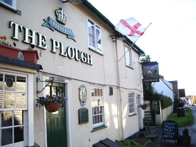
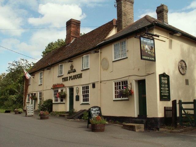
The Plough at Great Chesterford
Severe Storms On The Motorways Today's strong winds (Thursday 18 January 2007) have caused this lorry to overturn on the M11 in Essex. Within 50 metres behind this lorry is yet another overturned see <a title="https://www.geograph.org.uk/photo/314970" href="https://www.geograph.org.uk/photo/314970">Link</a>
Severe Storms On The Motorways
Today's strong winds (Thursday 18 January 2007) have caused this lorry to overturn on the M11 in Essex. Within 50 metres behind this lorry is yet another overturned see Link
Severe Storms On The Motorways Today's strong winds (Thursday 18 January 2007) have caused this lorry to overturn on the M11 in Essex. Within 50 metres in front of this lorry is yet another overturned you can just make out the other lorry in my car's mirror. Other lorry see <a title="https://www.geograph.org.uk/photo/314960" href="https://www.geograph.org.uk/photo/314960">Link</a>
Severe Storms On The Motorways
Today's strong winds (Thursday 18 January 2007) have caused this lorry to overturn on the M11 in Essex. Within 50 metres in front of this lorry is yet another overturned you can just make out the other lorry in my car's mirror. Other lorry see Link
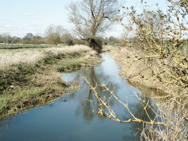
The River Cam (or Granta) The River Cam (or Granta) near Little Chesterford, Essex
The River Cam (or Granta)
The River Cam (or Granta) near Little Chesterford, Essex
'The Plough' inn This has been an inn at Great Chesterford since the 18th century.
'The Plough' inn
This has been an inn at Great Chesterford since the 18th century.
Great Chesterford station The station was built in 1845 by the Eastern Counties Railway, and is still in mainline passenger service.  A branch line was opened by the Newmarket & Chesterford Railway in 1848, and closed in 1851.  The buildings on No.2 (Cambridge) platform have been demolished, along with the signal box at the north end of the London platform, but the station building itself survives, it is currently used as offices.  A new ticket office has recently been opened.  

The picture was taken from the footbridge, looking southwards towards London.
Great Chesterford station
The station was built in 1845 by the Eastern Counties Railway, and is still in mainline passenger service. A branch line was opened by the Newmarket & Chesterford Railway in 1848, and closed in 1851. The buildings on No.2 (Cambridge) platform have been demolished, along with the signal box at the north end of the London platform, but the station building itself survives, it is currently used as offices. A new ticket office has recently been opened. The picture was taken from the footbridge, looking southwards towards London.
Old Milepost Old milepost near to Little Chesterford, Essex on what was the old A.11. For close up view see <a title="https://www.geograph.org.uk/photo/1276325" href="https://www.geograph.org.uk/photo/1276325">Link</a> for info on the post see <span class="nowrap"><a title="http://milestones.megalithia.com/sites/tl513418.htm" rel="nofollow ugc noopener" href="http://milestones.megalithia.com/sites/tl513418.htm">Link</a><img style="margin-left:2px;" alt="External link" title="External link - shift click to open in new window" src="https://s1.geograph.org.uk/img/external.png" width="10" height="10"/></span> do look at their home page.
Old Milepost
Old milepost near to Little Chesterford, Essex on what was the old A.11. For close up view see Link for info on the post see LinkExternal link do look at their home page.
Old Milestone Old milepost near to Little Chesterford, Essex on part of what was the A.11. For overall view see <a title="https://www.geograph.org.uk/photo/1276323" href="https://www.geograph.org.uk/photo/1276323">Link</a> For more info see <span class="nowrap"><a title="http://milestones.megalithia.com/sites/tl513418.htm" rel="nofollow ugc noopener" href="http://milestones.megalithia.com/sites/tl513418.htm">Link</a><img style="margin-left:2px;" alt="External link" title="External link - shift click to open in new window" src="https://s1.geograph.org.uk/img/external.png" width="10" height="10"/></span> do look at their home page.
Old Milestone
Old milepost near to Little Chesterford, Essex on part of what was the A.11. For overall view see Link For more info see LinkExternal link do look at their home page.
Old Milepost Old milepost at Great Chesterford, Essex on what was the old A.11. For close up view see <a title="https://www.geograph.org.uk/photo/1304771" href="https://www.geograph.org.uk/photo/1304771">Link</a> for info on the post see <span class="nowrap"><a title="http://milestones.megalithia.com/sites/tl505429.htm" rel="nofollow ugc noopener" href="http://milestones.megalithia.com/sites/tl505429.htm">Link</a><img style="margin-left:2px;" alt="External link" title="External link - shift click to open in new window" src="https://s1.geograph.org.uk/img/external.png" width="10" height="10"/></span> do look at their home page.
Old Milepost
Old milepost at Great Chesterford, Essex on what was the old A.11. For close up view see Link for info on the post see LinkExternal link do look at their home page.
Old Milestone Old milepost at Great Chesterford, Essex on part of what was the A.11. For overall view see <a title="https://www.geograph.org.uk/photo/1304766" href="https://www.geograph.org.uk/photo/1304766">Link</a> For more info see <span class="nowrap"><a title="http://milestones.megalithia.com/sites/tl505429.htm" rel="nofollow ugc noopener" href="http://milestones.megalithia.com/sites/tl505429.htm">Link</a><img style="margin-left:2px;" alt="External link" title="External link - shift click to open in new window" src="https://s1.geograph.org.uk/img/external.png" width="10" height="10"/></span> do look at their home page.
Old Milestone
Old milepost at Great Chesterford, Essex on part of what was the A.11. For overall view see Link For more info see LinkExternal link do look at their home page.
All Saints: the parish church of Great Chesterford This church dates back to the 13th century. The tower is 15th century, which was rebuilt in 1792 and altered in 1842 when the church was completely restored.
All Saints: the parish church of Great Chesterford
This church dates back to the 13th century. The tower is 15th century, which was rebuilt in 1792 and altered in 1842 when the church was completely restored.
Essex border on the M11
The Post Office in School Street at Great Chesterford
'Crown & Thistle' public house at Great Chesterford
Manor Lane, looking southeast This lane, that leads to Manor Farm, has some very interesting old timber-framed houses along both sides.
Manor Lane, looking southeast
This lane, that leads to Manor Farm, has some very interesting old timber-framed houses along both sides.
Show me another place!

Coploe Hill is located at Grid Ref: TL4942 (Lat: 52.057119, Lng: 0.17810176)

Administrative County: Essex

District: Uttlesford

Police Authority: Essex

What 3 Words

///revamping.tour.bells. Near Great Chesterford, Essex

Nearby Locations

Coploe Hill

Related Wikis

Great Chesterford railway station

Great Chesterford railway station is on the West Anglia Main Line serving the village of Great Chesterford in Essex, England. It is 45 miles 56 chains...

Ickleton Priory

Ickleton Priory was a Benedictine priory of nuns at Ickleton, Cambridgeshire, England. It was established in the middle of the 12th century and suppressed...

Ickleton

Ickleton is a village and civil parish about 9 miles (14 km) south of Cambridge in Cambridgeshire, England. The village is beside the River Cam, close...

St Mary Magdalene Church, Ickleton

St Mary Magdalene Church is the Church of England parish church in the village of Ickleton in Cambridgeshire. The church is a Grade I listed building....

Nearby Amenities

Located within 500m of 52.057119,0.17810176
Information: guidepost
Tourism: information
Lat/Long: 52.0541008/0.1764049
Coploe Hill
Natural: peak
Lat/Long: 52.0567817/0.1778727
The data included in this document is from www.openstreetmap.org. The data is made available under ODbL.

Have you been to Coploe Hill?

Leave your review of Coploe Hill below (or comments, questions and feedback).