Skillet Hill

Hill, Mountain in Essex Epping Forest

England

Skillet Hill

Bridge over the M25 near Upshire Officially named the London Orbital and frequently derided as nothing more than a very big car park, the M25 is a 117-mile orbital motorway that encircles London; one of the world's biggest ring roads (Europe's second longest orbital road after the Berliner Ring, which is 122 miles). It is not, however, a continuous loop of motorway as the Dartford Crossing section (comprising the Dartford Tunnels and the Queen Elizabeth II Bridge) over the Thames and its approach roads are designated as the A282. 

Constructed between 1975 and 1986, the M25 is reputedly the most expensive motorway Britain ever built, costing a total of £909m or roughly £7.5m per mile, but at the time of its planning, the demand for the road was considerably underestimated so that when it was finally completed in 1986, it was already out of date. Demand outstripped capacity within a few years and ever since then it's been very heavily congested. 

The M25 is one of the UK’s busiest motorways, carrying up to 200,000 vehicles and 10,000 HGVs per day (AADT - Annual Average Daily Traffic flow) on the section near to Heathrow Airport. Since its opening in the 1980s, the southern, western and eastern sections have been widened to largely dual four lane (D4M) standard, but much of the motorway retains its dual three lane road (D3M) cross-section as originally built. 

The M25 was home to England's first Variable Speed Limits on motorways between the A3 and M4 in the early 1990s.

<span class="nowrap"><a title="http://www.cbrd.co.uk/motorway/m25/" rel="nofollow ugc noopener" href="http://www.cbrd.co.uk/motorway/m25/">Link</a><img style="margin-left:2px;" alt="External link" title="External link - shift click to open in new window" src="https://s1.geograph.org.uk/img/external.png" width="10" height="10"/></span>  cbrd
<span class="nowrap"><a title="http://www.sabre-roads.org.uk/wiki/index.php?title=M25" rel="nofollow ugc noopener" href="http://www.sabre-roads.org.uk/wiki/index.php?title=M25">Link</a><img style="margin-left:2px;" alt="External link" title="External link - shift click to open in new window" src="https://s1.geograph.org.uk/img/external.png" width="10" height="10"/></span>  SABRE
Bridge over the M25 near Upshire Credit: David Dixon

Skillet Hill is a prominent natural landmark located in Essex, England. Situated in the eastern part of the county, it is known for its distinctive shape and stunning views. Despite its name, Skillet Hill is not actually a hill but rather a small mountain, with an elevation of approximately 300 meters (984 feet) above sea level.

The hill is characterized by its steep slopes and rugged terrain, making it a popular destination for outdoor enthusiasts and hikers. It is covered in a dense forest, primarily consisting of oak and beech trees, which adds to its picturesque appeal. The thick vegetation also provides a habitat for a variety of wildlife, including deer, foxes, and numerous bird species.

At the summit of Skillet Hill, visitors are rewarded with breathtaking panoramic views of the surrounding countryside, including the nearby villages and the rolling hills of Essex. On a clear day, it is even possible to see as far as the coast, offering a truly awe-inspiring sight.

Skillet Hill has a rich history dating back centuries. It has been the subject of various folklore and legends, with tales of buried treasures and mythical creatures associated with the area. Additionally, archaeological excavations have uncovered remnants of ancient settlements, indicating that the hill has been inhabited since prehistoric times.

In conclusion, Skillet Hill in Essex is a remarkable natural feature, offering both beauty and intrigue to those who explore its slopes. Whether for hiking, wildlife spotting, or simply enjoying the stunning vistas, it is a destination that captivates and delights visitors.

If you have any feedback on the listing, please let us know in the comments section below.
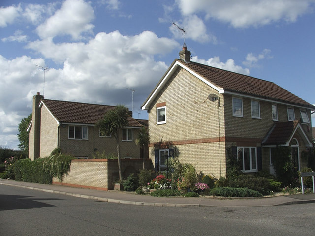
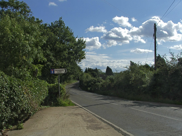
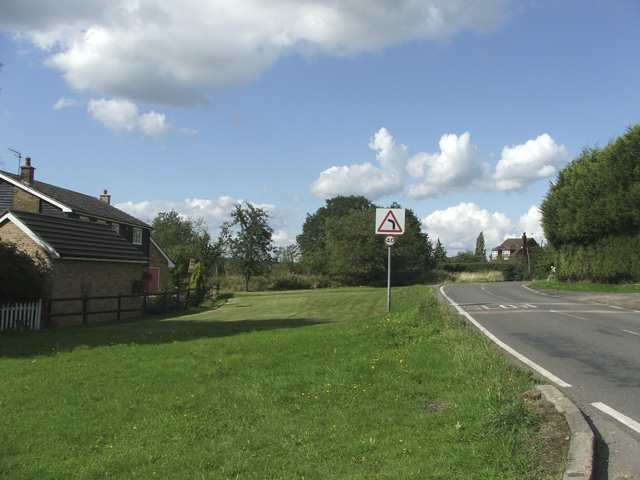
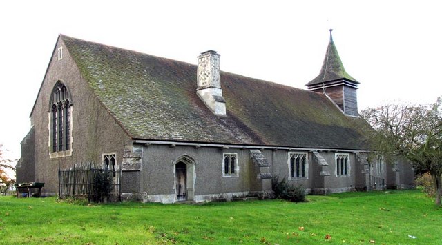
Skillet Hill Images

Images are sourced within 2km of 51.679121/0.039418475 or Grid Reference TQ4199. Thanks to Geograph Open Source API. All images are credited.

Bridge over the M25 near Upshire Officially named the London Orbital and frequently derided as nothing more than a very big car park, the M25 is a 117-mile orbital motorway that encircles London; one of the world's biggest ring roads (Europe's second longest orbital road after the Berliner Ring, which is 122 miles). It is not, however, a continuous loop of motorway as the Dartford Crossing section (comprising the Dartford Tunnels and the Queen Elizabeth II Bridge) over the Thames and its approach roads are designated as the A282. 

Constructed between 1975 and 1986, the M25 is reputedly the most expensive motorway Britain ever built, costing a total of £909m or roughly £7.5m per mile, but at the time of its planning, the demand for the road was considerably underestimated so that when it was finally completed in 1986, it was already out of date. Demand outstripped capacity within a few years and ever since then it's been very heavily congested. 

The M25 is one of the UK’s busiest motorways, carrying up to 200,000 vehicles and 10,000 HGVs per day (AADT - Annual Average Daily Traffic flow) on the section near to Heathrow Airport. Since its opening in the 1980s, the southern, western and eastern sections have been widened to largely dual four lane (D4M) standard, but much of the motorway retains its dual three lane road (D3M) cross-section as originally built. 

The M25 was home to England's first Variable Speed Limits on motorways between the A3 and M4 in the early 1990s.

<span class="nowrap"><a title="http://www.cbrd.co.uk/motorway/m25/" rel="nofollow ugc noopener" href="http://www.cbrd.co.uk/motorway/m25/">Link</a><img style="margin-left:2px;" alt="External link" title="External link - shift click to open in new window" src="https://s1.geograph.org.uk/img/external.png" width="10" height="10"/></span>  cbrd
<span class="nowrap"><a title="http://www.sabre-roads.org.uk/wiki/index.php?title=M25" rel="nofollow ugc noopener" href="http://www.sabre-roads.org.uk/wiki/index.php?title=M25">Link</a><img style="margin-left:2px;" alt="External link" title="External link - shift click to open in new window" src="https://s1.geograph.org.uk/img/external.png" width="10" height="10"/></span>  SABRE
Bridge over the M25 near Upshire
Officially named the London Orbital and frequently derided as nothing more than a very big car park, the M25 is a 117-mile orbital motorway that encircles London; one of the world's biggest ring roads (Europe's second longest orbital road after the Berliner Ring, which is 122 miles). It is not, however, a continuous loop of motorway as the Dartford Crossing section (comprising the Dartford Tunnels and the Queen Elizabeth II Bridge) over the Thames and its approach roads are designated as the A282. Constructed between 1975 and 1986, the M25 is reputedly the most expensive motorway Britain ever built, costing a total of £909m or roughly £7.5m per mile, but at the time of its planning, the demand for the road was considerably underestimated so that when it was finally completed in 1986, it was already out of date. Demand outstripped capacity within a few years and ever since then it's been very heavily congested. The M25 is one of the UK’s busiest motorways, carrying up to 200,000 vehicles and 10,000 HGVs per day (AADT - Annual Average Daily Traffic flow) on the section near to Heathrow Airport. Since its opening in the 1980s, the southern, western and eastern sections have been widened to largely dual four lane (D4M) standard, but much of the motorway retains its dual three lane road (D3M) cross-section as originally built. The M25 was home to England's first Variable Speed Limits on motorways between the A3 and M4 in the early 1990s. LinkExternal link cbrd LinkExternal link SABRE
Variable Message Sign on the M25 at Copthall Green Variable message signs (VMS), also sometimes referred to as matrix signs, are electronic traffic signs used on motorways (and some other major routes) to give drivers information about special events and to warn them about traffic congestion, accidents, incidents, roadworks or speed limits on specific sections of the route. They may also suggest (or instruct) drivers to take alternative routes, limit speed, warn of the duration and location of the incidents or just inform them of the traffic conditions. Drivers carrying freight bound for the cross-channel port of Dover are instructed to use the M20 by this sign.
Variable Message Sign on the M25 at Copthall Green
Variable message signs (VMS), also sometimes referred to as matrix signs, are electronic traffic signs used on motorways (and some other major routes) to give drivers information about special events and to warn them about traffic congestion, accidents, incidents, roadworks or speed limits on specific sections of the route. They may also suggest (or instruct) drivers to take alternative routes, limit speed, warn of the duration and location of the incidents or just inform them of the traffic conditions. Drivers carrying freight bound for the cross-channel port of Dover are instructed to use the M20 by this sign.
Cottages, Crown Hill, Copthall Green Cottages, Crown Hill, Copthall Green near Upshire, Essex
Cottages, Crown Hill, Copthall Green
Cottages, Crown Hill, Copthall Green near Upshire, Essex
Corner of Peregrene Road and Farthingale Lane, Waltham Abbey, Essex
Honeypot Lane Road Sign from Woodgreen Road, Upshire, Essex
Woodgreen Road, Upshire, Essex.
Pick Hill, Upshire, Essex
The Horseshoes Public House, Horseshoe Hill, Upshire, Essex
Horseshoe Hill, Upshire, Essex.
St Thomas, Upshire, Essex
The Good Intent..
The Good Intent..
The lych gate, St Thomas' Church, Upshire
1st World War Memorial The two war memorials are housed in the lych gate of St. Thomas' Church Upshire.
1st World War Memorial
The two war memorials are housed in the lych gate of St. Thomas' Church Upshire.
2nd World War Memorial, St Thomas' Church The two War Memorials are housed one in each side of the lych gate.
2nd World War Memorial, St Thomas' Church
The two War Memorials are housed one in each side of the lych gate.
St Thomas' Church,  Upshire
St Thomas' Church, Upshire
Show me another place!

Skillet Hill is located at Grid Ref: TQ4199 (Lat: 51.679121, Lng: 0.039418475)

Administrative County: Essex

District: Epping Forest

Police Authority: Essex

What 3 Words

///natively.gather.jump. Near Waltham Abbey, Essex

Related Wikis

Upshire

Upshire is a village and area of Waltham Abbey in the Epping Forest District of Essex, England. The centre of the village is on Horseshoe Hill (a minor...
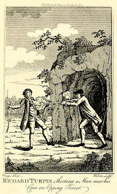
Turpin's Cave

Turpin's Cave is an area of Epping Forest in Essex which has been attributed as a hiding place of the highwayman Dick Turpin. Dick Turpin knew Epping...

Great Monk Wood

Great Monk Wood is a wood within Epping Forest, in Essex, England. The wood, in the parish of Loughton, is centred on the Wakes Arms junction roundabout...

High Beach

High Beach (or High Beech) is a village inside Epping Forest in south-west Essex, England. Part of the civil parish of Waltham Abbey, the village is within...

King Harold Business and Enterprise Academy

King Harold Business and Enterprise Academy (formerly King Harold School) is a secondary school and specialist business and enterprise college located...

A121 road (England)

The A121 road is a road in England connecting Waltham Cross and Woodford Wells. == Major settlements == The main settlements on it are Waltham Abbey and...

Epping Forest

Epping Forest is a 2,400-hectare (5,900-acre) area of ancient woodland, and other established habitats, which straddles the border between Greater London...

Waltham Abbey F.C.

Waltham Abbey F.C. is an English football club based in Waltham Abbey, Essex. The team currently plays in the Southern League Division One Central....

Nearby Amenities

Located within 500m of 51.679121,0.039418475
Created By: YahooApplet 1.0
Lat/Long: 51.6792455/0.0351373
Created By: YahooApplet 1.0
Lat/Long: 51.6791019/0.0352341
Created By: YahooApplet 1.0
Lat/Long: 51.6801969/0.0383042
Motorway Junction
Waltham Abbey
Destination: Waltham Abbey
Ref: 26
Lat/Long: 51.6806504/0.0399954
Created By: YahooApplet 1.0
Lat/Long: 51.67882/0.0334006
Created By: YahooApplet 1.0
Lat/Long: 51.6825052/0.0440836
Created By: YahooApplet 1.0
Lat/Long: 51.6826183/0.0439548
Created By: YahooApplet 1.0
Lat/Long: 51.6812878/0.0420665
Created By: YahooApplet 1.0
Lat/Long: 51.6819863/0.0417983
Created By: YahooApplet 1.0
Lat/Long: 51.6809419/0.0421416
Created By: YahooApplet 1.0
Lat/Long: 51.6800971/0.0419914
Created By: YahooApplet 1.0
Lat/Long: 51.6807623/0.0398349
Created By: YahooApplet 1.0
Lat/Long: 51.6810616/0.0408971
Created By: YahooApplet 1.0
Lat/Long: 51.6800571/0.0383973
Created By: YahooApplet 1.0
Lat/Long: 51.6797644/0.0418305
Created By: YahooApplet 1.0
Lat/Long: 51.6811681/0.0407576
Created By: YahooApplet 1.0
Lat/Long: 51.6788065/0.0339341
Created By: YahooApplet 1.0
Lat/Long: 51.6795316/0.036788
Created By: YahooApplet 1.0
Lat/Long: 51.6796829/0.0367968
Bus Stop
The Volunteer
Naptan AtcoCode: 150022016003
Naptan Bearing: W
Naptan CommonName: The Volunteer
Naptan Crossing: Woodgreen Road
Naptan Indicator: o/s
Naptan Landmark: The Volunteer
Naptan NaptanCode: esxdgtpw
Naptan Street: Honey Lane
Naptan Verified: no
Public Transport: platform
Shelter: yes
Source: naptan_import
Lat/Long: 51.6783792/0.0402636
Bus Stop
The Woodbine
Naptan AtcoCode: 150022016004
Naptan Bearing: E
Naptan CommonName: The Woodbine
Naptan Crossing: Woodgreen Road
Naptan Indicator: o/s
Naptan Landmark: The Woodbine
Naptan NaptanCode: esxdgtwa
Naptan Street: Honey Lane
Naptan Verified: no
Public Transport: platform
Shelter: yes
Source: naptan_import
Lat/Long: 51.678532/0.0415683
Phone
Emergency: phone
Lat/Long: 51.6804372/0.0386338
Telephone
Booth: KX100
Covered: booth
Source: Survey
Lat/Long: 51.6783832/0.0399053
Honey Lane Plain
Place: locality
Lat/Long: 51.6771252/0.0444065
Barrier: cattle_grid
Lat/Long: 51.6781005/0.0412855
Street Lamp
Lamp Model: Philips MA50
Lamp Type: SOX
Source: Personal memory
Lat/Long: 51.6786089/0.034959
Street Lamp
Lamp Model: Philips MA50
Lamp Type: SOX
Source: Personal memory
Lat/Long: 51.6793092/0.0371477
Street Lamp
Lamp Model: Philips MA50
Lamp Type: SOX
Source: Personal memory
Lat/Long: 51.6791944/0.0368098
Street Lamp
Lamp Model: Philips MA50
Lamp Type: SOX
Source: Personal memory
Lat/Long: 51.6788468/0.035686
Street Lamp
Lamp Model: Philips MA50
Lamp Type: SOX
Source: Personal memory
Lat/Long: 51.6784726/0.0346695
Street Lamp
Lamp Model: Philips MA50
Lamp Type: SOX
Source: Personal memory
Lat/Long: 51.6787154/0.035305
Street Lamp
Lamp Model: Philips MA50
Lamp Type: SOX
Source: Personal memory
Lat/Long: 51.679078/0.0364532
Street Lamp
Lamp Model: Philips MA50
Lamp Type: SOX
Source: Personal memory
Lat/Long: 51.678955/0.0360642
Street Lamp
Lamp Model: Philips MA50
Lamp Type: SOX
Source: Personal memory
Lat/Long: 51.6794339/0.037483
Street Lamp
Lamp Model: Philips MA50
Lamp Type: SOX
Source: Personal memory
Lat/Long: 51.6796085/0.0379418
Street Lamp
Lamp Model: Philips MA50
Lamp Type: SOX
Source: Personal memory
Lat/Long: 51.6781051/0.0326419
Street Lamp
Lamp Model: Philips MA50
Lamp Type: SOX
Source: Personal memory
Lat/Long: 51.6779786/0.0335485
Street Lamp
Lamp Model: Philips MA50
Lamp Type: SOX
Source: Personal memory
Lat/Long: 51.6780618/0.0330788
Street Lamp
Lamp Model: Philips MA50
Lamp Type: SOX
Source: Personal memory
Lat/Long: 51.6792726/0.032371
Street Lamp
Lamp Model: Philips MA50
Lamp Type: SOX
Source: Personal memory
Lat/Long: 51.6791046/0.0327545
Street Lamp
Lamp Model: Philips MA50
Lamp Type: SOX
Source: Personal memory
Lat/Long: 51.6789882/0.0333148
Street Lamp
Lamp Model: Philips MA50
Lamp Type: SOX
Source: Personal memory
Lat/Long: 51.6793906/0.0324917
Street Lamp
Lamp Model: Philips MA50
Lamp Type: SOX
Source: Personal memory
Lat/Long: 51.6789183/0.0331166
Street Lamp
Lamp Model: Philips MA50
Lamp Type: SOX
Source: Personal memory
Lat/Long: 51.6792161/0.0328994
Street Lamp
Lamp Type: SON
Source: Personal memory
Lat/Long: 51.6774613/0.0336984
Street Lamp
Lamp Type: SON
Source: Personal memory
Lat/Long: 51.6779171/0.0336984
Street Lamp
Lamp Type: SON
Source: Personal memory
Lat/Long: 51.6785026/0.0340767
Street Lamp
Lamp Type: SON
Source: Personal memory
Lat/Long: 51.6778073/0.0337467
Street Lamp
Lamp Type: SON
Source: Personal memory
Lat/Long: 51.6784626/0.0343825
Street Lamp
Lamp Type: SON
Source: Personal memory
Lat/Long: 51.6777141/0.0341411
Street Lamp
Lamp Type: SON
Source: Personal memory
Lat/Long: 51.6784526/0.033752
Street Lamp
Lamp Type: SON
Source: Personal memory
Lat/Long: 51.6781166/0.0348196
Street Lamp
Lamp Model: Philips MA50
Lamp Type: SOX
Source: Personal memory
Lat/Long: 51.6779703/0.0358738
Street Lamp
Lamp Type: SON
Source: Personal memory
Lat/Long: 51.6781284/0.0335348
Street Lamp
Lamp Type: SON
Source: Personal memory
Lat/Long: 51.6778139/0.0343154
Street Lamp
Lamp Model: Philips MA50
Lamp Type: SOX
Source: Personal memory
Lat/Long: 51.6778839/0.035415
Street Lamp
Lamp Type: SON
Source: Personal memory
Lat/Long: 51.678456/0.0335616
Street Lamp
Lamp Type: SON
Source: Personal memory
Lat/Long: 51.6773949/0.032993
Street Lamp
Lamp Type: SON
Source: Personal memory
Lat/Long: 51.678283/0.0346346
Street Lamp
Lamp Type: SON
Source: Personal memory
Lat/Long: 51.6779586/0.0347365
Street Lamp
Lamp Type: SON
Source: Personal memory
Lat/Long: 51.6780785/0.034648
Street Lamp
Lamp Type: SON
Source: Personal memory
Lat/Long: 51.6775761/0.0335375
Street Lamp
Lamp Type: SON
Source: Personal memory
Lat/Long: 51.6772635/0.0330439
Street Lamp
Lamp Type: SON
Source: Personal memory
Lat/Long: 51.6785691/0.0337976
Street Lamp
Lamp Model: Philips MA50
Lamp Type: SOX
Source: Personal memory
Lat/Long: 51.6778888/0.035069
Street Lamp
Lamp Type: SON
Source: Personal memory
Lat/Long: 51.6778157/0.0339748
Street Lamp
Lamp Type: SON
Source: Personal memory
Lat/Long: 51.6782963/0.0335643
Street Lamp
Lamp Type: SOX
Source: Personal memory
Lat/Long: 51.6787901/0.0333021
Street Lamp
Lamp Type: SOX
Source: Personal memory
Lat/Long: 51.6786537/0.0334282
Street Lamp
Lamp Type: SON
Source: Personal memory
Lat/Long: 51.6787085/0.0336722
Street Lamp
Lamp Type: SON
Source: Personal memory
Lat/Long: 51.6788515/0.0335328
Noexit: yes
Lat/Long: 51.6794587/0.0328892
Post Box
Post Box Mounting: brick_pillar
Post Box Type: wall
Royal Cypher: EIIR
Royal Cypher Wikidata: Q33102113
Lat/Long: 51.6783837/0.0399179
Bench
Backrest: yes
Check Date: 2023-06-04
Material: wood
Openbenches Id: 29093
Lat/Long: 51.683242/0.0374842
The data included in this document is from www.openstreetmap.org. The data is made available under ODbL.

Have you been to Skillet Hill?

Leave your review of Skillet Hill below (or comments, questions and feedback).