Beacon Hill

Hill, Mountain in Sussex

England

Beacon Hill

Slipway into sea off Undercliff Walk
Slipway into sea off Undercliff Walk Credit: Tom Page

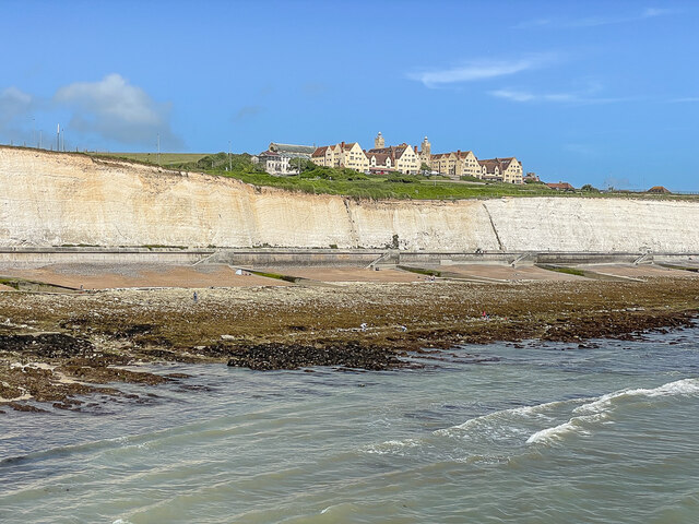
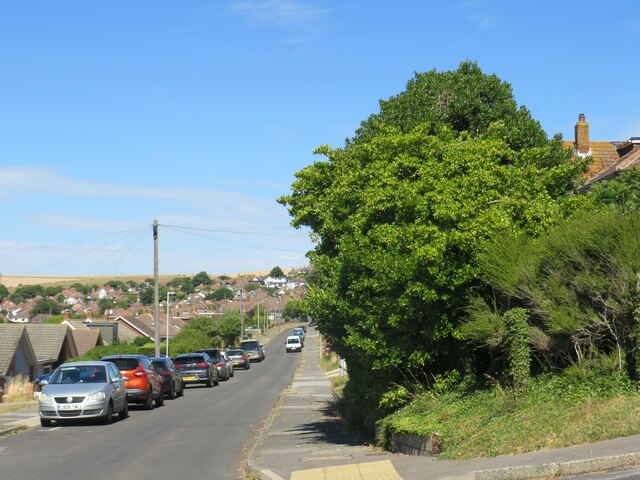
Beacon Hill is a prominent hill located in the county of Sussex, England. It is part of the South Downs National Park and stands at an impressive height of 243 meters (797 feet) above sea level. This makes it one of the highest points in Sussex and offers breathtaking panoramic views of the surrounding countryside.

The hill is covered in lush green vegetation, primarily consisting of grasslands and a variety of wildflowers. It is a popular spot for nature lovers and hikers, with several trails and footpaths winding their way up the hill. The summit provides a perfect vantage point to enjoy the picturesque landscape, including stunning vistas of the South Downs, rolling hills, and nearby villages.

Beacon Hill derives its name from the historical purpose it served as a beacon site, where signal fires were lit to warn of approaching enemies or to communicate important messages. The remains of the beacon itself can still be seen today, adding an extra layer of historical significance to the area.

The hill is also home to an abundance of wildlife, including various bird species such as skylarks and kestrels, as well as rabbits, badgers, and deer. It offers a tranquil and peaceful atmosphere, making it an ideal location for those seeking a break from the hustle and bustle of everyday life.

Overall, Beacon Hill in Sussex is a natural gem, providing a delightful combination of stunning views, historical significance, and a haven for wildlife. Whether you are a nature enthusiast, a history buff, or simply seeking a place to relax and reconnect with nature, Beacon Hill is definitely worth a visit.

If you have any feedback on the listing, please let us know in the comments section below.
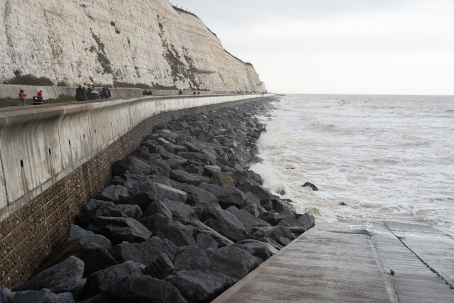
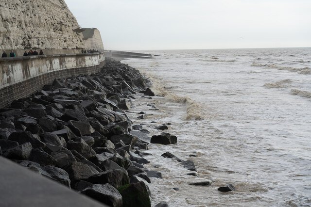
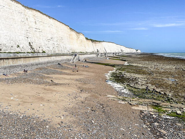
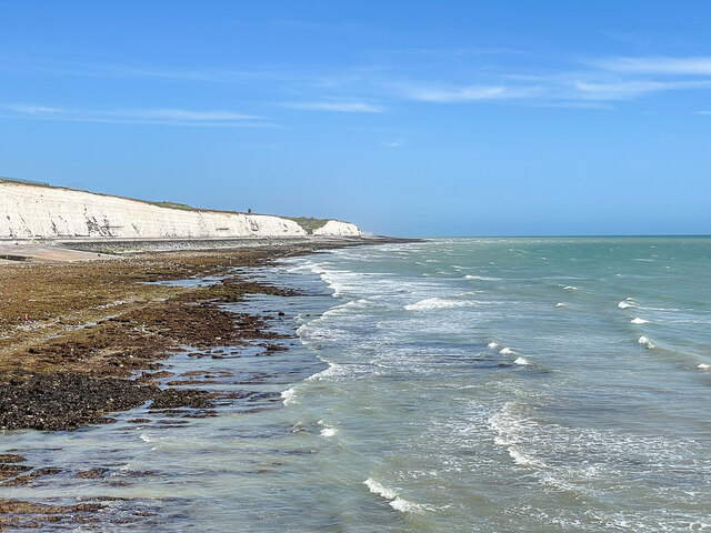
Beacon Hill Images

Images are sourced within 2km of 50.808414/-0.06530833 or Grid Reference TQ3602. Thanks to Geograph Open Source API. All images are credited.

Slipway into sea off Undercliff Walk
Undercliff walk near Rottingdean, facing east
Undercliff walk facing east
Beach at Rottingdean facing east
Roedean Beach Beach below Roedean Cliffs, seen from the eastern breakwater of Brighton Marina.
Roedean Beach
Beach below Roedean Cliffs, seen from the eastern breakwater of Brighton Marina.
Roedean Beach Beach below Roedean Cliffs, seen from the eastern breakwater of Brighton Marina.  On the clifftop in the background can be seen Rottingdean Windmill on Beacon Hill above Rottingdean.
Roedean Beach
Beach below Roedean Cliffs, seen from the eastern breakwater of Brighton Marina. On the clifftop in the background can be seen Rottingdean Windmill on Beacon Hill above Rottingdean.
Roedean Beach Beach below Roedean Cliffs, seen from the eastern breakwater of Brighton Marina.  On the clifftop is Roedean School.
Roedean Beach
Beach below Roedean Cliffs, seen from the eastern breakwater of Brighton Marina. On the clifftop is Roedean School.
Greenbank Avenue, Saltdean Greenbank Avenue is a residential road in Saltdean, on the Sussex coast near Brighton.
Greenbank Avenue, Saltdean
Greenbank Avenue is a residential road in Saltdean, on the Sussex coast near Brighton.
St. Nicholas parish church, Saltdean The parish church of St. Nicholas in Saltdean, on the Sussex coast near Brighton.
St. Nicholas parish church, Saltdean
The parish church of St. Nicholas in Saltdean, on the Sussex coast near Brighton.
Chichester Drive East, Saltdean Chichester Drive East is a residential road on a hillside in Saltdean, on the Sussex coast near Brighton.
Chichester Drive East, Saltdean
Chichester Drive East is a residential road on a hillside in Saltdean, on the Sussex coast near Brighton.
Founthill Avenue, Saltdean Founthill Avenue is a residential road in Saltdean, on the Sussex coast near Brighton.
Founthill Avenue, Saltdean
Founthill Avenue is a residential road in Saltdean, on the Sussex coast near Brighton.
Founthill Avenue, Saltdean Founthill Avenue is a residential road in Saltdean, on the Sussex coast near Brighton.
Founthill Avenue, Saltdean
Founthill Avenue is a residential road in Saltdean, on the Sussex coast near Brighton.
Chichester Drive West, Saltdean Chichester Drive West is a residential road in Saltdean, on the Sussex coast near Brighton.
Chichester Drive West, Saltdean
Chichester Drive West is a residential road in Saltdean, on the Sussex coast near Brighton.
Saltdean Drive, Saltdean Saltdean Drive is a residential road in Saltdean, on the Sussex coast near Brighton.
Saltdean Drive, Saltdean
Saltdean Drive is a residential road in Saltdean, on the Sussex coast near Brighton.
Marine Drive, Saltdean Marine Drive forms part of the route of the coastal A259 road as it passes through Saltdean between Newhaven and Brighton.
Marine Drive, Saltdean
Marine Drive forms part of the route of the coastal A259 road as it passes through Saltdean between Newhaven and Brighton.
Beach and undercliff walk at Saltdean The beach and undercliff walk at Saltdean, near Brighton.

The undercliff walk forms part of the route of the England Coast Path, and also route 2 of the National Cycle Network.
Beach and undercliff walk at Saltdean
The beach and undercliff walk at Saltdean, near Brighton. The undercliff walk forms part of the route of the England Coast Path, and also route 2 of the National Cycle Network.
Ramp to the shore, Saltdean A ramp enables vehicles to access the undercliff walk and beach in an emergency.  The metal gate prevents other vehicles from being driven down to the shoreline.

The ramp is on the route of the England Coast Path and National Cycle Network route 2.
Ramp to the shore, Saltdean
A ramp enables vehicles to access the undercliff walk and beach in an emergency. The metal gate prevents other vehicles from being driven down to the shoreline. The ramp is on the route of the England Coast Path and National Cycle Network route 2.
The eastern breakwater of Brighton Marina Brighton Marina is a large, man-made marina. The construction of the marina itself took place between 1971 and 1979, although developments within it have continued ever since. The marina covers an area of approximately 127 acres.
<span class="nowrap"><a title="http://en.wikipedia.org/wiki/Brighton_Marina" rel="nofollow ugc noopener" href="http://en.wikipedia.org/wiki/Brighton_Marina">Link</a><img style="margin-left:2px;" alt="External link" title="External link - shift click to open in new window" src="https://s1.geograph.org.uk/img/external.png" width="10" height="10"/></span>
The eastern breakwater of Brighton Marina
Brighton Marina is a large, man-made marina. The construction of the marina itself took place between 1971 and 1979, although developments within it have continued ever since. The marina covers an area of approximately 127 acres. LinkExternal link
Show me another place!

Beacon Hill is located at Grid Ref: TQ3602 (Lat: 50.808414, Lng: -0.06530833)

Unitary Authority: Brighton and Hove

Police Authority: Sussex

What 3 Words

///blunders.softly.resonates. Near Rottingdean, East Sussex

Related Wikis

Beacon Mill, Rottingdean

Beacon Mill or New Mill is a grade II listed smock mill at Rottingdean, Sussex, England which has been restored as a seamark. It sits within the boundary...

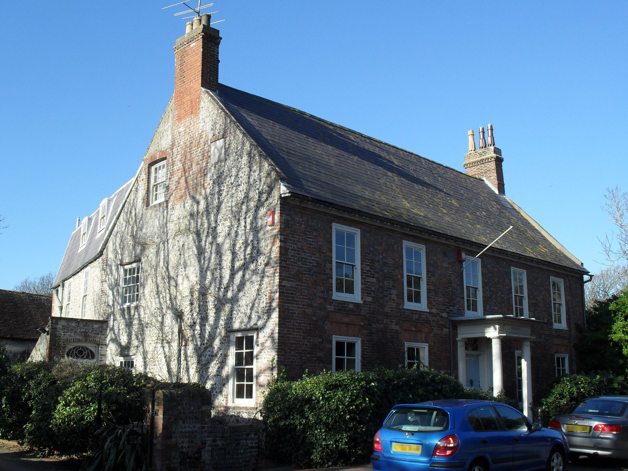
Hillside, Brighton and Hove

Hillside is an 18th-century Grade II* listed building in Rottingdean, in the city of Brighton and Hove. The house contains a gazebo listed for its special...

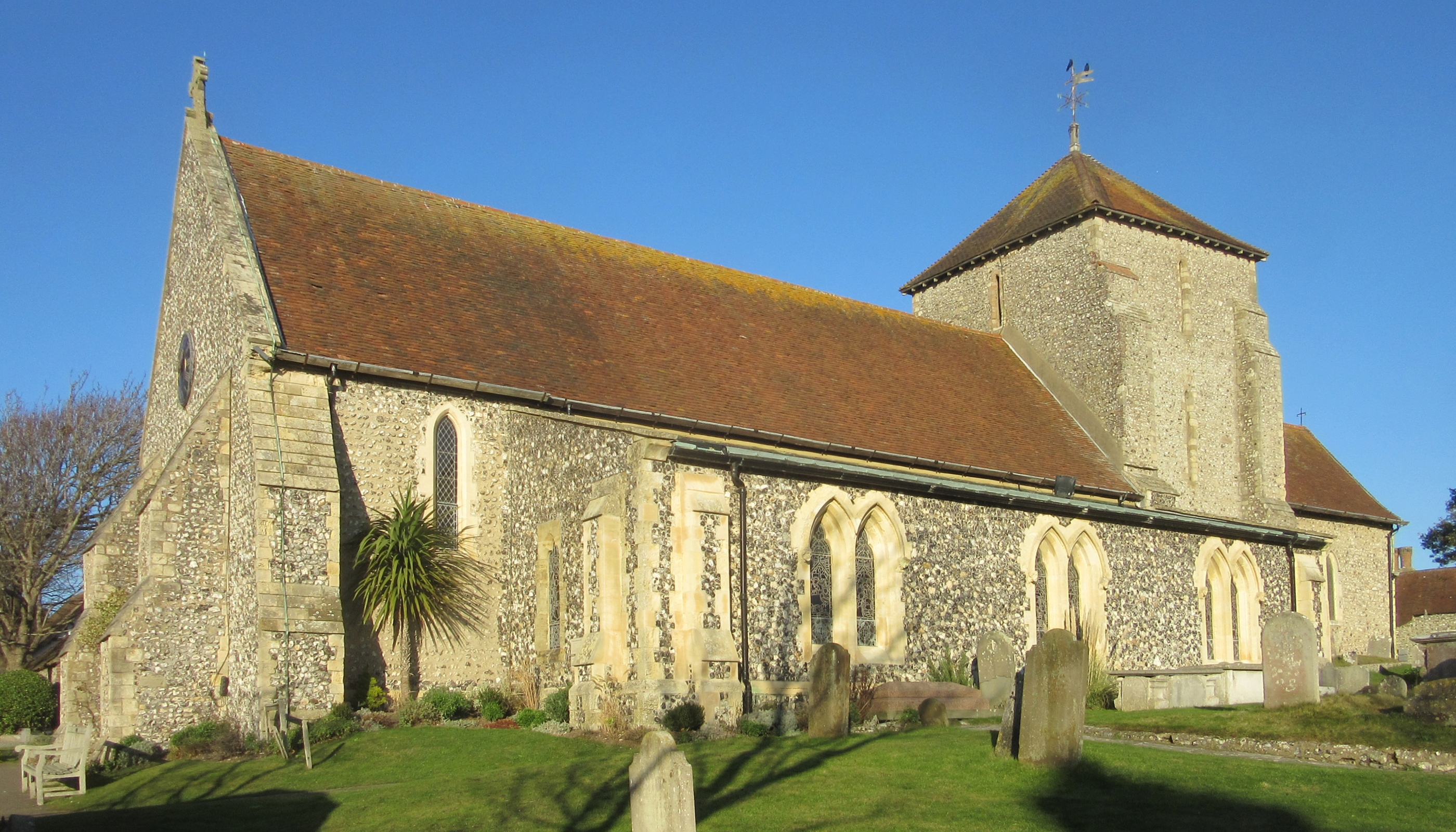
St Margaret's Church, Rottingdean

St Margaret's Church is an Anglican church in the village of Rottingdean, in the city of Brighton and Hove, England. It is the parish church of Rottingdean...
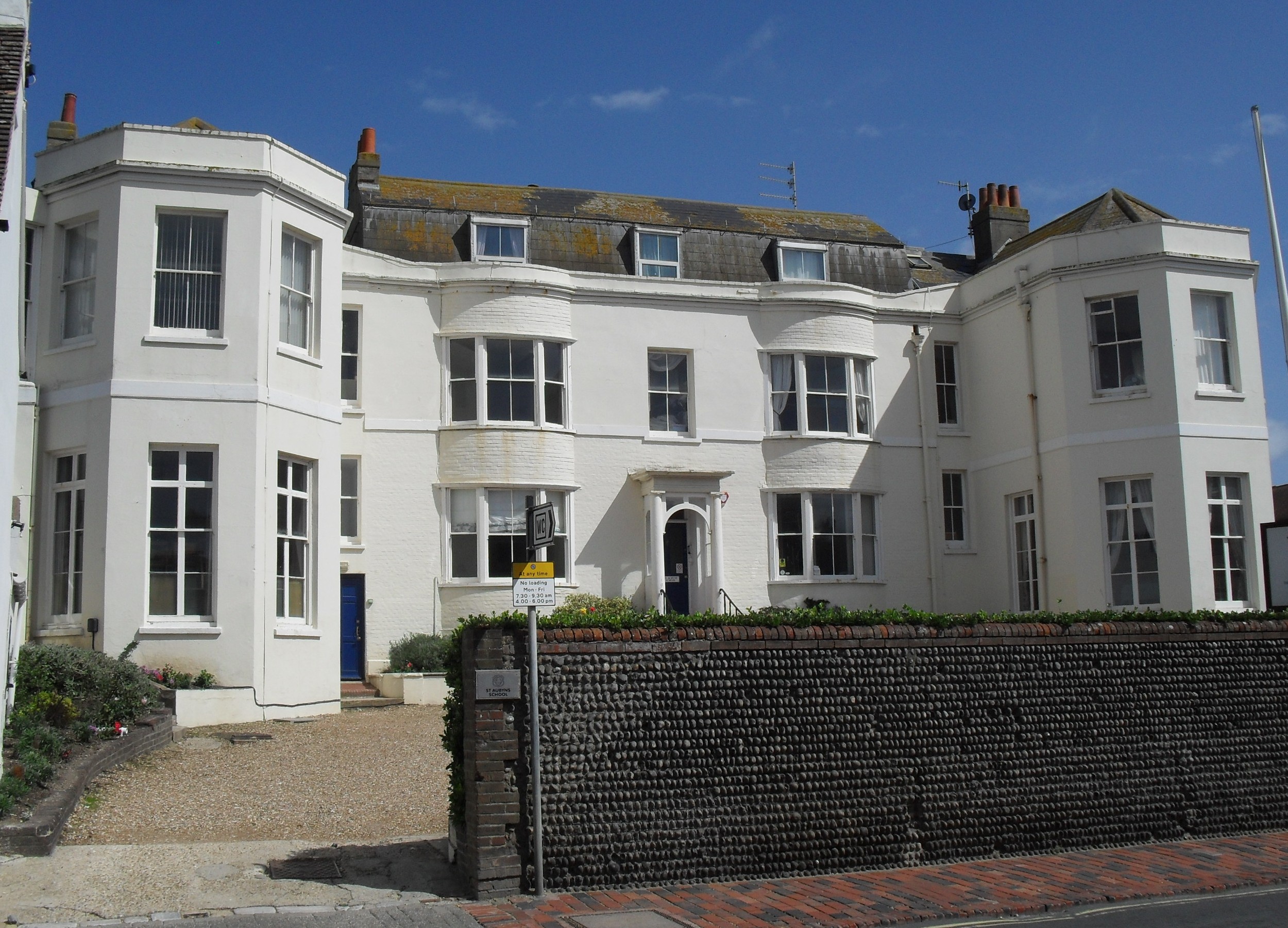
St Aubyns School

St. Aubyns School was a boys' preparatory school in Rottingdean, East Sussex, England, which in its final years became co-educational and taught children...

Nearby Amenities

Located within 500m of 50.808414,-0.06530833
Toilets
Lat/Long: 50.8099771/-0.0618539
Kiplings Gardens
Access: permissive
Leisure: garden
Lat/Long: 50.8068661/-0.0590206
Place Of Worship
St Martha's Convent
Denomination: catholic
Religion: christian
Lat/Long: 50.8062956/-0.0592278
Rottingdean Windmill
Man Made: windmill
Lat/Long: 50.8058863/-0.0629458
Toilets
Check Date: 2022-03-27
Fee: no
Wheelchair: yes
Lat/Long: 50.8064338/-0.0714845
Bus Stop
Greenways
Bus: yes
Name En: Greenways
Public Transport: platform
Shelter: yes
Lat/Long: 50.8062662/-0.069528
Bus Stop
St Dunstan's
Bus: yes
Public Transport: platform
Lat/Long: 50.8081276/-0.0707922
Crossing
Crossing: uncontrolled
Crossing Island: yes
Kerb: lowered
Tactile Paving: yes
Lat/Long: 50.8044168/-0.0636047
Beacon Hill
Place: locality
Lat/Long: 50.8112435/-0.0659977
Waste Basket
Lat/Long: 50.8066154/-0.0589413
Bench
Backrest: yes
Lat/Long: 50.806624/-0.0589716
Barrier: kissing_gate
Lat/Long: 50.8094447/-0.0635684
Shelter
Bus Stop
Greenways
Bus: yes
Name En: Greenways
Public Transport: platform
Seats: 3
Shelter: yes
Shelter Type: public_transport
Lat/Long: 50.8068003/-0.0715694
Post Box
Check Date Collection Times: 2023-03-05
Collection Plate: CP1D
Collection Times: Mo-Fr 09:00; Sa 07:00
Operator: Royal Mail
Post Box Type: wall
Ref: BN2 223D
Royal Cypher: VR
Royal Cypher Wikidata: Q33102356
Source: survey
Lat/Long: 50.8072692/-0.0597311
Bus Stop
Court Ord Road
Public Transport: platform
Lat/Long: 50.8123881/-0.0620157
Bus Stop
Cricket Ground
Bus: yes
Public Transport: platform
Lat/Long: 50.8108984/-0.0608372
Bus Stop
Rottingdean Green
Public Transport: platform
Lat/Long: 50.806311/-0.0590727
Bus Stop
Bazehill Road
Public Transport: platform
Lat/Long: 50.8094651/-0.0597358
Crossing
Crossing: marked
Lat/Long: 50.808301/-0.0590177
Bus Stop
The Windmill
Public Transport: platform
Lat/Long: 50.804346/-0.063113
Barrier: kissing_gate
Foot: yes
Lat/Long: 50.8084532/-0.0676207
Barrier: kissing_gate
Foot: yes
Lat/Long: 50.8084577/-0.0705845
Noexit: yes
Lat/Long: 50.8127423/-0.0665651
Post Box
Collection Times: Mo-Fr 16:30; Sa 11:15
Operator: Royal Mail
Post Box Type: pillar
Ref: BN2 218
Royal Cypher: GR
Royal Cypher Wikidata: Q33102273
Lat/Long: 50.8127813/-0.0639439
Post Box
Brand: Royal Mail
Brand Wikidata: Q638098
Collection Plate: CP1
Collection Times: Mo-Fr 09:00, Sa 07:00
Note: Collection plate states Mo-Fr 16:30, Sa 11:15, but label overrides stating "the last collection from this postbox will be made no earlier than 9am Monday to Friday and 7am on Saturday".
Operator: Royal Mail
Operator Wikidata: Q638098
Post Box Type: pillar
Ref: BN2 220
Royal Cypher: EIIR
Royal Cypher Wikidata: Q33102113
Source: survey
Survey Date: 2022-03-30
Lat/Long: 50.812194/-0.0621481
Cafe
Ovingdean Café
Opening Hours Signed: no
Lat/Long: 50.8063857/-0.0713555
Bus Stop
St Dunstan's
Public Transport: platform
Lat/Long: 50.8080173/-0.070638
Bus Stop
Bazehill Road
Public Transport: platform
Lat/Long: 50.809232/-0.0594386
Bus Stop
Cricket Ground
Naptan AtcoCode: 149000007380
Naptan NaptanCode: brijajm
Public Transport: platform
Lat/Long: 50.8107415/-0.0604233
Bench
Backrest: yes
Direction: 210
Lat/Long: 50.8063918/-0.0709374
Bench
Backrest: yes
Direction: 210
Lat/Long: 50.8063299/-0.0707356
Bench
Backrest: yes
Lat/Long: 50.8062867/-0.0709978
Bench
Backrest: yes
Lat/Long: 50.8062769/-0.0709576
Bench
Backrest: yes
Lat/Long: 50.8062646/-0.0709187
Waste Basket
Lat/Long: 50.8062744/-0.070836
Life Ring
Emergency: life_ring
Lat/Long: 50.8063111/-0.0710499
Recycling
Recycling Type: container
Lat/Long: 50.8062642/-0.0708111
Ovingdean Shaft
Man Made: shaft
Note: 8 m diameter, 16 m deep
Lat/Long: 50.8072824/-0.0714754
Street Lamp
Lat/Long: 50.8099111/-0.0598327
Street Lamp
Lat/Long: 50.8096255/-0.0598072
The data included in this document is from www.openstreetmap.org. The data is made available under ODbL.

Have you been to Beacon Hill?

Leave your review of Beacon Hill below (or comments, questions and feedback).