Bear Hill

Hill, Mountain in Sussex

England

Bear Hill

Montreal Road, Brighton Extinction Rebellion mural reflected on the side of a fossil-fuelled parked car, Montreal Road, Brighton
Montreal Road, Brighton Credit: screened out

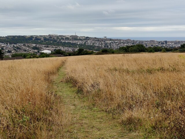
Bear Hill is a prominent hill located in the county of Sussex, England. Situated in the South Downs National Park, it forms part of the rolling landscape that characterizes the region. The hill stands at an elevation of approximately 200 meters (656 feet) above sea level, offering impressive panoramic views of the surrounding countryside.

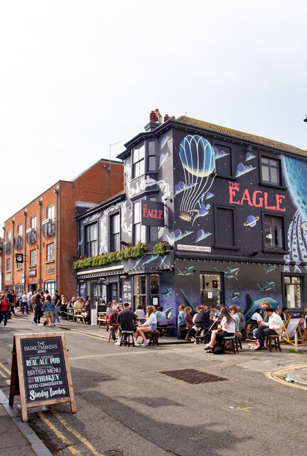
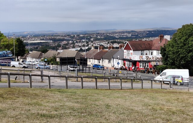
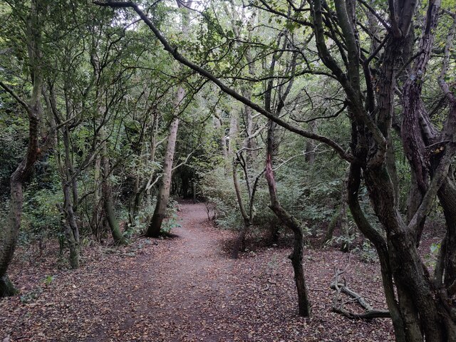
Covered in a patchwork of green fields, woodlands, and hedgerows, Bear Hill is a favorite destination for nature enthusiasts and hikers. The slopes are adorned with a variety of flora and fauna, providing a rich habitat for many species of plants and animals. Visitors can spot native wildlife such as deer, rabbits, and numerous bird species as they explore the hill's trails.

At its peak, Bear Hill features a prominent ancient hillfort, known as the Devil's Jumps. Believed to date back to the Iron Age, this historic site provides an intriguing glimpse into the region's past. The hillfort's earthworks and ramparts can still be seen today, offering visitors a chance to step back in time and imagine the lives of the people who once inhabited the area.

Aside from its natural and historical significance, Bear Hill also boasts recreational opportunities for outdoor enthusiasts. The hill's trails are popular among walkers, runners, and cyclists, who enjoy the challenge of its steep slopes and the beauty of the surrounding landscape.

Overall, Bear Hill in Sussex provides a captivating combination of natural beauty, historical intrigue, and outdoor activities, making it a must-visit destination for those exploring the region.

If you have any feedback on the listing, please let us know in the comments section below.

Bear Hill Images

Images are sourced within 2km of 50.837578/-0.11572978 or Grid Reference TQ3205. Thanks to Geograph Open Source API. All images are credited.

Montreal Road, Brighton Extinction Rebellion mural reflected on the side of a fossil-fuelled parked car, Montreal Road, Brighton
Montreal Road, Brighton
Extinction Rebellion mural reflected on the side of a fossil-fuelled parked car, Montreal Road, Brighton
Brighton : "The Prince Albert" public house Grade II listed - <span class="nowrap"><a title="https://historicengland.org.uk/listing/the-list/list-entry/1381035?section=official-list-entry," rel="nofollow ugc noopener" href="https://historicengland.org.uk/listing/the-list/list-entry/1381035?section=official-list-entry,">Link</a><img style="margin-left:2px;" alt="External link" title="External link - shift click to open in new window" src="https://s1.geograph.org.uk/img/external.png" width="10" height="10"/></span>
Brighton : "The Prince Albert" public house
Grade II listed - LinkExternal link
Brighton : "The Eagle" public house
Brighton Railway Station [1] The impressive large double-spanned curved glass and iron roof, covering all the platforms, was erected in 1882 and was renovated in 2000. The station opened in 1841 and part of the original building still stands but is obscured by later additions. The station is listed, grade II*, with details at: <span class="nowrap"><a title="https://historicengland.org.uk/listing/the-list/list-entry/1380797" rel="nofollow ugc noopener" href="https://historicengland.org.uk/listing/the-list/list-entry/1380797">Link</a><img style="margin-left:2px;" alt="External link" title="External link - shift click to open in new window" src="https://s1.geograph.org.uk/img/external.png" width="10" height="10"/></span>
Brighton is a seaside resort and one of the two main areas of the City of Brighton and Hove. Located on the south coast, the city is some 46 miles (76 kilometres) south of London. There is evidence of settlement in the area back to the Bronze Age. The city developed as a health resort, and with the arrival of the railway in 1841, it became a popular destination for day-trippers from London. The city is renowned for the Royal Pavilion and for its pier.
Brighton Railway Station [1]
The impressive large double-spanned curved glass and iron roof, covering all the platforms, was erected in 1882 and was renovated in 2000. The station opened in 1841 and part of the original building still stands but is obscured by later additions. The station is listed, grade II*, with details at: LinkExternal link Brighton is a seaside resort and one of the two main areas of the City of Brighton and Hove. Located on the south coast, the city is some 46 miles (76 kilometres) south of London. There is evidence of settlement in the area back to the Bronze Age. The city developed as a health resort, and with the arrival of the railway in 1841, it became a popular destination for day-trippers from London. The city is renowned for the Royal Pavilion and for its pier.
Brighton Railway Station [2] The impressive large double-spanned curved glass and iron roof, covering all the platforms, was erected in 1882 and was renovated in 2000. The station opened in 1841 and part of the original building still stands but is obscured by later additions. The station is listed, grade II*, with details at: <span class="nowrap"><a title="https://historicengland.org.uk/listing/the-list/list-entry/1380797" rel="nofollow ugc noopener" href="https://historicengland.org.uk/listing/the-list/list-entry/1380797">Link</a><img style="margin-left:2px;" alt="External link" title="External link - shift click to open in new window" src="https://s1.geograph.org.uk/img/external.png" width="10" height="10"/></span>
Brighton is a seaside resort and one of the two main areas of the City of Brighton and Hove. Located on the south coast, the city is some 46 miles (76 kilometres) south of London. There is evidence of settlement in the area back to the Bronze Age. The city developed as a health resort, and with the arrival of the railway in 1841, it became a popular destination for day-trippers from London. The city is renowned for the Royal Pavilion and for its pier.
Brighton Railway Station [2]
The impressive large double-spanned curved glass and iron roof, covering all the platforms, was erected in 1882 and was renovated in 2000. The station opened in 1841 and part of the original building still stands but is obscured by later additions. The station is listed, grade II*, with details at: LinkExternal link Brighton is a seaside resort and one of the two main areas of the City of Brighton and Hove. Located on the south coast, the city is some 46 miles (76 kilometres) south of London. There is evidence of settlement in the area back to the Bronze Age. The city developed as a health resort, and with the arrival of the railway in 1841, it became a popular destination for day-trippers from London. The city is renowned for the Royal Pavilion and for its pier.
Brighton viewed from near Whitehawk Hill
Round Hill Road in Brighton Round Hill is an inner city suburban area of Brighton. It was developed mostly in the late 19th century on an area of high land overlooking central Brighton, and contains a mix of privately owned and privately rented terraced housing.
Round Hill included a windmill, which stood on the 223-foot (68 m) hilltop until 1913.
Round Hill Road in Brighton
Round Hill is an inner city suburban area of Brighton. It was developed mostly in the late 19th century on an area of high land overlooking central Brighton, and contains a mix of privately owned and privately rented terraced housing. Round Hill included a windmill, which stood on the 223-foot (68 m) hilltop until 1913.
The Roundhill The Roundhill is a plant-based restaurant and pub on the corner of Round Hill Road and Ditchling Road, in the Round Hill area of Brighton.
Round Hill is an inner city suburban area of Brighton. It was developed mostly in the late 19th century on an area of high land overlooking central Brighton, and contains a mix of privately owned and privately rented terraced housing.
Round Hill included a windmill, which stood on the 223-foot (68 m) hilltop until 1913.
<a href="https://www.geograph.org.uk/photo/7270605">TQ3105 : The Roundhill at night</a>
The Roundhill
The Roundhill is a plant-based restaurant and pub on the corner of Round Hill Road and Ditchling Road, in the Round Hill area of Brighton. Round Hill is an inner city suburban area of Brighton. It was developed mostly in the late 19th century on an area of high land overlooking central Brighton, and contains a mix of privately owned and privately rented terraced housing. Round Hill included a windmill, which stood on the 223-foot (68 m) hilltop until 1913. TQ3105 : The Roundhill at night
The Jolly Brewer A public house along Ditchling Road on the corner of Florence Place, in the Round Hill area of Brighton. It dates back to as early as 1848. Tamplin's Brewery was a well known brewer in Victorian times, they acquired the property in 1874.
The Jolly Brewer
A public house along Ditchling Road on the corner of Florence Place, in the Round Hill area of Brighton. It dates back to as early as 1848. Tamplin's Brewery was a well known brewer in Victorian times, they acquired the property in 1874.
The Pub at Fiveways On the corner of Hollingbury Road and Ditchling Road in Brighton.
The Pub at Fiveways
On the corner of Hollingbury Road and Ditchling Road in Brighton.
Blakers Park in Brighton A small park in the Fiveways area of Brighton. The park was opened in 1894, and was given to the people of Brighton by Alderman Blaker.
Blakers Park in Brighton
A small park in the Fiveways area of Brighton. The park was opened in 1894, and was given to the people of Brighton by Alderman Blaker.
The Cleveland Arms A public house overlooking Blakers Park in the Fiveways and Preston Park area of Brighton. It is on the corner of Cleveland Road and Lucerne Road.
The Cleveland Arms
A public house overlooking Blakers Park in the Fiveways and Preston Park area of Brighton. It is on the corner of Cleveland Road and Lucerne Road.
The beer garden of the Preston Park Tavern A public house on the corner of Havelock Road and Lucerne Road, in the Preston Park area of Brighton.
The beer garden of the Preston Park Tavern
A public house on the corner of Havelock Road and Lucerne Road, in the Preston Park area of Brighton.
Havelock Road in Brighton At the junction of Lucerne Road in the Preston Park area of Brighton.
Havelock Road in Brighton
At the junction of Lucerne Road in the Preston Park area of Brighton.
Path to Roedale in Brighton
Hole 5 at Hollingbury Park Golf Course
Woodland next to the Hollingbury Park Golf Course
Grassland above Hollingdean
Show me another place!

Bear Hill is located at Grid Ref: TQ3205 (Lat: 50.837578, Lng: -0.11572978)

Unitary Authority: Brighton and Hove

Police Authority: Sussex

What 3 Words

///fool.squad.begun. Near Brighton, East Sussex

Nearby Locations

Bear Hill

Related Wikis

Bear Road, Brighton

The Bear Road area is a largely residential area in the east of Brighton, part of the English city of Brighton and Hove. Centred on the steep west–east...

Brighton Electric

Brighton Electric is a music studio complex in Brighton, UK, founded in 2000. The main premises was built in 1897 as the Brighton Corporation Tramways...

Brighton Business School

The School of Business and Law is part of the University of Brighton. It offers undergraduate and postgraduate degrees. The school has approximately 500...

Preston Barracks

Preston Barracks was a military installation on Lewes Road, Brighton. All of the buildings on the site (except for the Crimean War Building) have been...

Hartington Road Halt railway station

Hartington Road Halt railway station was a stop on the Kemp Town branch railway line between Brighton station and Kemp Town, Brighton, East Sussex. It...

William Clarke Park

William Clarke Park, better known as The Patch, is a public park in Brighton, England, which was opened in the late 20th century. The park has a sports...

Brighton General Hospital

Brighton General Hospital is an acute general hospital on Elm Grove in Brighton, East Sussex. It is managed by Sussex Community NHS Trust. The main Arundel...

St Wilfrid's Church, Brighton

St Wilfrid's Church is a former Anglican church in the Elm Grove area of Brighton, part of the English city of Brighton and Hove. Designed and built in...

Nearby Amenities

Located within 500m of 50.837578,-0.11572978
Turning Circle
Noexit: yes
Lat/Long: 50.8365657/-0.1218818
Traffic Calming: hump
Lat/Long: 50.8392941/-0.1203614
Traffic Calming: hump
Lat/Long: 50.8386712/-0.1210565
Traffic Calming: hump
Lat/Long: 50.8385042/-0.120195
Traffic Calming: bump
Lat/Long: 50.8394858/-0.1158338
Traffic Calming: hump
Lat/Long: 50.8399569/-0.1153576
Leisure: playground
Lat/Long: 50.8374768/-0.112594
Bus Stop
Eastbourne Road
Bus: yes
Naptan AtcoCode: 149000007738
Operator: Brighton & Hove Buses
Public Transport: platform
Lat/Long: 50.8395859/-0.1124531
Traffic Calming: hump
Lat/Long: 50.8406872/-0.1153594
Traffic Calming: hump
Lat/Long: 50.8403331/-0.1149815
Traffic Calming: hump
Lat/Long: 50.8385946/-0.1171062
Traffic Calming: hump
Lat/Long: 50.840386/-0.1191898
Traffic Calming: hump
Lat/Long: 50.8389962/-0.1164304
Traffic Calming: hump
Lat/Long: 50.8376818/-0.1155892
Direction: backward
Traffic Calming: choker
Lat/Long: 50.8394639/-0.1180318
Traffic Calming: hump
Lat/Long: 50.8381208/-0.119945
Traffic Calming: hump
Lat/Long: 50.8401375/-0.1181585
Traffic Calming: hump
Lat/Long: 50.8387485/-0.1181596
Traffic Calming: hump
Lat/Long: 50.8392742/-0.1136048
Traffic Calming: hump
Lat/Long: 50.8377126/-0.1146059
Traffic Calming: hump
Lat/Long: 50.8379827/-0.1161826
Traffic Calming: hump
Lat/Long: 50.8399449/-0.1125316
Traffic Calming: hump
Lat/Long: 50.8383776/-0.119248
Traffic Calming: hump
Lat/Long: 50.8402829/-0.1134214
Traffic Calming: hump
Lat/Long: 50.8415677/-0.1175649
Traffic Calming: hump
Lat/Long: 50.8380977/-0.1151539
Traffic Calming: hump
Lat/Long: 50.8380231/-0.1189578
Traffic Calming: hump
Lat/Long: 50.840838/-0.1146366
Traffic Calming: hump
Lat/Long: 50.8408875/-0.1201979
Traffic Calming: hump
Lat/Long: 50.841121/-0.1189797
Traffic Calming: hump
Lat/Long: 50.8405341/-0.1139627
Traffic Calming: hump
Lat/Long: 50.8400509/-0.1142644
Traffic Calming: hump
Lat/Long: 50.8399576/-0.1173759
Traffic Calming: hump
Lat/Long: 50.8382061/-0.1207867
Traffic Calming: hump
Lat/Long: 50.8377597/-0.1163712
Traffic Calming: hump
Lat/Long: 50.8402978/-0.116123
Traffic Calming: choker
Lat/Long: 50.8396757/-0.1190287
Traffic Calming: hump
Lat/Long: 50.837608/-0.1148653
Traffic Calming: choker
Lat/Long: 50.8398813/-0.1196756
Traffic Calming: hump
Lat/Long: 50.837934/-0.1214284
Traffic Calming: hump
Lat/Long: 50.8393018/-0.117361
Traffic Calming: hump
Lat/Long: 50.8379331/-0.1180423
Traffic Calming: hump
Lat/Long: 50.8387111/-0.1141206
Traffic Calming: hump
Lat/Long: 50.8378495/-0.1172063
Traffic Calming: hump
Lat/Long: 50.8405884/-0.1174241
Traffic Calming: hump
Lat/Long: 50.8411664/-0.1168997
Post Box
Brand: Royal Mail
Brand Wikidata: Q638098
Collection Plate: CP1
Collection Times: Mo-Fr 09:00; Sa 07:00
Note: There is a postbox sticker on this postbox which reads that from 31.12.2018 the last collection will be made at 09:00 Monday to Friday and 07:00 on Saturdays but the postbox notice has not been updated. The ref should be BN2 194D and CP should be CP1D.
Operator: Royal Mail
Operator Wikidata: Q638098
Post Box Type: pillar
Ref: BN2 194
Royal Cypher: GR
Royal Cypher Wikidata: Q33102273
Lat/Long: 50.8400304/-0.1204733
Post Box
Brand: Royal Mail
Brand Wikidata: Q638098
Collection Times: Mo-Fr 09:00; Sa 07:00
Operator: Royal Mail
Operator Wikidata: Q638098
Post Box Design: type_b
Post Box Type: pillar
Ref: BN2 197
Royal Cypher: EVIIR
Royal Cypher Wikidata: Q33102324
Source: survey
Lat/Long: 50.8339299/-0.119759
Post Box
Brand: Royal Mail
Brand Wikidata: Q638098
Brand Wikipedia: en:Royal Mail
Collection Plate: CP1D
Collection Times: Mo-Fr 09:00; Sa 07:00
Operator: Royal Mail
Operator Wikidata: Q638098
Post Box Type: pillar
Ref: BN2 195D
Royal Cypher: GR
Royal Cypher Wikidata: Q33102273
Lat/Long: 50.8379143/-0.1147663
Bus Stop
Eastbourne Road
Bus: yes
Naptan AtcoCode: 149000006739
Operator: Brighton & Hove Buses
Public Transport: platform
Lat/Long: 50.8399208/-0.1126059
Post Box
Brand: Royal Mail
Brand Wikidata: Q638098
Operator: Royal Mail
Operator Wikidata: Q638098
Ref: BN2 196D
Lat/Long: 50.8381194/-0.1193053
Woodvale North Chapel
Building: chapel
Lat/Long: 50.8349722/-0.1146912
Woodvale South Chapel
Building: chapel
Lat/Long: 50.8347944/-0.1148074
Motorcycle Parking
Access: yes
Covered: no
Lat/Long: 50.836611/-0.1221931
Traffic Calming: hump
Lat/Long: 50.8397725/-0.1165739
H's Cafe
Addr City: Brighton & Hove
Addr Housenumber: 11
Addr Postcode: BN2 4EB
Addr Street: Coombe Road
Contact Facebook: https://www.facebook.com/profile.php?id=100063671795510
Cuisine: english
Disused Amenity: cafe
Fhrs Id: 207665
Outdoor Seating: yes
Source Addr: FHRS Open Data
Wikimedia Commons: Category:H's Cafe, Coombe Road, Brighton
Lat/Long: 50.840249/-0.1206181
Fast Food
Rose Fish Bar
Addr City: Brighton & Hove
Addr Housenumber: 13
Addr Postcode: BN2 4EB
Addr Street: Coombe Road
Cuisine: fish_and_chips
Opening Hours: Mo-Sa 12:00-22:00; Su off
Lat/Long: 50.8402311/-0.1205532
Coombe Road Convenience
Addr City: Brighton & Hove
Addr Housenumber: 17
Addr Postcode: BN2 4EB
Addr Street: Coombe Road
Fhrs Id: 206916
Opening Hours: Mo-Sa 06:15-20:00; Su 07:30-20:00
Shop: convenience
Lat/Long: 50.8401936/-0.1204246
Dentist
South Cliff Dental
Addr City: Brighton & Hove
Addr Housenumber: 15
Addr Postcode: BN2 4EB
Addr Street: Coombe Road
Healthcare: dentist
Website: https://www.southcliffdentalgroup.com/moulescoomb-east-sussex
Lat/Long: 50.840212/-0.1204879
Leisure: garden
Lat/Long: 50.8379987/-0.1092206
Crossing
Lat/Long: 50.8413619/-0.1139819
Crossing
Lat/Long: 50.8415703/-0.1141836
Crossing
Lat/Long: 50.8419144/-0.1139759
Crossing
Lat/Long: 50.841568/-0.1126931
Crossing
Lat/Long: 50.8417586/-0.1142359
Turning Loop
Lat/Long: 50.8396444/-0.1118716
Crossing
Lat/Long: 50.841909/-0.1139681
Grit Bin
Lat/Long: 50.8402252/-0.1113021
Man Made: manhole
Manhole: drain
Lat/Long: 50.8402227/-0.1113445
Street Lamp
Lat/Long: 50.8414927/-0.112567
Street Lamp
Lat/Long: 50.8412352/-0.1122166
Street Lamp
Lat/Long: 50.8405316/-0.1115172
Street Lamp
Lat/Long: 50.8404356/-0.1118019
Crossing
Lat/Long: 50.840635/-0.112266
Crossing
Lat/Long: 50.8406515/-0.1123048
Natural: shrub
Lat/Long: 50.8407916/-0.1125421
Natural: shrub
Lat/Long: 50.8407866/-0.1125326
Crossing
Lat/Long: 50.841163/-0.1135049
Crossing
Lat/Long: 50.8408194/-0.1127026
Crossing
Lat/Long: 50.8408033/-0.112663
Crossing
Lat/Long: 50.8409297/-0.1129624
Crossing
Lat/Long: 50.8415726/-0.1141589
Natural: shrub
Lat/Long: 50.8416133/-0.1143517
Natural: shrub
Lat/Long: 50.8415605/-0.114528
Natural: shrub
Lat/Long: 50.8415448/-0.1145355
Grit Bin
Lat/Long: 50.8416609/-0.1143037
Crossing
Lat/Long: 50.8405558/-0.1123186
Crossing
Lat/Long: 50.8402662/-0.1116458
Crossing
Lat/Long: 50.8415192/-0.1142949
Crossing
Lat/Long: 50.8417047/-0.1143124
Crossing
Lat/Long: 50.8415475/-0.1149097
Crossing
Lat/Long: 50.8415255/-0.1149381
Crossing
Lat/Long: 50.8413465/-0.1141545
Crossing
Lat/Long: 50.8413283/-0.1141258
Crossing
Lat/Long: 50.8412181/-0.1138841
Crossing
Lat/Long: 50.8413816/-0.1149614
Crossing
Lat/Long: 50.8413762/-0.1149217
Crossing
Lat/Long: 50.8398603/-0.1117578
Crossing
Lat/Long: 50.8409237/-0.1146869
Natural: shrub
Lat/Long: 50.8408829/-0.1159818
Natural: shrub
Lat/Long: 50.8410642/-0.1158557
Natural: shrub
Lat/Long: 50.8411012/-0.1158243
Natural: shrub
Lat/Long: 50.8411364/-0.1157915
Natural: shrub
Lat/Long: 50.841132/-0.1157653
Natural: shrub
Lat/Long: 50.8410856/-0.1157911
Crossing
Lat/Long: 50.8410056/-0.1148671
Grit Bin
Lat/Long: 50.8409374/-0.1150019
Fire Hydrant
Emergency: fire_hydrant
Water Source: main
Lat/Long: 50.8413835/-0.1151267
Barrier: debris
Lat/Long: 50.8403615/-0.1127743
Fire Hydrant
Emergency: fire_hydrant
Water Source: main
Lat/Long: 50.8409838/-0.1118006
Crossing
Lat/Long: 50.8366834/-0.1115769
Street Lamp
Height: 18
Lamp Mount: straight_mast
Lamp Type: electric
Lat/Long: 50.8363713/-0.1092549
House: terraced
Lat/Long: 50.8405757/-0.1171567
Building Material: brick
Lat/Long: 50.8404247/-0.1195786
Traffic Calming: hump
Lat/Long: 50.8405203/-0.1184987
Entrance: main
Lat/Long: 50.8397141/-0.121713
Grave Yard
Brighton Extra-Mural Cemetery
Lat/Long: 50.8371768/-0.1201997
Historic: monument
Lat/Long: 50.8369617/-0.1105037
Historic: monument
Lat/Long: 50.8375486/-0.1094137
Bench
Lat/Long: 50.8356786/-0.1109315
Bench
Lat/Long: 50.8357173/-0.110901
Bench
Lat/Long: 50.8357427/-0.1108735
Height: 10
Lat/Long: 50.8416263/-0.1176707
House: terraced
Lat/Long: 50.8413374/-0.117925
Height: 10
Lat/Long: 50.8406588/-0.1185307
Traffic Calming: hump
Lat/Long: 50.8404652/-0.120576
Traffic Calming: hump
Lat/Long: 50.8395673/-0.1147866
Traffic Calming: hump
Lat/Long: 50.8392563/-0.1143412
Traffic Calming: bump
Lat/Long: 50.8390644/-0.1193657
Traffic Calming: table
Lat/Long: 50.8397868/-0.1191504
Give Way
Direction: backward
Lat/Long: 50.8398457/-0.1195575
Give Way
Direction: backward
Lat/Long: 50.839407/-0.1177865
Traffic Calming: bump
Lat/Long: 50.8335944/-0.1188001
Traffic Calming: bump
Lat/Long: 50.8333394/-0.1179589
Traffic Calming: bump
Lat/Long: 50.8396056/-0.1211403
Traffic Calming: bump
Lat/Long: 50.837355/-0.1220477
Addr Country: GB
Building: house
Building Levels: 2
Building Material: brick
Height: 10
House: terraced
Roof Material: roof_tiles
Roof Orientation: across
Roof Shape: gabled
Lat/Long: 50.8382072/-0.1128262
Man Made: antenna
Lat/Long: 50.8372962/-0.1141682
Power: transformer
Lat/Long: 50.8373119/-0.1141712
Barrier: bollard
Bollard: fixed
Material: stone
Lat/Long: 50.8384907/-0.1130898
Barrier: bollard
Bollard: fixed
Material: stone
Lat/Long: 50.8385479/-0.1130382
Barrier: bollard
Bollard: fixed
Material: stone
Lat/Long: 50.8385663/-0.1130213
Barrier: bollard
Bollard: fixed
Material: stone
Lat/Long: 50.8385089/-0.1130726
Bus: yes
Public Transport: stop_position
Lat/Long: 50.8395342/-0.1183624
Barrier: bollard
Bollard: fixed
Material: metal
Lat/Long: 50.839422/-0.1179921
Barrier: bollard
Bollard: fixed
Material: metal
Lat/Long: 50.8394362/-0.1180045
Barrier: bollard
Bollard: fixed
Material: metal
Lat/Long: 50.8394419/-0.1180259
Barrier: bollard
Bollard: fixed
Material: metal
Lat/Long: 50.8394506/-0.1180648
Barrier: bollard
Bollard: fixed
Material: metal
Lat/Long: 50.8394555/-0.1180879
Barrier: bollard
Bollard: fixed
Material: metal
Lat/Long: 50.8394565/-0.118106
Barrier: bollard
Bollard: fixed
Material: metal
Lat/Long: 50.839458/-0.1181248
Barrier: bollard
Bollard: fixed
Material: metal
Lat/Long: 50.8394587/-0.1181684
Barrier: bollard
Bollard: fixed
Material: metal
Lat/Long: 50.8394542/-0.118206
Barrier: bollard
Bollard: fixed
Material: metal
Lat/Long: 50.8394313/-0.1182455
Barrier: bollard
Bollard: fixed
Material: metal
Lat/Long: 50.8394072/-0.1183039
Barrier: bollard
Bollard: fixed
Material: metal
Lat/Long: 50.8393875/-0.1183582
Barrier: bollard
Bollard: fixed
Material: metal
Lat/Long: 50.8393693/-0.1184098
Barrier: bollard
Bollard: fixed
Material: metal
Lat/Long: 50.839418/-0.1184544
Barrier: bollard
Bollard: fixed
Material: metal
Lat/Long: 50.8394379/-0.1184018
Entrance: main
Lat/Long: 50.8399158/-0.1176982
Height: 30
Man Made: chimney
Lat/Long: 50.8357509/-0.1106344
Street Lamp
Lamp Mount: straight_mast
Lamp Type: electric
Ref: 4
Lat/Long: 50.8377096/-0.1224017
Street Lamp
Height: 18
Lamp Mount: straight_mast
Lamp Type: electric
Lat/Long: 50.8371772/-0.1161088
Street Lamp
Height: 18
Lamp Mount: straight_mast
Lamp Type: electric
Lat/Long: 50.8376502/-0.1210146
Street Lamp
Height: 18
Lamp Mount: straight_mast
Lamp Type: electric
Lat/Long: 50.8375501/-0.1199902
Street Lamp
Height: 18
Lamp Mount: straight_mast
Lamp Type: electric
Lat/Long: 50.8374591/-0.1190167
Street Lamp
Height: 18
Lamp Mount: straight_mast
Lamp Type: electric
Lat/Long: 50.8373677/-0.1180536
Street Lamp
Height: 18
Lamp Mount: straight_mast
Lamp Type: electric
Lat/Long: 50.8370694/-0.115082
Height: 9
Man Made: utility_pole
Material: wood
Operator: BT Openreach
Utility: telecom
Lat/Long: 50.8370244/-0.1155569
Height: 9
Man Made: utility_pole
Material: wood
Operator: BT Openreach
Utility: telecom
Lat/Long: 50.8377094/-0.1222982
Height: 9
Man Made: utility_pole
Material: wood
Operator: BT Openreach
Utility: telecom
Lat/Long: 50.8373282/-0.118701
Height: 9
Man Made: utility_pole
Material: wood
Operator: BT Openreach
Utility: telecom
Lat/Long: 50.8371192/-0.1165413
Street Lamp
Height: 18
Lamp Mount: straight_mast
Lamp Type: electric
Lat/Long: 50.8376064/-0.1215202
Street Lamp
Height: 18
Lamp Mount: straight_mast
Lamp Type: electric
Lat/Long: 50.8375033/-0.1205469
Street Lamp
Height: 18
Lamp Mount: straight_mast
Lamp Type: electric
Lat/Long: 50.8374065/-0.1195119
Street Lamp
Height: 18
Lamp Mount: straight_mast
Lamp Type: electric
Lat/Long: 50.8371305/-0.116655
Street Lamp
Height: 18
Lamp Mount: straight_mast
Lamp Type: electric
Lat/Long: 50.8367502/-0.1121867
Street Lamp
Height: 18
Lamp Mount: straight_mast
Lamp Type: electric
Lat/Long: 50.8366229/-0.1117482
Street Lamp
Height: 18
Lamp Mount: straight_mast
Lamp Type: electric
Lat/Long: 50.8367207/-0.1127104
Street Lamp
Height: 18
Lamp Mount: straight_mast
Lamp Type: electric
Lat/Long: 50.8369241/-0.1146685
Street Lamp
Height: 18
Lamp Mount: straight_mast
Lamp Type: electric
Lat/Long: 50.8370264/-0.1156495
Height: 9
Man Made: utility_pole
Lat/Long: 50.8364671/-0.1102545
Street Lamp
Height: 18
Lamp Mount: straight_mast
Lamp Type: electric
Lat/Long: 50.836523/-0.1107316
Street Lamp
Height: 18
Lamp Mount: straight_mast
Lamp Type: electric
Lat/Long: 50.8372797/-0.1171321
Barrier: bollard
Lat/Long: 50.8338238/-0.1194026
Street Lamp
Lamp Mount: straight_mast
Lamp Type: electric
Ref: 11
Lat/Long: 50.8337959/-0.1193064
Height: 9
Man Made: utility_pole
Material: wood
Operator: BT Openreach
Ref: DP 1869
Utility: telecom
Lat/Long: 50.8337014/-0.118991
Height: 9
Man Made: utility_pole
Material: wood
Operator: BT Openreach
Ref: DP 1870
Utility: telecom
Lat/Long: 50.8334483/-0.1181547
Fire Hydrant
Emergency: fire_hydrant
Fire Hydrant Position: sidewalk
Fire Hydrant Type: underground
Water Source: main
Lat/Long: 50.8332601/-0.1175228
Street Lamp
Lamp Mount: straight_mast
Lamp Type: electric
Lat/Long: 50.8332617/-0.1175388
Height: 9
Man Made: utility_pole
Material: wood
Operator: BT Openreach
Utility: telecom
Lat/Long: 50.8332172/-0.1173903
Street Lamp
Lamp Mount: straight_mast
Lamp Type: electric
Lat/Long: 50.8335897/-0.1189496
Height: 9
Man Made: utility_pole
Material: wood
Ref: DP 1868
Lat/Long: 50.8339374/-0.1197908
Power: transformer
Lat/Long: 50.8342142/-0.1203664
Street Lamp
Lamp Mount: straight_mast
Lamp Type: electric
Ref: 5
Lat/Long: 50.8357795/-0.1212105
Street Lamp
Lamp Mount: straight_mast
Lamp Type: electric
Ref: 2
Lat/Long: 50.835541/-0.1199212
Height: 9
Man Made: utility_pole
Material: wood
Operator: BT Openreach
Ref: *862
Utility: telecom
Lat/Long: 50.8355547/-0.1200299
Barrier: bollard
Lat/Long: 50.8358058/-0.1215165
Street Lamp
Lamp Mount: straight_mast
Lamp Type: electric
Ref: 6
Lat/Long: 50.8357231/-0.1216511
Height: 9
Man Made: utility_pole
Material: wood
Operator: BT Openreach
Utility: telecom
Lat/Long: 50.8357128/-0.1215586
Street Lamp
Lamp Mount: straight_mast
Lamp Type: electric
Ref: 4
Lat/Long: 50.8351759/-0.1200708
Street Lamp
Lamp Mount: straight_mast
Lamp Type: electric
Ref: 2
Lat/Long: 50.8346162/-0.1204734
Fire Hydrant
Emergency: fire_hydrant
Fire Hydrant Type: underground
Water Source: main
Lat/Long: 50.8353825/-0.1199159
Bench
Colour: Green
Material: wood
Seats: 3
Lat/Long: 50.8410366/-0.1118352
The data included in this document is from www.openstreetmap.org. The data is made available under ODbL.

Have you been to Bear Hill?

Leave your review of Bear Hill below (or comments, questions and feedback).