Balcombe Hill
Hill, Mountain in Sussex Mid Sussex
England
Balcombe Hill

Balcombe Hill is a prominent geographical feature located in Sussex, England. It is classified as a hill rather than a mountain, as its elevation does not meet the criteria for the latter designation. The hill is positioned within the wider South Downs National Park, which is renowned for its scenic landscapes and rich biodiversity.
With an elevation of approximately 137 meters (449 feet), Balcombe Hill offers captivating panoramic views of the surrounding countryside. The hill is characterized by its gently rolling terrain, covered in lush greenery and dotted with vibrant wildflowers during the spring and summer months. The area is a popular destination for nature enthusiasts and hikers, who can enjoy the numerous walking trails that crisscross the hill.
Balcombe Hill is also home to a diverse range of flora and fauna, with various species of plants and animals thriving in its natural habitat. Visitors may encounter wildlife such as rabbits, foxes, and a variety of bird species as they explore the hill's gentle slopes.
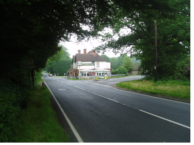
The hill is conveniently located near the village of Balcombe, which offers amenities such as cafes, pubs, and accommodations for those wishing to stay in the area. Additionally, Balcombe Hill's proximity to other attractions within the South Downs National Park, including ancient woodlands and historical sites, make it an ideal destination for both locals and tourists seeking to immerse themselves in the beauty of the English countryside.
If you have any feedback on the listing, please let us know in the comments section below.
Balcombe Hill Images
Images are sourced within 2km of 51.080948/-0.11144126 or Grid Reference TQ3232. Thanks to Geograph Open Source API. All images are credited.


Balcombe Hill is located at Grid Ref: TQ3232 (Lat: 51.080948, Lng: -0.11144126)
Administrative County: West Sussex
District: Mid Sussex
Police Authority: Sussex
What 3 Words
///classics.insulated.pulp. Near Balcombe, West Sussex
Nearby Locations
Related Wikis

Worth School
Worth School is a private co-educational Roman Catholic boarding and day school for pupils from 11 to 18 years of age near Worth, West Sussex, England...
Worth Abbey
The Abbey of Our Lady, Help of Christians, commonly known as Worth Abbey, is a community of Roman Catholic monks who follow the Rule of St Benedict near...

Wakehurst and Chiddingly Woods
Wakehurst and Chiddingly Woods is a 155.9-hectare (385-acre) biological and geological Site of Special Scientific Interest south-east of Crawley in West...

Worth Forest (electoral division)
Worth Forest is an electoral division of West Sussex in the United Kingdom, and returns one member to sit on West Sussex County Council. == Extent == The...

Burgess Hill East (electoral division)
Burgess Hill East is an electoral division of West Sussex in the United Kingdom, and returns one member to sit on West Sussex County Council. == Extent... ==

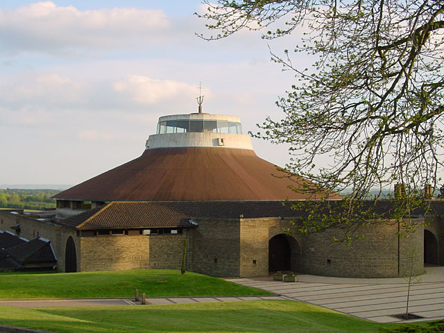
Millennium Seed Bank Partnership
The Millennium Seed Bank Partnership (MSBP or MSB), formerly known as the Millennium Seed Bank Project, is the largest ex situ plant conservation programme...

Wakehurst Place
Wakehurst, previously known as Wakehurst Place, is a house and botanic gardens in West Sussex, England, owned by the National Trust but used and managed...
Tulleys Farm
Tulleys Farm is a fourth-generation family farm, located in West Sussex. Originating in 1937, the farming business at Tulleys was founded by Bernard Beare...
Nearby Amenities
Located within 500m of 51.080948,-0.11144126Have you been to Balcombe Hill?
Leave your review of Balcombe Hill below (or comments, questions and feedback).