Houghton Hill

Hill, Mountain in Huntingdonshire Huntingdonshire

England

Houghton Hill

High water on the Great Ouse, St Ives Flooding, after heavy rain from Storm Henk, has rendered the footbridge to Holt Island inaccessible.
High water on the Great Ouse, St Ives Credit: Andrew Richardson

Houghton Hill is a prominent natural feature located in the district of Huntingdonshire, Cambridgeshire, England. With an elevation of approximately 63 meters (207 feet) above sea level, it is considered a hill rather than a mountain. The hill is situated near the village of Houghton, which lies about 6 kilometers (3.7 miles) northwest of the town of Huntingdon.

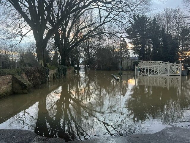
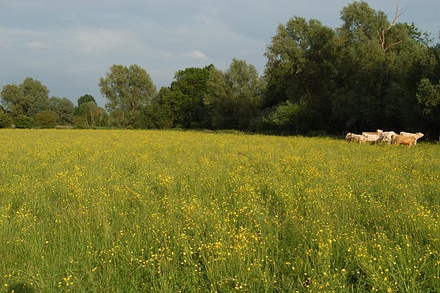
Houghton Hill is characterized by its gently sloping terrain and offers picturesque views of the surrounding countryside. It is covered with lush grassland and scattered patches of woodland, providing a diverse habitat for a variety of flora and fauna. The hill is part of the Houghton Meadows Site of Special Scientific Interest (SSSI), recognized for its biological importance.

Due to its accessible location, Houghton Hill is a popular destination for locals and visitors alike. It offers several walking trails and footpaths that allow visitors to explore the area and enjoy the scenic beauty. The hill is particularly renowned for its panoramic views, especially during the spring and summer months when the landscape is adorned with colorful wildflowers and vibrant greenery.

Houghton Hill also holds historical significance, with evidence of ancient settlements and archaeological finds in the vicinity. The hill's proximity to the River Great Ouse adds to its charm, as visitors can appreciate the river's meandering course from the elevated vantage point.

Overall, Houghton Hill is a cherished natural landmark in Huntingdonshire, offering a serene escape and a glimpse into the region's rich history and natural beauty.

If you have any feedback on the listing, please let us know in the comments section below.

Houghton Hill Images

Images are sourced within 2km of 52.334192/-0.10186845 or Grid Reference TL2972. Thanks to Geograph Open Source API. All images are credited.

High water on the Great Ouse, St Ives Flooding, after heavy rain from Storm Henk, has rendered the footbridge to Holt Island inaccessible.
High water on the Great Ouse, St Ives
Flooding, after heavy rain from Storm Henk, has rendered the footbridge to Holt Island inaccessible.
Flooding at The Waits, St Ives The result of rain from Storm Henk and high water levels in the River Great Ouse.
Flooding at The Waits, St Ives
The result of rain from Storm Henk and high water levels in the River Great Ouse.
Norris Museum gardens at St Ives
White bridge over the river The bridge leads to the Holt Island Nature Reserve which is currently open at weekends and bank holidays from 10-4.
White bridge over the river
The bridge leads to the Holt Island Nature Reserve which is currently open at weekends and bank holidays from 10-4.
The Holt Information point at Holt Island Nature Reserve.
The Holt
Information point at Holt Island Nature Reserve.
River Great Ouse from the Holt Island Nature Reserve A familiar landmark in the town of St Ives, the bridge over the river, but seen from an unusual angle.
River Great Ouse from the Holt Island Nature Reserve
A familiar landmark in the town of St Ives, the bridge over the river, but seen from an unusual angle.
Houghton at Christmas The village shop, owned and run by the community, is well lit up for the festivities.
Houghton at Christmas
The village shop, owned and run by the community, is well lit up for the festivities.
Junction with Houghton Road
Sheep on Hemingford Meadow
Houghton Meadows Species rich alkaline grassland managed as a Wildlife Trust reserve.
Houghton Meadows
Species rich alkaline grassland managed as a Wildlife Trust reserve.
Path by The Thicket A footpath, with considerate cycling permitted.
Path by The Thicket
A footpath, with considerate cycling permitted.
Hemingford Grey, St James
The Back Water of the River Great Ouse A narrow strip of water separating The Holt from the main stream of the river.
The Back Water of the River Great Ouse
A narrow strip of water separating The Holt from the main stream of the river.
Ouse Valley Way sign A sign for the public footpath along the Thicket to Houghton and Wyton. Also an information board about the island, that the bridge on the left leads to, Ingle Holt.
Ouse Valley Way sign
A sign for the public footpath along the Thicket to Houghton and Wyton. Also an information board about the island, that the bridge on the left leads to, Ingle Holt.
St Ives' Methodist Church On the Waits. With decorative wrought iron rails - for details see <a href="https://www.geograph.org.uk/photo/7178249">TL3171 : Wrought iron wildlife</a>, <a href="https://www.geograph.org.uk/photo/7178251">TL3171 : Wrought iron wildlife</a> and <a href="https://www.geograph.org.uk/photo/7178252">TL3171 : Wrought iron wildlife</a>.
St Ives' Methodist Church
On the Waits. With decorative wrought iron rails - for details see TL3171 : Wrought iron wildlife, TL3171 : Wrought iron wildlife and TL3171 : Wrought iron wildlife.
Wrought iron wildlife Part of the decorative railing in front of St Ives' Methodist Church <a href="https://www.geograph.org.uk/photo/7178244">TL3171 : St Ives' Methodist Church</a>.
Wrought iron wildlife
Part of the decorative railing in front of St Ives' Methodist Church TL3171 : St Ives' Methodist Church.
Wrought iron wildlife Decorative railing in front of St Ives' Methodist Church <a href="https://www.geograph.org.uk/photo/7178244">TL3171 : St Ives' Methodist Church</a>.
Wrought iron wildlife
Decorative railing in front of St Ives' Methodist Church TL3171 : St Ives' Methodist Church.
Wrought iron wildlife Decorative railing in front of St Ives' Methodist Church <a href="https://www.geograph.org.uk/photo/7178244">TL3171 : St Ives' Methodist Church</a>.
Wrought iron wildlife
Decorative railing in front of St Ives' Methodist Church TL3171 : St Ives' Methodist Church.
Show me another place!

Houghton Hill is located at Grid Ref: TL2972 (Lat: 52.334192, Lng: -0.10186845)

Administrative County: Cambridgeshire

District: Huntingdonshire

Police Authority: Cambridgeshire

What 3 Words

///massing.soonest.circles. Near Houghton, Cambridgeshire

Nearby Locations

Houghton Hill

Related Wikis

Houghton Poultry Research Station

The Houghton Poultry Research Station was a poultry disease research station in northern Cambridgeshire. By the 1970s, the site was the largest centre...

Houghton Meadows

Houghton Meadows is a 4.7-hectare (12-acre) biological Site of Special Scientific Interest (SSSI) between Houghton and St Ives in Cambridgeshire. The SSSI...

Houghton, Cambridgeshire

Houghton is a village and former civil parish, now in the parish of Houghton and Wyton, in Cambridgeshire, England, approximately 3 miles (5 km) east...

St Ivo Academy

St Ivo Academy is an academy secondary school and part of Astrea Academy Trust, with sixth form in St. Ives, Cambridgeshire, originally St Ivo School before...

Nearby Amenities

Located within 500m of 52.334192,-0.10186845
Bus Stop
Sawtry Way
Naptan AtcoCode: 0500HHOUG003
Naptan Bearing: SE
Naptan BusStopType: CUS
Naptan CommonName: Sawtry Way
Naptan Indicator: near
Naptan Landmark: Sawtry Way
Naptan NaptanCode: cmbdpgdt
Naptan ShortCommonName: Houghton Hill
Naptan Street: Houghton Road
Naptan Verified: no
Shelter: no
Source: naptan_import
Lat/Long: 52.3335265/-0.0994806
Bus Stop
Sawtry Way
Naptan AtcoCode: 0500HHOUG006
Naptan Bearing: NW
Naptan CommonName: Sawtry Way
Naptan Indicator: opp
Naptan Landmark: Sawtry Way
Naptan NaptanCode: cmbdpgjd
Naptan ShortCommonName: Houghton Hill
Naptan Street: Houghton Road
Naptan Verified: no
Source: naptan_import
Lat/Long: 52.3334587/-0.0995635
Power: pole
Lat/Long: 52.3316905/-0.1019483
Material: wood
Power: pole
Lat/Long: 52.3338426/-0.1008404
Power: pole
Lat/Long: 52.3298187/-0.1035489
Power: pole
Lat/Long: 52.333087/-0.1012051
Power: pole
Lat/Long: 52.3324117/-0.1015619
Power: pole
Lat/Long: 52.3307087/-0.1027958
Houghton Hill Farm
Landuse: farm
Note Retag: CS #48756035
Lat/Long: 52.3369318/-0.1010514
Power: pole
Lat/Long: 52.330837/-0.1067377
Traffic Signals
Lat/Long: 52.3332206/-0.094707
Bus Stop
Garner Drive
Bench: yes
Bus: yes
Naptan AtcoCode: 0500HHOUG022
Naptan Bearing: W
Naptan CommonName: Garner Drive
Naptan Indicator: opp
Naptan Landmark: Garner Drive
Naptan NaptanCode: CMBGMDMW
Naptan ShortCommonName: Garner Drive
Naptan StopType: CUS
Naptan Street: Houghton Road
Public Transport: platform
Shelter: yes
Source: naptan;make_stop.py
Lat/Long: 52.3331254/-0.0954529
Give Way
Lat/Long: 52.3342123/-0.1014452
Crossing
Lat/Long: 52.3340633/-0.102628
Noexit: yes
Lat/Long: 52.3339731/-0.0959375
Noexit: yes
Lat/Long: 52.333887/-0.0959357
Generator Method: photovoltaic
Generator Output Electricity: yes
Generator Source: solar
Generator Type: solar_photovoltaic_panel
Location: roof
Power: generator
Lat/Long: 52.3325749/-0.1081467
Generator Method: photovoltaic
Generator Output Electricity: yes
Generator Source: solar
Generator Type: solar_photovoltaic_panel
Location: roof
Power: generator
Lat/Long: 52.332756/-0.1037747
Generator Method: photovoltaic
Generator Output Electricity: yes
Generator Source: solar
Generator Type: solar_photovoltaic_panel
Location: roof
Power: generator
Lat/Long: 52.3327339/-0.1037197
Generator Method: photovoltaic
Generator Output Electricity: yes
Generator Source: solar
Generator Type: solar_photovoltaic_panel
Location: roof
Power: generator
Lat/Long: 52.3328241/-0.1034273
Crossing
Lat/Long: 52.3333978/-0.0994118
Crossing
Lat/Long: 52.3337029/-0.100294
Crossing
Lat/Long: 52.3340657/-0.1050919
Crossing
Lat/Long: 52.3340929/-0.1059606
Crossing
Lat/Long: 52.3341077/-0.1064635
Crossing
Lat/Long: 52.3341344/-0.1074514
Crossing
Lat/Long: 52.3341545/-0.1080999
Crossing
Lat/Long: 52.3341884/-0.1091127
Marker: aerial
Utility: gas
Lat/Long: 52.3331764/-0.0962913
Houghton Grange
Construction: residential
Operator: Savilles
Place: neighbourhood
Lat/Long: 52.3320453/-0.099641
The data included in this document is from www.openstreetmap.org. The data is made available under ODbL.

Have you been to Houghton Hill?

Leave your review of Houghton Hill below (or comments, questions and feedback).