Parting Hill

Hill, Mountain in Middlesex

England

Parting Hill

Clockwise M25, Enfield Officially named the London Orbital and frequently derided as nothing more than a very big car park, the M25 is a 117-mile orbital motorway that encircles London; one of the world's biggest ring roads (Europe's second longest orbital road after the Berliner Ring, which is 122 miles). It is not, however, a continuous loop of motorway as the Dartford Crossing section (comprising the Dartford Tunnels and the Queen Elizabeth II Bridge) over the Thames and its approach roads are designated as the A282. 

Constructed between 1975 and 1986, the M25 is reputedly the most expensive motorway Britain ever built, costing a total of £909m or roughly £7.5m per mile, but at the time of its planning, the demand for the road was considerably underestimated so that when it was finally completed in 1986, it was already out of date. Demand outstripped capacity within a few years and ever since then it's been very heavily congested. 

The M25 is one of the UK’s busiest motorways, carrying up to 200,000 vehicles and 10,000 HGVs per day (AADT - Annual Average Daily Traffic flow) on the section near to Heathrow Airport. Since its opening in the 1980s, the southern, western and eastern sections have been widened to largely dual four lane (D4M) standard, but much of the motorway retains its dual three lane road (D3M) cross-section as originally built. 

The M25 was home to England's first Variable Speed Limits on motorways between the A3 and M4 in the early 1990s.

<span class="nowrap"><a title="http://www.cbrd.co.uk/motorway/m25/" rel="nofollow ugc noopener" href="http://www.cbrd.co.uk/motorway/m25/">Link</a><img style="margin-left:2px;" alt="External link" title="External link - shift click to open in new window" src="https://s1.geograph.org.uk/img/external.png" width="10" height="10"/></span>  cbrd
<span class="nowrap"><a title="http://www.sabre-roads.org.uk/wiki/index.php?title=M25" rel="nofollow ugc noopener" href="http://www.sabre-roads.org.uk/wiki/index.php?title=M25">Link</a><img style="margin-left:2px;" alt="External link" title="External link - shift click to open in new window" src="https://s1.geograph.org.uk/img/external.png" width="10" height="10"/></span>  SABRE
Clockwise M25, Enfield Credit: David Dixon

Parting Hill is a prominent geographical feature located in the county of Middlesex, England. Situated in the southwestern part of the county, it is classified as a hill or mountain due to its significant elevation and steep slopes.

Rising to an impressive height of approximately 200 meters (656 feet) above sea level, Parting Hill offers breathtaking panoramic views of the surrounding countryside. Its strategic location allows visitors to observe the picturesque landscapes of Middlesex, with its rolling hills and verdant valleys stretching as far as the eye can see.

The hill is known for its distinctive shape, with a rounded peak that provides a distinctive silhouette against the sky. Its slopes are covered in lush greenery, including a variety of native trees and shrubs, creating a rich and diverse ecosystem. The hillside is also home to numerous species of wildlife, making it a popular destination for nature enthusiasts and birdwatchers.

Parting Hill's location has also played a significant role in local history. It is believed to have been a landmark for travelers and traders in ancient times, serving as a navigational point and a meeting place. Today, it continues to attract visitors from near and far, offering a peaceful retreat from the bustling urban areas nearby.

Access to Parting Hill is available through a network of footpaths and trails, allowing visitors to explore its beauty at their own pace. Whether one chooses to hike to the summit or simply enjoy a leisurely stroll around its base, Parting Hill promises an unforgettable experience for all who venture to its summit.

If you have any feedback on the listing, please let us know in the comments section below.
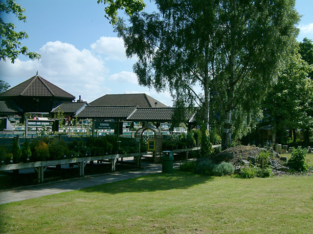
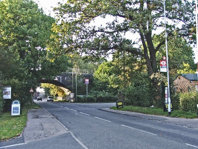
Parting Hill Images

Images are sourced within 2km of 51.678913/-0.13240367 or Grid Reference TQ2999. Thanks to Geograph Open Source API. All images are credited.

Clockwise M25, Enfield Officially named the London Orbital and frequently derided as nothing more than a very big car park, the M25 is a 117-mile orbital motorway that encircles London; one of the world's biggest ring roads (Europe's second longest orbital road after the Berliner Ring, which is 122 miles). It is not, however, a continuous loop of motorway as the Dartford Crossing section (comprising the Dartford Tunnels and the Queen Elizabeth II Bridge) over the Thames and its approach roads are designated as the A282. 

Constructed between 1975 and 1986, the M25 is reputedly the most expensive motorway Britain ever built, costing a total of £909m or roughly £7.5m per mile, but at the time of its planning, the demand for the road was considerably underestimated so that when it was finally completed in 1986, it was already out of date. Demand outstripped capacity within a few years and ever since then it's been very heavily congested. 

The M25 is one of the UK’s busiest motorways, carrying up to 200,000 vehicles and 10,000 HGVs per day (AADT - Annual Average Daily Traffic flow) on the section near to Heathrow Airport. Since its opening in the 1980s, the southern, western and eastern sections have been widened to largely dual four lane (D4M) standard, but much of the motorway retains its dual three lane road (D3M) cross-section as originally built. 

The M25 was home to England's first Variable Speed Limits on motorways between the A3 and M4 in the early 1990s.

<span class="nowrap"><a title="http://www.cbrd.co.uk/motorway/m25/" rel="nofollow ugc noopener" href="http://www.cbrd.co.uk/motorway/m25/">Link</a><img style="margin-left:2px;" alt="External link" title="External link - shift click to open in new window" src="https://s1.geograph.org.uk/img/external.png" width="10" height="10"/></span>  cbrd
<span class="nowrap"><a title="http://www.sabre-roads.org.uk/wiki/index.php?title=M25" rel="nofollow ugc noopener" href="http://www.sabre-roads.org.uk/wiki/index.php?title=M25">Link</a><img style="margin-left:2px;" alt="External link" title="External link - shift click to open in new window" src="https://s1.geograph.org.uk/img/external.png" width="10" height="10"/></span>  SABRE
Clockwise M25, Enfield
Officially named the London Orbital and frequently derided as nothing more than a very big car park, the M25 is a 117-mile orbital motorway that encircles London; one of the world's biggest ring roads (Europe's second longest orbital road after the Berliner Ring, which is 122 miles). It is not, however, a continuous loop of motorway as the Dartford Crossing section (comprising the Dartford Tunnels and the Queen Elizabeth II Bridge) over the Thames and its approach roads are designated as the A282. Constructed between 1975 and 1986, the M25 is reputedly the most expensive motorway Britain ever built, costing a total of £909m or roughly £7.5m per mile, but at the time of its planning, the demand for the road was considerably underestimated so that when it was finally completed in 1986, it was already out of date. Demand outstripped capacity within a few years and ever since then it's been very heavily congested. The M25 is one of the UK’s busiest motorways, carrying up to 200,000 vehicles and 10,000 HGVs per day (AADT - Annual Average Daily Traffic flow) on the section near to Heathrow Airport. Since its opening in the 1980s, the southern, western and eastern sections have been widened to largely dual four lane (D4M) standard, but much of the motorway retains its dual three lane road (D3M) cross-section as originally built. The M25 was home to England's first Variable Speed Limits on motorways between the A3 and M4 in the early 1990s. LinkExternal link cbrd LinkExternal link SABRE
Crews Hill Golf Club The large clubhouse proudly announces that Crews Hill Golf Club was founded in 1916, although the website gives a date of 1920. In fact, it seems that relatively little is known about the early years of the club although the land was initially leased from Trinity College, Cambridge and Harry Shapland Colt, a renowned golf architect at the time, was appointed to design the course. This must have been a significant undertaking at the time of the First World War when no mechanical equipment was available. The course was completed in 1922 and remains substantially the same today; it claims to be 'ranked one of the top 10 courses in Middlesex'.
Crews Hill Golf Club
The large clubhouse proudly announces that Crews Hill Golf Club was founded in 1916, although the website gives a date of 1920. In fact, it seems that relatively little is known about the early years of the club although the land was initially leased from Trinity College, Cambridge and Harry Shapland Colt, a renowned golf architect at the time, was appointed to design the course. This must have been a significant undertaking at the time of the First World War when no mechanical equipment was available. The course was completed in 1922 and remains substantially the same today; it claims to be 'ranked one of the top 10 courses in Middlesex'.
Cattlegate Road, Crews Hill Crews Hill could be used as an example of an area described as 'urban fringe' with a mix of land use including some housing, market gardening activity and a golf course. There is a railway station on the Hertford Loop to the left of this view along Cattlegate Road.
Cattlegate Road, Crews Hill
Crews Hill could be used as an example of an area described as 'urban fringe' with a mix of land use including some housing, market gardening activity and a golf course. There is a railway station on the Hertford Loop to the left of this view along Cattlegate Road.
Enfield Greenway This walking and cycling track follows the route of the London Loop from The Ridgeway towards Hadley Wood.  As part of the Greenway project, thousands of saplings have been planted along the way.
Enfield Greenway
This walking and cycling track follows the route of the London Loop from The Ridgeway towards Hadley Wood. As part of the Greenway project, thousands of saplings have been planted along the way.
Enfield Greenway Completed in 2021, this section of the Enfield Greenway is clearly designed to take London Loop walkers off The Ridgeway.  But at the time of writing, local signage was still directing walkers along the main road, and the new path was not shown on Ordnance Survey maps.

To the south of the path are four small ponds.
Enfield Greenway
Completed in 2021, this section of the Enfield Greenway is clearly designed to take London Loop walkers off The Ridgeway. But at the time of writing, local signage was still directing walkers along the main road, and the new path was not shown on Ordnance Survey maps. To the south of the path are four small ponds.
Crews Hill Golf Course Public footpaths crossing golf courses are not unusual and, however inconvenient the club may find them, the right of walkers to use them has to be respected. There are normally warning signs to watch out for flying golf balls and listen for shouts of 'fore'. This path is actually the beginning of the Hertfordshire Chain Walk which eventually leads to Ashwell & Morden station in the north of the county via a somewhat roundabout route. This stretch is in the London Borough of Enfield, however, part of the old county of Middlesex, and has never been in Hertfordshire.
Crews Hill Golf Course
Public footpaths crossing golf courses are not unusual and, however inconvenient the club may find them, the right of walkers to use them has to be respected. There are normally warning signs to watch out for flying golf balls and listen for shouts of 'fore'. This path is actually the beginning of the Hertfordshire Chain Walk which eventually leads to Ashwell & Morden station in the north of the county via a somewhat roundabout route. This stretch is in the London Borough of Enfield, however, part of the old county of Middlesex, and has never been in Hertfordshire.
Trent Park Woods Looking North The landscape looks like anywhere in middle England but is inside the M25 motorway in the London Borough of Enfield. In the gap on the horizon between the trees about a third in from the right is the Ridgeway, the road linking Enfield to Potters Bar. The grass in the field had just been mown and baled away. It was a baking June day and I can almost smell the hot cut grass in the photo.
Trent Park Woods Looking North
The landscape looks like anywhere in middle England but is inside the M25 motorway in the London Borough of Enfield. In the gap on the horizon between the trees about a third in from the right is the Ridgeway, the road linking Enfield to Potters Bar. The grass in the field had just been mown and baled away. It was a baking June day and I can almost smell the hot cut grass in the photo.
M25 crossing Cattlegate Road
Garden centre, Crews Hill Crews Hill road is lined with garden centres and other outdoor activity retailers on both sides.
Garden centre, Crews Hill
Crews Hill road is lined with garden centres and other outdoor activity retailers on both sides.
Crews Hill, Enfield, looking west towards the railway bridge Crews Hill Railway Bridge with the entrance to the station on the right just past the bus stop.
Crews Hill, Enfield, looking west towards the railway bridge
Crews Hill Railway Bridge with the entrance to the station on the right just past the bus stop.
Woodhurst Farm, Cattlegate Road This shows one of the buildings at Woodhurst Farm, where horses and ponies are bred.
Woodhurst Farm, Cattlegate Road
This shows one of the buildings at Woodhurst Farm, where horses and ponies are bred.
Crews Hill: The land of a thousand garden centres Well, that's what it looks like! This was taken looking along Cattlegate Road, and all the way down this road are independent garden centres and nurseries.
Crews Hill: The land of a thousand garden centres
Well, that's what it looks like! This was taken looking along Cattlegate Road, and all the way down this road are independent garden centres and nurseries.
Crews Hill railway station (1) The station is on the line between Moorgate and Hertford North. Trains are currently operated by First Capital Connect and there is a weekday daytime half hourly service to Moorgate taking a scheduled 36 minutes. This is the view looking northwards towards Cuffley.
Crews Hill railway station (1)
The station is on the line between Moorgate and Hertford North. Trains are currently operated by First Capital Connect and there is a weekday daytime half hourly service to Moorgate taking a scheduled 36 minutes. This is the view looking northwards towards Cuffley.
Crews Hill railway station (2) The station is on the line between Moorgate and Hertford North. Trains are currently operated by First Capital Connect and there is a weekday daytime half hourly service to Moorgate taking a scheduled 36 minutes. This is the view looking southwards towards Gordon Hill, the next station on the line.
Crews Hill railway station (2)
The station is on the line between Moorgate and Hertford North. Trains are currently operated by First Capital Connect and there is a weekday daytime half hourly service to Moorgate taking a scheduled 36 minutes. This is the view looking southwards towards Gordon Hill, the next station on the line.
Cattlegate Road Looking down towards the railway bridge from opposite Crews Hill Golf Club.
Cattlegate Road
Looking down towards the railway bridge from opposite Crews Hill Golf Club.
Crews Hill Station Looking north towards Cuffley on the Hertford Loop Line.  Facilities are spartan on this lightly used station.
Crews Hill Station
Looking north towards Cuffley on the Hertford Loop Line. Facilities are spartan on this lightly used station.
Crews Hill Station Looking south towards Gordon Hill on the Hertford Loop Line.   Access to the station is via stairs from the street below.   The station is not staffed and tickets are available from a machine.
Crews Hill Station
Looking south towards Gordon Hill on the Hertford Loop Line. Access to the station is via stairs from the street below. The station is not staffed and tickets are available from a machine.
Cattlegate Road The road for garden centres - and very busy as a result.  Most serious gardeners in north London come here for their plants and other gardening needs.
Cattlegate Road
The road for garden centres - and very busy as a result. Most serious gardeners in north London come here for their plants and other gardening needs.
Show me another place!

Parting Hill is located at Grid Ref: TQ2999 (Lat: 51.678913, Lng: -0.13240367)

Unitary Authority: Enfield

Police Authority: Metropolitan

What 3 Words

///tower.bless.fish. Near Hadley Wood, London

Nearby Locations

Botany Bay Parting Hill

Related Wikis

Botany Bay, London

Botany Bay is a hamlet in Enfield, England, on the outskirts of north London, located within the London Borough of Enfield. It has a population close to...

St John's Senior School

St. John's Prep and Senior School is an English all-through school, co-educational day school near the M25 motorway in The Ridgeway, Botany Bay, Enfield...

Crews Hill railway station

Crews Hill railway station serves Crews Hill in the London Borough of Enfield, north London. It is 11 miles 40 chains (11.50 miles, 18.51 km) down the...

The Paddocks

The Paddocks, in Crews Hill, Enfield, London, is a farmhouse that is grade II* listed with Historic England. It dates from the first half of the seventeenth...

Trent Park

Trent Park is an English country house, together with its former extensive grounds, in north London. The original great house and a number of statues and...
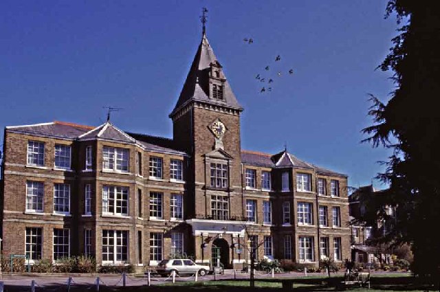
Chase Farm Hospital

Chase Farm Hospital is a hospital on The Ridgeway, in Gordon Hill, Enfield, run by the Royal Free London NHS Foundation Trust. == History == The hospital...

Crews Hill

Crews Hill is an elevated and green-buffered former hamlet grown into a small village-size community on the northern outskirts of London centred 12.3 miles...

Southgate Hockey Centre

Southgate Hockey Centre is a sports ground in Trent Park in North London, near Oakwood. The Centre is home to Southgate Hockey Club and Trent Park Running...

Nearby Amenities

Located within 500m of 51.678913,-0.13240367
Bus Stop
Botany Bay / The Robin Hood
Bench: yes
Bus: yes
Naptan AtcoCode: 490004172S
Naptan Bearing: N
Naptan CommonName: Botany Bay The Robin Hood
Naptan Street: THE RIDGEWAY
Naptan Verified: no
Public Transport: platform
Ref: 72834
Shelter: yes
Lat/Long: 51.6770394/-0.1274651
Bus Stop
Holly Cottage
Bench: no
Bus: yes
Naptan AtcoCode: 490008301N
Naptan Bearing: N
Naptan CommonName: Holly Cottage
Naptan Street: THE RIDGEWAY
Naptan Verified: no
Public Transport: platform
Ref: 52203
Shelter: no
Lat/Long: 51.6787155/-0.1317022
Bus Stop
Holly Cottage
Bench: yes
Bus: yes
Naptan AtcoCode: 490008301S
Naptan Bearing: N
Naptan CommonName: Holly Cottage
Naptan Street: THE RIDGEWAY
Naptan Verified: no
Public Transport: platform
Ref: 75508
Shelter: yes
Lat/Long: 51.6783628/-0.1306274
Bus Stop
Windrush
Naptan AtcoCode: 490014774N
Naptan Bearing: N
Naptan CommonName: Windrush
Naptan Street: THE RIDGEWAY
Naptan Verified: no
Public Transport: platform
Ref: 53784
Lat/Long: 51.6809759/-0.1386461
The data included in this document is from www.openstreetmap.org. The data is made available under ODbL.

Have you been to Parting Hill?

Leave your review of Parting Hill below (or comments, questions and feedback).