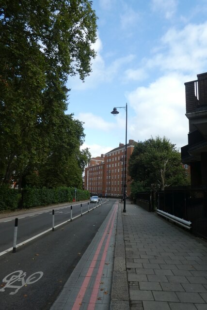
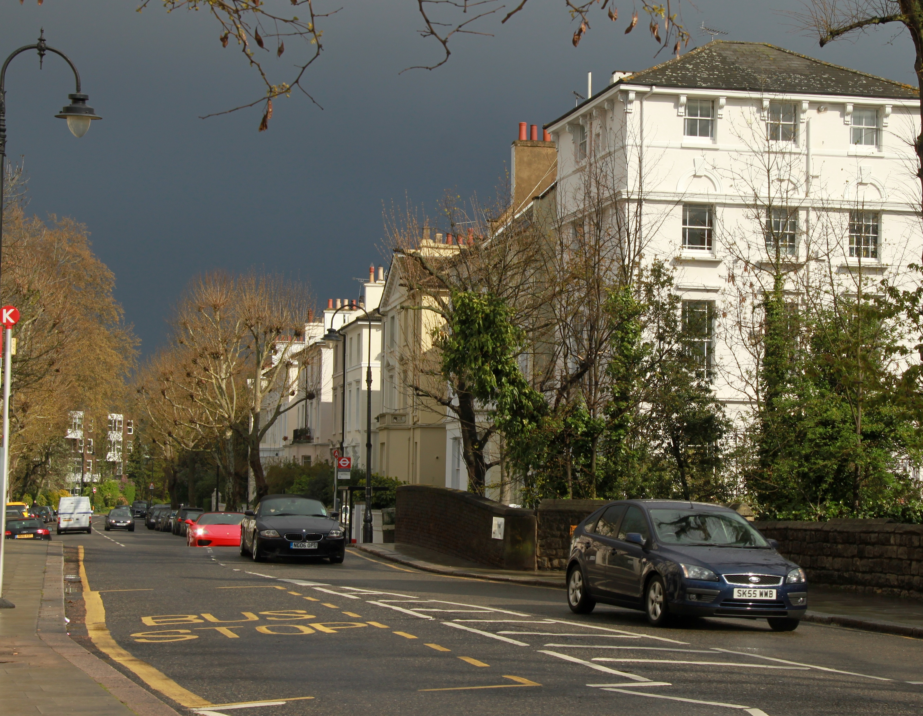
Barrow Hill

Hill, Mountain in Middlesex

England

Barrow Hill
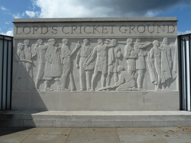
Tableau at Lord's Cricket Ground, Wellington Road, NW8 PLAY UP PLAY UP AND PLAY THE GAME
Tableau at Lord's Cricket Ground, Wellington Road, NW8 Credit: moska

The requested URL returned error: 429 Too Many Requests

If you have any feedback on the listing, please let us know in the comments section below.

Barrow Hill Images

Images are sourced within 2km of 51.537737/-0.16228392 or Grid Reference TQ2783. Thanks to Geograph Open Source API. All images are credited.

Tableau at Lord's Cricket Ground, Wellington Road, NW8 PLAY UP PLAY UP AND PLAY THE GAME
Tableau at Lord's Cricket Ground, Wellington Road, NW8
PLAY UP PLAY UP AND PLAY THE GAME
The remains of the Abbey National Building, 215-229 Baker Street, London NW1 Taken 15 August 2005, the real home of Sherlock Holmes i.e. the location of 221b Baker Street.  There is an informative website giving more details at <span class="nowrap"><a title="https://www.patrickcomerford.com/2018/09/would-real-sherlock-holmes-please-tell.html?m=1" rel="nofollow ugc noopener" href="https://www.patrickcomerford.com/2018/09/would-real-sherlock-holmes-please-tell.html?m=1">Link</a><img style="margin-left:2px;" alt="External link" title="External link - shift click to open in new window" src="https://s1.geograph.org.uk/img/external.png" width="10" height="10"/></span>.
The remains of the Abbey National Building, 215-229 Baker Street, London NW1
Taken 15 August 2005, the real home of Sherlock Holmes i.e. the location of 221b Baker Street. There is an informative website giving more details at LinkExternal link.
The Wallis Building, Penfold Street, NW8
Count Simon Woronzow plaque, Woronzow Road, NW8 1744 – 1832
THIS ROAD WAS NAMED AFTER
COUNT SIMON WORONZOW
RUSSIAN AMBASSADOR TO THE UNITED
KINGDOM FROM 1784 TO 1806
HE LIVED IN MARYLEBONE AND ON 
HIS DEATH IN 1832 LEFT A BEQUEST
FOR THE POOR OF THE PARISH
THE MONEY WAS USED TO BUILD
ST MARYLEBONE ALMSHOUSES AT
THE SOUTH-WEST CORNER 
OF THIS ROAD

THE PLAQUE WAS INSTALLED THE KIND PERMISSION OF
CAMDEN BOROUGH COUNCIL AND THE OWNERS OF THIS PROPERTY.
IT WAS UNVEILED ON 26 NOVEMBER 2002 BY H.E.GRIGORI KARASIN
THE RUSSIAN AMBASSADOR TO THE UK
AND THE MAYOR OF CAMDEN COUNCILLOR JUDY PATTISON
THE PLAQUE IS A GIFT OF PETER THE GREAT COMPANY
OF ST. PETERSBURG TO THE CITIZENS OF CAMDEN

ARCHITECT VYACHESLAV BUKHAEV, RUSSIA 

(I took this photo in 2008, but the plaque does not look so good now.)
Count Simon Woronzow plaque, Woronzow Road, NW8
1744 – 1832 THIS ROAD WAS NAMED AFTER COUNT SIMON WORONZOW RUSSIAN AMBASSADOR TO THE UNITED KINGDOM FROM 1784 TO 1806 HE LIVED IN MARYLEBONE AND ON HIS DEATH IN 1832 LEFT A BEQUEST FOR THE POOR OF THE PARISH THE MONEY WAS USED TO BUILD ST MARYLEBONE ALMSHOUSES AT THE SOUTH-WEST CORNER OF THIS ROAD THE PLAQUE WAS INSTALLED THE KIND PERMISSION OF CAMDEN BOROUGH COUNCIL AND THE OWNERS OF THIS PROPERTY. IT WAS UNVEILED ON 26 NOVEMBER 2002 BY H.E.GRIGORI KARASIN THE RUSSIAN AMBASSADOR TO THE UK AND THE MAYOR OF CAMDEN COUNCILLOR JUDY PATTISON THE PLAQUE IS A GIFT OF PETER THE GREAT COMPANY OF ST. PETERSBURG TO THE CITIZENS OF CAMDEN ARCHITECT VYACHESLAV BUKHAEV, RUSSIA (I took this photo in 2008, but the plaque does not look so good now.)
UCL Academy, Adelaide Road, London NW3 UCL Academy, under construction. View from Avenue Road.
UCL Academy, Adelaide Road, London NW3
UCL Academy, under construction. View from Avenue Road.
Defunct drinking fountain, Charlbert Street/Allitsen Road, NW8 Inscription Reads:

JESUS SAID
WHOSOEVER DRINKETH OF THIS WATER 
SHALL THIRST AGAIN 
BUT WHOSOEVER DRINKETH OF THE WATER 
I SHALL GIVE HIM SHALL 
NEVER THIRST

METROPOLITAN
DRINKING FOUNTAIN
AND
CATTLETROUGH
ASSOCIATION

1861
Defunct drinking fountain, Charlbert Street/Allitsen Road, NW8
Inscription Reads: JESUS SAID WHOSOEVER DRINKETH OF THIS WATER SHALL THIRST AGAIN BUT WHOSOEVER DRINKETH OF THE WATER I SHALL GIVE HIM SHALL NEVER THIRST METROPOLITAN DRINKING FOUNTAIN AND CATTLETROUGH ASSOCIATION 1861
Tableau, Embassy Court, 45 Wellington Road, NW8
MILK photograph exhibition, Regent's Park, NW1 Taken on 5 July 2003 when the exhibition used to be free of charge.
MILK photograph exhibition, Regent's Park, NW1
Taken on 5 July 2003 when the exhibition used to be free of charge.
The Holme, Inner Circle, Regent's Park, NW1 View of the rear elevation, as seen from across the boating lake.  Taken on 8 September 2006.
The Holme, Inner Circle, Regent's Park, NW1
View of the rear elevation, as seen from across the boating lake. Taken on 8 September 2006.
Eversholt Street Looking along Eversholt Street towards the junction with Oakley Square.
Eversholt Street
Looking along Eversholt Street towards the junction with Oakley Square.
Cycle lane in Oakley Square Looking along Oakley Square beside the Mayford Estate.
Cycle lane in Oakley Square
Looking along Oakley Square beside the Mayford Estate.
Regent's Park, London Fountains and hedging in the English Garden area within Regent's Park.
Regent's Park, London
Fountains and hedging in the English Garden area within Regent's Park.
Regent's Park, London A fountain and planting in the English Gardens in Regent's Park.
Regent's Park, London
A fountain and planting in the English Gardens in Regent's Park.
Regent's Park, London Sporting facilities within Regent's Park.
Regent's Park, London
Sporting facilities within Regent's Park.
Regent's Park, London Sporting facilities in Regent's Park. The circular building to the left of the image is The Hub - it operates as a centre to the surrounding sports pitches and has meeting rooms, changing rooms and a cafe.
Regent's Park, London
Sporting facilities in Regent's Park. The circular building to the left of the image is The Hub - it operates as a centre to the surrounding sports pitches and has meeting rooms, changing rooms and a cafe.
Regent's Park, London Looking northwest over the bridge which crosses the boating lake within Regent's Park.
Regent's Park, London
Looking northwest over the bridge which crosses the boating lake within Regent's Park.
Queen Mary's Garden, Regent's Park The last autumnal blooms of the rose Free Spirit in Queen Mary's Garden, Regent's Park. The garden was created in the 1930s and is famous for having 12,000 rose bushes - the largest collection in London.
Queen Mary's Garden, Regent's Park
The last autumnal blooms of the rose Free Spirit in Queen Mary's Garden, Regent's Park. The garden was created in the 1930s and is famous for having 12,000 rose bushes - the largest collection in London.
The Black Cats outside the Black Cat Factory The former Carreras Cigarette Factory in Mornington Crescent near Camden Town is sometimes called simply the ‘Black Cat Factory’. The Carreras Tobacco Company began in 19th century London. Don José Joaquin Carreras Ferrer had a shop at 61 Prince’s Street near Leicester Square. He had a black cat which, on sunny days, sat in the window of his shop. Londoners wishing to buy tobacco used to ask cab drivers to take them to the tobacconist's shop in Wardour Street with the black cat in the window, because the name Carreras was difficult to pronounce. Thus the Black Cat name became famous. In 1886 it was used as a trademark by Carrera.

In 1928, having outgrown previous sites, the Arcadia Works opened in Mornington Crescent. The extraordinary design was fuelled by the discovery of Tutankhamun’s tomb in 1922.The discovery prompted a wave of Egypt-mania in fashion, architecture and design. The combination of the Egyptian theme and the Black Cat, led to the Egyptian Cat Goddess, Bast, and helped decide the system of decoration. Local people still call the building the Black Cat Factory.
The Black Cats outside the Black Cat Factory
The former Carreras Cigarette Factory in Mornington Crescent near Camden Town is sometimes called simply the ‘Black Cat Factory’. The Carreras Tobacco Company began in 19th century London. Don José Joaquin Carreras Ferrer had a shop at 61 Prince’s Street near Leicester Square. He had a black cat which, on sunny days, sat in the window of his shop. Londoners wishing to buy tobacco used to ask cab drivers to take them to the tobacconist's shop in Wardour Street with the black cat in the window, because the name Carreras was difficult to pronounce. Thus the Black Cat name became famous. In 1886 it was used as a trademark by Carrera. In 1928, having outgrown previous sites, the Arcadia Works opened in Mornington Crescent. The extraordinary design was fuelled by the discovery of Tutankhamun’s tomb in 1922.The discovery prompted a wave of Egypt-mania in fashion, architecture and design. The combination of the Egyptian theme and the Black Cat, led to the Egyptian Cat Goddess, Bast, and helped decide the system of decoration. Local people still call the building the Black Cat Factory.
Show me another place!

Barrow Hill is located at Grid Ref: TQ2783 (Lat: 51.537737, Lng: -0.16228392)

Unitary Authority: Camden

Police Authority: Metropolitan

What 3 Words

///wiser.locker.turkey. Near Camden Town, London

Nearby Locations

Primrose Hill Barrow Hill

Related Wikis

Haverstock

Haverstock is an area of the London Borough of Camden: specifically the east of Belsize Park, north of Chalk Farm and west of Kentish Town. It is centred...

Primrose Hill (district)

Primrose Hill is a district in the London Borough of Camden, England. The area east of the park was developed and became known as Primrose Hill. Primrose...

Institute of Zoology

The Institute of Zoology (IoZ) is the research division of the Zoological Society of London (ZSL) in England. It is a government-funded research institute...

Zoological Society of London

The Zoological Society of London (ZSL) is a charity devoted to the worldwide conservation of animals and their habitats. It was founded in 1826. Since...

Nearby Amenities

Located within 500m of 51.537737,-0.16228392
Crossing
Crossing: unmarked
Crossing Island: no
Crossing Markings: no
Kerb: lowered
Tactile Paving: yes
Lat/Long: 51.5351235/-0.1588702
Crossing
Crossing: uncontrolled
Tactile Paving: yes
Lat/Long: 51.5389258/-0.1561418
Crossing
Crossing: uncontrolled
Crossing Island: no
Crossing Ref: zebra
Tactile Paving: yes
Traffic Calming: hump
Lat/Long: 51.5416634/-0.1617527
Ref GB Tflcid: RWG039753
Traffic Calming: table
Lat/Long: 51.5379239/-0.1680317
Access: yes
Barrier: entrance
Lat/Long: 51.538875/-0.1562154
Crossing
Check Date Crossing: 2020-11-10
Crossing: uncontrolled
Crossing Island: no
Crossing Ref: zebra
Tactile Paving: yes
Lat/Long: 51.5401911/-0.1593418
Crossing
Crossing: uncontrolled
Crossing Island: yes
Crossing Markings: zebra
Crossing Ref: zebra
Tactile Paving: yes
Lat/Long: 51.5363836/-0.1591401
Telephone
Booth: KX100
Covered: booth
Operator: BT
Lat/Long: 51.5348549/-0.1651663
Pub
The New Inn
Addr City: London
Addr Housenumber: 2
Addr Postcode: NW8 6LA
Addr Street: Allitsen Road
Fhrs Confidence Management: 10
Fhrs Hygiene: 5
Fhrs Id: 410952
Fhrs Local Authority Id: 00134/0002/0/000
Fhrs Rating: 3
Fhrs Structural: 10
Outdoor Seating: yes
Source Addr: FSA Food Hygiene Ratings Database
Source Postcode: FSA Food Hygiene Ratings Database
Toilets: yes
Toilets Access: customers
Website: http://www.newinnlondon.co.uk/
Lat/Long: 51.5354117/-0.1660949
Crossing
Crossing: uncontrolled
Ref GB Tflcid: RWG039955
Traffic Calming: hump
Lat/Long: 51.5359082/-0.1650667
Post Box
Collection Times: Mo-Fr 16:30; Sa 10:30
Operator: Royal Mail
Operator Wikidata: Q638098
Post Box Type: pillar
Postal Code: NW8
Ref: NW8 30
Royal Cypher: EIIR
Royal Cypher Wikidata: Q33102113
Source: survey
Lat/Long: 51.5363867/-0.1634929
Post Box
Collection Times: Mo-Fr 17:30; Sa 12:00
Ref: NW8 18
Lat/Long: 51.5360145/-0.160874
Post Box
Collection Times: Mo-Fr 17:30; Sa 12:00
Operator: Royal Mail
Operator Wikidata: Q638098
Postal Code: NW8
Ref: NW8 3
Lat/Long: 51.5377954/-0.1682062
Crossing
Button Operated: no
Crossing: traffic_signals
Crossing Island: no
Crossing Ref: puffin
Tactile Paving: yes
Lat/Long: 51.535373/-0.1684152
Telephone
Booth: KX100
Covered: booth
Lat/Long: 51.535968/-0.166784
Recycling
Recycling Glass: yes
Lat/Long: 51.5360056/-0.1668565
Bus Stop
Avenue Road
Bench: yes
Bus: yes
Local Ref: G
Naptan AtcoCode: 490003497E
Naptan Bearing: E
Naptan CommonName: Avenue Road Prince Albert Rd
Naptan Indicator: Stop G
Naptan Street: PRINCE ALBERT ROAD
Naptan Verified: no
Public Transport: platform
Shelter: yes
Lat/Long: 51.5346736/-0.1643506
Bus Stop
Avenue Road
Bench: yes
Bus: yes
Local Ref: D
Naptan AtcoCode: 490003497W
Naptan Bearing: W
Naptan CommonName: Avenue Road Prince Albert Rd
Naptan Indicator: Stop D
Naptan Street: PRINCE ALBERT ROAD
Naptan Verified: no
Public Transport: platform
Shelter: yes
Lat/Long: 51.5351734/-0.1629607
Bus Stop
Wells Rise
Bus: yes
Local Ref: C
Naptan AtcoCode: 490014371W
Naptan Bearing: W
Naptan CommonName: Wells Rise
Naptan Indicator: Stop C
Naptan Verified: no
Public Transport: platform
Ref: 55886
Source Ref: naptan
Lat/Long: 51.5360617/-0.1602085
Bus Stop
Primrose Hill / London Zoo
Bench: yes
Bus: yes
Local Ref: H
Naptan AtcoCode: 490015357E
Naptan Bearing: E
Naptan CommonName: Primrose Hill
Naptan Indicator: Stop H
Naptan Verified: no
Public Transport: platform
Shelter: yes
Tactile Paving: no
Lat/Long: 51.5365789/-0.1585905
Crossing
Button Operated: yes
Crossing: traffic_signals
Crossing Island: no
Crossing Ref: pelican
Traffic Signals Sound: yes
Traffic Signals Vibration: yes
Lat/Long: 51.5349823/-0.1635888
Post Box
Collection Times: Mo-Fr 09:00, Sa 07:00
Operator: Royal Mail
Operator Wikidata: Q638098
Ref: NW3 61
Royal Cypher: EVIIR
Royal Cypher Wikidata: Q33102324
Lat/Long: 51.5410721/-0.1650926
Post Box
Collection Times: Mo-Fr 17:30; Sa 12:00
Operator: Royal Mail
Operator Wikidata: Q638098
Ref: NW3 69
Royal Cypher: no
Lat/Long: 51.5419229/-0.1618225
Direction: 130
Tourism: viewpoint
Lat/Long: 51.5395287/-0.1606936
Crossing
Crossing: uncontrolled
Crossing Island: no
Crossing Ref: zebra
Tactile Paving: yes
Lat/Long: 51.5420469/-0.1619789
Friedrich Engels
Erected By: Greater London Council
Historic: memorial
Inscription: Friedrich Engels, 1820-1895, Political Philosopher lived here 1870-1894
Memorial: blue_plaque
Openplaques Id: 213
Subject Wikidata: Q34787
Wikimedia Commons: File:FRIEDRICH ENGELS 1820-1895 Political Philosopher lived here 1870-1894.jpg
Lat/Long: 51.5405005/-0.1573825
Post Box
Brand: Royal Mail
Brand Wikidata: Q638098
Check Date: 2024-04-05
Collection Times: Mo-Fr 09:00; Sa 07:00
Colour: red
Note: LH aperture blocked up, LH collection plate missing
Operator: Royal Mail
Operator Wikidata: Q638098
Post Box Design: type_c
Post Box Type: pillar
Ref: NW1 45D
Royal Cypher: EIIR
Royal Cypher Wikidata: Q33102113
Wikimedia Commons: Category:United Kingdom post box NW1 45D
Lat/Long: 51.5403719/-0.1576294
Telephone
Booth: K2
Covered: booth
Listed Status: Grade II
Wikidata: Q27084447
Lat/Long: 51.5403296/-0.1577018
Telephone
Booth: K2
Covered: booth
Listed Status: Grade II
Wikidata: Q27084447
Lat/Long: 51.5403474/-0.1577057
Emus
Attraction: animal
Operator: London Zoo
Species Wikidata: Q93208
Species Wikipedia: en:Emu
Tourism: attraction
Zoo: enclosure
Lat/Long: 51.534874/-0.1568989
Turning Circle
Lat/Long: 51.5396001/-0.1564667
Bicycle Rental
Prince Albert Road
Bicycle Rental: docking_station
Brand: Santander Cycles
Brand Wikidata: Q807961
Capacity: 24
Local: The Regent's Park
Network: tfl_cycle_hire
Official Name: Prince Albert Road, The Regent's Park
Official Ref: 329
Operator: Serco
Operator Wikidata: Q499104
Lat/Long: 51.5358808/-0.1607051
Barrier: bollard
Lat/Long: 51.5379432/-0.1655612
Barrier: yes
Lat/Long: 51.5373673/-0.1643113
Post Box
Brand: Royal Mail
Brand Wikidata: Q638098
Check Date: 2024-04-05
Collection Times: Mo-Fr 09:00; Sa 07:00
Colour: red
Note: LH aperture blocked up, LH collection plate missing
Operator: Royal Mail
Operator Wikidata: Q638098
Post Box Apertures: 1
Post Box Design: type_c
Post Box Type: pillar
Ref: NW1 36D
Royal Cypher: EIIR
Royal Cypher Wikidata: Q33102113
Wikimedia Commons: Category:United Kingdom post box NW1 36D
Lat/Long: 51.5390012/-0.1559086
Hill View
Building: yes
Note: Outline not clear on OS Street View.
Lat/Long: 51.5404122/-0.1590893
Recycling
Recycling Glass Bottles: yes
Lat/Long: 51.539498/-0.1569948
Shepherd Foods
Shop: deli
Lat/Long: 51.5408208/-0.1576464
Dentist
Primrose Dental Practice
Healthcare: dentist
Phone: +44 20 7722 0860
Lat/Long: 51.5408692/-0.1576142
Shampoo
Phone: +44 20 7722 9594
Shop: hairdresser
Lat/Long: 51.5409259/-0.15759
Gale
Number: 65
Shop: clothes
Lat/Long: 51.540986/-0.1575498
Nicolas
Brand: Nicolas
Brand Wikidata: Q3340012
Shop: alcohol
Lat/Long: 51.541041/-0.1575257
Primrose Interiors
Number: 55
Shop: furniture
Lat/Long: 51.5407041/-0.157735
Restaurant
Pesantissimo
Cuisine: italian
Number: 57
Lat/Long: 51.5407473/-0.1577218
Bicycle Parking
Bicycle Parking: stands
Capacity: 8
Check Date: 2022-11-21
Covered: no
Lat/Long: 51.5401535/-0.1576973
Bicycle Parking
Bicycle Parking: stands
Capacity: 8
Check Date: 2022-11-21
Covered: no
Lat/Long: 51.5404913/-0.1574639
Cafe
Le Tea Cosy
Cuisine: crepe;sandwich
Indoor Seating: yes
Internet Access: no
Number: 51
Outdoor Seating: sidewalk
Payment Visa: yes
Lat/Long: 51.5406548/-0.1577484
Fast Food
Lat/Long: 51.5372914/-0.1575373
Crossing
Crossing: uncontrolled
Crossing Island: no
Crossing Markings: zebra;dots
Crossing Ref: zebra
Kerb: flush
Ref GB Tflcid: RWG039752
Surface: asphalt
Tactile Paving: yes
Traffic Calming: table
Lat/Long: 51.5373186/-0.1671293
Primrose Hill
Contact Email: regents@royalparks.gsi.gov.uk
Contact Phone: +44 300 061 2300
Ele: 64
Natural: peak
Lat/Long: 51.539538/-0.1607567
Ref GB Tflcid: RWG002902
Traffic Calming: cushion
Lat/Long: 51.5418311/-0.1631126
Ref GB Tflcid: RWG089642
Traffic Calming: cushion
Lat/Long: 51.541211/-0.1648339
Ref GB Tflcid: RWG040132
Traffic Calming: hump
Lat/Long: 51.5409331/-0.1655853
Give Way
Direction: forward
Lat/Long: 51.5355635/-0.1622469
Give Way
Direction: forward
Lat/Long: 51.5363822/-0.1593933
Give Way
Direction: forward
Lat/Long: 51.5360279/-0.1607332
Stop
Direction: forward
Source: Survey of 2016-03-09
Lat/Long: 51.5340966/-0.1627256
Street Lamp
Lat/Long: 51.5366749/-0.1591924
Street Lamp
Lat/Long: 51.5369101/-0.1590996
Street Lamp
Lat/Long: 51.5371555/-0.159047
Street Lamp
Lat/Long: 51.5373895/-0.1601169
Street Lamp
Lat/Long: 51.5373916/-0.1597301
Street Lamp
Lat/Long: 51.5373976/-0.1593543
Street Lamp
Lat/Long: 51.5373919/-0.1589715
Street Lamp
Lat/Long: 51.5375267/-0.1604585
Street Lamp
Lat/Long: 51.5375319/-0.1601874
Street Lamp
Lat/Long: 51.5376024/-0.1588934
Street Lamp
Lat/Long: 51.5376814/-0.1590559
Street Lamp
Lat/Long: 51.5377276/-0.1599742
Street Lamp
Lat/Long: 51.5377593/-0.1607039
Street Lamp
Lat/Long: 51.5378686/-0.1588195
Street Lamp
Lat/Long: 51.5379243/-0.1597507
Street Lamp
Lat/Long: 51.5379878/-0.1609272
Street Lamp
Lat/Long: 51.5381167/-0.1587473
Street Lamp
Lat/Long: 51.5381203/-0.1595501
Street Lamp
Lat/Long: 51.5381791/-0.1611187
Street Lamp
Lat/Long: 51.538316/-0.1593404
Street Lamp
Lat/Long: 51.5383642/-0.158676
Street Lamp
Lat/Long: 51.538365/-0.1612925
Street Lamp
Lat/Long: 51.5385031/-0.1591307
Street Lamp
Lat/Long: 51.5385716/-0.1614663
Street Lamp
Lat/Long: 51.5386107/-0.1586104
Street Lamp
Lat/Long: 51.5386955/-0.1589278
Street Lamp
Lat/Long: 51.5387836/-0.1617636
Street Lamp
Lat/Long: 51.5388101/-0.1615642
Street Lamp
Lat/Long: 51.538904/-0.1586823
Street Lamp
Lat/Long: 51.5390418/-0.1615548
Street Lamp
Lat/Long: 51.5390519/-0.1584465
Street Lamp
Lat/Long: 51.5392745/-0.1583542
Street Lamp
Lat/Long: 51.5393028/-0.1615342
Street Lamp
Lat/Long: 51.5394951/-0.1582332
Street Lamp
Lat/Long: 51.5395719/-0.161023
Street Lamp
Lat/Long: 51.5396668/-0.160762
Street Lamp
Lat/Long: 51.5397929/-0.1615884
Street Lamp
Lat/Long: 51.5400438/-0.1615982
Street Lamp
Lat/Long: 51.5402714/-0.16161
Bicycle Parking
Bicycle Parking: stands
Capacity: 12
Covered: no
Lat/Long: 51.5365184/-0.1590277
Bench
Backrest: yes
Mapillary: 1385680331795543
Survey Date: 2018-05-27
Lat/Long: 51.5367118/-0.1591723
Bench
Backrest: no
Lat/Long: 51.537113/-0.1578433
Give Way
Direction: backward
Lat/Long: 51.5354588/-0.1658665
Bench
Backrest: no
Mapillary: 812937616272799
Source: gps+mapnoter
Survey Date: 2018-05-27
Lat/Long: 51.5348977/-0.1586956
Waste Basket
Source: gps+mapnoter
Lat/Long: 51.5349982/-0.1586403
Waste Basket
Check Date: 2021-10-25
Source: gps+mapnoter
Waste: dog
Lat/Long: 51.5347759/-0.1588404
West Service Gate
Lat/Long: 51.5352799/-0.157553
Bench
Backrest: yes
Mapillary: 770716183640113
Source: gps+mapnoter
Survey Date: 2018-04-15
Lat/Long: 51.5347192/-0.1631373
Crossing
Crossing: uncontrolled
Crossing Island: yes
Tactile Paving: yes
Lat/Long: 51.5389243/-0.1558983
Crossing
Crossing: uncontrolled
Crossing Island: yes
Tactile Paving: yes
Lat/Long: 51.538786/-0.1558401
Bench
Backrest: yes
Source: gps+mapnoter
Lat/Long: 51.5389627/-0.1565713
Bench
Backrest: yes
Source: gps+mapnoter
Lat/Long: 51.5395029/-0.1579805
Bench
Backrest: yes
Material: wood
Source: gps+mapnoter
Lat/Long: 51.5395801/-0.1607869
Bench
Backrest: yes
Material: wood
Lat/Long: 51.5399202/-0.1591998
Bench
Backrest: yes
Mapillary: 473557733860423
Source: gps+mapnoter
Survey Date: 2018-05-27
Lat/Long: 51.5397968/-0.1580733
Bench
Backrest: yes
Material: wood
Source: gps+mapnoter
Lat/Long: 51.5395697/-0.160697
Bench
Backrest: no
Material: wood
Source: gps+mapnoter
Lat/Long: 51.5395184/-0.1607225
Waste Basket
Check Date: 2021-03-02
Source: gps+mapnoter
Lat/Long: 51.5388505/-0.1563283
Bench
Backrest: no
Material: wood
Source: gps+mapnoter
Lat/Long: 51.5395422/-0.1607124
Bench
Backrest: yes
Source: gps+mapnoter
Lat/Long: 51.5392944/-0.1574333
Waste Basket
Source: gps+mapnoter
Lat/Long: 51.5400629/-0.161705
Information: map
Source: gps+mapnoter
Tourism: information
Lat/Long: 51.5395397/-0.1608063
Waste Basket
Check Date: 2022-11-21
Source: gps+mapnoter
Lat/Long: 51.5395628/-0.1610438
Fixme: 1-5m
Source: gps+mapnoter
Lat/Long: 51.539449/-0.1615977
Barrier: bollard
Bollard: removable
Lat/Long: 51.5405866/-0.1647491
Bicycle Parking
Bicycle Parking: stands
Capacity: 8
Covered: no
Source: gps+mapnoter
Lat/Long: 51.5405567/-0.1647949
Information: map
Source: gps+mapnoter
Tourism: information
Lat/Long: 51.5405033/-0.1646447
Waste Basket
Source: gps+mapnoter
Waste: dog_excrement
Lat/Long: 51.5400629/-0.1616621
Bench
Backrest: yes
Source: gps+mapnoter
Lat/Long: 51.5385014/-0.1554394
Bench
Backrest: yes
Source: gps+mapnoter
Lat/Long: 51.5386804/-0.155883
Bench
Backrest: yes
Source: gps+mapnoter
Lat/Long: 51.5393494/-0.1625724
Bench
Backrest: yes
Source: gps+mapnoter
Lat/Long: 51.5388705/-0.1618888
Information: map
Source: gps+mapnoter
Tourism: information
Lat/Long: 51.5373803/-0.1603317
Waste Basket
Source: gps+mapnoter
Waste: dog_excrement
Lat/Long: 51.5405483/-0.1645954
Bench
Backrest: yes
Source: gps+mapnoter
Lat/Long: 51.5394656/-0.1627484
Bench
Backrest: yes
Source: gps+mapnoter
Lat/Long: 51.5391737/-0.1623166
Waste Basket
Source: gps+mapnoter
Lat/Long: 51.5405016/-0.1645267
Waste Basket
Source: gps+mapnoter
Lat/Long: 51.5374069/-0.1588726
Waste Basket
Source: gps+mapnoter
Lat/Long: 51.5376739/-0.1587868
Bench
Backrest: yes
Source: gps+mapnoter
Lat/Long: 51.5390619/-0.1621556
Waste Basket
Check Date: 2022-11-21
Source: gps+mapnoter
Lat/Long: 51.538755/-0.161705
Information: map
Source: gps+mapnoter
Tourism: information
Lat/Long: 51.5365261/-0.1590872
Bench
Backrest: yes
Source: gps+mapnoter
Lat/Long: 51.5404633/-0.1644516
Bench
Backrest: yes
Source: gps+mapnoter
Lat/Long: 51.5403698/-0.1642585
Bench
Backrest: yes
Source: gps+mapnoter
Lat/Long: 51.5389952/-0.1620269
Bench
Backrest: yes
Source: gps+mapnoter
Lat/Long: 51.5387487/-0.1616162
Bench
Backrest: yes
Source: gps+mapnoter
Lat/Long: 51.5402631/-0.1640439
Bench
Backrest: yes
Source: gps+mapnoter
Lat/Long: 51.5381544/-0.1609755
Bench
Backrest: yes
Source: gps+mapnoter
Lat/Long: 51.5400979/-0.1637274
Bench
Backrest: yes
Source: gps+mapnoter
Lat/Long: 51.5399628/-0.1634914
Waste Basket
Check Date: 2022-11-21
Lat/Long: 51.5374524/-0.1602701
Bench
Backrest: yes
Source: gps+mapnoter
Lat/Long: 51.5398493/-0.1633143
Waste Basket
Source: gps+mapnoter
Lat/Long: 51.5397826/-0.1632285
Bench
Backrest: yes
Source: gps+mapnoter
Lat/Long: 51.5396408/-0.1630408
Waste Basket
Source: gps+mapnoter
Waste: dog_excrement
Lat/Long: 51.5397559/-0.1631856
Bench
Backrest: yes
Source: gps+mapnoter
Lat/Long: 51.5395663/-0.1629077
Girl and the Jaguar
Artist Name: Tom Harvey
Artwork Type: sculpture
Material: wood
Tourism: artwork
Website: https://www.carverharvey.co.uk/
Wheelchair: limited
Wikimedia Commons: File:Girl_and_the_Jaguar,_Regent's_Park.jpg
Lat/Long: 51.5339735/-0.1589548
Barrier: bollard
Lat/Long: 51.5372776/-0.1643091
Barrier: lift_gate
Lat/Long: 51.5368053/-0.163363
Barrier: bollard
Lat/Long: 51.5368212/-0.1636609
Ref GB Tflcid: RWG003169
Traffic Calming: cushion
Lat/Long: 51.5398396/-0.1680367
Proposed Barrier: bollard
Lat/Long: 51.5347401/-0.1630817
Proposed Barrier: bollard
Lat/Long: 51.534883/-0.1634525
Barrier: kerb
Kerb: lowered
Tactile Paving: yes
Lat/Long: 51.535046/-0.158825
Barrier: kerb
Kerb: lowered
Tactile Paving: yes
Lat/Long: 51.5351409/-0.1588803
Information: map
Map Size: site
Map Type: street
Operator: The Royal Parks
Tourism: information
Lat/Long: 51.5401229/-0.1577447
Entrance: yes
Lat/Long: 51.5343131/-0.1661279
Entrance: yes
Lat/Long: 51.5344089/-0.1660091
Entrance: yes
Lat/Long: 51.5346816/-0.1663073
Entrance: yes
Lat/Long: 51.5348703/-0.1666098
Entrance: yes
Lat/Long: 51.5344677/-0.1669077
Entrance: yes
Lat/Long: 51.5343768/-0.1667663
Entrance: yes
Lat/Long: 51.5342884/-0.166611
Entrance: yes
Lat/Long: 51.5345849/-0.1670997
Entrance: yes
Lat/Long: 51.5349499/-0.1663237
Entrance: yes
Lat/Long: 51.5348568/-0.166166
Entrance: yes
Lat/Long: 51.534768/-0.1660254
Entrance: yes
Lat/Long: 51.534673/-0.1658615
Entrance: yes
Lat/Long: 51.5348894/-0.1654306
Entrance: yes
Lat/Long: 51.5347892/-0.165558
Entrance: yes
Lat/Long: 51.535157/-0.1656815
Entrance: yes
Lat/Long: 51.5350599/-0.165535
Entrance: yes
Lat/Long: 51.5351498/-0.1661148
Entrance: yes
Lat/Long: 51.5352337/-0.1659334
Entrance: yes
Lat/Long: 51.5353573/-0.1636407
Entrance: yes
Lat/Long: 51.5361507/-0.1630604
Entrance: yes
Lat/Long: 51.5360838/-0.1639323
Parking
Lat/Long: 51.5354831/-0.1667232
Parking
Lat/Long: 51.5352167/-0.1670931
Addr Housenumber: 8
Addr Street: Woronzow Road
Entrance: yes
Lat/Long: 51.5363248/-0.1682356
Addr Housenumber: 6
Addr Street: Woronzow Road
Entrance: yes
Lat/Long: 51.536269/-0.1681696
Addr Housenumber:
Addr Street: Woronzow Road
Entrance: yes
Lat/Long: 51.5362478/-0.1681444
Addr Housenumber: 4
Addr Street: Woronzow Road
Entrance: yes
Lat/Long: 51.5361771/-0.1680624
Addr Housenumber:
Addr Street: Woronzow Road
Entrance: yes
Lat/Long: 51.5361507/-0.1680287
Addr Housenumber: 2
Addr Street: Woronzow Road
Entrance: yes
Lat/Long: 51.5360936/-0.1679618
Entrance: yes
Lat/Long: 51.5372925/-0.169371
Entrance: yes
Lat/Long: 51.5372608/-0.1694181
Bicycle Parking
Bicycle Parking: stands
Capacity: 8
Covered: no
Lat/Long: 51.5349778/-0.1585998
Bench
Backrest: yes
Lat/Long: 51.5359403/-0.1591071
Information: map
Map Size: park
Tourism: information
Lat/Long: 51.5350192/-0.1586706
Bench
Lat/Long: 51.5342681/-0.1604147
Agnes Arber née Robertson
Historic: memorial
Inscription: Agnes Arber née Robertson (1879-1960)Botanist lived here 1890-1909
Memorial: blue_plaque
Openplaques Id: 50751
Lat/Long: 51.5405602/-0.1649761
Henry Wood
Historic: memorial
Inscription: Sir Henry Wood (1869-1944)Musician lived here
Memorial: blue_plaque
Openplaques Id: 68
Subject Wikidata: Q449299
Lat/Long: 51.5419932/-0.1630724
Bench
Backrest: yes
Material: wood
Lat/Long: 51.540156/-0.1606614
Blind: no
Playground: slide
Playground Theme: playground
Wheelchair: no
Lat/Long: 51.5371359/-0.1571139
Blind: no
Playground: structure
Playground Theme: playground
Wheelchair: no
Lat/Long: 51.5371421/-0.1572172
Blind: no
Description: Tall rope structure
Playground: climbingframe
Playground Theme: playground
Wheelchair: no
Lat/Long: 51.5370374/-0.1571294
Baby: no
Blind: no
Capacity: 2
Playground: swing
Wheelchair: no
Lat/Long: 51.5371896/-0.1569336
Baby: yes
Capacity: 2
Playground: swing
Lat/Long: 51.5372701/-0.156997
Blind: no
Playground: springy
Playground Theme: playground
Wheelchair: no
Lat/Long: 51.5373088/-0.1570801
Blind: no
Playground: slide
Playground Theme: playground
Wheelchair: no
Lat/Long: 51.5371014/-0.1573811
Street Lamp
Lat/Long: 51.5377756/-0.1586059
Street Lamp
Lat/Long: 51.5378317/-0.1583379
Street Lamp
Lat/Long: 51.5379086/-0.1579662
Street Lamp
Lat/Long: 51.537986/-0.1576089
Street Lamp
Lat/Long: 51.5380635/-0.1572318
Street Lamp
Lat/Long: 51.5381342/-0.1568655
Street Lamp
Lat/Long: 51.5382026/-0.1564947
Street Lamp
Lat/Long: 51.5382711/-0.1561248
Street Lamp
Lat/Long: 51.5383407/-0.155764
Street Lamp
Lat/Long: 51.5374826/-0.1589396
Street Lamp
Lat/Long: 51.5373398/-0.1589825
Street Lamp
Lat/Long: 51.5373925/-0.1585813
Street Lamp
Lat/Long: 51.5373959/-0.1581982
Direction: SE
Generator Method: photovoltaic
Generator Output Electricity: yes
Generator Solar Modules: 42
Generator Source: solar
Generator Type: solar_photovoltaic_panel
Location: roof
Note: angled panels on flat roof 'zigzag' configuration in part
Power: generator
Lat/Long: 51.5365516/-0.1643749
Direction: 145
Generator Method: photovoltaic
Generator Output Electricity: yes
Generator Solar Modules: 31
Generator Source: solar
Generator Type: solar_photovoltaic_panel
Location: roof
Power: generator
Lat/Long: 51.5367816/-0.1639259
Direction: SE
Generator Method: photovoltaic
Generator Output Electricity: yes
Generator Source: solar
Generator Type: solar_photovoltaic_panel
Location: roof
Note: angled panels on flat roof 'zigzag' configuration in part
Power: generator
Lat/Long: 51.5365176/-0.1644764
Direction: SE
Generator Method: photovoltaic
Generator Output Electricity: yes
Generator Solar Modules: 60
Generator Source: solar
Generator Type: solar_photovoltaic_panel
Location: roof
Power: generator
Lat/Long: 51.536731/-0.1640203
Direction: 145
Generator Method: photovoltaic
Generator Output Electricity: yes
Generator Solar Modules: 38
Generator Source: solar
Generator Type: solar_photovoltaic_panel
Location: roof
Power: generator
Lat/Long: 51.5374649/-0.1612967
Direction: 145
Generator Method: photovoltaic
Generator Output Electricity: yes
Generator Solar Modules: 44
Generator Source: solar
Generator Type: solar_photovoltaic_panel
Location: roof
Power: generator
Lat/Long: 51.5374221/-0.1612319
Direction: 145
Generator Method: photovoltaic
Generator Output Electricity: yes
Generator Solar Modules: 14
Generator Source: solar
Generator Type: solar_photovoltaic_panel
Location: roof
Power: generator
Lat/Long: 51.5373674/-0.1612096
Direction: 145
Generator Method: photovoltaic
Generator Output Electricity: yes
Generator Solar Modules: 10
Generator Source: solar
Generator Type: solar_photovoltaic_panel
Location: roof
Power: generator
Lat/Long: 51.5373125/-0.161256
Waste Basket
Source: gps+mapnoter
Lat/Long: 51.5397138/-0.1608934
Crossing
Crossing: unmarked
Crossing Island: yes
Crossing Markings: no
Lat/Long: 51.5341194/-0.1627575
Door: hinged
Entrance: yes
Lat/Long: 51.5405558/-0.164685
Access: yes
Door: hinged
Entrance: main
Wheelchair: yes
Lat/Long: 51.537314/-0.1572074
Waste Basket
Waste: trash
Lat/Long: 51.5395461/-0.1582108
Bench
Lat/Long: 51.5393543/-0.1583232
Bench
Lat/Long: 51.5390493/-0.1585374
Bench
Lat/Long: 51.5391897/-0.1584157
Tourism: apartment
Lat/Long: 51.5368822/-0.1612136
Bicycle: no
Direction: backward
Traffic Sign: GB:951
Lat/Long: 51.535168/-0.1588901
Street Lamp
Lamp Mount: straight_mast
Lamp Type: electric
Lat/Long: 51.5350943/-0.1588386
Barrier: bollard
Bollard: fixed
Lat/Long: 51.5350203/-0.1588101
Crossing
Crossing: unmarked
Crossing Island: no
Crossing Markings: no
Kerb: lowered
Tactile Paving: yes
Lat/Long: 51.5350611/-0.1588338
Barrier: kerb
Kerb: flush
Tactile Paving: yes
Lat/Long: 51.5350762/-0.1588426
Kerb: flush
Tactile Paving: yes
Lat/Long: 51.5351061/-0.15886
Bench
Backrest: yes
Lat/Long: 51.5352537/-0.1599011
Bench
Backrest: yes
Lat/Long: 51.535111/-0.1604562
Bench
Backrest: yes
Lat/Long: 51.5348838/-0.1613397
Crossing
Crossing: uncontrolled
Crossing Island: no
Crossing Ref: zebra
Lat/Long: 51.5385444/-0.1693109
Primrose Hill Petanque Pitch
Boules: petanque
Leisure: pitch
Sport: boules
Lat/Long: 51.5370045/-0.1570623
Crossing
Crossing: uncontrolled
Crossing Island: yes
Kerb: lowered
Tactile Paving: yes
Lat/Long: 51.5402466/-0.1577633
Operator: UK Power Networks
Power: substation
Ref: 21166
Lat/Long: 51.5408878/-0.1640337
Addr Housenumber: 17
Addr Street: Elsworthy Rise
Entrance: yes
Lat/Long: 51.5416564/-0.1641693
Addr Flats: 1-10
Addr Housename: Primrose Hill Court
Addr Street: King Henry's Road
Entrance: yes
Lat/Long: 51.5418898/-0.1604643
Addr Flats: 11-22
Addr Housename: Primrose Hill Court
Addr Street: King Henry's Road
Entrance: yes
Lat/Long: 51.5419317/-0.160225
Primrose Hill
Place: quarter
Wikidata: Q105085949
Lat/Long: 51.541589/-0.1615368
Crossing: uncontrolled
Crossing Ref: zebra
Fixme: Check exact location once zebra crossing is installed
Proposed Highway: crossing
Lat/Long: 51.5415612/-0.1616915
Give Way
Direction: forward
Lat/Long: 51.5354584/-0.1658006
Barrier: bollard
Lat/Long: 51.5354588/-0.1658502
Barrier: bollard
Lat/Long: 51.5354586/-0.1658232
Stop
Direction: backward
Lat/Long: 51.5402645/-0.157587
Crossing
Crossing: uncontrolled
Crossing Island: no
Kerb: flush
Tactile Paving: yes
Lat/Long: 51.5403307/-0.1597581
Information: map
Map Size: site
Map Type: street
Operator: The Royal Parks
Tourism: information
Lat/Long: 51.5401131/-0.15934
Bicycle Parking
Bicycle Parking: post_hoop
Capacity: 2
Ref GB Tflcid: RWG048046
Lat/Long: 51.5342489/-0.1659576
Bicycle Parking
Bicycle Parking: post_hoop
Capacity: 2
Ref GB Tflcid: RWG048043
Lat/Long: 51.5341503/-0.1663999
Bicycle Parking
Bicycle Parking: post_hoop
Capacity: 2
Ref GB Tflcid: RWG014810
Lat/Long: 51.5342583/-0.1666798
Bicycle Parking
Bicycle Parking: stands
Capacity: 6
Ref GB Tflcid: RWG014814
Lat/Long: 51.5345816/-0.1658215
Bicycle Parking
Bicycle Parking: stands
Capacity: 6
Ref GB Tflcid: RWG014813
Lat/Long: 51.5340003/-0.1660577
Bicycle Parking
Bicycle Parking: post_hoop
Capacity: 2
Ref GB Tflcid: RWG048049
Lat/Long: 51.5355146/-0.1654844
Bicycle Parking
Bicycle Parking: post_hoop
Capacity: 2
Ref GB Tflcid: RWG048062
Lat/Long: 51.5342663/-0.164645
Bicycle Parking
Bicycle Parking: post_hoop
Capacity: 2
Ref GB Tflcid: RWG014831
Lat/Long: 51.5355593/-0.1646869
Bicycle Parking
Bicycle Parking: post_hoop
Capacity: 2
Ref GB Tflcid: RWG014816
Lat/Long: 51.5352516/-0.1657032
Bicycle Parking
Bicycle Parking: post_hoop
Capacity: 2
Ref GB Tflcid: RWG048045
Lat/Long: 51.534677/-0.1659286
Bicycle Parking
Bicycle Parking: post_hoop
Capacity: 2
Ref GB Tflcid: RWG048048
Lat/Long: 51.5346285/-0.1656613
Bicycle Parking
Bicycle Parking: post_hoop
Capacity: 2
Ref GB Tflcid: RWG048063
Lat/Long: 51.533825/-0.1651535
Bicycle Parking
Bicycle Parking: post_hoop
Capacity: 2
Ref GB Tflcid: RWG048044
Lat/Long: 51.5348852/-0.1663531
Ref GB Tflcid: RWG040040
Traffic Calming: hump
Lat/Long: 51.5411/-0.1608274
Ref GB Tflcid: RWG002900
Traffic Calming: cushion
Lat/Long: 51.5416116/-0.1637362
Ref GB Tflcid: RWG017092
Traffic Calming: hump
Lat/Long: 51.5370657/-0.1611346
Ref GB Tflcid: RWG040041
Traffic Calming: hump
Lat/Long: 51.5412386/-0.1609724
Ref GB Tflcid: RWG003170
Traffic Calming: cushion
Lat/Long: 51.5402659/-0.1671131
Ref GB Tflcid: RWG003164
Traffic Calming: cushion
Lat/Long: 51.5410696/-0.1661106
Ref GB Tflcid: RWG040036
Traffic Calming: hump
Lat/Long: 51.540882/-0.1604764
Ref GB Tflcid: RWG017087
Traffic Calming: hump
Lat/Long: 51.5361049/-0.164063
Ref GB Tflcid: RWG040034
Traffic Calming: hump
Lat/Long: 51.5405654/-0.1597269
Ref GB Tflcid: RWG002918
Traffic Calming: hump
Lat/Long: 51.5361063/-0.1640589
Ref GB Tflcid: RWG003171
Traffic Calming: cushion
Lat/Long: 51.5405674/-0.1664543
Ref GB Tflcid: RWG003165
Traffic Calming: cushion
Lat/Long: 51.5410541/-0.1662675
Ref GB Tflcid: RWG002415
Traffic Calming: cushion
Lat/Long: 51.5392017/-0.1565575
Ref GB Tflcid: RWG040035
Traffic Calming: hump
Lat/Long: 51.5406665/-0.1599988
Bicycle Parking
Bicycle Parking: stands
Capacity: 2
Ref GB Tflcid: RWG038808
Lat/Long: 51.5407402/-0.1592082
Bicycle Parking
Bicycle Parking: stands
Capacity: 8
Ref GB Tflcid: RWG000803
Lat/Long: 51.5415381/-0.1619562
Bicycle Parking
Bicycle Parking: stands
Bicycle Parking Stands: m_stand
Capacity: 2
Ref GB Tflcid: RWG038807
Lat/Long: 51.5415845/-0.1585493
Bicycle Parking
Bicycle Parking: stands
Capacity: 10
Ref GB Tflcid: RWG014882
Lat/Long: 51.5344837/-0.1616862
Traffic Signals
Traffic Signals Direction: forward
Lat/Long: 51.5350397/-0.1638425
Cycleway: asl
Direction: forward
Lat/Long: 51.535002/-0.1637943
Cycleway: asl
Direction: forward
Lat/Long: 51.5350022/-0.1635472
Crossing
Button Operated: yes
Crossing: traffic_signals
Crossing Island: no
Crossing Ref: pelican
Traffic Signals Sound: yes
Traffic Signals Vibration: yes
Lat/Long: 51.5348787/-0.1637885
Crossing
Button Operated: yes
Crossing: traffic_signals
Crossing Island: no
Crossing Ref: pelican
Traffic Signals Sound: yes
Traffic Signals Vibration: yes
Lat/Long: 51.5349847/-0.163768
Crossing
Button Operated: yes
Crossing: traffic_signals
Crossing Island: no
Crossing Ref: pelican
Traffic Signals Sound: yes
Traffic Signals Vibration: yes
Lat/Long: 51.53487/-0.1635836
Toilets
Access: yes
Fee: no
Lat/Long: 51.5359087/-0.1577081
Iolo Morganwg plaque
Description: The Iolo Morganwg plaque mark the site of the first meeting of the "Gorsedd of Bards of the Island of Britain" and commemorates its founder, Iolo Morganwg.
Historic: memorial
Memorial: plaque
Subject Wikidata: Q547716
Subject Wikipedia: en:Iolo Morganwg
Lat/Long: 51.5395907/-0.1608982
Fountain
Fountain: drinking
Historic: yes
Wikidata: Q26423486
Lat/Long: 51.5384453/-0.1551819
Primrose Hill / London Zoo
Bus: yes
Local Ref: H
Public Transport: stop_position
Lat/Long: 51.5365215/-0.1585594
Avenue Road
Bus: yes
Local Ref: G
Public Transport: stop_position
Lat/Long: 51.5346107/-0.1642631
Avenue Road
Bus: yes
Local Ref: D
Public Transport: stop_position
Lat/Long: 51.5352214/-0.1630195
Wells Rise
Bus: yes
Local Ref: C
Public Transport: stop_position
Lat/Long: 51.536104/-0.1602539
Ostriches
Attraction: animal
Operator: London Zoo
Species Wikidata: Q17592
Species Wikipedia: en:Common ostrich
Tourism: attraction
Lat/Long: 51.5356662/-0.1579607
Guy the Gorilla
Artist Name: William Timym
Artwork Type: statue
Material: bronze
Tourism: artwork
Wikidata: Q5622717
Wikipedia: en:Guy the Gorilla
Lat/Long: 51.5355169/-0.1560909
Traffic Signals
Traffic Signals Direction: forward
Lat/Long: 51.5350395/-0.1634651
Cycleway: asl
Direction: backward
Lat/Long: 51.5348641/-0.1638143
Traffic Signals
Traffic Signals Direction: backward
Lat/Long: 51.5348335/-0.1638685
Tactile Paving: yes
Lat/Long: 51.5349147/-0.1638398
Tactile Paving: yes
Lat/Long: 51.5349653/-0.1638069
Tactile Paving: yes
Lat/Long: 51.5350084/-0.1637204
Tactile Paving: yes
Lat/Long: 51.5348439/-0.1637391
Tactile Paving: yes
Lat/Long: 51.5349383/-0.1635335
Tactile Paving: yes
Lat/Long: 51.5350132/-0.1636271
Tactile Paving: yes
Lat/Long: 51.5348517/-0.1636245
Tactile Paving: yes
Lat/Long: 51.5348919/-0.1635348
Cycleway: asl
Direction: backward
Lat/Long: 51.5348431/-0.1635501
Traffic Signals
Traffic Signals Direction: backward
Lat/Long: 51.5348114/-0.1635169
The data included in this document is from www.openstreetmap.org. The data is made available under ODbL.

Have you been to Barrow Hill?

Leave your review of Barrow Hill below (or comments, questions and feedback).