Kirkibost

Settlement in Inverness-shire

Scotland

Kirkibost

Looks like a misty walk to Camasunary
Looks like a misty walk to Camasunary Credit: David Brown

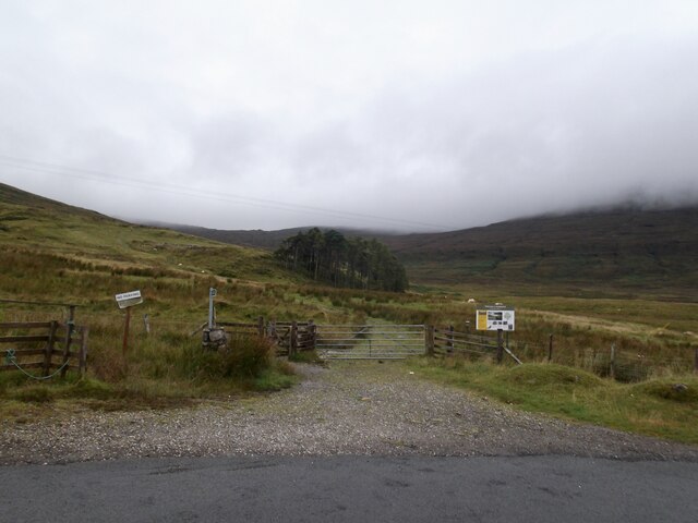
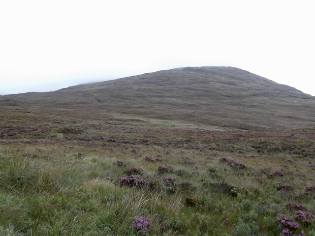
Kirkibost is a small rural settlement located in the county of Inverness-shire, Scotland. Situated in the northwest part of the country, it lies on the western coast of the Isle of Lewis, which is part of the Outer Hebrides archipelago. Kirkibost is nestled within a picturesque landscape, surrounded by rolling hills, moorlands, and breathtaking coastal scenery.

The settlement is home to a close-knit community and has a population of approximately 100 residents. The primary occupation of the locals is centered around traditional industries such as agriculture, fishing, and crofting. The fertile soils in the region make it ideal for farming, and the inhabitants engage in the cultivation of crops and rearing of livestock.

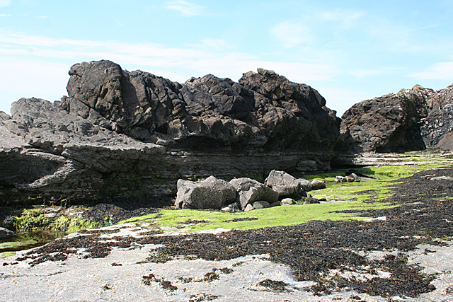
Kirkibost is renowned for its untouched natural beauty, attracting visitors who seek tranquility and a connection with nature. The coastline boasts pristine sandy beaches, rugged cliffs, and crystal-clear waters, making it a popular spot for outdoor activities such as hiking, birdwatching, and fishing.

The village itself comprises a cluster of traditional stone cottages, some of which have been preserved for centuries. The local community is proud of its heritage and cultural traditions, and the settlement hosts various events throughout the year, including music festivals, ceilidhs, and Highland games.

Despite its remote location, Kirkibost is well-connected to the rest of the island, with regular bus services and road links to nearby towns and cities. The village also has basic amenities such as a community center, a small shop, and a primary school, ensuring a comfortable lifestyle for its inhabitants.

Overall, Kirkibost offers a peaceful and idyllic setting, providing an escape from the bustling city life and a chance to immerse oneself in the rich Scottish culture and natural splendor.

If you have any feedback on the listing, please let us know in the comments section below.

Kirkibost Images

Images are sourced within 2km of 57.182598/-6.059126 or Grid Reference NG5417. Thanks to Geograph Open Source API. All images are credited.

Looks like a misty walk to Camasunary
Ford on the Camasunary track
Strathaird moor The southernmost slopes of the Blaven massif
Strathaird moor
The southernmost slopes of the Blaven massif
Path to Dun Ringill, Kilmarie On the north side of Abhainn Cille Mhaire. Bluebells in flower.
Path to Dun Ringill, Kilmarie
On the north side of Abhainn Cille Mhaire. Bluebells in flower.
Dun Ringill View from the west (landward side). Dun Ringill is the rocky hillock on the left.  See <span class="nowrap"><a title="https://canmore.org.uk/site/11431/skye-dun-ringill" rel="nofollow ugc noopener" href="https://canmore.org.uk/site/11431/skye-dun-ringill">Link</a><img style="margin-left:2px;" alt="External link" title="External link - shift click to open in new window" src="https://s1.geograph.org.uk/img/external.png" width="10" height="10"/></span>
Dun Ringill
View from the west (landward side). Dun Ringill is the rocky hillock on the left. See LinkExternal link
Ruin at Ringill I've not found any information about a settlement here.
Ruin at Ringill
I've not found any information about a settlement here.
Cliffs at Ringill The cliffs hereabouts are generally split into short sections. There are at least two tiers.
Cliffs at Ringill
The cliffs hereabouts are generally split into short sections. There are at least two tiers.
Cliffs at Ringill I won't attempt to describe these.
Cliffs at Ringill
I won't attempt to describe these.
Walkers on the Camasunary Track A group of walkers have just set off on the good track to Camasunary in the Cuillin Hills. The southern end of the Cuillin Ridge can clearly be seen above them.
Walkers on the Camasunary Track
A group of walkers have just set off on the good track to Camasunary in the Cuillin Hills. The southern end of the Cuillin Ridge can clearly be seen above them.
Loch Slapin
Loch Slapin
Kilmarie House A Victorian shooting lodge dating from the 1870s. It stands near the mouth of the Abhainn Cille Mhaire
Kilmarie House
A Victorian shooting lodge dating from the 1870s. It stands near the mouth of the Abhainn Cille Mhaire
House in Kilmarie The southernmost house in Kilmarie has a beautiful setting overlooking Loch Slapin.
The hills behind it are Beinn Dearg Mhor and Beinn Dearg Bheag, near Torrin.
House in Kilmarie
The southernmost house in Kilmarie has a beautiful setting overlooking Loch Slapin. The hills behind it are Beinn Dearg Mhor and Beinn Dearg Bheag, near Torrin.
Leaving the Elgol road Setting off on a walk to Camasunary and Sligachan. Volcanic rocks ahead.
Leaving the Elgol road
Setting off on a walk to Camasunary and Sligachan. Volcanic rocks ahead.
Old Milestone by the B8083, Kilmarie Cemetery, Strath Parish By the B8083, in parish of Strath (District), South of Kilmarie, North end of Cemetery in rush patches.

Inscription reads:- : III : (To Elgoll 3)

Surveyed

Milestone Society National ID: HI_SKELBF03
Old Milestone by the B8083, Kilmarie Cemetery, Strath Parish
By the B8083, in parish of Strath (District), South of Kilmarie, North end of Cemetery in rush patches. Inscription reads:- : III : (To Elgoll 3) Surveyed Milestone Society National ID: HI_SKELBF03
Footbridge over the Abhainn Cille Mhaire The path branches at the far end of the bridge. To the left is a route to Kirkibost. A right turn leads to Dùn Ringill.
Footbridge over the Abhainn Cille Mhaire
The path branches at the far end of the bridge. To the left is a route to Kirkibost. A right turn leads to Dùn Ringill.
Ruin in Drinan One of the houses of a settlement that was cleared in the mid nineteenth century.
Ruin in Drinan
One of the houses of a settlement that was cleared in the mid nineteenth century.
Moorland below Keppoch forest The Allt na Nigheidh meanders towards Keppoch <a title="https://www.geograph.org.uk/photo/6184191" href="https://www.geograph.org.uk/photo/6184191">Link</a> , to the right.  The plateau soon drops steeply towards Loch Slapin.  At the centre, the Suisnish headland can be seen, with Loch Eishort and the Sleat peninsula beyond.
Moorland below Keppoch forest
The Allt na Nigheidh meanders towards Keppoch Link , to the right. The plateau soon drops steeply towards Loch Slapin. At the centre, the Suisnish headland can be seen, with Loch Eishort and the Sleat peninsula beyond.
Keppoch The village of Keppoch (originally: Ceapach) was abandoned after 44 crofting families were evicted in 1852.  By 1875, it was practically abandoned <span class="nowrap"><a title="https://canmore.org.uk/site/11421/skye-keppoch" rel="nofollow ugc noopener" href="https://canmore.org.uk/site/11421/skye-keppoch">Link</a><img style="margin-left:2px;" alt="External link" title="External link - shift click to open in new window" src="https://s1.geograph.org.uk/img/external.png" width="10" height="10"/></span> .  Nowadays, only overgrown ruins of some houses are left <a title="https://www.geograph.org.uk/photo/6184191" href="https://www.geograph.org.uk/photo/6184191">Link</a> .
Keppoch
The village of Keppoch (originally: Ceapach) was abandoned after 44 crofting families were evicted in 1852. By 1875, it was practically abandoned LinkExternal link . Nowadays, only overgrown ruins of some houses are left Link .
Show me another place!

Kirkibost is located at Grid Ref: NG5417 (Lat: 57.182598, Lng: -6.059126)

Unitary Authority: Highland

Police Authority: Highlands and Islands

What 3 Words

///sensibly.they.care. Near Elgol, Highland

Nearby Locations

Kilmarie Kirkibost

Related Wikis

Kilmarie

Kilmarie or Kilmaree (Scottish Gaelic: Cill Ma Ruibhe), (Gaelic: cill =' church or cell'; marie from St. Maolrubha) is a village in the Isle of Skye, Scotland...

Dun Ringill

Dun Ringill (Gaelic: Dùn, 'fort', Ringill, 'point of the ravine') is an Iron Age hill fort on the Strathaird peninsula on the island of Skye, Scotland...

Kilmaluag Formation

The Kilmaluag Formation is a Middle Jurassic geologic formation in Scotland. It was formerly known as the Ostracod Limestone for preserving an abundance...

Camasunary

Camasunary is a bay on the Strathaird peninsula of the Isle of Skye, Scotland. Camasunary is the Scots form of the Gaelic name Camas Fhionnairigh, and...

Nearby Amenities

Located within 500m of 57.182598,-6.059126
Passing Place
Lat/Long: 57.181665/-6.0603287
Post Box
Ref: IV49 100
Source: survey
Lat/Long: 57.1830317/-6.05777
Bus Stop
Kirkibost, Post Box
Local Ref: AT
Naptan AtcoCode: 6700713137
Naptan Bearing: SW
Naptan CommonName: Letterbox
Naptan Indicator: at
Naptan Landmark: Letterbox
Naptan NaptanCode: 45328546
Naptan Street: B8083
Naptan Verified: no
Source: naptan_import
Lat/Long: 57.1829749/-6.0579429
Bus Stop
Kirkibost, opp Post Box
Naptan AtcoCode: 6700713137A
Naptan Bearing: NE
Naptan CommonName: Letterbox
Naptan Indicator: opp
Naptan Landmark: Letterbox
Naptan NaptanCode: 45329535
Naptan Street: B8083
Naptan Verified: no
Source: naptan_import
Lat/Long: 57.1830461/-6.0579672
Access: yes
Access Cattle: no
Barrier: cattle_grid
Lat/Long: 57.1820035/-6.0583828
Kilmarie
Alt Name En: Kilmaree
Name En: Kilmarie
Name Gd: Cill Ma Ruibhe
Place: hamlet
Wikidata: Q2205089
Wikipedia: en:Kilmarie
Lat/Long: 57.1826083/-6.0592016
Power: pole
Lat/Long: 57.1789994/-6.0639948
Power: pole
Lat/Long: 57.1795148/-6.0639436
Power: pole
Lat/Long: 57.1800497/-6.0639232
Power: pole
Lat/Long: 57.1806372/-6.0638286
Power: pole
Lat/Long: 57.1812136/-6.0636522
Power: pole
Lat/Long: 57.1817886/-6.0635065
Power: pole
Lat/Long: 57.1823373/-6.0634272
Power: pole
Lat/Long: 57.1830384/-6.0632559
Power: pole
Lat/Long: 57.1834471/-6.0625094
Power: pole
Lat/Long: 57.1837201/-6.0619751
Power: pole
Lat/Long: 57.1841163/-6.0613743
Power: pole
Lat/Long: 57.1844784/-6.0608404
Power: pole
Lat/Long: 57.1849703/-6.0601089
Power: pole
Lat/Long: 57.185468/-6.0593881
Power: pole
Lat/Long: 57.1859715/-6.0586513
Power: pole
Lat/Long: 57.1869668/-6.057175
Power: pole
Lat/Long: 57.1791095/-6.0583589
Power: pole
Lat/Long: 57.1799465/-6.0596832
Power: pole
Lat/Long: 57.1807771/-6.0609781
Power: pole
Lat/Long: 57.181294/-6.0617731
Power: pole
Lat/Long: 57.1818163/-6.0625861
Destination W: Camasunary: 2.4 miles, Sligachan: 9.5 miles
Ele: 41
Hiking: yes
Information: guidepost
Operator: Scottish Rights of Way and Access Society
Tourism: information
Lat/Long: 57.1795512/-6.0636233
Barrier: kissing_gate
Foot: yes
Lat/Long: 57.1845039/-6.0540228
Barrier: kissing_gate
Foot: yes
Lat/Long: 57.184026/-6.0529086
Barrier: kissing_gate
Lat/Long: 57.1796075/-6.0637276
Track to Camasunary
Historic: memorial
Inscription: Track to Camasunary constructed by M Squadrom & 107 Field Squadron 75 Engineer Regiment (Volunteers) June 1968
Memorial: plaque
Lat/Long: 57.1795295/-6.0635854
Strathaird
Board Type: nature
Information: board
Operator: John Muir Trust
Tourism: information
Lat/Long: 57.1796604/-6.0637162
The data included in this document is from www.openstreetmap.org. The data is made available under ODbL.

Have you been to Kirkibost?

Leave your review of Kirkibost below (or comments, questions and feedback).